

ATL: Tropical Storm Cristobal in North Atlantic
Moderator: S2k Moderators
-
brunota2003

- S2K Supporter

- Posts: 9476
- Age: 35
- Joined: Sat Jul 30, 2005 9:56 pm
- Location: Stanton, KY...formerly Havelock, NC
- Contact:
-
brunota2003
- S2K Supporter
- Posts: 9476
- Age: 35
- Joined: Sat Jul 30, 2005 9:56 pm
- Location: Stanton, KY...formerly Havelock, NC
- Contact:
Re: ATL: INVEST 96L near Southeast US
MHX (Morehead City's) Discussion of this system:
ILM (Wilmington's) Discussion:
.SHORT TERM /FRIDAY THROUGH FRIDAY NIGHT/...
-- Changed Discussion --
MAIN PLAYER IN THE FCST THROUGH THE WEEKEND WILL BE DEVELOPING
SFC LOW OFF THE NORTHEAST FLORIDA COAST. THE GFS/NAM12 AND SREF
ALL INDICATE THAT THE LOW WILL MOVE N/NNE TOWARD THE CAROLINAS
OVER THE NEXT COUPLE OF DAYS. GFS KEEPS THE LOW MORE INLAND AND IS
CONSIDERABLY WEAKER WHILE THE NAM12 DEVELOPS A STRONG TROPICAL LOW
WHICH IS CENTERED SE OF MYR BY 18Z SUN AND SE OF ILM BY 00Z MON.
ALL THE SOLUTIONS WILL LEAD TO A WETTER FCST FOR SATURDAY AND
SUNDAY. SFC RIDGE WILL HOLD OVER THE AREA FRIDAY WITH POPS MAINLY
CONFINED TO THE SRN TIER OF THE AREA. USING A BLEND OF THE
GFS/NAM12 AND SREF...HAVE INCREASED POPS TO HIGH CHC FOR SATURDAY
AND SUNDAY. QPF VALUES FROM HPC AND THE SREF INDICATE PSBL ONE
INCH OR GREATER AMOUNTS ALONG THE SRN COAST STARTING LATE FRIDAY
NIGHT. THIS SEEMS PLAUSIBLE GIVEN THE WEAK UPPER LEVEL FLOW AND
LIKELY SLOW MOVEMENT OF THE SYSTEM.
-- End Changed Discussion --
ILM (Wilmington's) Discussion:
.SHORT TERM /FRIDAY THROUGH SATURDAY NIGHT/...
-- Changed Discussion --
AS OF 3 PM THURSDAY...GFS AND NAM COMING MUCH MORE INTO PHASE WITH
EACH OTHER IN MOVING UPPER LOW AND ITS SURFACE REFLECTION FROM
PRESENT LOCATION OFFSHORE JACKSONVILLE FL UP THE COAST ON FRIDAY
AND SATURDAY. BOTH OF THESE SOLUTIONS ALSO CLOSE TO ECMWF.
ACCOMPANYING MOISTURE SEEMS UNDERDONE BY GUIDANCE CONSIDERING
SOURCE REGION AND TRAJECTORY OF SYSTEM. CONSIDERING CONVERGENCE IN
GUIDANCE SOLUTIONS AND ACCOMPANYING MOISTURE EVEN MORE CONFIDENT
THAN YESTERDAY AFTERNOON THAT WE WILL SEE A SIGNIFICANT RAIN EVENT
IN THE SHORT TERM. HAVE REINTRODUCED LIKELY POPS FOR MUCH OF THE
CWA FOR FRIDAY AFTERNOON AND EVENING AND ALSO FOR ALONG THE COAST
THROUGH SATURDAY EVENING. SOLID CHANCE POPS ELSEWHERE THRU THE
PERIOD. HAVE CLOSELY FOLLOWED HPC QPF GUIDANCE AS IT MIRRORS OUR
THOUGHTS ON WHAT WE COULD EXPECT CONSIDERING POTENTIAL MOVEMENT
AND DEVELOPMENT OF SYSTEM. FOR TEMPERATURES HAVE GONE WITH A BLEND
OF GUIDANCE. THIS WILL KEEP MAX TEMPS MAINLY IN THE 80S OR A BIT
BELOW CLIMO...WHICH LOOKS GOOD CONSIDERING SUBSTANTIAL CLOUD COVER
EXPECTED WITH SYSTEM.
-- End Changed Discussion --
0 likes


-
HurricaneHunter914
- Category 5

- Posts: 4439
- Age: 32
- Joined: Fri Mar 10, 2006 7:36 pm
- Location: College Station, TX

-
brunota2003
- S2K Supporter
- Posts: 9476
- Age: 35
- Joined: Sat Jul 30, 2005 9:56 pm
- Location: Stanton, KY...formerly Havelock, NC
- Contact:

Re: ATL: INVEST 96L near Southeast US
I specifically recall yesterday aric you mentioned the possibility of this spinning up once it crossed fl into the atlantic good call! 
0 likes
This looks like a real possible runner IMO to be our next TD if 94l doesn't have a circulation found today, its got good convergence, fairly warm waters as well. The only question mark is the exact track it takes from now on because if it does go NW thgen its got only a little amount of time over water.
This may be like Arthur 1996 if it forms...
This may be like Arthur 1996 if it forms...
0 likes
-
Aric Dunn
- Category 5
- Posts: 21238
- Age: 43
- Joined: Sun Sep 19, 2004 9:58 pm
- Location: Ready for the Chase.
- Contact:
so since convection is not firing over the center at all .. i imagine if the convection that is firing persists the center should start tucking underneath it or reform again closer to it.. as for motion the steering is very week and only slow drifting ene should be the predominate motion do to the fact that it is still slightly attached to the boundary .. but i would not rule out a wobble or loop like motion as the center starts becoming more well defined and the smaller vortices that are spinning around in that area come together, so some erratic motion is inline
0 likes


-
cheezyWXguy

- Category 5
- Posts: 6281
- Joined: Mon Feb 13, 2006 12:29 am
- Location: Dallas, TX
Re:
Derek Ortt wrote:now this is something that does need to be closely monitored
How strong do you think this could get and where could it go? I know these are early questions, but I like to hear your opinion.
0 likes


Re: ATL: INVEST 96L near Southeast US
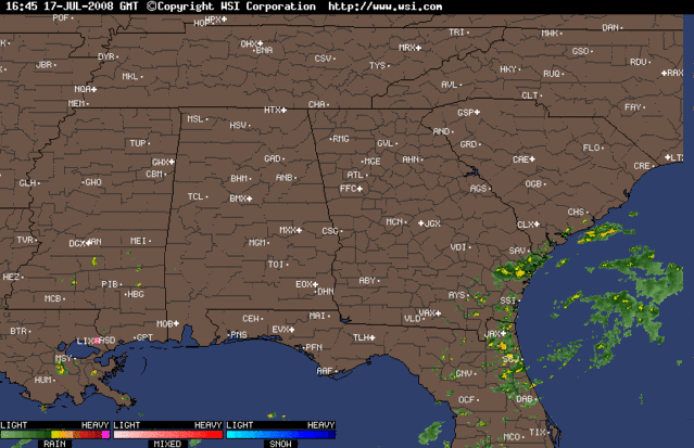
I thought I saw NOAA's WP-3 fly in to jax this morning, can anyone confirm or deny that. I am assuming 96L would be why its here. Yes there is an obvious swirl, but until the pressure starts to fall and the winds pick up I will not be impressed. There have been scattered showers here from the 'rainbands' today and currently it is calm with a few showers to my west. Certainly not looking like we have an imminent storm brewing off the coast.
0 likes
-
Ed Mahmoud
Re: ATL: INVEST 96L near Southeast US
Visible satellite loop
Appears to have a tight and closed surface circulation, and while a little bare on the West side (dry air from the continent, maybe?) has storms in abundance on the East side, and anticyclonic outflow seems well established on the East side.
I'd say, unofficially since I can't officially say anything officially, being an amateur, this is already technically at least an STD, and probably a TD.
Unofficially.
0 likes
-
Ed Mahmoud
Re: ATL: INVEST 96L near Southeast US
The first run of SHIPs didn't seem overly impressed with strengthening potential. Not sure why. Perhaps the dry air to its West.
0 likes

-
Stratosphere747
- Category 5
- Posts: 3772
- Joined: Thu Sep 11, 2003 8:34 pm
- Location: Surfside Beach/Freeport Tx
- Contact:
Re: ATL: INVEST 96L near Southeast US
17/1745 UTC 30.5N 80.3W TOO WEAK INVEST -- Atlantic Ocean
0 likes
Who is online
Users browsing this forum: No registered users and 16 guests