Ex Invest 99L in Western Atlantic

Moderator: S2k Moderators

Message
Author
RL3AO
Moderator-Pro Met
Moderator-Pro Met
Posts: 16308
Joined: Thu Jun 14, 2007 10:03 pm
Location: NC

Re: ATL: Invest 98L - 8 AM TWO: TD may form later today

#161 Postby RL3AO » Wed Jul 30, 2008 9:38 am

Mecklenburg wrote:grrrr.... the SAL is such a nuisance... why do this waves form at such higher latitudes than before?.. this season is getting to be boring...


Yeah...lets see.

- Might get 5th named storm before the end of July...check
- Long lived major hurricane...check
- Landfalling hurricane in USA...check

Nope. I don't get boring out of that.
0 likes   

User avatar
gatorcane
S2K Supporter
S2K Supporter
Posts: 23691
Age: 47
Joined: Sun Mar 13, 2005 3:54 pm
Location: Boca Raton, FL

Re:

#162 Postby gatorcane » Wed Jul 30, 2008 9:38 am

Frank2 wrote:wxman57,

Thanks for sharing that - it does seem the high is weaker than normal, per our frequent southerly winds across Florida, which is usually an indicator that the high is weak...

If that's true, then, that also means that the Fall cold fronts will be able to make more of an impact on the tropics...

That's why each season is unique - I know some don't like my giving "negative" opinions on hurricane formation, but, if there is a hurricane on the map, some here know that I usually step back and do not comment, since the system is already out there, but, outside of that, sometimes it's best to hear what is causing a slowing in activity, if little or no activity exists at the moment...

One great thing is the fact that I've met just about all of these well-known atmospheric scientists, and, if nothing else, it's good to know that they are not only scientists, but, have families and lives outside of the world of meteorology...

Frank


Considering the date is July 30th, I think its premature to start talking about cold fronts and weak Bermuda Highs for later in August and September. In fact the long-wave pattern usually flips back-and-forth several times during the hurricane season. Given the long-wave pattern has featured weak substropical ridging in the early half of the season gives more credence to the possibility the ridging becomes more pronounced later in the season (much like what happened in 2004 where it took until late August to even early September before the Bermuda High built in strong for a period of about 4-6 weeks.).

Not only that, but the SE US and in particular Florida is extremely vulnerable to Western and SW Caribbean systems. October is a busy month especially for Florida. Bermuda High is not the key steering mechanism for these Western Caribbean-born systems.
Last edited by gatorcane on Wed Jul 30, 2008 9:40 am, edited 1 time in total.
0 likes   

User avatar
wxman57
Moderator-Pro Met
Moderator-Pro Met
Posts: 22978
Age: 67
Joined: Sat Jun 21, 2003 8:06 pm
Location: Houston, TX (southwest)

Re: ATL: Invest 98L - 8 AM TWO: TD may form later today

#163 Postby wxman57 » Wed Jul 30, 2008 9:39 am

Air Force Met wrote:
extradited wrote:What storm would that be, WX?


I'm guessing Humberto...


I was thinking the same, but I can't find that discussion mentioning the "cloud-free central area".
0 likes   

cpdaman
Category 5
Category 5
Posts: 3131
Joined: Sat Jun 10, 2006 11:44 am
Location: SPB county (gulf stream)

Re: ATL: Invest 98L - 8 AM TWO: TD may form later today

#164 Postby cpdaman » Wed Jul 30, 2008 9:40 am

so given the potential for a weaker bermuda high to be the trend this summer, do those seasons correlate to more action in the Gulf or Carib. And either way i would wager a guess that even if gulf/carib activity is not enhanced by a weak bermuda high that those would be the area's to watch more concering lower 48 threats
0 likes   

User avatar
gatorcane
S2K Supporter
S2K Supporter
Posts: 23691
Age: 47
Joined: Sun Mar 13, 2005 3:54 pm
Location: Boca Raton, FL

Re: ATL: Invest 98L - 8 AM TWO: TD may form later today

#165 Postby gatorcane » Wed Jul 30, 2008 9:42 am

cpdaman wrote:so given the potential for a weaker bermuda high to be the trend this summer, do those seasons correlate to more action in the Gulf or Carib. And either way i would wager a guess that even if gulf/carib activity is not enhanced by a weak bermuda high that those would be the area's to watch concering lower 48 threats


All I am saying to the board here is --- do not assume the Bermuda High is going to stay weak through the rest of the year. All it takes is for the Bermuda High to be strong for 1 week out of the season where a Cape Verde system manages to get underneath it and the Leewards and the US can be in the target zone. It's all about timing.

Now back on 98L :) It does appear to be a recurve candidate looking at climatology and the current synoptic setup. I'd be shocked if it manages to traverse west across the Atlantic without hitting some weakness at the lattitude it is at
Last edited by gatorcane on Wed Jul 30, 2008 9:44 am, edited 2 times in total.
0 likes   

User avatar
drezee
S2K Supporter
S2K Supporter
Posts: 3664
Joined: Mon Jun 09, 2003 12:49 pm
Location: FL

Re: ATL: Invest 98L - 8 AM TWO: TD may form later today

#166 Postby drezee » Wed Jul 30, 2008 9:43 am

wxman57 wrote:
Air Force Met wrote:
extradited wrote:What storm would that be, WX?


I'm guessing Humberto...


I was thinking the same, but I can't find that discussion mentioning the "cloud-free central area".


It was Luis:

ZCZC MIATCDAT3 ALL
TTAA00 KNHC DDHHMM
...FOR INTERGOVERNMENTAL USE ONLY...
TROPICAL STORM LUIS DISCUSSION NUMBER 9
NATIONAL WEATHER SERVICE MIAMI FL
5 PM EDT WED AUG 30 1995

LATEST VISIBLE SATELLITE IMAGES SHOW A WELL DEFINED CIRCULATION WITH
A CLOUDLESS CENTER.
THE OVERALL CIRCULATION HAS BECOME BETTER
ORGANIZED THE PAST SIX HOURS AND DVORAK CLASSIFICATIONS INDICATE
INTENSIFICATION. CONSISTENT WITH THIS TREND THE OFFICIAL FORECAST IS
FOR STEADY INTENSIFICATION THE NEXT 24 HOURS WITH AN INITIAL
INTENSITY OF 45 KNOTS. OUTFLOW ALOFT OVER LUIS IS BEST DEFINED OVER
THE SOUTH AND SOUTHEAST QUADRANTS. SLIGHT SHEARING AND SINKING
EVIDENT ON WATER VAPOR IMAGERY ARE ALONG THE WEST SIDE OF
LUIS...POSSIBLY ASSOCIATED WITH OUTFLOW FROM KAREN AND IRIS.

THE CURRENT TRACK IS 290/11 AND THIS TRACK IS FORECAST TO CONTINUE
THE NEXT 24 TO 36 HOURS. THIS TRACK IS CONSISTENT WITH A DEEP LAYER
MEAN EASTERLY WINDS. ALL TRACK FORECAST GUIDANCE CONTINUES TO
BE IN VERY GOOD AGREEMENT WITH THE OFFICIAL TRACK AND SPEED FORECAST
TOWARD 290 DEGREES AT ABOUT 10 TO 12 KNOTS.


LYONS

FORECAST POSITIONS AND MAX WINDS

INITIAL 30/2100Z 14.1N 37.6W 45 KTS
12HR VT 31/0600Z 14.7N 39.2W 50 KTS
24HR VT 31/1800Z 15.2N 41.4W 55 KTS
36HR VT 01/0600Z 15.8N 43.5W 60 KTS
48HR VT 01/1800Z 16.0N 45.5W 65 KTS
72HR VT 02/1800Z 16.5N 49.5W 65 KTS


NNNN

Last edited by drezee on Wed Jul 30, 2008 9:56 am, edited 1 time in total.
0 likes   

coreyl
Tropical Depression
Tropical Depression
Posts: 77
Age: 36
Joined: Wed Jul 16, 2008 9:14 pm
Location: Bay St Louis,Mississippi

#167 Postby coreyl » Wed Jul 30, 2008 9:43 am

So does it look like this system will go out to sea?
0 likes   

User avatar
HURAKAN
Professional-Met
Professional-Met
Posts: 46086
Age: 38
Joined: Thu May 20, 2004 4:34 pm
Location: Key West, FL
Contact:

Re:

#168 Postby HURAKAN » Wed Jul 30, 2008 9:44 am

coreyl wrote:So does it look like this system will go out to sea?


That's the current thinking.
0 likes   

User avatar
gatorcane
S2K Supporter
S2K Supporter
Posts: 23691
Age: 47
Joined: Sun Mar 13, 2005 3:54 pm
Location: Boca Raton, FL

Re: ATL: Invest 98L - 8 AM TWO: TD may form later today

#169 Postby gatorcane » Wed Jul 30, 2008 9:47 am

Mecklenburg wrote:grrrr.... the SAL is such a nuisance... why do this waves form at such higher latitudes than before?.. this season is getting to be boring...


Nothing wrong with recurves. I welcome them. Thank the SAL also, whatever it takes to keep these systems out at sea and weak is fine with me :)
0 likes   

cpdaman
Category 5
Category 5
Posts: 3131
Joined: Sat Jun 10, 2006 11:44 am
Location: SPB county (gulf stream)

Re: ATL: Invest 98L - 8 AM TWO: TD may form later today

#170 Postby cpdaman » Wed Jul 30, 2008 9:48 am

gator i was asking a serious question, it was based on a hypothetical.
0 likes   

User avatar
HURAKAN
Professional-Met
Professional-Met
Posts: 46086
Age: 38
Joined: Thu May 20, 2004 4:34 pm
Location: Key West, FL
Contact:

Re: ATL: Invest 98L - 8 AM TWO: TD may form later today

#171 Postby HURAKAN » Wed Jul 30, 2008 9:51 am

Image

Image
0 likes   

User avatar
gatorcane
S2K Supporter
S2K Supporter
Posts: 23691
Age: 47
Joined: Sun Mar 13, 2005 3:54 pm
Location: Boca Raton, FL

#172 Postby gatorcane » Wed Jul 30, 2008 9:51 am

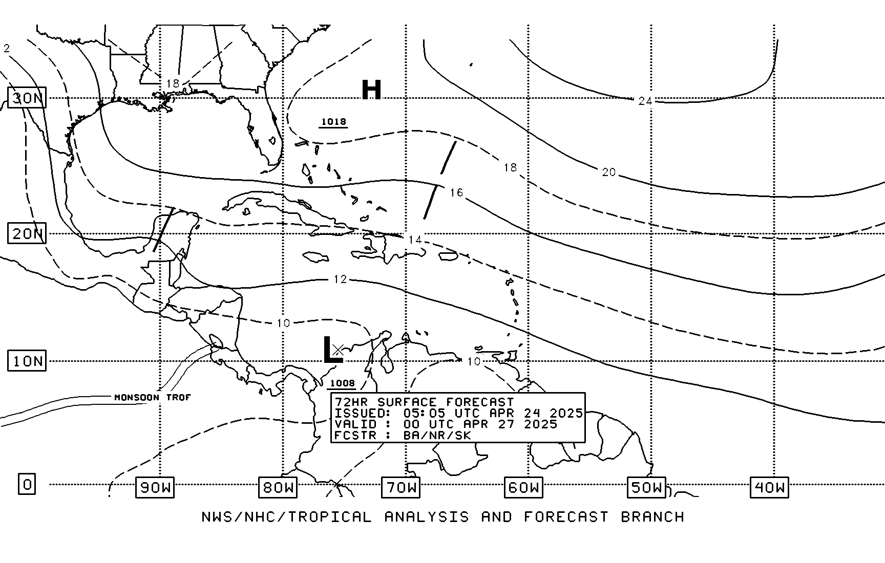
Has anybody noticed how far West the TAFB estimate puts 98L? Look at that strong ridge to the north (the swiggling line). Anybody care to comment? I think TAFB is going with the GFS of a more westerly track albeit a weaker 98L that flows with the easterlies.

Image
Last edited by gatorcane on Wed Jul 30, 2008 9:54 am, edited 2 times in total.
0 likes   

RL3AO
Moderator-Pro Met
Moderator-Pro Met
Posts: 16308
Joined: Thu Jun 14, 2007 10:03 pm
Location: NC

#173 Postby RL3AO » Wed Jul 30, 2008 9:52 am

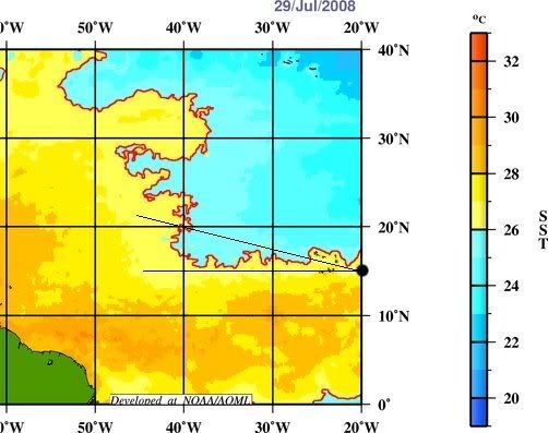
Looking at the CIMSS maps, the ridge looks pretty strong until 45W. Also, its right on the 26C line if it moves north at all. Could keep it as a wave/td in the LL flow.
0 likes   

Derek Ortt

Re: ATL: Invest 98L - 8 AM TWO: TD may form later today

#174 Postby Derek Ortt » Wed Jul 30, 2008 9:57 am

wxman57 wrote:
Air Force Met wrote:
extradited wrote:What storm would that be, WX?


I'm guessing Humberto...


I was thinking the same, but I can't find that discussion mentioning the "cloud-free central area".


I'd guess Luis
0 likes   

Honeyko

#175 Postby Honeyko » Wed Jul 30, 2008 9:58 am

Most models, and climatology agree that after the CVI, it should remain over open waters.


What's the recent track-record of those models with east-Atlantic systems? (A couple of years ago they were notorious for wide-right errors on west-bound systems.)
0 likes   

User avatar
HURAKAN
Professional-Met
Professional-Met
Posts: 46086
Age: 38
Joined: Thu May 20, 2004 4:34 pm
Location: Key West, FL
Contact:

#176 Postby HURAKAN » Wed Jul 30, 2008 9:59 am

Derek, what do you think is holding the NHC from making 98L a depression or weak TS? It may be that amateurs like us are not seeing it.
0 likes   

RL3AO
Moderator-Pro Met
Moderator-Pro Met
Posts: 16308
Joined: Thu Jun 14, 2007 10:03 pm
Location: NC

#177 Postby RL3AO » Wed Jul 30, 2008 10:00 am

Image

SST map

Black dot is latest center location from ATCF file. Two lines are a 270 (west) movement and a 285 (WNW) movement.
0 likes   

User avatar
Chacor
Category 5
Category 5
Posts: 10229
Joined: Mon Oct 02, 2006 10:43 pm
Location: Singapore

Re:

#178 Postby Chacor » Wed Jul 30, 2008 10:02 am

HURAKAN wrote:Derek, what do you think is holding the NHC from making 98L a depression or weak TS? It may be that amateurs like us are not seeing it.


Why would it be a weak TS? Quikscat only showed 30 kt wind barbs iirc and the ATCF file says 25 kt. Nothing showing TS.
0 likes   

User avatar
Category 5
Category 5
Category 5
Posts: 10074
Age: 35
Joined: Sun Feb 11, 2007 10:00 pm
Location: New Brunswick, NJ
Contact:

Re: ATL: Invest 98L - 8 AM TWO: TD may form later today

#179 Postby Category 5 » Wed Jul 30, 2008 10:03 am

Mecklenburg wrote:grrrr.... the SAL is such a nuisance... why do this waves form at such higher latitudes than before?.. this season is getting to be boring...


I'm sure those just hit by Dolly will take kindly to that remark.

The numbers reveal the ignorance of this comment as well. 4/2/1 and it's not even August. Only 1995 and 2005 surpass that in recent memory.

Please think before you post.
0 likes   

User avatar
drezee
S2K Supporter
S2K Supporter
Posts: 3664
Joined: Mon Jun 09, 2003 12:49 pm
Location: FL

Re: ATL: Invest 98L - 8 AM TWO: TD may form later today

#180 Postby drezee » Wed Jul 30, 2008 10:09 am

Derek Ortt wrote:
wxman57 wrote:
Air Force Met wrote:I'm guessing Humberto...


I was thinking the same, but I can't find that discussion mentioning the "cloud-free central area".


I'd guess Luis


I posted the discussion above. It was Luis.
0 likes   


Return to “2008”

Who is online

Users browsing this forum: No registered users and 3 guests