ATL: Tropical Depression Dolly

Moderator: S2k Moderators

Message
Author
tolakram
Admin
Admin
Posts: 20012
Age: 62
Joined: Sun Aug 27, 2006 8:23 pm
Location: Florence, KY (name is Mark)

Re: ATL: INVEST 94L=8 AM EDT TWO=Better Organized

#1461 Postby tolakram » Wed Jul 16, 2008 7:24 am

No I'm not talking about Felix. The blob we watched never developed.

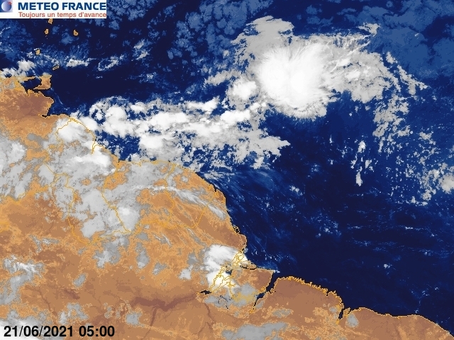
I encourage you all to observe what you're posting and compare it with what you really know. I've seen no, 0, zip, nada proof of a closed low. Fortunately the hurricane hunters will determine this for sure later today.

I am not saying it won't develop, I'm not saying it will develop. :)
0 likes   

User avatar
Gustywind
Category 5
Category 5
Posts: 12334
Joined: Mon Sep 03, 2007 7:29 am
Location: Baie-Mahault, GUADELOUPE

#1462 Postby Gustywind » Wed Jul 16, 2008 7:27 am

http://www.meteo.fr/temps/domtom/antill ... Tagant.jpg
Convection is seriously on the increase huge bulk is consolidating...for my untrained eyes....
0 likes   

Derek Ortt

#1463 Postby Derek Ortt » Wed Jul 16, 2008 7:31 am

looks like a wave to me... I would not send the recon

However, it should bring TS winds to the Windwrds this afternoon
0 likes   

User avatar
Fego
S2K Supporter
S2K Supporter
Posts: 767
Age: 65
Joined: Sun Apr 18, 2004 7:58 pm
Location: San Juan, Puerto Rico
Contact:

Re:

#1464 Postby Fego » Wed Jul 16, 2008 7:32 am

Gustywind wrote::uarrow:
Absolutely Hurricane Robert you're right that was near the 30th of August if my head does not deceiving me, a pimpy wave popping tremendously hours after hours near the south of the windwards islands....with the story that we all know! If there's no TD today how lucky we are, but it's July....If we were in August it would be a TD with in theory much more better conditions... :oops: :roll:


Gustywind would you please share the link for those met france sat images? upsss. looks like you already did it :roll: Thanks!
0 likes   

User avatar
gatorcane
S2K Supporter
S2K Supporter
Posts: 23691
Age: 47
Joined: Sun Mar 13, 2005 3:54 pm
Location: Boca Raton, FL

Re: ATL: INVEST 94L=8 AM EDT TWO=Better Organized

#1465 Postby gatorcane » Wed Jul 16, 2008 7:34 am

Hi all:

Does anybody care to eat some crow?

As you know I provided evidence as to why I thought this invest would develop. I will eat some crow as to the fact I thought it would develop a bit earlier than I said albeit the Upper-Level trough that dug down yesterday thwarted the speed at which it was to develop.

It's looking increasingly likely that a depression can form at anytime over the next 24 hours.
Last edited by gatorcane on Wed Jul 16, 2008 7:35 am, edited 1 time in total.
0 likes   

User avatar
DESTRUCTION5
Category 5
Category 5
Posts: 4423
Age: 43
Joined: Wed Sep 03, 2003 11:25 am
Location: Stuart, FL

Re: ATL: INVEST 94L=8 AM EDT TWO=Better Organized

#1466 Postby DESTRUCTION5 » Wed Jul 16, 2008 7:35 am

gatorcane wrote:Hi all:

Does anybody care to eat some crow?

As you know I provided evidence as to why I thought this invest would develop. I will eat some crow as to the fact I thought it would develop a bit earlier than I said.

It's looking increasingly likely that a depression can form at anytime over the next 24 hours.


It still has not developed...
0 likes   

User avatar
HURAKAN
Professional-Met
Professional-Met
Posts: 46086
Age: 38
Joined: Thu May 20, 2004 4:34 pm
Location: Key West, FL
Contact:

#1467 Postby HURAKAN » Wed Jul 16, 2008 7:36 am

Image
0 likes   

User avatar
gatorcane
S2K Supporter
S2K Supporter
Posts: 23691
Age: 47
Joined: Sun Mar 13, 2005 3:54 pm
Location: Boca Raton, FL

#1468 Postby gatorcane » Wed Jul 16, 2008 7:36 am

Latest:
Image
0 likes   

User avatar
NDG
S2K Supporter
S2K Supporter
Posts: 15446
Joined: Sun Jul 09, 2006 10:14 pm
Location: Orlando, FL

#1469 Postby NDG » Wed Jul 16, 2008 7:38 am

Derek, have you really looked at the vis sat pics this morning, what you have to say about in the southern quadrant of this system the easterly and notheasterly moving clouds towards an apparent center near near 13N & 56W, like I asked wxman57 earlier, is this normal for a typical tropical wave?
I am not saying it has a closed LLC, but it does appear to have a cyclonic circulation unlike a ....
0 likes   

User avatar
Thunder44
Category 5
Category 5
Posts: 5922
Age: 44
Joined: Mon Jun 09, 2003 7:53 pm
Location: New York City

Re:

#1470 Postby Thunder44 » Wed Jul 16, 2008 7:41 am

Derek Ortt wrote:looks like a wave to me... I would not send the recon

However, it should bring TS winds to the Windwrds this afternoon


I disagree. Even though it may not have closed LLC now, it may have one this afternoon. Honestly, it looks like a developing TC to me.
0 likes   

User avatar
gatorcane
S2K Supporter
S2K Supporter
Posts: 23691
Age: 47
Joined: Sun Mar 13, 2005 3:54 pm
Location: Boca Raton, FL

#1471 Postby gatorcane » Wed Jul 16, 2008 7:42 am

Does Wxman have a Bones "It's NOT Dead" image to resurrect something from the dead?

I think we are going to need it.
0 likes   

User avatar
NDG
S2K Supporter
S2K Supporter
Posts: 15446
Joined: Sun Jul 09, 2006 10:14 pm
Location: Orlando, FL

Re: ATL: INVEST 94L=8 AM EDT TWO=Better Organized

#1472 Postby NDG » Wed Jul 16, 2008 7:44 am

This might be a reason why convection looks better organized this morning, is not catching the light NW ML shear it was getting yesterday.
Image
0 likes   

User avatar
Gustywind
Category 5
Category 5
Posts: 12334
Joined: Mon Sep 03, 2007 7:29 am
Location: Baie-Mahault, GUADELOUPE

Re: Re:

#1473 Postby Gustywind » Wed Jul 16, 2008 7:44 am

Fego wrote:
Gustywind wrote::uarrow:
Absolutely Hurricane Robert you're right that was near the 30th of August if my head does not deceiving me, a pimpy wave popping tremendously hours after hours near the south of the windwards islands....with the story that we all know! If there's no TD today how lucky we are, but it's July....If we were in August it would be a TD with in theory much more better conditions... :oops: :roll:


Gustywind would you please share the link for those met france sat images? upsss. looks like you already did it :roll: Thanks!

LOL :P No problem Fego he all make mistakes lol , try this link :wink:
http://www.meteo.fr/temps/domtom/antill ... Tagant.jpg
http://www.meteo.fr/temps/domtom/antill ... SAIC2.html
http://www.meteo.fr/temps/domtom/antill ... imVS2.html
http://www.meteo.fr/temps/domtom/antill ... ISAT2.html
http://www.meteo.fr/temps/domtom/antill ... Tagguy.jpg Definitely bombing convection!
0 likes   

User avatar
alan1961
Category 2
Category 2
Posts: 771
Joined: Mon Mar 20, 2006 11:58 am
Location: Derby, Derbyshire, England
Contact:

Re: ATL: INVEST 94L=8 AM EDT TWO=Better Organized

#1474 Postby alan1961 » Wed Jul 16, 2008 7:46 am

ready to rumble?..i said TS before the islands yesterday..maybe..maybe not..i wasn't going to give up on this becos you should never give up on anything that stays suspicious even in july in a marginal environment..carry on the good work you guys..its a learning curve all the time in the tropics..we'll see what happens :wink:
Last edited by alan1961 on Wed Jul 16, 2008 7:52 am, edited 1 time in total.
0 likes   

User avatar
gatorcane
S2K Supporter
S2K Supporter
Posts: 23691
Age: 47
Joined: Sun Mar 13, 2005 3:54 pm
Location: Boca Raton, FL

Re: ATL: INVEST 94L=8 AM EDT TWO=Better Organized

#1475 Postby gatorcane » Wed Jul 16, 2008 7:46 am

NDG wrote:This might be a reason why convection looks better organized this morning, is not catching the light NW ML shear it was getting yesterday.
Image


Indeed there was an Upper-Level trough that dug farther south than originally progged. That caused a higher-than expected shear environment over 94L but only for about 24 hours or so...

Now it is pulling out leaving behind marginally favorable Upper-Level winds which should allow our invest to become a depression over the next 24 hours or so.
0 likes   

Derek Ortt

Re: Re:

#1476 Postby Derek Ortt » Wed Jul 16, 2008 7:47 am

Thunder44 wrote:
Derek Ortt wrote:looks like a wave to me... I would not send the recon

However, it should bring TS winds to the Windwrds this afternoon


I disagree. Even though it may not have closed LLC now, it may have one this afternoon. Honestly, it looks like a developing TC to me.


I don't see it. However, once it moves a little farther to the west, it will move into the range of our 1km resolution satellite data; thus, it will be easier to detect.

Looked on the vis like a very sharp trough axis.

Regardless... TS winds are almost certainly to occur. development at this point is merely a matter of semantics
0 likes   

User avatar
wx247
S2K Supporter
S2K Supporter
Posts: 14279
Age: 41
Joined: Wed Feb 05, 2003 10:35 pm
Location: Monett, Missouri
Contact:

#1477 Postby wx247 » Wed Jul 16, 2008 7:49 am

They need to move the floater shortly or 94L will float right on out of the picture. LOL
0 likes   

User avatar
HURAKAN
Professional-Met
Professional-Met
Posts: 46086
Age: 38
Joined: Thu May 20, 2004 4:34 pm
Location: Key West, FL
Contact:

#1478 Postby HURAKAN » Wed Jul 16, 2008 7:50 am

0 likes   

mattpetre
Category 2
Category 2
Posts: 510
Age: 53
Joined: Mon Sep 19, 2005 3:20 pm
Location: Missouri City,TX & Galleria
Contact:

Re: ATL: INVEST 94L=8 AM EDT TWO=Better Organized

#1479 Postby mattpetre » Wed Jul 16, 2008 7:53 am

I just wanted to say wxman57 is probably my favorite poster on this message board and I value his opinion extremely. I read my comment from yesterday again this morning and thought that I did sound a little rude. I wasn't trying to accuse anyone of anything in particular, I just hate when I still believe there might be something left in a system but insightful mets stop posting because they know things I don't about it. I just hope to learn as much as I can here and I realize that these boards cut into valuable professional time for people like D. Ortt, miami... and wxman57. I just want to extend my apology (if I offended) and thank you to them for their time.

BTW, it is my very unofficial opinion that this storm will strenghten until the western Caribbean and then will be sheared into a mess of nothingness.
0 likes   

User avatar
NDG
S2K Supporter
S2K Supporter
Posts: 15446
Joined: Sun Jul 09, 2006 10:14 pm
Location: Orlando, FL

#1480 Postby NDG » Wed Jul 16, 2008 7:59 am

Thanks for ignoring my question Derek, :wink:
0 likes   


Return to “2008”

Who is online

Users browsing this forum: No registered users and 6 guests