

Friendly warning:
If you post a one-liner, smilies, etc, it will be deleted. Your opinion is very welcomed but please, sustain it.
ATL: Tropical Depression Fay
Moderator: S2k Moderators


-
Category 5

- Category 5

- Posts: 10074
- Age: 36
- Joined: Sun Feb 11, 2007 10:00 pm
- Location: New Brunswick, NJ
- Contact:
Re: ATL: Invest 92L in Central Atlantic
Mecklenburg wrote:so far the atlantic hasn't been really friendly... i wonder what less can we expect for the remainder of the season
This is my only reply to that remark.
http://www.youtube.com/watch?v=LQCU36pkH7c
Seriously, we are ahead of last years 15 storm pace. This system has plenty of time. Remember Dolly? It had the same problem and went on to become a Hurricane. Sheesh.
0 likes
Re: ATL: Invest 92L in Central Atlantic
This storm's history is having almost faded out completely and rebounded once already yesterday. Today 92 did a d-max around 5am. Watch for another at that same time tomorrow. Or it could really have '99L-ed.
0 likes
Re:
HURAKAN wrote:If I post the first picture at one time and the second at another, you will say, I has weakened. But it's in fact the curvature of the Earth and the angle at which the satellite is looking at the system.

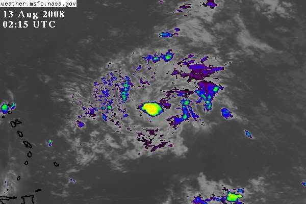
You made a good point those satelite pics looked totally different. I then looked and it was infact the same time. The earth's curvatures can play tricks on us.
0 likes
-
curtadams
- S2K Supporter

- Posts: 1122
- Joined: Sun Aug 28, 2005 7:57 pm
- Location: Orange, California
- Contact:
Re: ATL: Invest 92L in Central Atlantic
Anybody posted the latest Quickscat? (Scroll down for the latest at present). It's got a low level circulation - BUT 200 miles south of the MLC (or whatever it is). So it's not about to start up - that MLC doesn't have anything like the energy needed for such a large relocation.
On another note, what's all this next invest/sayonara/au revior business? This is a strong tropical wave in August. It's not going away, and it could generate a TC more or less anytime if it hits favorable conditions. That's unlikely to change. I'm sorry if it annoys people that it's likely to remain a mid-to-low-level invest for days but that's just the way it is.
On another note, what's all this next invest/sayonara/au revior business? This is a strong tropical wave in August. It's not going away, and it could generate a TC more or less anytime if it hits favorable conditions. That's unlikely to change. I'm sorry if it annoys people that it's likely to remain a mid-to-low-level invest for days but that's just the way it is.
0 likes
-
Ed Mahmoud
Re: ATL: Invest 92L in Central Atlantic
Not sure about GFDL last two seasons, but it seems to initialize fairly closely, and has a borderline Cat 3/Cat 4 at the end, so this bears watching still.
0 likes
-
americanrebel
Re: ATL: Invest 92L in Central Atlantic
My guess with no scientific backing is that this will be a TD by 5pm advisory Wednesday, a TS by 11 am advisory Thursday and a hurricane by 5pm advisory on Sunday. I am saying that the track would be sort of like Katrina, just North of Hispanola and head over the Keys and into the GoM by Sunday-Monday.
Personal Forecast Disclaimer:
The posts in this forum are NOT official forecast and should not be used as such. They are just the opinion of the poster and may or may not be backed by sound meteorological data. They are NOT endorsed by any professional institution or storm2k.org. For official information, please refer to the NHC and NWS products.
0 likes
-
Mecklenburg
Re: ATL: Invest 92L in Central Atlantic
boca wrote:It still looks good on this sat pic.
http://metofis.rsmas.miami.edu/~dortt/s ... 1_loop.gif
not quite, i agree with derek, it's in time for it's decline... the convection seems to be spreading out coz it's about to be ka-poofed
0 likes
Re: ATL: Invest 92L in Central Atlantic
I'll wait till the morning before I cross the poof fence.93L looks good on this sat as well.
http://www.ssd.noaa.gov/goes/east/catl/loop-avn.html
http://www.ssd.noaa.gov/goes/east/catl/loop-avn.html
0 likes
Re: ATL: Invest 92L in Central Atlantic
Mecklenburg wrote:boca wrote:It still looks good on this sat pic.
http://metofis.rsmas.miami.edu/~dortt/s ... 1_loop.gif
not quite, i agree with derek, it's in time for it's decline... the convection seems to be spreading out coz it's about to be ka-poofed
It's not ka-poofing it's ka-slowly ka-organizing
0 likes
Re: ATL: Invest 92L in Central Atlantic
well the convection near the MLC seems pretty consistent however the convection outside of that has been on a steady decline and this is what seems to make the storm more vulnerable........should the MLC convection die off, the system may be done for awhile, unless it has gotten itself a LLC in the last few hours.
0 likes
-
canetracker

- S2K Supporter
- Posts: 751
- Age: 63
- Joined: Wed Jul 27, 2005 8:49 pm
- Location: Suburbia New Orleans...Harahan, LA
Re: ATL: Invest 92L in Central Atlantic
funster wrote:Mecklenburg wrote:boca wrote:It still looks good on this sat pic.
http://metofis.rsmas.miami.edu/~dortt/s ... 1_loop.gif
not quite, i agree with derek, it's in time for it's decline... the convection seems to be spreading out coz it's about to be ka-poofed
It's not ka-poofing it's ka-slowly ka-organizing
I don't think its time to call Bones and Jim yet. The GFDL, the EURO and the NHC is not calling for immediate development. If it crosses the rough path of shear and survives, as progged to do, we could be looking at a TD, TS etc. Time will tell.
0 likes
-
cheezyWXguy

- Category 5
- Posts: 6282
- Joined: Mon Feb 13, 2006 12:29 am
- Location: Dallas, TX
Re: ATL: Invest 92L in Central Atlantic
cpdaman wrote:well the convection near the MLC seems pretty consistent however the convection outside of that has been on a steady decline and this is what seems to make the storm more vulnerable........should the MLC convection die off, the system may be done for awhile, unless it has gotten itself a LLC in the last few hours.
Actually Ive noticed something looking at satellite loops thats show a large portion of the atlantic tonight. I noticed that 93L just had some major bursts of convection. Then I saw it spread to the ITCZ convection in between 92 and 93. Now I notice some spots occuring on the eastern outflow of 92. Anyone notice a pattern? I get the feeling theres at least a chance that the Dmax could kick in tonight.
0 likes
-
BensonTCwatcher

- Category 5
- Posts: 1050
- Joined: Sat Aug 28, 2004 10:11 pm
- Location: Southport NC
Re: ATL: Invest 92L in Central Atlantic
Who was the guy who would post the "space dust" updates. I recall he would provide somekind of link between convective activity and the number of chged particles in the solar system. Maybe he was on to something?
0 likes

Re: ATL: Invest 92L in Central Atlantic
BensonTCwatcher wrote:Who was the guy who would post the "space dust" updates. I recall he would provide somekind of link between convective activity and the number of chged particles in the solar system. Maybe he was on to something?
that was Jim....havent seen him around much anymore.....
0 likes
-
senorpepr

- Military Met/Moderator

- Posts: 12542
- Age: 43
- Joined: Fri Aug 22, 2003 9:22 pm
- Location: Mackenbach, Germany
- Contact:
Fay Weather Charts
Charts produced hourly at :30
Ensure you refresh for the latest imagery
Tropical Storm Fay (06L)
Surface Pressure and Plots

Displayed is surface pressure (lines of equal pressure are displayed as blue lines) and surface plots. Click here for weather symbols explanation.
Surface Streamlines and Plots

Displayed is surface wind (lines of equal wind direction are displayed as blue lines) and surface plots. Click here for weather symbols explanation.
Sea Surface Temperatures and Plots

Displayed is sea surface temperatures.
Storm-specific Zoomed Surface Plots

Displayed is surface plots, zoomed toward the storm. Click here for weather symbols explanation.
Storm-specific Zoomed Surface Plots, Streamlines, Surface Pressure, and 0.5° Base Reflectivity Radar

Displayed are a collage of the previous charts, zoomed in further, with base reflective radar added.
Ensure you refresh for the latest imagery
Tropical Storm Fay (06L)
Surface Pressure and Plots
Displayed is surface pressure (lines of equal pressure are displayed as blue lines) and surface plots. Click here for weather symbols explanation.
Surface Streamlines and Plots
Displayed is surface wind (lines of equal wind direction are displayed as blue lines) and surface plots. Click here for weather symbols explanation.
Sea Surface Temperatures and Plots
Displayed is sea surface temperatures.
Storm-specific Zoomed Surface Plots
Displayed is surface plots, zoomed toward the storm. Click here for weather symbols explanation.
Storm-specific Zoomed Surface Plots, Streamlines, Surface Pressure, and 0.5° Base Reflectivity Radar
Displayed are a collage of the previous charts, zoomed in further, with base reflective radar added.
0 likes
Who is online
Users browsing this forum: No registered users and 111 guests