ATL: Tropical Depression Dolly
Moderator: S2k Moderators

-
cycloneye

- Admin

- Posts: 149320
- Age: 69
- Joined: Thu Oct 10, 2002 10:54 am
- Location: San Juan, Puerto Rico
Re: ATL: INVEST 94L East of the Windward Islands
ABNT20 KNHC 151738
TWOAT
TROPICAL WEATHER OUTLOOK
NWS TPC/NATIONAL HURRICANE CENTER MIAMI FL
200 PM EDT TUE JUL 15 2008
FOR THE NORTH ATLANTIC...CARIBBEAN SEA AND THE GULF OF MEXICO...
THE NATIONAL HURRICANE CENTER IS ISSUING ADVISORIES ON TROPICAL
STORM BERTHA...LOCATED ABOUT 260 MILES NORTH-NORTHEAST OF BERMUDA.
THUNDERSTORM ACTIVITY ASSOCIATED WITH AN AREA OF LOW PRESSURE
LOCATED ABOUT 770 MILES EAST OF THE WINDWARD ISLANDS HAS BECOME
LESS ORGANIZED DURING THE DAY. THE POTENTIAL FOR A TROPICAL
DEPRESSION TO FORM IS DECREASING SINCE ENVIRONMENTAL CONDITIONS ARE
ONLY MARGINALLY FAVORABLE FOR DEVELOPMENT.
ELSEWHERE...TROPICAL CYCLONE FORMATION IS NOT EXPECTED DURING THE
NEXT 48 HOURS.
$$
FORECASTER BLAKE
0 likes
-
HURAKAN

- Professional-Met

- Posts: 46084
- Age: 39
- Joined: Thu May 20, 2004 4:34 pm
- Location: Key West, FL
- Contact:
MARINE WEATHER DISCUSSION
NWS TPC/NATIONAL HURRICANE CENTER MIAMI FL
141 PM EDT TUE JUL 15 2008
A 1012 MB LOW PRES AREA NEAR 13N48W ALONG
ANOTHER TROPICAL WAVE CONTINUES TO SPIN WESTWARD TOWARD THE
CARIBBEAN. THE SYSTEM HAS NOT SHOWN ANY SIGNS OF DEVELOPMENT
OVER THE PAST 24 HOURS AND FURTHER DEVELOPMENT IS BECOMING LESS
LIKELY. HOWEVER...INCREASING E WINDS WILL ACCOMPANY THE PASSAGE
OF THE LOW ACROSS THE TROPICAL ATLC WATERS W OF 55W WED INTO
THU.
0 likes
-
Stratosphere747
- Category 5

- Posts: 3772
- Joined: Thu Sep 11, 2003 8:34 pm
- Location: Surfside Beach/Freeport Tx
- Contact:
Re:
KWT wrote:Well the latest TWO pretty much confirms what we all think, development is looking increasingly unlikely now. I still don't see the point in sending recon in there to be honest but they may do just in case.
Recon is only scheduled for tomorrow. It can easily be canceled.
0 likes
-
cycloneye
- Admin
- Posts: 149320
- Age: 69
- Joined: Thu Oct 10, 2002 10:54 am
- Location: San Juan, Puerto Rico
Re: ATL: INVEST 94L East of the Windward Islands
From 2 PM Discussion:
STRONG TROPICAL WAVE IS ALONG 48W S OF 18N MOVING W NEAR 15 KT
WITH A 1012 MB LOW ANALYZED ALONG THE AXIS NEAR 12N MOVING
ROUGHLY WNW NEAR 15 KT. SATELLITE IMAGERY SHOWS A LARGE WELL
DEFINED ENVELOPE OF CYCLONIC ROTATION...FOCUSED NEAR THE LOW
CENTER. SCATTERED MODERATE CONVECTION IS MAINLY WEST OF THE AXIS
FROM 11N-14N BETWEEN 47W-53W. THIS SYSTEM HAS GENERALLY BECOME
LESS ORGANIZED AND THE POSSIBILITY OF A TROPICAL DEPRESSION TO
FORM IS DECREASING.
0 likes


Re:
gatorcane wrote:It doesn't surprise if they were on their way. I see 94L is continuing to gradually organize today...considering the relatively high likelyhood of it becoming a depression and its proximity to the islands it makes sense.
Best 94L has looked in 24 hours:

Good thing that these systems are not nearly as tenacious as you are in predicting that they will develop!!
Time to move on to the next one, Chris.
Can this still develop? Yes, of course
But so can any area of convection in the tropics between about June and November...
Still plenty of invests and systems to come, so I am moving on to whatever is tossed at us next and disregarding Invest 94L.
When Jim proclaims it dead...................................its dead.....................

0 likes
-
Ed Mahmoud
Re: ATL: INVEST 94L East of the Windward Islands
dizzyfish wrote:skysummit wrote:dizzyfish wrote:Speaking of recon. Wouldn't they have had to move their plane today in order to reach 94L? I wonder if they did....
Looks like they might be on their way right now...
hmmmm
If they cancel recon for tomorrow do you think they may hang out wherever they are going for a couple of days? "Just in case". (Thinking of the wave behind 94L)
I think it'd be nice for people who have to live in Mississippi to have a chance to sip piña coladas and take walks in the rain...on a tropical beach somewhere in the USVI.
0 likes

Re: ATL: INVEST 94L East of the Windward Islands
dizzyfish wrote:Speaking of recon. Wouldn't they have had to move their plane today in order to reach 94L? I wonder if they did....
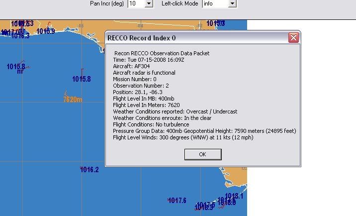
yes and they did... you should be able to find the reports on the NHC website... I don't know if they dropped, but the HDOBs & RECCO should be up.
0 likes
-
Stratosphere747
- Category 5
- Posts: 3772
- Joined: Thu Sep 11, 2003 8:34 pm
- Location: Surfside Beach/Freeport Tx
- Contact:
Re: ATL: INVEST 94L East of the Windward Islands
pojo wrote:
yes and they did... you should be able to find the reports on the NHC website... I don't know if they dropped, but the HDOBs & RECCO should be up.
Hey Pojo,
What is the 'rest' time required for the flight crew between missions?
0 likes
-
Stratosphere747
- Category 5
- Posts: 3772
- Joined: Thu Sep 11, 2003 8:34 pm
- Location: Surfside Beach/Freeport Tx
- Contact:
Re: ATL: INVEST 94L East of the Windward Islands
http://www.ssd.noaa.gov/PS/TROP/positions.html
15/1745 UTC 12.1N 50.1W T2.0/2.0 94L -- Atlantic Ocean
15/1745 UTC 12.1N 50.1W T2.0/2.0 94L -- Atlantic Ocean
0 likes

Re: ATL: INVEST 94L East of the Windward Islands
Stratosphere747 wrote:pojo wrote:
yes and they did... you should be able to find the reports on the NHC website... I don't know if they dropped, but the HDOBs & RECCO should be up.
Hey Pojo,
What is the 'rest' time required for the flight crew between missions?
ALL military aircrews have a minimum of 12 hours crew rest inbetween flights regardless of position & rank. If interrupted and in crew rest, clock starts all over again.
0 likes

Who is online
Users browsing this forum: No registered users and 116 guests