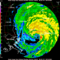
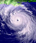
ATL GUSTAV: Tropical Depression - Discussion

Moderator: S2k Moderators

Message
Author
fasterdisaster
Category 5
Category 5
Posts: 1868
Joined: Mon Sep 19, 2005 4:41 pm
Location: Miami, Florida

Re: Re:

#10241 Postby fasterdisaster » Mon Sep 01, 2008 6:03 pm

bob rulz wrote:
fasterdisaster wrote:bob rulz, it was Category 4 surge.


How could it have been a category 4 surge if it was never a cat 4 in the Gulf? Isn't a cat 4 surge upwards of 20 feet? This surge isn't that high...


It was 150 mph over Cuba. Cat 4 surge is 13-18 feet and I think some surge was 14 feet from Gustav.
0 likes   

User avatar
HarlequinBoy
Category 5
Category 5
Posts: 1400
Age: 34
Joined: Wed Nov 29, 2006 1:57 am
Location: Memphis

#10242 Postby HarlequinBoy » Mon Sep 01, 2008 6:04 pm

1130 AM TROPICAL STORM 10 S HATTIESBURG 31.17N 89.31W
09/01/2008 FORREST MS EMERGENCY MNGR

SPORADIC REPORTS OF A FEW TREES DOWN ALONG THE PATH OF
ROTATING SQUALL THAT MOVED ACROSS CENTRAL FORREST COUNTY.
TREE DOWN ACROSS INTERSTATE 59.

1210 PM TROPICAL STORM PURVIS 31.14N 89.41W
09/01/2008 LAMAR MS EMERGENCY MNGR

SCATTERED TREES DOWN ACROSS LAMAR COUNTY ASSOCIATED WITH
BANDS OF SQUALLS MOVING ACROSS COUNTY.

1215 PM NON-TSTM WND GST COLUMBIA 31.26N 89.83W
09/01/2008 M52.00 MPH MARION MS LAW ENFORCEMENT

1233 PM TROPICAL STORM COLUMBIA 31.26N 89.83W
09/01/2008 MARION MS EMERGENCY MNGR

POWER OUTAGES AND TREES DOWN ACROSS MARION
COUNTY...INCLUDING TREES DOWN AND OUTAGES IN THE CITY OF
COLUMBIA.

1233 PM TROPICAL STORM ROXIE 31.51N 91.07W
09/01/2008 FRANKLIN MS EMERGENCY MNGR

TREES DOWN ACROSS WESTERN FRANKLIN COUNTY.

1233 PM TROPICAL STORM BOGUE CHITTO 31.43N 90.45W
09/01/2008 LINCOLN MS EMERGENCY MNGR

SCATTERED TREES DOWN AND POWER OUTAGES ACROSS THE
SOUTHERN PART OF LINCOLN COUNTY.

0134 PM TORNADO PURVIS 31.14N 89.41W
09/01/2008 LAMAR MS EMERGENCY MNGR

AT LEAST A BRIEF TOUCHDOWN...FUNNEL CLOUD WITH DEBRIS
REPORTED NEAR SHERIFF OFFICE. FUNNEL CLOUD ALSO SPOTTED
ABOUT 1 MILE NW.

0144 PM TROPICAL STORM BROOKLYN 31.06N 89.18W
09/01/2008 FORREST MS EMERGENCY MNGR

TREES DOWN ACROSS HWY 49 AT HWY 13. BLOCKING SOUTHBOUND
LANE.

0154 PM FUNNEL CLOUD 12 ENE COLUMBIA 31.32N 89.64W
09/01/2008 LAMAR MS EMERGENCY MNGR

ON LAMAR...MARION COUNTY LINE.

0158 PM NON-TSTM WND GST 12 N COLUMBIA 31.43N 89.83W
09/01/2008 M60.00 MPH MARION MS EMERGENCY MNGR

MEASURED WIND GUST AS ROTATING SQUALL PASSED BETWEEN
BUNKER HILL AND SOCIETY HILL NEAR THE MARION/JEFFERSON
DAVIS COUNTY LINE

0205 PM TROPICAL STORM GALLMAN 31.93N 90.39W
09/01/2008 COPIAH MS AMATEUR RADIO

TREES AND POWERLINE DOWN

0215 PM TROPICAL STORM PURVIS 31.14N 89.41W
09/01/2008 LAMAR MS EMERGENCY MNGR

TWO TRAVEL TRAILERS FLIPPED OVER.

0223 PM TROPICAL STORM BROOKHAVEN 31.58N 90.45W
09/01/2008 LINCOLN MS EMERGENCY MNGR

SUSTAINED TROPICAL STORM FORCE WINDS OF 40 TO 50 MPH.
NUMEROUS...WIDESPREAD TREES DOWN ACROSS LINCOLN COUNTY.
TREE FELL ON A FIRE ENGINE AND INJURIES HAVE BEEN
REPORTED.

0223 PM TROPICAL STORM NATCHEZ 31.55N 91.39W
09/01/2008 ADAMS MS EMERGENCY MNGR

NUMEROUS REPORTS OF TREES DOWN ACROSS ADAMS COUNTY.

0231 PM TORNADO 2 NE STRINGER 31.89N 89.24W
09/01/2008 JASPER MS LAW ENFORCEMENT

TREES DOWN ON CR 10. PROBABLE TORNADO BASED ON RADAR.

0240 PM TORNADO 3 SW BAY SPRINGS 31.95N 89.32W
09/01/2008 SMITH MS LAW ENFORCEMENT

TREES DOWN ON HWY 531. PROBABLE TORNADO BASED ON RADAR.

0417 PM TROPICAL STORM RALEIGH 32.03N 89.52W
09/01/2008 SMITH MS LAW ENFORCEMENT

NUMEROUS TREES DOWN COUNTYWIDE. BASED ON RADAR MAY BE
TORNADO TRACKS WITHIN THE COUNTY. SURVEYS WILL BE
CONDUCTED AT LATER DATES.

0440 PM TORNADO 6 NNW FANNIN 32.50N 90.00W
09/01/2008 MADISON MS LAW ENFORCEMENT

ROSS BARNETT RESERVOIR PATROL REPORTS TORNADO ON THE
GROUND NEAR HWY 43 AT THE RESERVOIR

0538 PM TROPICAL STORM NATCHEZ 31.55N 91.39W
09/01/2008 ADAMS MS EMERGENCY MNGR

EXTENSIVE TREE AND POWERLINE DAMAGE ACROSS ADAMS COUNTY.
ESTIMATE OF 50 PCT OF THE COUNTY WITHOUT POWER. LOTS OF
ROADS BLOCKED BY TREES AND POWERLINES. MEASURED GUSTS OF
50 MPH AT NATCHEZ ADAMS CD OFFICE.
0 likes   

User avatar
HarlequinBoy
Category 5
Category 5
Posts: 1400
Age: 34
Joined: Wed Nov 29, 2006 1:57 am
Location: Memphis

Re: Re:

#10243 Postby HarlequinBoy » Mon Sep 01, 2008 6:05 pm

fasterdisaster wrote:
bob rulz wrote:
fasterdisaster wrote:bob rulz, it was Category 4 surge.


How could it have been a category 4 surge if it was never a cat 4 in the Gulf? Isn't a cat 4 surge upwards of 20 feet? This surge isn't that high...


It was 150 mph over Cuba. Cat 4 surge is 13-18 feet and I think some surge was 14 feet from Gustav.


Yeah, but most of the surge was blocked by Cuba from when it was a Cat 4.
0 likes   

JusLimin
Tropical Low
Tropical Low
Posts: 16
Joined: Thu Sep 09, 2004 8:24 pm
Location: S.E Florida

Re: Cat 1 Hurricane Gustav makes landfall-Cocodrie, LA

#10244 Postby JusLimin » Mon Sep 01, 2008 6:06 pm


I'm trying to get info out of Terrebonne too. I'm sure lower Terrebonne got some heft damage but I haven't had anything confirmed except from watching Jim Cantore on TWC.


http://www.houmatoday.com/apps/pbcs.dll/frontpage

Look to right side of web page for 'most read' and 'most recent' articles. Some specifics there.
0 likes   

bob rulz
Category 5
Category 5
Posts: 1704
Age: 35
Joined: Sat Jan 28, 2006 7:30 pm
Location: Salt Lake City, Utah

Re: Re:

#10245 Postby bob rulz » Mon Sep 01, 2008 6:09 pm

fasterdisaster wrote:
bob rulz wrote:
fasterdisaster wrote:bob rulz, it was Category 4 surge.


How could it have been a category 4 surge if it was never a cat 4 in the Gulf? Isn't a cat 4 surge upwards of 20 feet? This surge isn't that high...


It was 150 mph over Cuba. Cat 4 surge is 13-18 feet and I think some surge was 14 feet from Gustav.


That could be considered upper cat 3 surge for many areas.

I have been having trouble finding standard surge for each category. Does anyone have a link that has that info?
0 likes   

User avatar
KWT
Category 5
Category 5
Posts: 31415
Joined: Tue Aug 17, 2004 11:02 am
Location: UK!!!

#10246 Postby KWT » Mon Sep 01, 2008 6:12 pm

Yep i'm hearing the Plaquemines Parish levee has been breached, I don't think those leevees have been strengthened nearly as much as they had around N.O it seems
0 likes   

User avatar
Enzo Aquarius
Tropical Storm
Tropical Storm
Posts: 160
Joined: Wed Jul 23, 2008 12:53 pm
Location: Canada

Re:

#10247 Postby Enzo Aquarius » Mon Sep 01, 2008 6:14 pm

KWT wrote:Yep i'm hearing the Plaquemines Parish levee has been breached, I don't think those leevees have been strengthened nearly as much as they had around N.O it seems


As it was said on WDSU, the levee hasn't breached, but is at risk of failing. These conflicting news reports and some lack of information can be confusing. :double:
0 likes   

User avatar
KWT
Category 5
Category 5
Posts: 31415
Joined: Tue Aug 17, 2004 11:02 am
Location: UK!!!

#10248 Postby KWT » Mon Sep 01, 2008 6:17 pm

Yeah I'm watching fox Enzo and they are reporting water is leaking through, what exactly that means and how severe it is I've not got a clue but its never a good sign when that starts to happen.
0 likes   

User avatar
funster
Category 3
Category 3
Posts: 816
Joined: Sat Dec 29, 2007 4:27 pm
Location: North Dallas

#10249 Postby funster » Mon Sep 01, 2008 6:26 pm

Seems to surge is still rising.

Governor Bobby Jindal said the Corps of Engineers is closing the London Avenue Canal for the first time ever after Lake Pontchartrain continues to rise as Hurricane Gustav marches inland.

The safe water mark is 5 feet at this canal, but the Corps closes the gate at 4 feet. It should take 45 minutes.


http://www.beloblog.com/WWLTV_Blogs/bre ... ue-ca.html
0 likes   

User avatar
wxman57
Moderator-Pro Met
Moderator-Pro Met
Posts: 22976
Age: 67
Joined: Sat Jun 21, 2003 8:06 pm
Location: Houston, TX (southwest)

Re: Re:

#10250 Postby wxman57 » Mon Sep 01, 2008 6:26 pm

bob rulz wrote:
fasterdisaster wrote:bob rulz, it was Category 4 surge.


How could it have been a category 4 surge if it was never a cat 4 in the Gulf? Isn't a cat 4 surge upwards of 20 feet? This surge isn't that high...


There's no such thing as a "Category 4 surge" or a "Category 3 surge". A hurricane's peak wind over a small area is only a very tiny part, an almost insignificant part of the total surge height. Surge should never be tied to a hurricane's peak wind, but to the size of its wind field (in particular, the hurricane force and greater winds), the forward speed and angle of approach, the coastal bathymetry, and any bays/inlets in the path of a hurricane. All of those factors are far more significant than the peak wind (SS Category).
0 likes   

CajunMama
Retired Staff
Retired Staff
Posts: 10791
Joined: Thu Feb 06, 2003 9:57 pm
Location: 30.22N, 92.05W Lafayette, LA

#10251 Postby CajunMama » Mon Sep 01, 2008 6:33 pm

Lost power for 3 hours. It came back on just as we started the generator and were plugging things in. Breinla and i are fine, no damage. Tenspeed had damage to her house.

One fatality here from a tree falling on a house. He was 27. Katc showed a video and it didn't even look like a house was there.
0 likes   

Frank P
S2K Supporter
S2K Supporter
Posts: 2775
Joined: Fri Aug 29, 2003 10:52 am
Location: Biloxi Beach, Ms
Contact:

Re: Hurricane Gustav makes landfall-Cocodrie, LA

#10252 Postby Frank P » Mon Sep 01, 2008 6:34 pm

I was quite impressed with Gustav's surge here in Biloxi.. my best guess would be in the 10-11 foot range as it did cover the sea wall and it's 10.5 feet ASL and also completely flooded the south lane of HWY 90.. it's gone down quite a bit but I'd estimate its still a good 4-5 feet ASL due to the brisk 20+ mph southerly wind flow...
0 likes   

jimguru
S2K Supporter
S2K Supporter
Posts: 50
Joined: Sun Aug 31, 2008 12:50 am
Location: Centralia, Washington
Contact:

Re: Hurricane Gustav makes landfall-Cocodrie, LA

#10253 Postby jimguru » Mon Sep 01, 2008 6:36 pm

Levee is going over the top near St Bernard Parish - CNN / FOX now reporting - does'nt look good. Looks like they are trying to do their best to stop it....
0 likes   

User avatar
Hybridstorm_November2001
S2K Supporter
S2K Supporter
Posts: 2811
Joined: Sat Aug 21, 2004 2:50 pm
Location: SW New Brunswick, Canada
Contact:

Re:

#10254 Postby Hybridstorm_November2001 » Mon Sep 01, 2008 6:36 pm

CajunMama wrote:Lost power for 3 hours. It came back on just as we started the generator and were plugging things in. Breinla and i are fine, no damage. Tenspeed had damage to her house.

One fatality here from a tree falling on a house. He was 27. Katc showed a video and it didn't even look like a house was there.


That is heart breakingly tragic. :cry: My thoughts, and prayers, are with his friends and family.
0 likes   

User avatar
x-y-no
Category 5
Category 5
Posts: 8359
Age: 65
Joined: Wed Aug 11, 2004 12:14 pm
Location: Fort Lauderdale, FL

Re:

#10255 Postby x-y-no » Mon Sep 01, 2008 6:38 pm

CajunMama wrote:Lost power for 3 hours. It came back on just as we started the generator and were plugging things in. Breinla and i are fine, no damage. Tenspeed had damage to her house.

One fatality here from a tree falling on a house. He was 27. Katc showed a video and it didn't even look like a house was there.


Welcome back Mama! Glad you're OK.
0 likes   

Brent
S2K Supporter
S2K Supporter
Posts: 38087
Age: 36
Joined: Sun May 16, 2004 10:30 pm
Location: Tulsa Oklahoma
Contact:

Re:

#10256 Postby Brent » Mon Sep 01, 2008 6:40 pm

CajunMama wrote:Lost power for 3 hours. It came back on just as we started the generator and were plugging things in. Breinla and i are fine, no damage. Tenspeed had damage to her house.

One fatality here from a tree falling on a house. He was 27. Katc showed a video and it didn't even look like a house was there.


Glad you and Bre are OK but sad news. :cry:
0 likes   

jimguru
S2K Supporter
S2K Supporter
Posts: 50
Joined: Sun Aug 31, 2008 12:50 am
Location: Centralia, Washington
Contact:

Re: Hurricane Gustav makes landfall-Cocodrie, LA

#10257 Postby jimguru » Mon Sep 01, 2008 6:43 pm

Anybody else heard that Lake Charles may get 20+ (yes twenty) inches of rain?
0 likes   

User avatar
scotto
S2K Supporter
S2K Supporter
Posts: 64
Age: 60
Joined: Sat Aug 18, 2007 12:46 pm
Location: Baton Rouge, LA

#10258 Postby scotto » Mon Sep 01, 2008 7:02 pm

The winds have calmed down here in Baton Rouge. Lost power at 12:08 and conditions declined from there. I was doing alright till the first 60' oak pushed over and smashed my neighbor's house. Everyone was ok. Highest winds I have ever seen. I can't imagine staying through a larger storm.

The heavy winds came from the NE and several hours later began shifting to the SE, which I was thankful to see. I guess some people might say Gustav was a little one but I think Baton Rouge set a record today for max wind speed during a hurricane.

Gotta put some fuel in the generator.
0 likes   

Ed Mahmoud

Re: Hurricane Gustav makes landfall-Cocodrie, LA

#10259 Postby Ed Mahmoud » Mon Sep 01, 2008 7:02 pm

jimguru wrote:Anybody else heard that Lake Charles may get 20+ (yes twenty) inches of rain?


I don't think so. Shreveport, maybe.

LCH is well South/West of the track. They got some good rain, but areas near the center, especially at night during the core rain event, will get the most. ESF also could get a lot.

Image

Image
0 likes   

User avatar
Enzo Aquarius
Tropical Storm
Tropical Storm
Posts: 160
Joined: Wed Jul 23, 2008 12:53 pm
Location: Canada

Re: Hurricane Gustav makes landfall-Cocodrie, LA

#10260 Postby Enzo Aquarius » Mon Sep 01, 2008 7:03 pm

Water is no longer overtopping the Braithwaite levee, thank goodness.

Glad to hear you are fine CajunMama. Sorry to hear the bad news. :(
0 likes   


Return to “2008”

Who is online

Users browsing this forum: No registered users and 12 guests