ATL OMAR: Remnant Low - Discussion
Moderator: S2k Moderators
-
Gustywind

- Category 5

- Posts: 12334
- Joined: Mon Sep 03, 2007 7:29 am
- Location: Baie-Mahault, GUADELOUPE
http://www.meteo.fr/temps/domtom/antill ... Tagant.jpg
Look at that size, getting fater ad fater impressive for sure... what a presentation!
Look at that size, getting fater ad fater impressive for sure...
0 likes


TCCA22 KNHC 131430
STDCCA
SATELLITE TROPICAL DISTURBANCE RAINFALL ESTIMATES
NWS TPC/NATIONAL HURRICANE CENTER MIAMI FL
1215 UTC MON OCT 13 2008
SYSTEM NAME/IDENTIFIER...AL982008
MAX RAINFALL
DATE/TIME LOCATION MOTION MEAN LAST
----------- ------------ ------ ------- -------
12/1215 UTC 14.9N 69.6W 270/06 14.5 IN 15.6 IN
LAST RAINFALL DISTRIBUTION...
DISTANCE LEFT OF CENTER RIGHT OF CENTER
------------- --------------- ---------------
0 TO 1 DEGREE 2.8 TO 15.6 IN 3.1 TO 11.9 IN
1 TO 2 DEGREE 1.4 TO 3.4 IN 0.4 TO 2.9 IN
2 TO 3 DEGREE 0.2 TO 1.0 IN 0.0 TO 0.8 IN
3 TO 4 DEGREE 0.0 TO 0.6 IN 0.0 TO 0.2 IN
...LEGEND...
SYSTEM NAME/IDENTIFIER...NAME OR NUMBER ASSIGNED TO SYSTEM
(E.G. TROPICAL STORM ALPHA, TROPICAL
DISTURBANCE 01, SURFACE TROUGH)
DATE/TIME... DAY OF MONTH AND TIME IN UNIVERSAL TIME
COORDINATES (UTC) IN A DY/HRMN FORMAT
LOCATION... ESTIMATED CENTER OF SYSTEM OR ADVISORY
POSITION FOR TROPICAL CYCLONE IN TENTHS
OF DEGREES OF LATITUDE AND LONGITUDE
MOTION... ESTIMATED DIRECTION AND SPEED OF SYSTEM
IN DEGREES AND KNOTS
MEAN MAXIMUM RAINFALL... THE 24-HOUR MEAN MAXIMUM ACCUMULATION OF
RAINFALL FOR THE SYSTEM IN INCHES BASED
ON FOUR SATELLITE IMAGES SIX HOURS APART
LAST MAXIMUM RAINFALL... THE MAXIMUM ACCUMULATION OF RAINFALL FOR
THE SYSTEM IN INCHES BASED ON THE MOST
RECENT SATELLITE IMAGE
RAINFALL DISTRIBUTION... THE DISTRIBUTION OF RAINFALL WITHIN FOUR
DEGREES (240 NM) LEFT AND RIGHT OF THE
SYSTEM CENTER IN ONE DEGREE (60NM)
INCREMENTS...LOOKING DOWNSTREAM
(1 IN = 25.4 MM)
0 likes

-
cycloneye

- Admin

- Posts: 149827
- Age: 69
- Joined: Thu Oct 10, 2002 10:54 am
- Location: San Juan, Puerto Rico
Re: ATL: Tropical Depression 15 - Discussion
I better go to Home Depot this afternoon.
Seriously,this looks worse than the massive flooding event of September that gave birth later to Kyle.
Seriously,this looks worse than the massive flooding event of September that gave birth later to Kyle.
0 likes

-
HURAKAN

- Professional-Met

- Posts: 46084
- Age: 39
- Joined: Thu May 20, 2004 4:34 pm
- Location: Key West, FL
- Contact:
Luis, the only good news I can see at the moment for Puerto Rico is that if the storm continues to have the area of convection mainly to the east of the center, then there is the possibility that the center passes to the east of Puerto Rico and most of the convection will remain to the east of the island. We will see what happens but it doesn't look good for the NE Caribbean.
0 likes
-
HURAKAN
- Professional-Met
- Posts: 46084
- Age: 39
- Joined: Thu May 20, 2004 4:34 pm
- Location: Key West, FL
- Contact:
Re:
AdamFirst wrote:What's calling for the sudden jerk to the NE?
Discussion:
THEREAFTER...GLOBAL MODELS DEVELOP A LARGE AND STRONG MID-
LATITUDE TROUGH OVER THE WESTERN ATLANTIC. THE CYCLONE IS EXPECTED
TO BECOME EMBEDDED WITHIN THE SOUTHWESTERLY FLOW AHEAD OF THIS
TROUGH AND RECURVE. THIS TRACK SHOULD BRING THE CYCLONE VERY CLOSE
TO PUERTO RICO BETWEEN 48 AND 72 HOURS AND OVER THE OPEN ATLANTIC
THEREAFTER. THIS TRACK IS VERY CLOSE TO THE MODEL CONSENSUS AND
ALSO IS HEAVILY BIASED TOWARD THE GFDL AND HWRF MODELS.
0 likes

-
cycloneye
- Admin
- Posts: 149827
- Age: 69
- Joined: Thu Oct 10, 2002 10:54 am
- Location: San Juan, Puerto Rico
Re:
HURAKAN wrote:Luis, the only good news I can see at the moment for Puerto Rico is that if the storm continues to have the area of convection mainly to the east of the center, then there is the possibility that the center passes to the east of Puerto Rico and most of the convection will remain to the east of the island. We will see what happens but it doesn't look good for the NE Caribbean.
Yes,that is the only silver line for us.However,my worrie is how much rainfall Puerto Rico will get even well before the center of TD 15/Omar moves thru or close.Already some rivers are out or close to being out of their banks and still many families haved not recuperated from that massive flood event of last month.
0 likes


-
Tampa Bay Hurricane

- Category 5
- Posts: 5597
- Age: 38
- Joined: Fri Jul 22, 2005 7:54 pm
- Location: St. Petersburg, FL
Re: ATL: Tropical Depression 15 - Discussion
Cycloneye, My prayers are with you and eveeryone on the islands of
Puerto Rico and adjacent islands that may get deadly flooding. I hope
that people are evacuated from mudslide and flood danger zones.
Puerto Rico and adjacent islands that may get deadly flooding. I hope
that people are evacuated from mudslide and flood danger zones.
Last edited by Tampa Bay Hurricane on Mon Oct 13, 2008 10:07 am, edited 1 time in total.
0 likes

Re: ATL: Tropical Depression 15 - Discussion
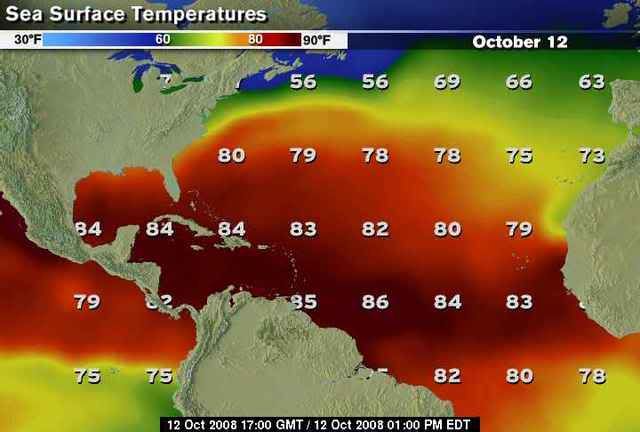
Deep energy stewing over warm Caribbean SST's.
I'm more concerned with the west Caribbean disturbance that the models plucked out of thin air and is now apparently materializing to our south.
#15 and looks like #16 on the way making my 15-9-4 prediction -low-!
I'm more concerned with the west Caribbean disturbance that the models plucked out of thin air and is now apparently materializing to our south.
#15 and looks like #16 on the way making my 15-9-4 prediction -low-!
0 likes
-
bvigal

- S2K Supporter

- Posts: 2276
- Joined: Sun Jul 24, 2005 8:49 am
- Location: British Virgin Islands
- Contact:
Re: ATL: Tropical Depression 15 - Discussion
Sanibel wrote:I'm more concerned with the west Caribbean disturbance that the models plucked out of thin air and is now apparently materializing to our south.
Well that's nice, there is a thread topic for 99L... here we are discussing TD15.
0 likes
Who is online
Users browsing this forum: No registered users and 63 guests