

Interesting to see that cycloneye however as its a developing system and we have a broad area of lower pressure the center could well jump about quite a bit, I think we saw that yesterday when they had to adjust the center about 2 degrees further east then was progged at first.
Thunder44, I agree it doesn't appear to me that there is much in the way of shear over the system as of yet!
EPAC: Tropical Depression Alma (01E)
Moderator: S2k Moderators
-
cycloneye

- Admin

- Posts: 149825
- Age: 69
- Joined: Thu Oct 10, 2002 10:54 am
- Location: San Juan, Puerto Rico
Re: EPAC: Invest 90E (T1.5) GTWO-Red,TCFA Issued
WHXX04 KWBC 281727
CHGQLM
ATTENTION...NATIONAL HURRICANE CENTER
NCEP COUPLED GFDL HURRICANE MODEL FORECAST MADE FOR
TROPICAL DEPRESSION INVEST 90E
INITIAL TIME 12Z MAY 28
DISCLAIMER ... THIS INFORMATION IS PROVIDED AS GUIDANCE. IT
REQUIRES INTERPRETATION BY HURRICANE SPECIALISTS AND SHOULD
NOT BE CONSIDERED AS A FINAL PRODUCT. PLEASE SEE THE TPC/NHC
OFFICIAL FORECAST.
FORECAST STORM POSITION
HOUR LATITUDE LONGITUDE HEADING/SPEED(KT)
0 9.6 88.0 65./ 4.1
6 10.0 87.6 41./ 5.9
12 10.4 87.2 54./ 6.0
18 11.2 86.9 16./ 8.9
24 12.2 87.3 337./ 9.9
30 12.5 87.9 295./ 7.1
36 12.9 88.3 323./ 5.4
42 13.8 88.7 332./ 9.5
48 15.3 88.8 358./15.3
54 15.9 89.1 336./ 6.8
60 16.2 89.5 304./ 4.7
66 16.6 90.1 303./ 7.1
72 17.0 90.7 300./ 7.4
78 17.0 91.2 276./ 4.8
84 16.9 91.3 211./ 1.2
90 17.2 91.5 328./ 3.7
STORM DISSIPATED AT 90 HRS AT THE ABOVE PSN.
0 likes
-
Derek Ortt


-
Ed Mahmoud
Re: EPAC: Invest 90E (T1.5) GTWO-Red,TCFA Issued
Playing around with 12Z Nogaps, it seems the Caribbean low quickly becomes dominant, per the model, and system heads for Gulf (and Florida)?
 Not all computers will want you to see this picture

 The Navy website has some issue with security certificates, although if the US Navy gives you a virus, well, I'd be surprised. I was an E-5 in the Navy, ET2, NEC 3383, and while there was a Mac in the RC Division office even then, I don't think we had interweb access.
0 likes

Re:
Derek Ortt wrote:could be some very serious flooding in Nicaragua, Honduras, El Salvador and Guatemala (possibly Costa Rica as well)
Costa Rica is already getting drenched since most of the moisture is on the east side, it could be deadly with their mountainous terrrain.
0 likes
Yep thats a big risk I hope there aren't any of those big landslides that can occur with these sorts of slow moving tropical disturbances, because if there is we could well see some deaths even if it doesn't actually develop into a tropical cyclone.
Last edited by KWT on Wed May 28, 2008 1:17 pm, edited 1 time in total.
0 likes
-
cycloneye
- Admin
- Posts: 149825
- Age: 69
- Joined: Thu Oct 10, 2002 10:54 am
- Location: San Juan, Puerto Rico
Re: EPAC: Invest 90E (T1.5) GTWO-Red,TCFA Issued
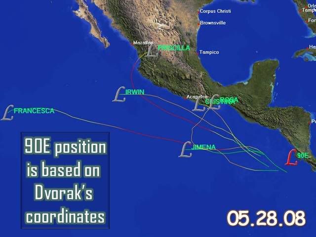
28/1745 UTC 10.0N 86.3W T1.5/1.5 90E -- East Pacific Ocean
http://www.ssd.noaa.gov/PS/TROP/positions.html
http://www.ssd.noaa.gov/PS/TROP/positions.html
0 likes
Has an non-ATL crossover EPAC storm ever formed this far east? I don't think so.
It's so close to Costa Rica, I honestly think it could form soon and become the EPAC name (which escapes me right now), or form later and become Arthur. Or ... not at all. Either way, it looks to be drifting east to my untrained eye.
EDIT: Just re-read this, seems like a stated the obvious a lot. Either way, this is exiting, we're kinda breaking new ground here.
Last edited by Cyclone1 on Wed May 28, 2008 1:28 pm, edited 1 time in total.
0 likes
-
Ed Mahmoud
Re:
Cyclone1 wrote:Has an non-ATL crossover EPAC storm ever formed this far east? I don't think so.
It's so close to Costa Rica, I honestly think it could form soon and become the EPAC name (which escapes me right now), or form later and become Arthur. Or ... not at all. Either way, it looks to be drifting east to my untrained eye.
"Alma", IIRC
0 likes

-
cycloneye
- Admin
- Posts: 149825
- Age: 69
- Joined: Thu Oct 10, 2002 10:54 am
- Location: San Juan, Puerto Rico
Re: EPAC: Invest 90E (T1.5) GTWO-Red,TCFA Issued
TROPICAL CYCLONE GUIDANCE MESSAGE
NWS TPC/NATIONAL HURRICANE CENTER MIAMI FL
1830 UTC WED MAY 28 2008
DISCLAIMER...NUMERICAL MODELS ARE SUBJECT TO LARGE ERRORS.
PLEASE REFER TO NHC OFFICIAL FORECASTS FOR TROPICAL CYCLONE
AND SUBTROPICAL CYCLONE INFORMATION.
EAST PACIFIC OBJECTIVE AIDS FOR
DISTURBANCE INVEST (EP902008) 20080528 1800 UTC
...00 HRS... ...12 HRS... ...24 HRS. .. ...36 HRS...
080528 1800 080529 0600 080529 1800 080530 0600
LAT LON LAT LON LAT LON LAT LON
BAMS 9.8N 86.4W 10.9N 86.5W 12.0N 86.9W 13.2N 87.4W
BAMD 9.8N 86.4W 11.1N 86.5W 12.6N 87.6W 13.8N 89.2W
BAMM 9.8N 86.4W 11.0N 86.3W 12.3N 86.9W 13.7N 88.0W
LBAR 9.8N 86.4W 10.9N 86.0W 13.0N 86.6W 15.3N 87.7W
SHIP 25KTS 32KTS 41KTS 50KTS
DSHP 25KTS 32KTS 34KTS 30KTS
...48 HRS... ...72 HRS... ...96 HRS. .. ..120 HRS...
080530 1800 080531 1800 080601 1800 080602 1800
LAT LON LAT LON LAT LON LAT LON
BAMS 14.4N 88.3W 15.9N 90.5W 16.0N 93.6W 15.6N 97.2W
BAMD 14.6N 91.1W 14.3N 94.8W 12.6N 98.3W 12.0N 101.7W
BAMM 14.6N 89.3W 15.2N 92.1W 14.4N 95.2W 14.3N 98.7W
LBAR 17.3N 88.8W 19.0N 90.6W 19.3N 92.1W 19.7N 94.5W
SHIP 57KTS 65KTS 70KTS 73KTS
DSHP 28KTS 27KTS 34KTS 36KTS
...INITIAL CONDITIONS...
LATCUR = 9.8N LONCUR = 86.4W DIRCUR = 80DEG SPDCUR = 7KT
LATM12 = 9.5N LONM12 = 87.7W DIRM12 = 75DEG SPDM12 = 8KT
LATM24 = 9.3N LONM24 = 89.5W
WNDCUR = 25KT RMAXWD = 150NM WNDM12 = 25KT
CENPRS = 1006MB OUTPRS = 1009MB OUTRAD = 200NM SDEPTH = M
RD34NE = 0NM RD34SE = 0NM RD34SW = 0NM RD34NW = 0NM
$$
NNNN

It continues to move towards the coast now a little more fast.
NWS TPC/NATIONAL HURRICANE CENTER MIAMI FL
1830 UTC WED MAY 28 2008
DISCLAIMER...NUMERICAL MODELS ARE SUBJECT TO LARGE ERRORS.
PLEASE REFER TO NHC OFFICIAL FORECASTS FOR TROPICAL CYCLONE
AND SUBTROPICAL CYCLONE INFORMATION.
EAST PACIFIC OBJECTIVE AIDS FOR
DISTURBANCE INVEST (EP902008) 20080528 1800 UTC
...00 HRS... ...12 HRS... ...24 HRS. .. ...36 HRS...
080528 1800 080529 0600 080529 1800 080530 0600
LAT LON LAT LON LAT LON LAT LON
BAMS 9.8N 86.4W 10.9N 86.5W 12.0N 86.9W 13.2N 87.4W
BAMD 9.8N 86.4W 11.1N 86.5W 12.6N 87.6W 13.8N 89.2W
BAMM 9.8N 86.4W 11.0N 86.3W 12.3N 86.9W 13.7N 88.0W
LBAR 9.8N 86.4W 10.9N 86.0W 13.0N 86.6W 15.3N 87.7W
SHIP 25KTS 32KTS 41KTS 50KTS
DSHP 25KTS 32KTS 34KTS 30KTS
...48 HRS... ...72 HRS... ...96 HRS. .. ..120 HRS...
080530 1800 080531 1800 080601 1800 080602 1800
LAT LON LAT LON LAT LON LAT LON
BAMS 14.4N 88.3W 15.9N 90.5W 16.0N 93.6W 15.6N 97.2W
BAMD 14.6N 91.1W 14.3N 94.8W 12.6N 98.3W 12.0N 101.7W
BAMM 14.6N 89.3W 15.2N 92.1W 14.4N 95.2W 14.3N 98.7W
LBAR 17.3N 88.8W 19.0N 90.6W 19.3N 92.1W 19.7N 94.5W
SHIP 57KTS 65KTS 70KTS 73KTS
DSHP 28KTS 27KTS 34KTS 36KTS
...INITIAL CONDITIONS...
LATCUR = 9.8N LONCUR = 86.4W DIRCUR = 80DEG SPDCUR = 7KT
LATM12 = 9.5N LONM12 = 87.7W DIRM12 = 75DEG SPDM12 = 8KT
LATM24 = 9.3N LONM24 = 89.5W
WNDCUR = 25KT RMAXWD = 150NM WNDM12 = 25KT
CENPRS = 1006MB OUTPRS = 1009MB OUTRAD = 200NM SDEPTH = M
RD34NE = 0NM RD34SE = 0NM RD34SW = 0NM RD34NW = 0NM
$$
NNNN
It continues to move towards the coast now a little more fast.
0 likes
Well it seems like its going to have about another 12-18hrs to get its act together before its almost totally overland. Once that happens then chances of development are very much reduced for this area. Still I see no reason why this won't go on to become a tropical depression very shortly given everything I've seen.
In this case DSHIP's are going to be the one to use and this shows it peaking at 34kts before heading inland.
I think the models haven't really got a good grip with this easterly movement probably being brought on by the other low pressure system in the SW Caribbean presently, esp the statistical models which you'd kind of expect.
0 likes
-
Evil Jeremy

- S2K Supporter

- Posts: 5463
- Age: 32
- Joined: Mon Apr 10, 2006 2:10 pm
- Location: Los Angeles, CA
Re: EPAC: Invest 90E (T1.5) GTWO-Red,TCFA Issued
If those coordinates are correct, than 90E is just a few miles off the coast I think.
http://hypersock.com/index.php?q=aHR0cD ... FrbV96b29t
http://hypersock.com/index.php?q=aHR0cD ... FrbV96b29t
0 likes

Oh its closer to land then I thought it was, if thats the case then I think its now or never for upgrading this system.
It gets very complicated from now on because where is this going to go, I'd guess the voricity will ermerge out in the Sw Caribbean...just wonder if it will finally decide on a dominant vortex because its going to have a hard time developing with this sort of structure.
It gets very complicated from now on because where is this going to go, I'd guess the voricity will ermerge out in the Sw Caribbean...just wonder if it will finally decide on a dominant vortex because its going to have a hard time developing with this sort of structure.
0 likes
Who is online
Users browsing this forum: No registered users and 16 guests