URNT15 KNHC 181711
AF304 0604A DEAN HDOB 40 20070818
170100 1546N 06909W 6976 02612 9439 +116 +116 213089 099 094 013 00
170130 1547N 06910W 6965 02571 9355 +142 +142 206063 073 076 008 03
170200 1548N 06912W 6965 02541 9304 +160 +150 199036 045 041 006 03
170230 1549N 06914W 6971 02518 9291 +161 +141 191014 020 032 006 03
170300 1549N 06915W 6967 02527 9296 +154 +143 347009 013 016 005 03
170330 1550N 06917W 6963 02529 9286 +168 +132 018022 025 999 999 03
170400 1551N 06916W 6967 02518 9282 +168 +130 065022 024 031 006 03
170430 1552N 06915W 6977 02510 9282 +170 +126 113033 043 038 006 00
170500 1553N 06913W 6959 02543 9307 +151 +144 129048 051 047 006 00
170530 1553N 06912W 6967 02555 9336 +145 +145 140067 072 074 005 00
170600 1554N 06910W 6969 02586 9378 +138 +138 146088 098 113 014 00
170630 1554N 06909W 6935 02679 9990 +104 +999 153123 132 118 022 05
170700 1555N 06907W 7004 02670 9990 +088 +999 150129 133 110 025 05
170730 1555N 06906W 6945 02785 9584 +102 +102 150122 123 101 042 03
170800 1556N 06905W 6973 02791 9630 +110 +110 150116 123 097 030 03
170830 1556N 06904W 6962 02839 9674 +107 +107 151111 111 090 010 00
170900 1557N 06902W 6969 02854 9726 +086 +086 149110 112 089 005 00
170930 1558N 06901W 6968 02882 9726 +109 +109 149111 113 091 006 00
171000 1558N 06900W 6963 02906 9750 +103 +103 150109 111 088 006 00
171030 1559N 06858W 6955 02927 9777 +087 +087 151105 110 087 037 05
133kt FL wind in NE quad . . .
CAT 5 Hurricane Dean - Archived threads
Moderator: S2k Moderators
-
WindRunner

- Category 5

- Posts: 5803
- Age: 35
- Joined: Fri Jul 29, 2005 8:07 pm
- Location: Warrenton, VA, but Albany, NY for school
- Contact:
-
southerngale

- Retired Staff

- Posts: 27418
- Joined: Thu Oct 10, 2002 1:27 am
- Location: Southeast Texas (Beaumont area)
Re: Hurricane DEAN: Global Models
wxmann_91 wrote:canegrl04 wrote:PTrackerLA wrote:I might eat my words later but I'm really starting to think this is Mexico storm. I was pretty convinced Texas was going to get it but the models continue to shift south. Looks like the GFS nailed this one as of a couple of days ago.
Just keep in mind models had Rita pegged as a Mexico hit 4 or 5 days out
The first run, and ONLY the first run, had a Mex hit (extrapolating), and that was 6-7 days out from a landfall. Once Rita began to deepen, the models did a better job initializing it, and they shifted northward.
And also, totally different scenario with Dean. Like comparing apples to oranges.
5 days out, they showed Mexico and/or Deep South Texas. After that, they started slowly shifting right up the coast.
0 likes
-
fasterdisaster
- Category 5
- Posts: 1868
- Joined: Mon Sep 19, 2005 4:41 pm
- Location: Miami, Florida

Re: Hurricane DEAN: Global Models
Go easy on wxman. Not everyone is a walking hurricane compendium.
0 likes
-
wxmann_91

- Category 5
- Posts: 8007
- Age: 34
- Joined: Fri Jul 15, 2005 2:49 pm
- Location: Southern California
- Contact:
Re: Hurricane DEAN: Global Models
tolakram wrote:and all those tracks had the Storms south of Jamacia....what would happen to the tracks if the Storms were North of Jamacia as we will probably see in the case of Dean?
I don't understand why people are comparing Dean to other tracks? The track is dependent on the weather around the storm, not a previous track.
Yeah, I know track is dependent on steering flow. However, if all major storms had steering flow driving them to MX, wouldn't that say something about the tendency of that particular steering flow being in place for a next storm, ESPECIALLY if the models indicate it to be?
0 likes
-
webke
- S2K Supporter

- Posts: 290
- Age: 70
- Joined: Sun Sep 05, 2004 12:39 pm
- Location: North Myrtle Beach SC
Re: Major Hurricane DEAN: (11AM page 217) Discussions, Analysis
Question, As Dean gets closer to the D.R. and Haiti wouldn't it try to move more to the west as it interacts with the mountains.
Last edited by webke on Sat Aug 18, 2007 12:24 pm, edited 1 time in total.
0 likes
-
wx247

- S2K Supporter
- Posts: 14279
- Age: 42
- Joined: Wed Feb 05, 2003 10:35 pm
- Location: Monett, Missouri
- Contact:
Okay, so I have been doing some math calculations. The floater does a nice job of giving great lat/lon on the loop when you freeze it. Within the course of the loop, about 6 hrs... it has moved 1.1 W and .5 N.
If that trend continues (and I am not saying it will) that would eventually bring Dean to 74.5W, 18.4N... north of the forecasted point and north of Jamaica.
Just some food for thought this afternoon.
If that trend continues (and I am not saying it will) that would eventually bring Dean to 74.5W, 18.4N... north of the forecasted point and north of Jamaica.
Just some food for thought this afternoon.
0 likes
-
Extremeweatherguy

- Category 5
- Posts: 11095
- Joined: Mon Oct 10, 2005 8:13 pm
- Location: Florida
Re: Hurricane DEAN: Global Models
Windtalker2 wrote:and all those tracks had the Storms south of Jamacia....what would happen to the tracks if the Storms were North of Jamacia as we will probably see in the case of Dean?
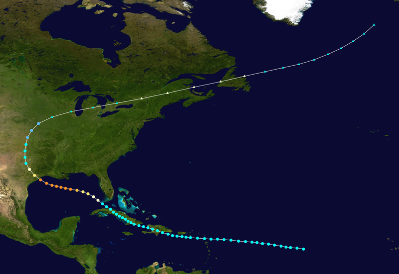
Historically, the storms that pass north of Jamaica tend to miss the Yucatan all together...which could happen with Dean. A few examples of a north of Jamaica hit followed by a close brush just north of the Yucatan and then onto a landfall in TX or Western LA would be...
Tropical storm Claudette (1979) = http://upload.wikimedia.org/wikipedia/c ... _track.png
Hurricane of 1915 = http://upload.wikimedia.org/wikipedia/c ... _track.png
Hurricane of 1900 = http://upload.wikimedia.org/wikipedia/c ... _track.png
0 likes
Re: Hurricane DEAN: Global Models
Just the opposite. Wxman's perfectly correct to cite the major status because, scientifically, a strong ridge guiding it west is more likely to force a stronger system. His analogy is valid.
0 likes

Re:
artist wrote:The area between The Western Tip of Cuba and the Eastern tip of Cuba shows winds from South to North....Could this area tend to pull Dean more Northward when he reaches it?
If it could then wouldn't it be able to do it where it is now as well which would take it across Puerto Rico and out to sea. Just my thoughts. I am not a pro.
The ULL is far to the west of Dean. Now moving off Florida into the Gulf.
http://www.ssd.noaa.gov/goes/east/gmex/loop-wv.html
0 likes
-
tolakram
- Admin

- Posts: 20183
- Age: 62
- Joined: Sun Aug 27, 2006 8:23 pm
- Location: Florence, KY (name is Mark)
Re: Hurricane DEAN: Global Models
wxmann_91 wrote:tolakram wrote:and all those tracks had the Storms south of Jamacia....what would happen to the tracks if the Storms were North of Jamacia as we will probably see in the case of Dean?
I don't understand why people are comparing Dean to other tracks? The track is dependent on the weather around the storm, not a previous track.
Yeah, I know track is dependent on steering flow. However, if all major storms had steering flow driving them to MX, wouldn't that say something about the tendency of that particular steering flow being in place for a next storm, ESPECIALLY if the models indicate it to be?
I'm not sure how to answer that question. Too little data, too many variables.
0 likes
-
Ivanhater

- Storm2k Moderator

- Posts: 11221
- Age: 39
- Joined: Fri Jul 01, 2005 8:25 am
- Location: Pensacola
Re:
wx247 wrote:Okay, so I have been doing some math calculations. The floater does a nice job of giving great lat/lon on the loop when you freeze it. Within the course of the loop, about 6 hrs... it has moved 1.1 W and .5 N.
If that trend continues (and I am not saying it will) that would eventually bring Dean to 74.5W, 18.4N... north of the forecasted point and north of Jamaica.
Just some food for thought this afternoon.
Lol..Im sitting here doing the same thing..Ol' paper line across the computer screen analysis
0 likes
-
WindRunner
- Category 5
- Posts: 5803
- Age: 35
- Joined: Fri Jul 29, 2005 8:07 pm
- Location: Warrenton, VA, but Albany, NY for school
- Contact:
URNT15 KNHC 181721
AF304 0604A DEAN HDOB 41 20070818
171100 1559N 06857W 6981 02909 9820 +078 +078 148111 112 084 018 01
171130 1600N 06856W 6968 02945 9833 +076 +076 152111 113 080 021 00
171200 1600N 06854W 6966 02963 9847 +081 +081 150108 110 077 017 03
171230 1601N 06853W 6966 02974 9863 +079 +079 152107 107 077 011 00
171300 1602N 06852W 6965 02991 9877 +081 +081 153104 105 072 008 00
171330 1602N 06850W 6968 02997 9874 +093 +093 151100 102 072 006 00
171400 1603N 06849W 6963 03016 9893 +089 +089 150097 097 072 004 00
171430 1603N 06848W 6976 03008 9902 +090 +090 150094 095 072 006 00
171500 1604N 06846W 6964 03030 9907 +093 +090 151092 092 071 006 00
171530 1605N 06845W 6964 03038 9928 +082 +082 151092 094 066 008 00
171600 1605N 06843W 6971 03034 9939 +079 +079 149083 086 064 009 00
171630 1606N 06842W 6969 03046 9945 +081 +081 148085 088 063 057 03
171700 1607N 06840W 6971 03046 9979 +059 +059 148089 089 063 032 03
171730 1607N 06839W 6968 03056 9976 +066 +066 147089 091 062 039 03
171800 1608N 06838W 6973 03056 9952 +089 +089 149084 085 061 016 00
171830 1608N 06836W 6965 03070 9968 +081 +081 147082 083 061 007 00
171900 1609N 06835W 6965 03074 9968 +082 +082 146081 083 061 007 00
171930 1609N 06835W 6965 03074 9978 +078 +078 146081 083 061 007 00
172000 1610N 06832W 6968 03078 9990 +074 +074 147078 079 058 014 03
172030 1611N 06831W 6967 03084 9985 +082 +082 147077 078 057 009 00
Seems to be a rather large area of FL winds >110kts . . . and VDM should be in at any moment . . .
0 likes


-
Extremeweatherguy
- Category 5
- Posts: 11095
- Joined: Mon Oct 10, 2005 8:13 pm
- Location: Florida
Re: Hurricane DEAN: Global Models
I would disagree. Stronger storms are more inclined to find a weakness and try to push north. Weaker storms are the ones that are typically pushed the furthest west. It just so happens though that with Allen, Gilbert, and the others..the ridge was exceptionally strong with no real weakness available. In Dean's case though, there might be a window of opportunity for him to find a weakness. That is why we should watch him closely and not let our gaurd down.Sanibel wrote:Just the opposite. Wxman's perfectly correct to cite the major status because, scientifically, a strong ridge guiding it west is more likely to force a stronger system. His analogy is valid.
0 likes
-
Galvestongirl

- Category 1

- Posts: 288
- Joined: Fri Aug 22, 2003 8:13 am
hou/gal out of the woods??
any chance they are out of the woods? I had major abd. surgery on tuesday, just to wake up to 2 storms...lol what a supprise. I will leave if necessary, but, just dont feel up to a long evacuation, and dont know if my body can handle it...so I am hoping that we are clear.
0 likes
-
Wthrman13

- Professional-Met

- Posts: 502
- Joined: Sun Jul 06, 2003 12:44 pm
- Location: West Lafayette, IN
- Contact:
Re: Hurricane DEAN: Global Models=12z GFS is rolling in
LSU2001 wrote:I thought one of the pro-mets (wxman57 maybe) was taking about how storms are not really affected by the idea of momentum because of the fluidity of the system. In my experience I have seen storms make very sharp turns even when they were expected to maintain a relatively straight course. Not saying this will happen but with strong hurricanes but I never rule anything out until well after landfall.
JMHO,
Tim
That was me. This is a pernicious myth that just seems to keep popping up
0 likes
Re: Major Hurricane DEAN: (11AM page 217) Discussions, Analysis
webke wrote:Question, As Dean getes closer to thte D.R. and Haiti wouldn't it try to move more to the west as it interacts with the mountains.
You're sorta thinking the storm feels mountains and has direction control. It doesn't. It is moved by large-scale deep-layer winds. If the steering currents push it into a mountain or a coast, that's where it goes. It'd be nice if they bounced off obstacles -- they would never make landfall.
0 likes
-
southerngale
- Retired Staff
- Posts: 27418
- Joined: Thu Oct 10, 2002 1:27 am
- Location: Southeast Texas (Beaumont area)
Re: Hurricane DEAN: Global Models
tolakram wrote:and all those tracks had the Storms south of Jamacia....what would happen to the tracks if the Storms were North of Jamacia as we will probably see in the case of Dean?
I don't understand why people are comparing Dean to other tracks? The track is dependent on the weather around the storm, not a previous track.
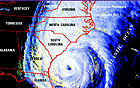
True... totally different scenario. I think the comparison to the Rita forecast track (at least for me) was that 5 days out, it seemed like SE TX would NOT get hit. The models, as well as the official 5 day track, pointed to Northern Mexico / Deep South Texas. With Rita still on everyone's mind (at least where I live), there's just an uneasy feeling of something similar occurring. That's all. I think it's normal to be a little nervous after going through the hell that was Rita. Exactly 5 days later from this advisory (10 pm cdt Friday), we were sitting in the pitch dark, with Rita's winds howling outside as she approached the coast.
I guess they didn't archive the 5-day graphic, but here's the 3-day, 5 days out, plus a few hours.

0 likes
Who is online
Users browsing this forum: No registered users and 22 guests