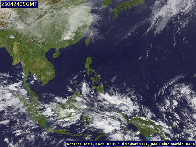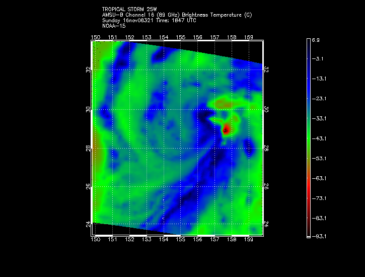
Super Typhoon Chanchu - Cat. 4
Moderator: S2k Moderators
-
CHRISTY
-
Weatherfreak000
It's probably not gonna become a "MONSTER" but it's pretty good.

Shear has been impacting the storm but it's still maintaining a strong core. Unless the shear impacts the storm soon the TS will move into even lower shear. Still I have no doubt we'll be seeing our first typhoon of the season.

Shear has been impacting the storm but it's still maintaining a strong core. Unless the shear impacts the storm soon the TS will move into even lower shear. Still I have no doubt we'll be seeing our first typhoon of the season.
0 likes
-
HurricaneHunter914
- Category 5

- Posts: 4439
- Age: 32
- Joined: Fri Mar 10, 2006 7:36 pm
- Location: College Station, TX
- HURAKAN
- Professional-Met

- Posts: 46084
- Age: 39
- Joined: Thu May 20, 2004 4:34 pm
- Location: Key West, FL
- Contact:
T0601 (CHANCHU)
Issued at 15:00 UTC 9 May 2006RSMC TROPICAL CYCLONE ADVISORY
NAME TS 0601 CHANCHU (0601)
ANALYSIS
PSTN 091500UTC 08.4N 131.8E POOR
MOVE WNW 06KT
PRES 1000HPA
MXWD 035KT
30KT 120NM
FORECAST
24HF 101500UTC 09.4N 129.2E 80NM 70%
MOVE WNW 06KT
PRES 992HPA
MXWD 045KT
45HF 111200UTC 10.3N 126.6E 150NM 70%
MOVE WNW 07KT
PRES 980HPA
MXWD 055KT
69HF 121200UTC 12.1N 123.9E 220NM 70%
MOVE WNW 08KT
PRES 980HPA
MXWD 055KT
IT'S OFFICIAL. JMA SAYS THAT CHANCHU IS HERE!!!
0 likes
-
MiamiensisWx
I think we may be seeing the start of some rapid deepening, especially as the trough enhances Chanchu's outflow and pulls away. Convection is near the center (right next vto or over it, actually), outflow is VERY well-established on the southern side, and outflow is beginning to develop on the north side. Similar setups have often produced rapid deepening and strengthening of western Pacific systems. I think Chanchu may be about to do the same. Who agrees, especially after looking at the latest images? With lower shear becoming established, this may well become reality.
Classic western Pacific rapid deepening setup may be taking place...
Classic western Pacific rapid deepening setup may be taking place...
0 likes
-
MiamiensisWx
- senorpepr
- Military Met/Moderator

- Posts: 12542
- Age: 43
- Joined: Fri Aug 22, 2003 9:22 pm
- Location: Mackenbach, Germany
- Contact:
CapeVerdeWave wrote:By the way, Chanchu has some of the looks of a possible super typhoon developing and strengthening...
I think that statement is extremely farfetched. With all due respect, it's Greatone-like.
No forecasts have it reaching super typhoon status... much less major typhoon status. JTWC (which is normally too high on forecasts) is going with a whopping 75 knots. Keep in mind that within 48 hours, Chanchu will be traversing the Philippines. This will weaken the storm. It has a chance of limited redevelopment once it's over the South China Sea, but that will only be until the cyclone approaches land once again.
0 likes
-
MiamiensisWx
Oh... sorry. I just meant that it is a possibility, since I thought it might have some room between the area to it's east and the Philippines. I didn't mean for it to sound Greatone-like, and I know it is highly unlikely. However, some rapid strengthening - though very likely not to a super typhoon - I think is quite possible. Sorry for sounding like Greatone... I just said it wrong. Sorry...


0 likes
-
whereverwx
- Category 5

- Posts: 1107
- Joined: Mon May 31, 2004 10:15 pm
senorpepr wrote:CapeVerdeWave wrote:By the way, Chanchu has some of the looks of a possible super typhoon developing and strengthening...
I think that statement is extremely farfetched. With all due respect, it's Greatone-like.
No forecasts have it reaching super typhoon status... much less major typhoon status. JTWC (which is normally too high on forecasts) is going with a whopping 75 knots. Keep in mind that within 48 hours, Chanchu will be traversing the Philippines. This will weaken the storm. It has a chance of limited redevelopment once it's over the South China Sea, but that will only be until the cyclone approaches land once again.
jtwc considerably downplayed Mala's intensity for a good while along with a number of other storms in the past...it goes both ways. the ECMWF is bombing this storm in the South China Sea and the nogaps isn't far off.
0 likes
-
JonathanBelles
- Professional-Met

- Posts: 11430
- Age: 35
- Joined: Sat Dec 24, 2005 9:00 pm
- Location: School: Florida State University (Tallahassee, FL) Home: St. Petersburg, Florida
- Contact:
-
JonathanBelles
- Professional-Met

- Posts: 11430
- Age: 35
- Joined: Sat Dec 24, 2005 9:00 pm
- Location: School: Florida State University (Tallahassee, FL) Home: St. Petersburg, Florida
- Contact:
Who is online
Users browsing this forum: No registered users and 10 guests


