Next Wave to Exit the Coast of Africa

This is the general tropical discussion area. Anyone can take their shot at predicting a storms path.

Moderator: S2k Moderators

Forum rules

The posts in this forum are NOT official forecasts and should not be used as such. They are just the opinion of the poster and may or may not be backed by sound meteorological data. They are NOT endorsed by any professional institution or STORM2K. For official information, please refer to products from the National Hurricane Center and National Weather Service.

Help Support Storm2K
Message
Author
User avatar
SouthFloridawx
S2K Supporter
S2K Supporter
Posts: 8346
Age: 46
Joined: Tue Jul 26, 2005 1:16 am
Location: Sarasota, FL
Contact:

Next Wave to Exit the Coast of Africa

#1 Postby SouthFloridawx » Wed Aug 23, 2006 5:10 pm

Ok so I see no one else has posted a thread concerning the next wave coming off of Africa. Looking at the size of the 850mb vorticity it looks like this one if it gets going will have a larger circulation than Debby does. Streamline analysis of the 850mb level indicates that this area already has a circulation. http://www.nhc.noaa.gov/tafb/QUNA00.jpg

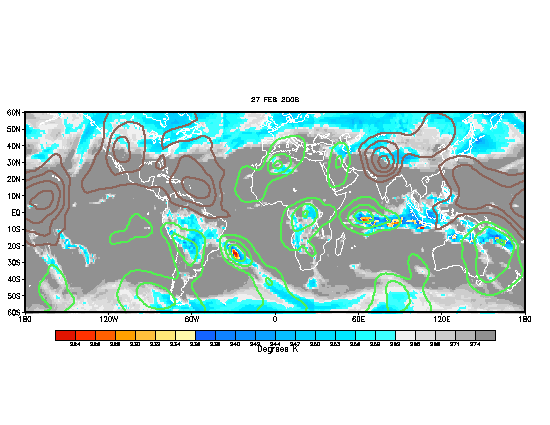
With Favorable MJO in the Atlantic it looks like this could be a decent next couple of weeks for the E. Atlantic.
Image

http://tinyurl.com/qjfmy
:uarrow: :uarrow: Satelite Imagry

1009mb in 84 Hours
http://www.nco.ncep.noaa.gov/pmb/nwprod ... n_084s.gif
http://moe.met.fsu.edu/cyclonephase/gfs ... 2/114.html
GFS already picking up on it. :uarrow: :uarrow:

http://moe.met.fsu.edu/cyclonephase/cmc ... 12/11.html
Canadian Picking up on it. :uarrow: :uarrow: :uarrow:

http://moe.met.fsu.edu/cyclonephase/mm5 ... 12/23.html
MM5FSU :uarrow: :uarrow: :uarrow:
0 likes   

User avatar
ConvergenceZone
Category 5
Category 5
Posts: 5200
Joined: Fri Jul 29, 2005 1:40 am
Location: Northern California

#2 Postby ConvergenceZone » Wed Aug 23, 2006 6:06 pm

man, look at that train over Africa in the satellite pic you posted..... :eek:


Yep, it's FINALLY here....This is the most active week since the season started.

#1 Debbie
#2 97L (soon to be Ernesto)
#3 The wave about to emerge off of Africa
0 likes   

User avatar
WindRunner
Category 5
Category 5
Posts: 5806
Age: 34
Joined: Fri Jul 29, 2005 8:07 pm
Location: Warrenton, VA, but Albany, NY for school
Contact:

#3 Postby WindRunner » Wed Aug 23, 2006 6:28 pm

That's the system people were labeling as soon-to-be TD5 a couple of days ago . . . let me go find that thread . . . still looks pretty good, even though convection is weaker.
0 likes   

User avatar
SouthFloridawx
S2K Supporter
S2K Supporter
Posts: 8346
Age: 46
Joined: Tue Jul 26, 2005 1:16 am
Location: Sarasota, FL
Contact:

#4 Postby SouthFloridawx » Wed Aug 23, 2006 6:48 pm

Please post about it when you find it windrunner.
0 likes   

User avatar
WindRunner
Category 5
Category 5
Posts: 5806
Age: 34
Joined: Fri Jul 29, 2005 8:07 pm
Location: Warrenton, VA, but Albany, NY for school
Contact:

#5 Postby WindRunner » Wed Aug 23, 2006 6:57 pm

Sorry . . . got distracted with some models.

This is the thread . . . an interesting discussion, but old enough that this thread is fine, if that's what you are worrying about.

http://www.storm2k.org/phpbb2/viewtopic.php?t=88516

I don't know if any of those sat images in that thread got archived, but they did show the gray color on IR with very little rotation. Obviously it has developed significantly since then, even though the intense convection has waned. Of course, the convection could swing either way once it hits the water . . .
0 likes   

Air Force Met
Military Met
Military Met
Posts: 4372
Age: 56
Joined: Tue Jul 08, 2003 9:30 am
Location: Roan Mountain, TN

#6 Postby Air Force Met » Wed Aug 23, 2006 7:09 pm

Yes...this is a monster in size. The 850 mb circulation is over 1200nm in diameter...if not larger. It is roughly the size of Super Typhoon Tip...but that is where the comparison ends.

I think it will have a hard time. First, it is coming off above 15N...and second...the lower level circulation is so large...it is going to be pulling in a lot of stable air from the north. A TS is certainly not out of the question...but getting something more than that will take a while because large systems pull in so much dry air from everywhere...it has to be well away from the cooler water.
0 likes   

Air Force Met
Military Met
Military Met
Posts: 4372
Age: 56
Joined: Tue Jul 08, 2003 9:30 am
Location: Roan Mountain, TN

#7 Postby Air Force Met » Wed Aug 23, 2006 7:11 pm

PS...this is the same one I've been speaking of...and the GFS has been advertising it now for about a week.

Here is a good shot of it. It dwarfs Debby.

Pic
0 likes   

User avatar
SouthFloridawx
S2K Supporter
S2K Supporter
Posts: 8346
Age: 46
Joined: Tue Jul 26, 2005 1:16 am
Location: Sarasota, FL
Contact:

#8 Postby SouthFloridawx » Wed Aug 23, 2006 7:13 pm

Air Force Met wrote:Yes...this is a monster in size. The 850 mb circulation is over 1200nm in diameter...if not larger. It is roughly the size of Super Typhoon Tip...but that is where the comparison ends.

I think it will have a hard time. First, it is coming off above 15N...and second...the lower level circulation is so large...it is going to be pulling in a lot of stable air from the north. A TS is certainly not out of the question...but getting something more than that will take a while because large systems pull in so much dry air from everywhere...it has to be well away from the cooler water.


Airforcemet it appears according to the TPC TWD suface analysis graphic that there is already a 1003mb surface low associated with it.
http://www.nhc.noaa.gov/tafb/ATSA_18Z.gif

GFS initializes it at 1004mb
http://www.nco.ncep.noaa.gov/pmb/nwprod ... n_000l.gif
0 likes   

Air Force Met
Military Met
Military Met
Posts: 4372
Age: 56
Joined: Tue Jul 08, 2003 9:30 am
Location: Roan Mountain, TN

#9 Postby Air Force Met » Wed Aug 23, 2006 7:33 pm

SouthFloridawx wrote:Airforcemet it appears according to the TPC TWD suface analysis graphic that there is already a 1003mb surface low associated with it.
http://www.nhc.noaa.gov/tafb/ATSA_18Z.gif

GFS initializes it at 1004mb
http://www.nco.ncep.noaa.gov/pmb/nwprod ... n_000l.gif


Yes...it won't take much to upgrade it...and the GFS has been showing a 1004 MB low coming off the coast for a few days now.
0 likes   

User avatar
EDR1222
S2K Supporter
S2K Supporter
Posts: 1253
Joined: Mon Nov 10, 2003 12:58 pm
Location: Melbourne, FL

#10 Postby EDR1222 » Wed Aug 23, 2006 7:36 pm

Looking at those images it looks as if the ITCZ is situated a little farther north than normal for this time of year. I know it varies somewhat, but maybe someone can shed some light on why the storms are rolling off the coast at the higher latitudes. Possibly a weaker than normal high pressure system over there?
0 likes   

HurricaneHunter914
Category 5
Category 5
Posts: 4439
Age: 31
Joined: Fri Mar 10, 2006 7:36 pm
Location: College Station, TX

#11 Postby HurricaneHunter914 » Wed Aug 23, 2006 9:05 pm

http://www.ssd.noaa.gov/PS/TROP/DATA/RT/EATL/IR4/20.jpg

Cylconic turning is showing up on Satellite. If there is an El Nino going on, this is probably the weakest one ever.
0 likes   
Personal Forecast Disclaimer:
The posts in this forum are NOT official forecast and should not be used as such. They are just the opinion of the poster and may or may not be backed by sound meteorological data. They are NOT endorsed by any professional institution or storm2k.org. For official information, please refer to the NHC and NWS products.

User avatar
HurricaneMaster_PR
Category 2
Category 2
Posts: 795
Joined: Tue Jul 22, 2003 6:23 pm
Location: San Juan, Puerto Rico

#12 Postby HurricaneMaster_PR » Thu Aug 24, 2006 10:50 am

GFS 12Z shows a strong area of low pressure (1006mb) emerging from the coast within the next 24 hours..
http://www.nco.ncep.noaa.gov/pmb/nwprod ... loop.shtml
0 likes   

User avatar
terstorm1012
S2K Supporter
S2K Supporter
Posts: 1314
Age: 43
Joined: Fri Sep 10, 2004 5:36 pm
Location: Millersburg, PA

#13 Postby terstorm1012 » Thu Aug 24, 2006 10:54 am

I put it up on Google Earth last night and it was quite impressive.

(linky)
http://bbs.keyhole.com/ubb/showthreaded ... in/561535/
http://bbs.keyhole.com/ubb/showflat.php ... PHPSESSID=
0 likes   

Derecho
Category 5
Category 5
Posts: 1011
Joined: Sat Mar 15, 2003 3:15 pm

#14 Postby Derecho » Thu Aug 24, 2006 12:09 pm

Dakar was at 1006 mb this morning, and earlier other sites in Senegal were as low as 1005 mb. It's very, very rare for waves to have sfc pressures under 1006 mb as they come off.
0 likes   

OuterBanker
S2K Supporter
S2K Supporter
Posts: 1750
Joined: Wed Feb 26, 2003 10:53 am
Location: Nags Head, NC
Contact:

#15 Postby OuterBanker » Thu Aug 24, 2006 2:10 pm

Hmmmmm, huge flare up of convec between 12 and 18z run. Large ll swirl but no convec earlier. Wow, what a difference 6 hrs can make. But, I think this will be fish because of high lats.

http://www.ssd.noaa.gov/PS/TROP/DATA/RT ... -loop.html
0 likes   

User avatar
cycloneye
Admin
Admin
Posts: 146157
Age: 69
Joined: Thu Oct 10, 2002 10:54 am
Location: San Juan, Puerto Rico

#16 Postby cycloneye » Thu Aug 24, 2006 7:11 pm

...TROPICAL WAVES...
SATELLITE IMAGERY AND SURFACE OBSERVATIONS SUGGEST A DEVELOPING
TROPICAL WAVE...ACCOMPANIED BY A 1005 MB SURFACE LOW NEAR
16N16W...IS BEGINNING TO MOVE OFF THE COAST OF AFRICA. A WAVE IS
THUS LIKELY TO BE ADDED TO THE 25/0000 UTC MAP THROUGH THE LOW.
A CLUSTER OF SCATTERED MODERATE/ISOLATED STRONG CONVECTION IS
BEGINNING TO MOVE OFF THE COAST OF SENEGAL FROM 13N-18N BETWEEN
13W-19W. ANOTHER CLUSTER OF SCATTERED MODERATE EXISTS OFF THE
COAST OF GUINEA...BUT THIS MAY BE MORE ASSOCIATED WITH THE
ITCZ.


8 PM Discussion.

The low pressure is going to emerge very far north in latitud (16n).
0 likes   
Visit the Caribbean-Central America Weather Thread where you can find at first post web cams,radars
and observations from Caribbean basin members Click Here

whereverwx
Category 5
Category 5
Posts: 1109
Joined: Mon May 31, 2004 10:15 pm

#17 Postby whereverwx » Thu Aug 24, 2006 7:12 pm

It's on its way off the coast...

Image
0 likes   

tropicsPR
Tropical Depression
Tropical Depression
Posts: 79
Joined: Fri Aug 15, 2003 9:52 pm
Location: Puerto Rico

#18 Postby tropicsPR » Thu Aug 24, 2006 7:19 pm

Impressive surface low reading for a wave moving off from Africa...1005mb :eek:
0 likes   

User avatar
Hurricaneman
Category 5
Category 5
Posts: 7390
Age: 45
Joined: Tue Aug 31, 2004 3:24 pm
Location: central florida

#19 Postby Hurricaneman » Thu Aug 24, 2006 7:21 pm

Wouldnt it be funny if this became Ernesto first instead of td 5
0 likes   

Patrick99
Category 5
Category 5
Posts: 1772
Joined: Mon May 24, 2004 3:43 pm
Location: SW Broward, FL

#20 Postby Patrick99 » Thu Aug 24, 2006 7:28 pm

Any reason why this wave exiting Africa, whatever it becomes, won't just follow Debby?
0 likes   


Return to “Talkin' Tropics”

Who is online

Users browsing this forum: No registered users and 56 guests