A DEEP LAYERED CYCLONE IS AT 32N142W WITH AN UPPER TROUGH S TO
15N150W. A SURFACE FRONT IS ALONG 32N137W 24N140W ACCOMPANIED BY
SCATTERED SHOWERS WITHIN 120 NM E OF THE FRONT. AN UPPER ANTICYCLONE
IS NEAR 12N135W WITH AN UPPER RIDGE AMPLIFYING N BEYOND 32N125W.
THE RIDGE SEPARATES THE UPPER TROUGH TO THE W FROM ANOTHER UPPER
CYCLONE AT 27N114W WITH AN ILL-DEFINED TROUGH EXTENDING S TO A BASE
ESTIMATED NEAR 11N110W. A BAND OF UPPER MOISTURE IS OBSERVED WITHIN
180 NM EITHER SIDE OF LINE 32N136W 22N131W 11N140W. OTHERWISE
MODERATE TO STRONG UPPER DRY AIR AND SUBSIDENCE IS NOTED N OF THE
ITCZ W OF 108W...AND IS SUPPRESSING CONVECTION ALONG THE ITCZ W OF
120W.
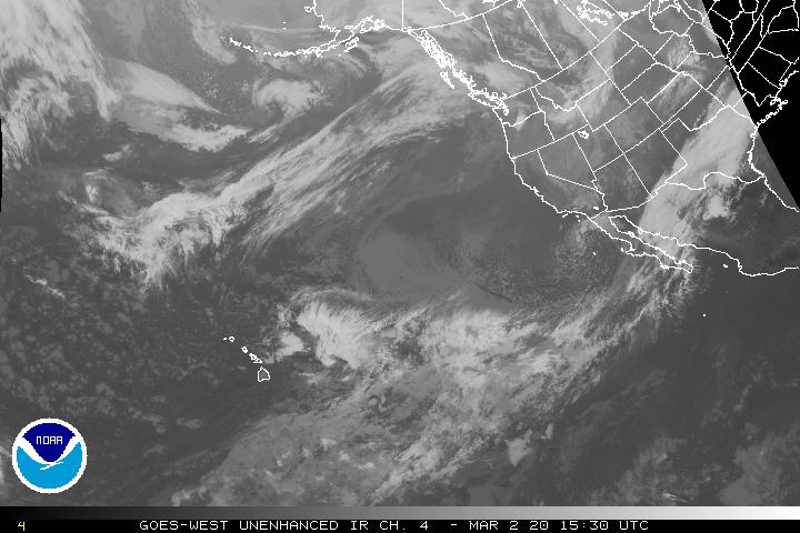
But then I saw the coordinates for it and found out it was way north. Still looks pretty good for an extratropical low.
http://www.ssd.noaa.gov/goes/west/nepac/ir4.jpg
I beleive these types of lows are common in Pacific but I just found it weird why the NHC acknowledged it when they usually don't.
This almost scared me.
Moderator: S2k Moderators
Forum rules

The posts in this forum are NOT official forecasts and should not be used as such. They are just the opinion of the poster and may or may not be backed by sound meteorological data. They are NOT endorsed by any professional institution or STORM2K. For official information, please refer to products from the National Hurricane Center and National Weather Service.
-
HurricaneHunter914
- Category 5

- Posts: 4439
- Age: 32
- Joined: Fri Mar 10, 2006 7:36 pm
- Location: College Station, TX
This almost scared me.
0 likes
Who is online
Users browsing this forum: No registered users and 34 guests