gulf loop current
Moderator: S2k Moderators
Forum rules

The posts in this forum are NOT official forecasts and should not be used as such. They are just the opinion of the poster and may or may not be backed by sound meteorological data. They are NOT endorsed by any professional institution or STORM2K. For official information, please refer to products from the National Hurricane Center and National Weather Service.
-
windycity

- S2K Supporter

- Posts: 461
- Joined: Wed Aug 24, 2005 6:45 pm
- Location: P.B.county,Fl.
- Contact:
gulf loop current
can anyone tell me why the loop current seems larger this year. The water in some areas also seems warmer. I have sisters in clearwater that just moved down from Nebr, and im a little nervous about this coming season. I think where they live is practiclly at sea level. ( they live on the beach ...) Does the loop current effect any areas more than others?
0 likes
-
JonathanBelles
- Professional-Met

- Posts: 11430
- Age: 35
- Joined: Sat Dec 24, 2005 9:00 pm
- Location: School: Florida State University (Tallahassee, FL) Home: St. Petersburg, Florida
- Contact:
-
Cookiely

- S2K Supporter
- Posts: 3211
- Age: 75
- Joined: Fri Aug 13, 2004 7:31 am
- Location: Tampa, Florida
Re: gulf loop current
windycity wrote:can anyone tell me why the loop current seems larger this year. The water in some areas also seems warmer. I have sisters in clearwater that just moved down from Nebr, and im a little nervous about this coming season. I think where they live is practiclly at sea level. ( they live on the beach ...) Does the loop current effect any areas more than others?
Good explanation
http://en.wikipedia.org/wiki/Loop_Current
0 likes

Does it look like ocean temps in general are lowering since 2003? Just looking at some SSTA maps this seems to true. That could mean more systems getting acroos the ATL. and into the Carribean before developing( along with lots of other factors.
0 likes
The following post is NOT an official forecast and should not be used as such. It is just the opinion of the poster and may or may not be backed by sound meteorological data. It is NOT endorsed by any professional institution including storm2k.org For Official Information please refer to the NHC and NWS products.

-
Extremeweatherguy

- Category 5

- Posts: 11095
- Joined: Mon Oct 10, 2005 8:13 pm
- Location: Florida
early last season we also expected a somewhat strong cape verde season...and look at what happened...only one "true" hurricane on the east coast (Ophelia) and everything else was in the Caribbean, Gulf, or near Florida. In my opinion, I think we will see a year mixed between 1999 and 2005...may be slightly more cape verde than last year, but a little less than in 1999. BTW, a hurricane hit Texas in both 1999 and 2005 which means that I expect one this year.
0 likes
-
SouthFloridawx

- S2K Supporter
- Posts: 8346
- Age: 47
- Joined: Tue Jul 26, 2005 1:16 am
- Location: Sarasota, FL
- Contact:
-
Hybridstorm_November2001

- S2K Supporter
- Posts: 2817
- Joined: Sat Aug 21, 2004 2:50 pm
- Location: SW New Brunswick, Canada
- Contact:
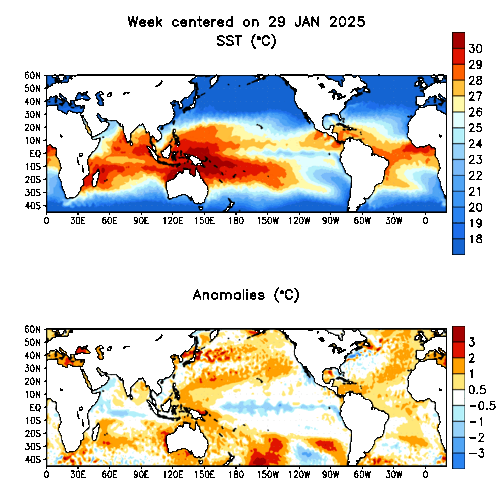
Interesting how the anomalies graphic shows warmer than normal (1 to 3) Sea Surface Temps in the far North Atlantic around the Labrador Current. Which is the coldest part of the whole damn Ocean! Still wouldn't recommend taking a swim there anytime soon  , but it should be interesting to see how this plays out as we progress towards Spring and Summer.
0 likes
-
vacanechaser

- Category 5
- Posts: 1461
- Joined: Wed Dec 03, 2003 9:34 pm
- Location: Portsmouth, Va
- Contact:
here is a good map to see the loop current

Jesse V. Bass III
http://www.vastormphoto.com
Hurricane Intercept Research Team
Jesse V. Bass III
http://www.vastormphoto.com
Hurricane Intercept Research Team
0 likes
-
Jim Cantore
-
Hybridstorm_November2001
- S2K Supporter
- Posts: 2817
- Joined: Sat Aug 21, 2004 2:50 pm
- Location: SW New Brunswick, Canada
- Contact:
Speaking of the relatively warm water for this time of year surrounding the Labrador Current. Check out the below story. It covers the lack of the usual Ice seen in said waters this time of year:
http://www.cbc.ca/nb/story/nb_straitwarm20060109.html
http://www.cbc.ca/nb/story/nb_straitwarm20060109.html
0 likes
-
windycity
- S2K Supporter
- Posts: 461
- Joined: Wed Aug 24, 2005 6:45 pm
- Location: P.B.county,Fl.
- Contact:
every week iv been comparing sst s in the gulf an checkin out the loop current for any changes, its got me nervous. it looks like a cape season but if a storm doesnt fish we could have a east co. fl hit, then tampa from the back,only to reemerge ,strengthen, in the gulf. I hate to think of this happenen. The loop current is quite large compared to last year. can anyone tell me why???
0 likes
think of the loop current as Canearade .the loop current is a pool of hot water that goes down about 300-500 ft.Katrina and Rita were moving at turtle speed once they got over the loop current.when they got over the loop current all that water they were drinking was causing those 2 storms to have WPAC windspeeds which is insane in the atlantic basin
0 likes
Who is online
Users browsing this forum: kevin and 42 guests