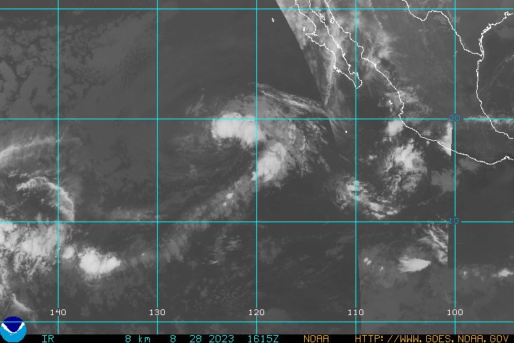
With the season so close, are these the kind of systems that we should be looking at, or is nothing likely to come from them?
E. Pacific flare-ups
Moderator: S2k Moderators
Forum rules
The posts in this forum are NOT official forecasts and should not be used as such. They are just the opinion of the poster and may or may not be backed by sound meteorological data. They are NOT endorsed by any professional institution or STORM2K. For official information, please refer to products from the National Hurricane Center and National Weather Service.
- James
- Category 5

- Posts: 1531
- Joined: Tue Aug 24, 2004 10:29 am
- Location: Gloucestershire, England
- Contact:
E. Pacific flare-ups
There is some impressive convection firing up in the E. Pacific this afternoon. The one furthest east looks particularly strong.

With the season so close, are these the kind of systems that we should be looking at, or is nothing likely to come from them?
With the season so close, are these the kind of systems that we should be looking at, or is nothing likely to come from them?
0 likes
- Aslkahuna
- Professional-Met

- Posts: 4550
- Joined: Thu Feb 06, 2003 5:00 pm
- Location: Tucson, AZ
- Contact:
The transverse banded cirrus between 15 and 20N shows that there are some moderate to strong westerlies and associated shear there so development, if any, would be minimal at this point in time. Need to get the trough to the north over the western US out of the way and develop the STR before we can get going. Models do indicate this happening next week but right it would be wait and see as the models have tended to overdevelop the STR in recent months.
Steve
Steve
0 likes
Who is online
Users browsing this forum: No registered users and 109 guests
