


USVI, BVI forecast to escape harshest winds from Frances
By JEREMY W. PETERS
Tuesday, August 31st 2004
Daily News Photo by SEAN McCOY A St. Thomas resident boards up his home Monday in preparation for the storm.
Hurricane Frances continued its slow westward track on Monday, steering away from the U.S. Virgin Islands but still passing close enough to threaten the territory with some of the worst tropical weather in years.
Frances, a fierce Category 3 storm packing sustained winds close to 125 mph, crept dangerously close to the northern Leeward Islands overnight and into this morning but is forecast to spare the islands from its most destructive winds.
The storm's severe intensity put the Virgin Islands on high alert Monday as the National Weather Service issued a tropical storm warning for St. Thomas and St. John. A warning means a hurricane is expected to strike within 24 hours. A watch means a strike is possible but not expected.
At presstime this morning, the storm was centered about 100 miles northeast of the northern Leeward Islands and moving west about 14 mph.
According to the National Weather Service, tropical storm force winds will begin shortly after sunrise and continue through the afternoon.
On Monday, Frances grew stronger as its central pressure dropped and its winds intensified. Hurricane force winds extended some 70 miles from the eye, and tropical storm force winds were blowing as much as 140 miles out.
"It's a dangerous storm," said Todd Kimberlain, a meteorologist with the National Weather Service in San Juan. "It is stronger than Hurricane Marilyn was in 1995, and it's probably almost as strong as Hugo was when it hit Puerto Rico."
Because of Frances' ferocity, strong winds and heavy rain are forecast through tonight even though the storm's eye is expected to remain north of the territory.
Kimberlain said tropical storm force winds sustained at 45 mph likely will blow through today.
"It's definitely not a good day to be outside, but those are nothing compared to 100, 150 mph winds," he said.
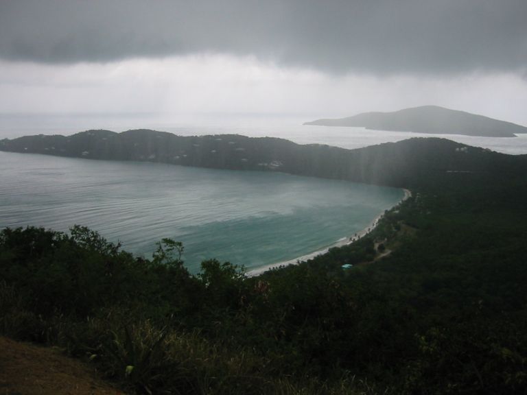
The National Weather Service predicted the storm could bring as much as 3 inches of rain to the Virgin Islands.
The fringes of Frances began to affect the U.S. Virgin Islands as early as Monday afternoon, when bands of heavy rain and gusty winds moved through intermittently.
Earlier in the day, Frances began brushing the islands east of the territory. St. Martin, Anguilla, St. Kitts and Nevis and Antigua all were under tropical storm warnings.
By virtue of its position 40 miles south of St. Thomas, St. Croix is expected to see the least rain and wind from Frances.
Unlike St. Thomas and St. John, St. Croix was under a tropical storm watch.

FROM TORTOLA
1230pm
The heavens have opened up. God is draining his bathtub!
It is POURING down rain!
Very gray, cannot see more than 100 feet!
I got to go clean the balcony off.
It is thundering mightily.
My company (against my wishes) left about 20 minutes ago for a walk. Now they are still gone and it is a deluge with the winds picking up!
Now they know why I am such a wuss and refuse to go out and "look around" the island!
They wanted to go joy riding and watching the surfers and me, the old stick in the mud, said NO WAY!
It is nice and dry here, and I don't plan to be half way across the island when the rains pour down and the rock and mud slides cut off the roads. Nope. Not me.
Now, do I go out in the storm to look for my friend or do I pray she makes it back alive on her own?
This is a tad scary!
I am sure, where ever she is, she is cursing now, cause I wouldn't go out with her, nope, I wanted to stay inside, nice and dry!
FROM ST THOMAS
Getting cloudier. Winds still picking up. Town area not as windy as up in the hills. No seaplanes sighted lately. Stores closed, restaurants closed although I hear the Greenhouse is open. Schools, banks, Government offices, almost everything is closed. Airport still open. just heard a plane take off!
10 o'clock has Frances almost north of us, hopefully she will be past us in a few hours with hardly any winds!
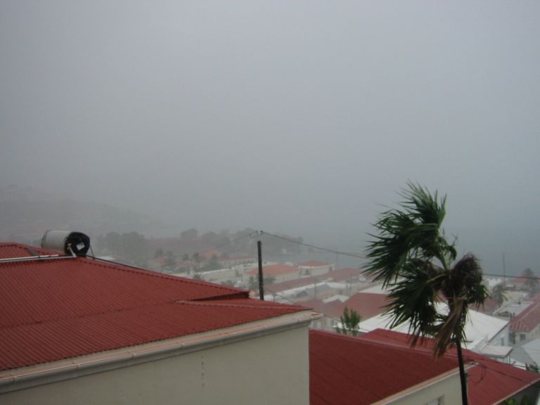
5:00 PM: I am convinced it's all gone. Drove most of the island. Only thing I saw were two trees down and a big flower pot turned over by the pottery place in Smith Bay! The waves at Hull Bay weren't even up to par, like the ones last year when we had a storm pass north.
Looks like we will be okay. Thank God and you guys for your thoughts!
APCEDI
http://www.afap.org/apcedi