Not understanding north turn - ensembles

This is the general tropical discussion area. Anyone can take their shot at predicting a storms path.

Moderator: S2k Moderators

Forum rules

The posts in this forum are NOT official forecasts and should not be used as such. They are just the opinion of the poster and may or may not be backed by sound meteorological data. They are NOT endorsed by any professional institution or STORM2K. For official information, please refer to products from the National Hurricane Center and National Weather Service.

Help Support Storm2K
Message
Author
User avatar
x-y-no
Category 5
Category 5
Posts: 8359
Age: 65
Joined: Wed Aug 11, 2004 12:14 pm
Location: Fort Lauderdale, FL

Not understanding north turn - ensembles

#1 Postby x-y-no » Tue Aug 31, 2004 10:28 am

In the absence of a strong east-coast trough (like what happened with Floyd) I'm not understanding why the models (particularly the GFS) are taking this north rather than wnw or nw across Florida.

Looking at the GFS ensembles from this morning:

Image

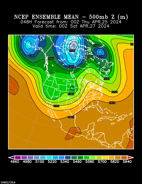
Ridge looks strong Thursday.

----

Image

A little weaker but still sticking well into the Gulf, and with the trough digging in the west.

----

Image

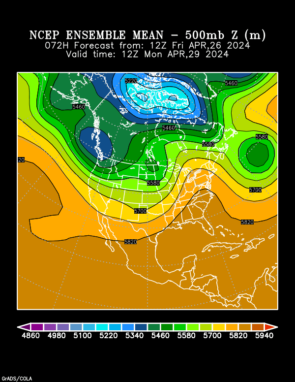
Getting thinner now, but still reaching into the Gulf. Also, why should it be getting thinner with the trough still digging in the west? Shouldn't that pump the ridge a bit more?

----

Image

Finally backing off Saturday night/Sunday morning - but by then the official track has Frances nearing Jacksonville.

---

It looks to me like this is more conducive to a south/central Florida landfall, then tracking up to the Florida panhandle.

What am I missing?
0 likes   

Air Force Met
Military Met
Military Met
Posts: 4372
Age: 56
Joined: Tue Jul 08, 2003 9:30 am
Location: Roan Mountain, TN

#2 Postby Air Force Met » Tue Aug 31, 2004 10:56 am

The high to the north of Frances is pretty strong now. But...as it moves around the western side of it...it is a lot weaker. There is a trough that will erode it enough to allow for a turn more to the NW. Notice on your images how the high juts out west of the storm like a banana. It is moving around a part of the high that is not strong enough to keep it south. So...its really the high being weak in that area more than it is some monster trough taking the high out all together. Tropical cycles can move into areas of weak ridging.
0 likes   

User avatar
hial2
S2K Supporter
S2K Supporter
Posts: 809
Joined: Fri Oct 10, 2003 9:20 pm
Location: Indian trail N.C.

AFM

#3 Postby hial2 » Tue Aug 31, 2004 11:02 am

There is a trough that will erode it enough to allow for a turn more to the NW.

Can you tell where it's at, or is the through mentioned just a forecast? thanks
0 likes   

PurdueWx80
Professional-Met
Professional-Met
Posts: 2720
Joined: Fri Aug 13, 2004 8:33 pm
Location: Madison, WI
Contact:

#4 Postby PurdueWx80 » Tue Aug 31, 2004 11:23 am

12Z Eta at 300 mb Friday evening:

Image

The trough in the west just isn't far enough east to force her to a hard northerly turn. Last night's 00Z GFS ensembles were evenly split between 3 places: NC, northern FL, and Central FL to Gulf. The 00Z GEM ensembles leaned much more towards the Gulf option, but there still some members to the right, although they turned her due north from where she is now. That's not an option. That is one monster full latitude trough though, and with that strong jet streak to the west (120-130 kt perhaps), this thing will dig even more. I really see this as the best option, and that means the ridge would amplify enough to keep her on a WNW to NW path as long as possible. I honestly think this is a central FL to northeast Gulf storm. From there, this looks like one hell of a nasty storm all the way through the Appalachians or eastern Great Lakes (give or take 200 miles), as her energy combines with the incoming trough. If Frances weren't there, that trough would cause a severe weather outbreak to beat the band.
0 likes   

User avatar
x-y-no
Category 5
Category 5
Posts: 8359
Age: 65
Joined: Wed Aug 11, 2004 12:14 pm
Location: Fort Lauderdale, FL

Re: AFM

#5 Postby x-y-no » Tue Aug 31, 2004 11:26 am

hial2 wrote:There is a trough that will erode it enough to allow for a turn more to the NW.

Can you tell where it's at, or is the through mentioned just a forecast? thanks


I assume he means the trough over the Canadian maritimes in the 24, 48 and 72 hour plots above. That's lifting out gradually after tomorrow, though, and at the same time the trough in the west is digging in (which outh to indicate a stronger atlantic ridge if I'm understanding things) so I'm not sure why the ridge continues to weaken so much after 24-48 hours.

AFM is the pro, though and I'm just learning this stuff, so I'd trust him before I trust me. :-)
0 likes   

PurdueWx80
Professional-Met
Professional-Met
Posts: 2720
Joined: Fri Aug 13, 2004 8:33 pm
Location: Madison, WI
Contact:

#6 Postby PurdueWx80 » Tue Aug 31, 2004 11:35 am

12Z GEM and GFS going for a FL/GA border hit. That's a one in a million year storm.
0 likes   


Return to “Talkin' Tropics”

Who is online

Users browsing this forum: AnnularCane, ElectricStorm, Europa non è lontana, Google [Bot], StormWeather, Torgo and 56 guests