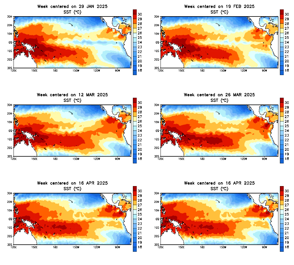
ENSO update ... including SST's depth anomalies ...
Moderator: S2k Moderators
Forum rules
The posts in this forum are NOT official forecasts and should not be used as such. They are just the opinion of the poster and may or may not be backed by sound meteorological data. They are NOT endorsed by any professional institution or STORM2K. For official information, please refer to products from the National Hurricane Center and National Weather Service.
- Stormsfury
- Category 5

- Posts: 10549
- Age: 53
- Joined: Wed Feb 05, 2003 6:27 pm
- Location: Summerville, SC
ENSO update ... including SST's depth anomalies ...
Still remains neutral ... with a decrease in overall coverage of warmer SST's west of the IDL ... and a small area of warmer SST's cropping up in the equatorial EPAC ... however, on this link provided HERE, notice early in the loop, the large area of very warm SST's at 150 meters come to the SFC (and currently where the blip of above normal SST's are located) ... notice that the area of colder SST's are currently located just off the coast of South America, and a new area of colder SST's are forming where the very warm pool at 150 meters deep was just a month and a half ago... conditions should continue to remain neutral fro the foreseeable future, IMHO ...


0 likes
- hurricanetrack
- HurricaneTrack.com

- Posts: 1781
- Joined: Tue Dec 02, 2003 10:46 pm
- Location: Wilmington, NC
- Contact:
SSTs
Excellent info there. It looks like the El Nino will have to wait a while longer. We'll see what implications, if any, this has on Dr. Gray's upcoming revised forecast.
0 likes
- Stormsfury
- Category 5

- Posts: 10549
- Age: 53
- Joined: Wed Feb 05, 2003 6:27 pm
- Location: Summerville, SC
Re: SSTs
hurricanetrack wrote:Excellent info there. It looks like the El Nino will have to wait a while longer. We'll see what implications, if any, this has on Dr. Gray's upcoming revised forecast.
Thanks, hurricanetrack ... Right now, I don't think it'll affect Dr. Gray's numbers a bit, since he's generally expecting neutral ENSO conditions, and IF El Niño were to develop this year, it would likely be too late to affect the 2004 Hurricane Season ... the only thing I see that really goes against higher numbers is climo ... hence, my prelim release in Mid-December with very conservative numbers and 1887-1888 as a prime analog then ...
One thing that was interesting (and was posted elsewhere) is the recent warming globally ... not due to global warming, but the LACK of Major Volcanic Activity ... Volcanic "Dust" in the atmosphere is way below normal and the last MAJOR eruption was Mt. Pinatubo in 1991 ...
SF
0 likes
- cycloneye
- Admin

- Posts: 148763
- Age: 69
- Joined: Thu Oct 10, 2002 10:54 am
- Location: San Juan, Puerto Rico
I agree with SF that the ENSO factor wont revise Dr Gray's forecast because no changes haved been noted and for the next at least 3-6 months no el nino will be in sight.It will be other factors that may make the doc to do some changes to his forecast if any changes come.
Here are the latest projections from CPC for ENSO at link below.
http://www.emc.ncep.noaa.gov/research/c ... cordxy.gif
No big changes from them as the neutral phase will continue.What we have to watch is if el nino begins to form at the ladder part of the season.
Here are the latest projections from CPC for ENSO at link below.
http://www.emc.ncep.noaa.gov/research/c ... cordxy.gif
No big changes from them as the neutral phase will continue.What we have to watch is if el nino begins to form at the ladder part of the season.
0 likes
Visit the Caribbean-Central America Weather Thread where you can find at first post web cams,radars
and observations from Caribbean basin members Click Here
and observations from Caribbean basin members Click Here
cycloneye wrote:I agree with SF that the ENSO factor wont revise Dr Gray's forecast because no changes haved been noted and for the next at least 3-6 months no el nino will be in sight.It will be other factors that may make the doc to do some changes to his forecast if any changes come.
Here are the latest projections from CPC for ENSO at link below.
http://www.emc.ncep.noaa.gov/research/c ... cordxy.gif
No big changes from them as the neutral phase will continue.What we have to watch is if el nino begins to form at the ladder part of the season.
even IF (and i stress the word IF) weak warm ENSO conditions develop toward the end of the 2004 Tropical season, thus, i strongly doubt it will be in time to have ANY mitigating effect whatsoever.
lets also remember that weak and moderate +ENSO events, (especally when most other predictors are arguing against the El Nino signal) dont have much of an effect at all on TC formation in the Atlantic basin.
the NCEP ENSO model has been showing the same thing with regard to the development of a warm episode since at least december (if not longer), and so far nothing has materialized, nor should it. the majority of the other climate models suggest NO SUCH thing happens period, and a few even have a weak La Nina developing.

also heres some other links for you that i think will help:
http://www.cdc.noaa.gov/seasonalfcsts/sst/lag1.html
http://www.cdc.noaa.gov/seasonalfcsts/sst/lag4.html
the NCEP ENSO model has little support from the rest of the data which suggest near neutral conditions thru SEPT.
othwerise 200 and 850mb zonal winds, the SOI, OLR anomalies, and MJO activity have not been consistent with what one would expect to see in the weeks and months leading up to the onset of a weak warm ENSO episode. this also holds true for the treens in SSTA across the region since late fall.
0 likes
Who is online
Users browsing this forum: Kingarabian and 84 guests


