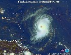
http://www.ssd.noaa.gov/PS/TROP/DATA/RT/WATL/IR4/20.jpg
But upper winds are not favorable (at this time) as a trough is interacting with that wave.Barbados will get some rain today from part of that wave/trough.
Tropical wave affecting the lesser antilles will it develop?
Moderator: S2k Moderators
Forum rules

The posts in this forum are NOT official forecasts and should not be used as such. They are just the opinion of the poster and may or may not be backed by sound meteorological data. They are NOT endorsed by any professional institution or STORM2K. For official information, please refer to products from the National Hurricane Center and National Weather Service.
-
cycloneye

- Admin

- Posts: 148758
- Age: 69
- Joined: Thu Oct 10, 2002 10:54 am
- Location: San Juan, Puerto Rico
Tropical wave affecting the lesser antilles will it develop?
Last edited by cycloneye on Wed Oct 08, 2003 5:58 am, edited 2 times in total.
0 likes
Visit the Caribbean-Central America Weather Thread where you can find at first post web cams,radars
and observations from Caribbean basin members Click Here
and observations from Caribbean basin members Click Here
-
AussieMark

- Category 5

- Posts: 5858
- Joined: Tue Sep 02, 2003 6:36 pm
- Location: near Sydney, Australia
Is it possible for the wave to develop in the Caribbean Sea or won't the wave survive to reach the Caribbean.
I know past years don't mean anything this year but historically the really strong and intense Hurricanes in recent years have formed from Tropical Waves that became organized in the Caribbean.
For Example, Roxanne, Mitch, Iris, Michelle
I know past years don't mean anything this year but historically the really strong and intense Hurricanes in recent years have formed from Tropical Waves that became organized in the Caribbean.
For Example, Roxanne, Mitch, Iris, Michelle
0 likes
-
cycloneye
- Admin
- Posts: 148758
- Age: 69
- Joined: Thu Oct 10, 2002 10:54 am
- Location: San Juan, Puerto Rico
The wave axis is well east of the islands around 45w this monday morning and it has to be watched just in case the shear fades.
Last edited by cycloneye on Mon Oct 06, 2003 7:04 am, edited 1 time in total.
0 likes
Visit the Caribbean-Central America Weather Thread where you can find at first post web cams,radars
and observations from Caribbean basin members Click Here
and observations from Caribbean basin members Click Here
-
wxman57

- Moderator-Pro Met

- Posts: 23131
- Age: 68
- Joined: Sat Jun 21, 2003 8:06 pm
- Location: Houston, TX (southwest)
Upper-level winds appear favorable for development. The GFS indicates a path toward the islands of the northeast Caribbean then straight north and out to sea as a VERY strong/sharp upper-level trof moves into the central Caribbean. So it looks like no threat to the U.S, just a threat to the NE Caribbean should it develop.
0 likes
Wonder what J. B. has to say this week. Yeah, I know everybody picks on him, but he speculates based on the pattern and whens its dull out there, it'll get us by til the next (last) spike of activity in the basin. Since the EPAC is bustling, expect tht to translate somehow into the Atlantic. EC and GFS show development of wave (low) east of the islands, with the EC and GGEM showing development near the Bahamas heading north as well. The GGEM also shows development in the GOM at 144 hours. But that's it for the models. Oh, the ETA tries to close a low near the SE GOM, but nothing else shows that. Other than that its hurricane trivia....yawn. Monday, time to rise and shine!! 
0 likes
-
Stormsfury

- Category 5
- Posts: 10549
- Age: 53
- Joined: Wed Feb 05, 2003 6:27 pm
- Location: Summerville, SC
Steve H. wrote:Wonder what J. B. has to say this week. Yeah, I know everybody picks on him, but he speculates based on the pattern and whens its dull out there, it'll get us by til the next (last) spike of activity in the basin. Since the EPAC is bustling, expect tht to translate somehow into the Atlantic. EC and GFS show development of wave (low) east of the islands, with the EC and GGEM showing development near the Bahamas heading north as well. The GGEM also shows development in the GOM at 144 hours. But that's it for the models. Oh, the ETA tries to close a low near the SE GOM, but nothing else shows that. Other than that its hurricane trivia....yawn. Monday, time to rise and shine!!
The EPAC has been bustling along a pretty good monsoon trough in that region. It could get interesting if the neg. MJO translates east into the ATL.
Of another note, the QBO has gone WAY negative (think it was around -26.9 the last time I checked a few days ago. I'm at work (on my lunch hour) and don't have all my links readily handy.
I think we may get one more storm and then the season concludes.
SF
0 likes
-
Weathermaster
- Tropical Depression

- Posts: 79
- Joined: Thu Sep 04, 2003 10:33 am
- Location: Carolina, PR
NCEP tropical desk....something may develop in 72 hrs EC.
This tropical wave may develop and affect the islands.
Here the message...
THE GFS INDICATES A STRONG EASTERLY WAVE AT 48 HRS OVER THE
WESTERN ATLANTIC NEAR 55W WHICH DEVELOPS INTO A STRONG FEATURE
ON THE DOORSTEPS OF THE WINDWARD ISLES AT 72 HRS. FROM THE
WINDWARDS AND EAST..THIS EASTERLY WAVE WILL HAVE PLENTY OF
DIFFLUENCE IN THE UPPER TROPOSPHERE TO ENHANCE DEVELOPMENT
GIVEN THE ORIENTATION OF THE 250 HPA RIDGE ACCESS.
HOWEVER..WEST OF THE WINDWARDS STRONG SHEAR ALOFT WILL LIKELY
INHIBIT FURTHER INTENSIFICATION. THE TPC TREATS THIS FEATURE AS
A TROPICAL WAVE MOVING IT ALONG FROM 45W AND S OF 17N TO 49W BY
24 HRS...53W BY 36 HRS...57W BY 48 HRS...61W BY 60 HRS AND 65W
BY 72 HRS.
:o
0 likes
-
cycloneye
- Admin
- Posts: 148758
- Age: 69
- Joined: Thu Oct 10, 2002 10:54 am
- Location: San Juan, Puerto Rico
I dont know if you saw Ada Monzon but I saw her and she said at univision at noon that this wave has to be watched for further development in comming days so let's see what happens.
0 likes
Visit the Caribbean-Central America Weather Thread where you can find at first post web cams,radars
and observations from Caribbean basin members Click Here
and observations from Caribbean basin members Click Here
-
*StOrmsPr*

- Tropical Storm

- Posts: 198
- Joined: Thu May 01, 2003 7:39 pm
- Location: Humacao,Puerto Rico
- Contact:
I saw her too Cycloneye!
so lets wacht it.
Hmm i found this,didn't knew it was a cat 4 :
1867 29 oct. "San Narciso" Cat 4
http://www.weather.unisys.com/hurricane ... /track.gif
so lets wacht it.
Hmm i found this,didn't knew it was a cat 4 :
1867 29 oct. "San Narciso" Cat 4
http://www.weather.unisys.com/hurricane ... /track.gif
0 likes
-
cycloneye
- Admin
- Posts: 148758
- Age: 69
- Joined: Thu Oct 10, 2002 10:54 am
- Location: San Juan, Puerto Rico
StOrmsPr I saw her(Ada Monzon) this evening saying that the models develop that wave and moves it WNW or NW close to PR by the weekend so let's watch it.
0 likes
Visit the Caribbean-Central America Weather Thread where you can find at first post web cams,radars
and observations from Caribbean basin members Click Here
and observations from Caribbean basin members Click Here

There may be more than a storm..
in Puerto Rico by this weekend if Ivan "Pudge" Rodriguez, a Puerto Rican superstar, leads the Marlins to victory against the Cubs :o
Sorry about the post..got caught up in all the excitement
Sorry about the post..got caught up in all the excitement
0 likes


Re: Tropical wave flares up east of the lesser antilles
cycloneye wrote:But upper winds are not favorable (at this time) as a trough is interacting with that wave.Barbados will get some rain today from part of that wave/trough.
Conditions are becoming more favorable according to the latest TWO. BTW, we're finally getting some much needed rain at my house!
0 likes
-
cycloneye
- Admin
- Posts: 148758
- Age: 69
- Joined: Thu Oct 10, 2002 10:54 am
- Location: San Juan, Puerto Rico
http://www.srh.noaa.gov/data/JSJ/AFDSJU
Here is the discussion from the San Juan NWS and we here in Puerto Rico can expect plenty of rain as this wave moves slowly thru the region.But the question is if it will have the chance to be more than a wave down the road as upper winds are a bit more favorable.
Here is the discussion from the San Juan NWS and we here in Puerto Rico can expect plenty of rain as this wave moves slowly thru the region.But the question is if it will have the chance to be more than a wave down the road as upper winds are a bit more favorable.
0 likes
Visit the Caribbean-Central America Weather Thread where you can find at first post web cams,radars
and observations from Caribbean basin members Click Here
and observations from Caribbean basin members Click Here
-
Weathermaster
- Tropical Depression
- Posts: 79
- Joined: Thu Sep 04, 2003 10:33 am
- Location: Carolina, PR
Rotation east of Martinique..
Looking at satellite images loop, there is some rotation and some thunderstorms near it just east of the island of Martinique.
Maybe, there is something trying to develop.
http://www.ssd.noaa.gov/PS/TROP/DATA/RT ... -loop.html
:?
Maybe, there is something trying to develop.
http://www.ssd.noaa.gov/PS/TROP/DATA/RT ... -loop.html
:?
0 likes
Just remember east coast residents
There hasn't been a ladnfalling hurricane in October along the eastern seaboard since 1954 when Hazel hit the eastern seaboard. It shows how rare we see hurricane impact the eastern seaboard directly in October.
Jim
Jim
0 likes

Re: Just remember east coast residents
WXBUFFJIM wrote:There hasn't been a ladnfalling hurricane in October along the eastern seaboard since 1954 when Hazel hit the eastern seaboard. It shows how rare we see hurricane impact the eastern seaboard directly in October.
That's good information, Jim. Not that east coast residents (north of FL) should completely ignore the tropics, but certainly there is less concern in October/November than in August or September.
0 likes
-
cycloneye
- Admin
- Posts: 148758
- Age: 69
- Joined: Thu Oct 10, 2002 10:54 am
- Location: San Juan, Puerto Rico
John like here in the islands we are worried every year in august and september than october and november but it doesn't mean that in any given year something forms in the last weeks of the season and the best example was crazy Lenny in 1999 which was a cat 4 in mid to late november which moved from west to east from south of Cuba to the leewards.
0 likes
Visit the Caribbean-Central America Weather Thread where you can find at first post web cams,radars
and observations from Caribbean basin members Click Here
and observations from Caribbean basin members Click Here
Who is online
Users browsing this forum: No registered users and 25 guests