Has no real model support except last night's CMC that tries to close a low as it reaches the islands in a couple of days.

Moderator: S2k Moderators


tailgater wrote:I guess in a day or 2 it will be near Barbados, I thought this was about the wave before this one.
Nice inflow and decent vorticity at 850mb so yes I'd say Invest with a 10 percent in the next 48 hrs. without studing what lies ahead.
Sanibel wrote:I can't see how TWC would say that 47W system won't develop. It's clearly spinning-up even with its weak convection.
ROCK wrote:this has got to be the area the 0Z GFS is developomg as it enters the EGOM....0Z NOGAPS sees it also....
colbroe wrote:The area is question now has a 1012 low attached to it .


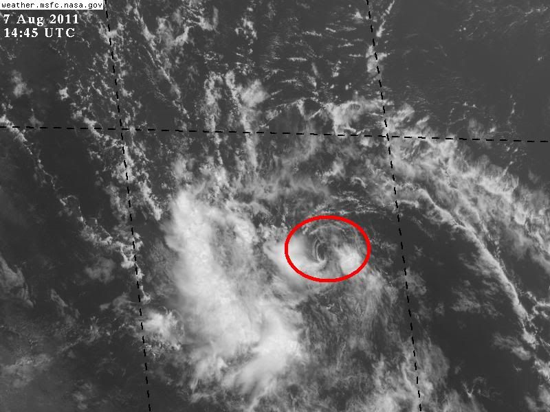
Aric Dunn wrote:I have to say... that is a quite the vigorous Circ. in about 12 to 24hrs it should begin to move into a better environment. if that circ can hold together we could see some development.
Gustywind wrote:Aric Dunn wrote:I have to say... that is a quite the vigorous Circ. in about 12 to 24hrs it should begin to move into a better environment. if that circ can hold together we could see some development.
Ok thanks Aric, what does it mean by better for you? Do you think that we could deal with a very strong twave during the next 12, 24H?


StarmanHDB wrote:A very clear swirl, but any possible convection is firing about 350 miles west of that circulation. Does this swirl have any chance of really developing?
Users browsing this forum: No registered users and 231 guests