I lost the links to the NAO data,but mainly my question here is how the North Atlantic Occillation (NAO) is right now.A negative NAO means weaker Azores/Bermuda Highs and positive NAO is the contrary.
I suspect the NAO is positive as the Azores high is fairly strong at this time.
NAO
Moderator: S2k Moderators
Forum rules

The posts in this forum are NOT official forecasts and should not be used as such. They are just the opinion of the poster and may or may not be backed by sound meteorological data. They are NOT endorsed by any professional institution or STORM2K. For official information, please refer to products from the National Hurricane Center and National Weather Service.
-
srainhoutx

- S2K Supporter

- Posts: 6919
- Age: 68
- Joined: Sun Jan 14, 2007 11:34 am
- Location: Haywood County, NC
- Contact:
Re: NAO
cycloneye wrote:I lost the links to the NAO data,but mainly my question here is how the North Atlantic Occillation (NAO) is right now.A negative NAO means weaker Azores/Bermuda Highs and positive NAO is the contrary.
I suspect the NAO is positive as the Azores high is fairly strong at this time.
http://www.cpc.ncep.noaa.gov/products/p ... /nao.shtml
0 likes
-
MiamiensisWx
Re: NAO
cycloneye wrote:I lost the links to the NAO data,but mainly my question here is how the North Atlantic Occillation (NAO) is right now.A negative NAO means weaker Azores/Bermuda Highs and positive NAO is the contrary.
I suspect the NAO is positive as the Azores high is fairly strong at this time.
Actually, a negative NAO correlates with a weaker or non-existant Bermuda ridge and a positive H5 anomaly near the Azores. This is particularly evident when the global circulation reflects a La Nina-esque pattern in June. On average, historical base averages show a positive correlation with a developing upper ridge over the desert Southwest. This is most prounounced in a negative PDO regime, which supports an upper ridge over the American Southwest and a broad H5 trough over the Midwest/Northeast in a similar -NAO configuration in regards to mean ridge position over Greenland. Exhaustive previous studies have also identified a correlation with higher heights in the Azores region during a base Nina state in the global pattern. Consequently, when coupled with the identifiable current pattern, negative heights in the typical "territory" of the Bermuda/Southeast ridge (western North Atlantic) is evident, along with a stronger ridge over the vicinity of the Azores.
0 likes
-
Blown Away

- S2K Supporter
- Posts: 10253
- Joined: Wed May 26, 2004 6:17 am
Re: NAO
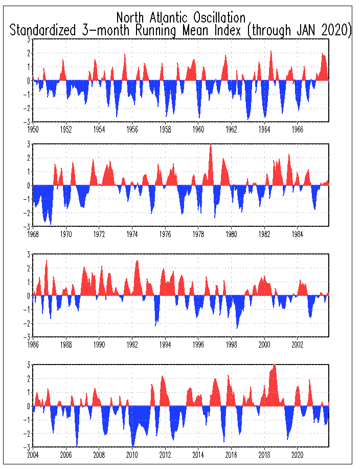
Since the 1950's pretty much every Cane that impacted SFL occurred during a positive NAO. The graph shows the NAO moving into negative phase for now.
http://www.cpc.ncep.noaa.gov/data/teled ... series.gif
http://www.cpc.ncep.noaa.gov/data/teled ... series.gif
0 likes
-
cycloneye

- Admin

- Posts: 149844
- Age: 69
- Joined: Thu Oct 10, 2002 10:54 am
- Location: San Juan, Puerto Rico
Re: NAO
MiamiensisWx wrote:cycloneye wrote:I lost the links to the NAO data,but mainly my question here is how the North Atlantic Occillation (NAO) is right now.A negative NAO means weaker Azores/Bermuda Highs and positive NAO is the contrary.
I suspect the NAO is positive as the Azores high is fairly strong at this time.
Actually, a negative NAO correlates with a weaker or non-existant Bermuda ridge and a positive H5 anomaly near the Azores. This is particularly evident when the global circulation reflects a La Nina-esque pattern in June. On average, historical base averages show a positive correlation with a developing upper ridge over the desert Southwest. This is most prounounced in a negative PDO regime, which supports an upper ridge over the American Southwest and a broad H5 trough over the Midwest/Northeast in a similar -NAO configuration in regards to mean ridge position over Greenland. Exhaustive previous studies have also identified a correlation with higher heights in the Azores region during a base Nina state in the global pattern. Consequently, when coupled with the identifiable current pattern, negative heights in the typical "territory" of the Bermuda/Southeast ridge (western North Atlantic) is evident, along with a stronger ridge over the vicinity of the Azores.
Good clarification about what the NAO does.I made this thread not only because I lost links of the data of NAO,but I wanted to have this thread as a learning one that I am sure that many members especially the newbies dont know what is the NAO and how it affects the hurricane seasons.
0 likes
Who is online
Users browsing this forum: No registered users and 52 guests