What is the strongest Hurricane you've been in
Moderator: S2k Moderators
Forum rules

The posts in this forum are NOT official forecasts and should not be used as such. They are just the opinion of the poster and may or may not be backed by sound meteorological data. They are NOT endorsed by any professional institution or STORM2K. For official information, please refer to products from the National Hurricane Center and National Weather Service.

-
Extremeweatherguy

- Category 5

- Posts: 11095
- Joined: Mon Oct 10, 2005 8:13 pm
- Location: Florida
yeah, you will be loving that next time a storm comes around.ROCK wrote:I meant NW quad....Geez, that other Katrina thread taking alot out of me. I never lost power with Rita. However I found a great deal on a 15kw generator to run my whole house (A/C included) when this season rolls around. Peace of mind, since I will not be leaving ever again.....
0 likes
-
Pearl River

- S2K Supporter

- Posts: 825
- Age: 66
- Joined: Fri Dec 09, 2005 6:07 pm
- Location: SELa
-
Epsilon_Fan

- Category 1

- Posts: 353
- Joined: Fri Jan 13, 2006 1:03 pm
- Location: Charleston, SC
-
Jim Cantore
-
NCHurricane

- Category 1
- Posts: 400
- Age: 54
- Joined: Sun Jul 24, 2005 2:50 pm
- Location: Winterville, North Carolina, USA
- Contact:
wxman57 wrote:NCHurricane wrote:Isabel and Diana were probably the strongest of the six or seven that have been close to me. Minimum cat 2 gusts, middle to high cat 1 winds where I was in relation to both storms.
Ok, I found the Isabel wind swath map and indicated Cat 1-2 winds on it. Unfortunately, the graphic is much lower resolution than those of 2004/2005. Looks like Cat 1 winds were confined to Albemarle Sounde to your east. If the graphic is correct,t hen it indicates somewhere around 65 mph in Williamston. But the map may be +/- 10-15 mph, so you could have seen minimal Cat 1 with Isabel.
http://myweb.cableone.net/nolasue/IsabelWinds.gif
They were close, especially the gusts. 95 MPH gust in Plymouth.

I guess I overestimated. Thanks for correcting me.
0 likes
-
jujubean

- Tropical Depression

- Posts: 93
- Age: 54
- Joined: Thu Feb 17, 2005 3:04 pm
- Location: jacksonville.fl
Extremeweatherguy wrote:Unless you were standing right on the coast looking over the ocean, I highly doubt you got Cat. 5 force winds, most of the destroyed area from Andrew was caused by Cat.3/4 force winds. Yes, it seemed extreme, but then again, that is why a cat. 3 force wind is called "major".DESTRUCTION5 wrote:Cat 5....Got everything Andrew had to offer in Homestead 1992...No to mention the 3 beatings I took in Martin County the past 2 years..
I was going to say I experienced cat 4/5 winds with andrew, but now I'm not sure what category winds I witnessed. I'm curious now what the strongest winds were over the area of cutler ridge during andrew. does anyone know the windspeeds for that area? thanks
0 likes
-
wxman57

- Moderator-Pro Met

- Posts: 23153
- Age: 68
- Joined: Sat Jun 21, 2003 8:06 pm
- Location: Houston, TX (southwest)
Epsilon_Fan wrote:Hurricane Charley.. Cat 1 at most
Here ya go, I found the map for Charley's landfall in SC. Looks like it didn't have any hurricane-force winds on re-analysis. 50 mph winds brushed the beach at Myrtle Beach:
http://myweb.cableone.net/nolasue/CharleySCWinds.gif
Remember, the maps I'm posting are 1-minute SUSTAINED wind, not gusts. In some cases, a hurricane (particularly a strong one that weakened quickly at landfall) can produce wind gusts quite a bit higher than the sustained wind. Lili in 2002, for example, produced sustained wind across south Louisiana of only 40-60 mph but gusts twice that high.
As I read through this tread, a common theme appears. Most of you think (or want to think) that you've seen much stronger sustained wind than you actually have. That's common wherever a hurricane hits. Wind force increases with the square of the velocity. An 80 mph wind is 4 times as strong as a 40 mph wind. "Minimal" (not really a good word) hurricane-force sustained wind can do quite a bit of damage, but so can 40-60 mph sustained wind. A 75 mph wind can completely obliterate a home if there is a sudden breech in the structure (window or roof failure). Window/door blows in (generally a garage door), house immediately becomes pressurized, roof lifts off, walls blow out. Seen it many times. Doesn't take a Cat 3-4-5 hurricane to do that. That's why it's very important to board up windows and secure your garage door in a high wind.
I sure hope that those of you who think you've experienced Cat 2-3-4 sustained winds never really do. I certainly don't want to see such wind. The 45-55 mph sustained wind I saw with Alicia in 1983 was quite scary enough. I remember huddling in the hallway with my parents in 1964 and 1965 when Hilda and Betsy went by. Of course, I'd occasionally peek outside to see the big oak trees bending. Had one about 3-4 feet in diameter right outside my bedroom window. Always feared it would topple over onto the house like so many did in our neighborhood. It's still there, today, though.
0 likes
-
wxman57
- Moderator-Pro Met
- Posts: 23153
- Age: 68
- Joined: Sat Jun 21, 2003 8:06 pm
- Location: Houston, TX (southwest)
jujubean wrote:
I was going to say I experienced cat 4/5 winds with andrew, but now I'm not sure what category winds I witnessed. I'm curious now what the strongest winds were over the area of cutler ridge during andrew. does anyone know the windspeeds for that area? thanks
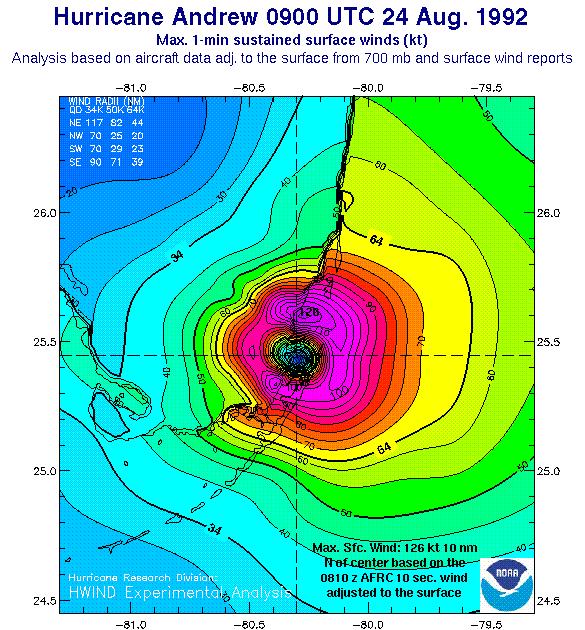
That's hard to say, as the wind analysis for Andrew isn't very high-resolution:
http://www.aoml.noaa.gov/hrd/Storm_page ... ndfall.jpg
But you may well be one of the few here that has actually seen sustained Cat 3-4 winds. Andrew's northern eyewall passed very close to you, but you're a little bit inland. From the map above, it looks like you may have seen 125-140 mph sustained wind with gusts to Cat 5. I'll bet you don't want to see those kind of winds again.
0 likes
-
Jim Cantore
Extremeweatherguy wrote:wxman57 wrote:The poll question is somewhat vague. It's interesting that 50% of the people here claim to have been in Cat 2 or Cat 3 winds, or are you (they) saying that they were somewhere in the wind field of a Cat 2/3 hurricane? I can't think of many Cat 3 or 4 hurricanes that actually brought those winds inland. Dennis's Cat 3 winds remained offshore (See the HRD post-storm wind analysis). Wilma's winds over Florida were Cat 1 mostly, with maybe a few pockets of low-end Cat 2. Rita's winds in southwest Louisiana were mostly Cat 1. I don't think that Jeanne or Frances produced any Cat 2 winds inland over Florida. Andrew's hurricane force winds stayed on the south side of Miami, for the most part. Everyone wants to believe he/she has seen Cat 2 or 3 (or higher winds), but I doubt that many of us have, even when in a Cat 2-3-4 hurricane. That's why so many were surprised by what Wilma's Cat 1 winds did to south Florida.
As for me, I don't know. Here in Houston in Alicia (Cat 3) we got about 45-55 mph sustained winds at the most with maye some gusts to 70-80 mph. Back in 1965, I remember that we had some pretty strong winds from Betsy in south-central Louisiana, maybe hurricane force, possibly not. Same from Hilda in 1964. Cat 3 Carmen in 1974 that went over Lafayette produced only TS force winds that far inland. So even going through the center/eye of two Cat 3 hurricanes, I doubt that I have seen sustained hurricane force winds. Can't verify that for sure, as I was only 7-8 years old in 1964-1965.
Exactly. There are many people that believe that they had strong Cat. 3 force winds on the north side of Miami from Andrew...or there are some that think that Miami got Cat. 4 force winds from Andrew...and I have to laugh because that was not the case. The cat. 4/5 winds only impacted a small area of homestead NOT Miami. A few storms that did have Cat. 2+ force winds inland over the last few years include Charley (http://www.srh.noaa.gov/mlb/charley/charley_windswath.jpg <<<These are sustained winds...gusts were higher..there was a 105mph gusts at the Orlando International Aiport) which produced Cat. 2/3 forcw winds well inland and then Cat. 1 force winds from Orlando to Daytona. As for Frances, looking at the wind swath, the top inland winds were only 80-90mph sustained, and the only Cat. 2 winds were right at the coast (http://www.srh.noaa.gov/mlb/frances/map ... dswath.jpg), and with Jeanne, the strongest winds (even on the coast) were strong Cat. 1 force. It is weird though because I thought Jeanne had produced much stronger coastal winds, but instead she created weaker hurricane force winds over a larger area (http://www.srh.noaa.gov/mlb/jeanne/jeanne_swath.jpg). The NWS in Melbourne, FL has provided all those great wind swath maps on the links. Basically though, most of us have not seen greater than Cat. 1 force winds...unless you live on the coast...or if you went through Charley along the thin line of Cat. 2/3 force winds which extended to south Orange county, or unless you went through another monster (usually fast moving, and strengthening) storm that happenened to go right over you. It seems that strengthening storms at landfall can produce stronger winds further inland than weakening ones (ex: Charley), and that also goes for smaller storms too. The larger storms tend to produce weaker winds over a larger area, where as the smaller storms tend to produce much stronger winds over a smaller area. Basically were a Cat. 5 charley-like storm (size wise) to make landfall on your coast and be moving at lets say 15mph...then here are the probable wind forces you will feel were it to move RIGHT OVER your area:
Immediate Coast: Cat. 5
Up to 15 miles inland: Cat. 4
Up to 50-60 miles inland: Cat. 3
Up to 80-90 miles inland: Cat. 2
Up to 100-150 miles inland: Cat. 1
Up to 200-300 miles inland: TS
***Now these are not exact, but these are probably the worst case winds your area could recieve from a strom...unless for some god foresakin reason a monsterous 175+mph Cat. 5 were to make landfall (which I hope we never live to see).***
wow that was a lot of writting I just did!lol.
***If the links are not clickable..then copy and paste them to your search bar***
the problem is at the time your mind is running a mile a minute and without a wind gauge its hard to tell and easy to exagerate
0 likes
-
Jim Cantore
Extremeweatherguy wrote:wxman57 wrote:In case they're missed on "Page 2" of these posts, here are the various HRD wind analyses with Cat 1-2-3 wind fields indicated:
http://myweb.cableone.net/nolasue/JeanneWinds.gif
http://myweb.cableone.net/nolasue/FrancesWinds.gif
http://myweb.cableone.net/nolasue/KatrinaWinds.gif
http://myweb.cableone.net/nolasue/DennisWinds.gif
http://myweb.cableone.net/nolasue/IvanWinds.gif
most people don't believe me when I try to tell them that New Orleans only got Cat. 1 force winds from Katrina...and now this proves it. I have even had some try to tell me that gusts reach 150mph in N.O...wow, were they wrong. If a 75-80mph sustained wind could produce a 150mph gust I would be shocked.
150???
MAYBE at the tops of tall buildings but probably not even there
0 likes
-
wxman57
- Moderator-Pro Met
- Posts: 23153
- Age: 68
- Joined: Sat Jun 21, 2003 8:06 pm
- Location: Houston, TX (southwest)
In general, the wind gusts in tropical cyclones are about 1.25 to 1.28 times the sustained wind. But that's only a generality. A lot depends on the vertical wind structure of the hurricane at landfall. In cases of rapid dry or cool air intrusion at landfall, the surface winds can be knocked down very quickly, but the winds aloft can still be quite high. At times, the still-high winds aloft can dip down to the surface, producing gusts far above the typical range. Such was the case with Lili in 2002. Many stations reported sustained wind of only 40-45 mph or so but gusts were nearly twice that high. I suppose such a relationship of sustained wind to gusts could apply to a very intense Cat 4-5 hurricane that weakened very rapidly to a Cat 1 or 2 at landfall. But you can't get 140-150 mph winds unless the hurricane has those winds somewhere vertically.
0 likes
-
Jim Cantore
wxman57 wrote:In general, the wind gusts in tropical cyclones are about 1.25 to 1.28 times the sustained wind. But that's only a generality. A lot depends on the vertical wind structure of the hurricane at landfall. In cases of rapid dry or cool air intrusion at landfall, the surface winds can be knocked down very quickly, but the winds aloft can still be quite high. At times, the still-high winds aloft can dip down to the surface, producing gusts far above the typical range. Such was the case with Lili in 2002. Many stations reported sustained wind of only 40-45 mph or so but gusts were nearly twice that high. I suppose such a relationship of sustained wind to gusts could apply to a very intense Cat 4-5 hurricane that weakened very rapidly to a Cat 1 or 2 at landfall. But you can't get 140-150 mph winds unless the hurricane has those winds somewhere vertically.
you are absolutely right
people forget the fact though I must bring up that the surge doesnt drop with the wind, it drops much slower.
0 likes
-
"Ice"

- Tropical Storm

- Posts: 131
- Joined: Mon Dec 26, 2005 10:30 pm
- Location: Northwest Fla.(good ole Pensacola to be exact)
I could be wrong! I'm no expert, I was just saying what I heard.Extremeweatherguy wrote:though it was classified as a Cat. 3 at landfall...the strongest wind reports in Pensacola only support Cat. 1/2 wind speeds. The surge though was that of a 3."Ice" wrote:Ivan- strong cat. 3
All I know is I finally ventured outside about 10 or 11 hours later, and it was still raining horizontally and the wind like to blew me away.
By the way, we were in the northern/central part of Escambia County . Probably about ten miles from the water and we looked like a war zone.
0 likes
-
docjoe

- S2K Supporter
- Posts: 262
- Joined: Thu Sep 09, 2004 10:42 pm
- Location: SE Alabama..formerly the land of ivan and dennis
I am not suggeting that Ivan brought widespread cat 3 winds because it didnt. However if you look at Santa Rosa and Escambia county maps there is quite an extensive bay sytem. Although I am not a pro in this area I wonder if areas 10-15 miles inland received higher winds that other places due to winds blowing over the bays. Highway 90 runs between Pace and Milton. With the exception of Garcon Point there is virtually no land between the barrier island and central Santa Rosa county. Perhaps this would have allowed stronger sustained winds to penetrate inland a little further than usual??
docjoe
docjoe
0 likes
-
cajungal

- Category 5
- Posts: 2345
- Age: 49
- Joined: Sun Mar 14, 2004 9:34 pm
- Location: Schriever, Louisiana (60 miles southwest of New Orleans)
Andrew is the only true hurricane I ever been through. 100 mph sustained winds, so Cat 2. Even though I know we had a few gusts probably over that. If I was born for Betsy, I would of got close to cat 3. 130 mph sustained winds in the Houma-Thibodaux area were recorded for Betsy. We evacuated for Katrina and Houma/Thibodaux only had cat 1 winds of 80 mph. For Rita and Cindy, we only got tropical storm force. But, for Rita, a few gusts of 80 were recorded.
0 likes
Who is online
Users browsing this forum: No registered users and 62 guests