

Hypercane_Kyle wrote:12z GFS is a stretch... that looks like an August-type system, not something you'd see in November.
I'd normally agree with you, especially considering it is the GFS. However, I wouldn't be too quick to dismiss it.
Model consensus is forecasting 500 mb heights that are as high as 2.5 SD above the mean for early November in the NE US Wednesday night. That is equivalent to saying 500 mb hts that are at the 99% percentile meaning hts that high or higher in early November there happen only 1% of the time.
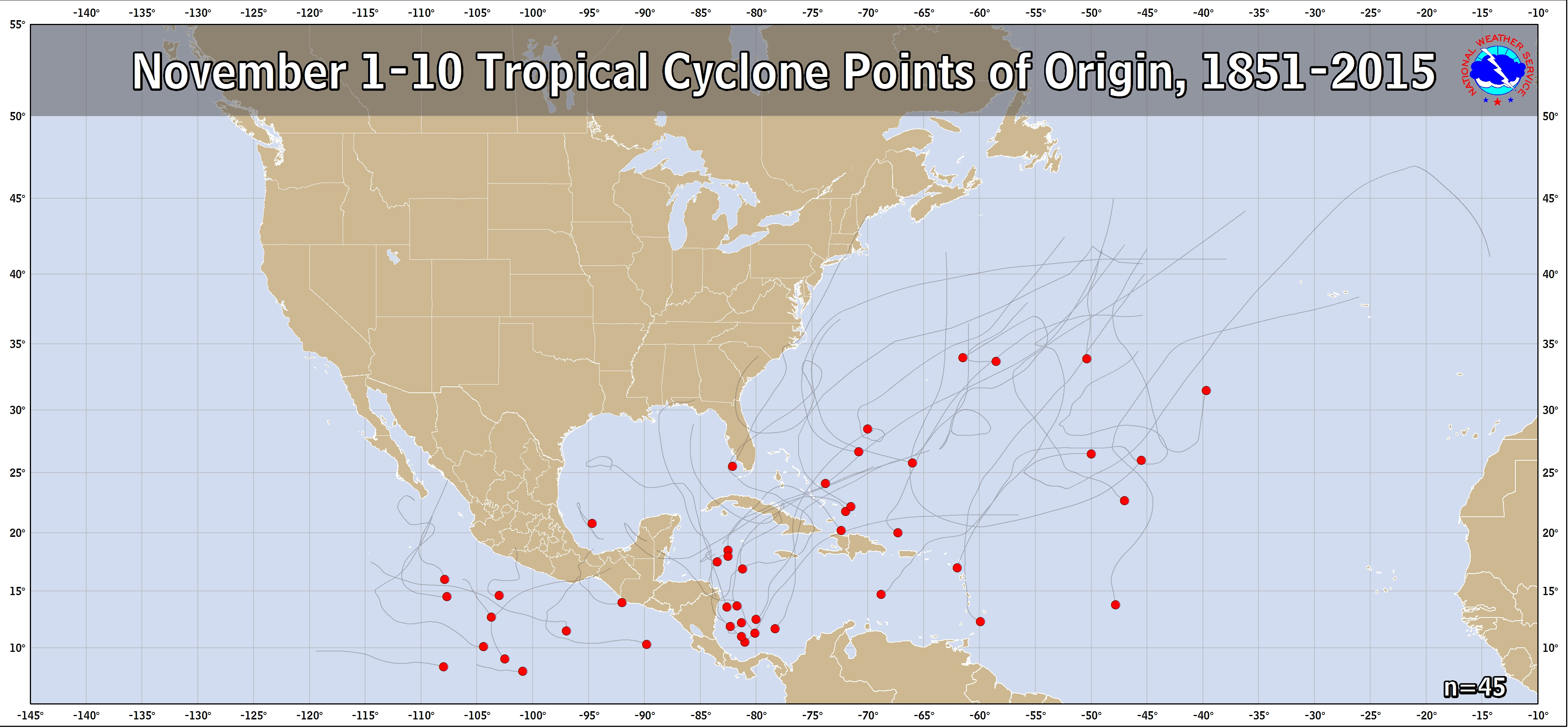
With that strong of a high to the north, the SW Atlantic/Bahamas/SE US is in a highly unusual pattern for early November as regards tropical potential. With only 8 TCs having formed since 1851 in the SW Atlantic Nov 1-10 (see link below) and considering this highly anomalous pattern, there's not much historical track data/climo to utilize to predict what will happen. So even though none of those 8 SW Atlantic originating TCs hit the US, that doesn't mean much in this very unusual pattern:
https://www.nhc.noaa.gov/climo/images/nov_1_10.png
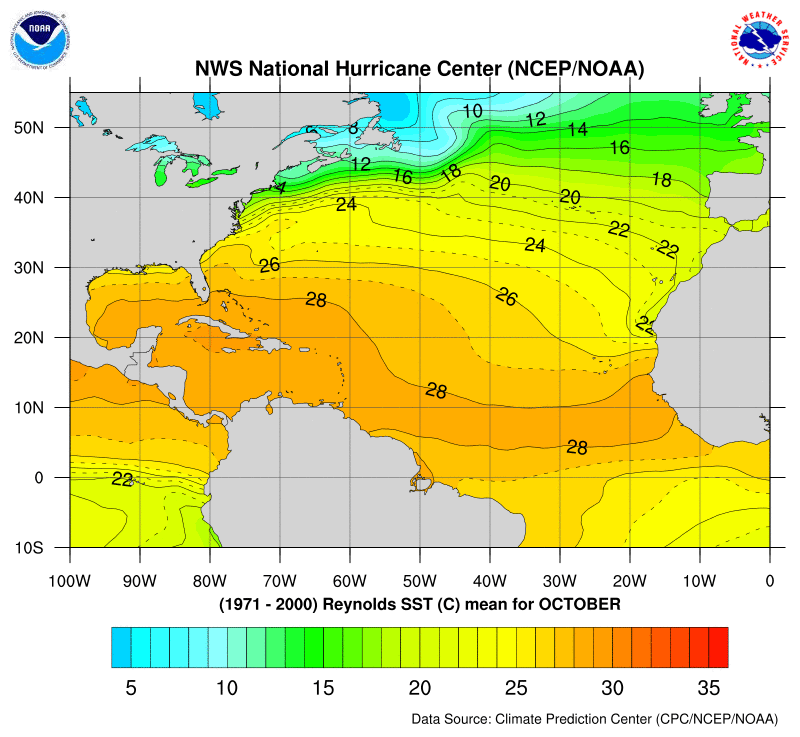
If we incorporate the current SW Atlantic SSTs, we get even further from normal early Nov tropical potential. They're currently 28 to 29 C (82-84 F), which is ~1C/2F warmer than the normal and near the normal for mid October (normal found here):
https://www.nhc.noaa.gov/gifs/SST/AL_10 ... 0_RSST.gif
Along with this very strong H5 ridge to the north and warm SSTAs, 200 mb wind speeds are forecasted to plunge well below normal early to mid next week in the SW Atlantic. So, shear may become unusually light then.
Considering all of the above, the NHC has quite a challenge and there will be lots for us to discuss over the coming days.


