Low Pressure Trough Over the Central Atlantic (Is Invest 99L)

This is the general tropical discussion area. Anyone can take their shot at predicting a storms path.

Moderator: S2k Moderators

Forum rules

The posts in this forum are NOT official forecasts and should not be used as such. They are just the opinion of the poster and may or may not be backed by sound meteorological data. They are NOT endorsed by any professional institution or STORM2K. For official information, please refer to products from the National Hurricane Center and National Weather Service.

Help Support Storm2K
Message
Author
User avatar
SFLcane
S2K Supporter
S2K Supporter
Posts: 9627
Age: 46
Joined: Sat Jun 05, 2010 1:44 pm
Location: Lake Worth Florida

Re: Low Pressure Forecast to Develop over the Central Atlantic

#61 Postby SFLcane » Tue Aug 15, 2023 8:03 pm

lsuhurricane wrote:Appears to be 1004mb at the 84-90 hr frames.

Very compact


So about a minimal TS
0 likes   

BobHarlem
Category 5
Category 5
Posts: 1668
Joined: Thu Oct 20, 2005 6:11 pm

Re: Low Pressure Forecast to Develop over the Central Atlantic

#62 Postby BobHarlem » Tue Aug 15, 2023 8:12 pm

Quite a shift between 12z and 18z euro (frame alternates between 12 and 18z)

Image
2 likes   

zzzh
Category 2
Category 2
Posts: 560
Joined: Thu Sep 02, 2021 1:13 pm

Re: Low Pressure Forecast to Develop over the Central Atlantic

#63 Postby zzzh » Tue Aug 15, 2023 8:20 pm

Monsoon trough systems are hard to predict. I'd wait until a TD actually forms.
2 likes   

LarryWx
Category 5
Category 5
Posts: 5788
Joined: Sun Sep 07, 2003 2:04 pm
Location: GA

Re: Low Pressure Forecast to Develop over the Central Atlantic

#64 Postby LarryWx » Tue Aug 15, 2023 8:29 pm

SFLcane wrote:
lsuhurricane wrote:Appears to be 1004mb at the 84-90 hr frames.

Very compact


So about a minimal TS


TD most likely imo
0 likes   
Personal Forecast Disclaimer:
The posts in this forum are NOT official forecasts and should not be used as such. They are just the opinion of the poster and may or may not be backed by sound meteorological data. They are NOT endorsed by any professional institution or storm2k.org. For official information, please refer to the NHC and NWS products.

User avatar
ElectricStorm
Category 5
Category 5
Posts: 4623
Age: 23
Joined: Tue Aug 13, 2019 11:23 pm
Location: Skiatook, OK / Norman, OK

Re: Low Pressure Forecast to Develop over the Central Atlantic

#65 Postby ElectricStorm » Tue Aug 15, 2023 11:04 pm

0z GFS continues to develop this quickly. I'm skeptical it develops that fast, but I do think it has a decent chance of development at some point.

Could be an invest soon
0 likes   
I am in no way a professional. Take what I say with a grain of salt as I could be totally wrong. Please refer to the NHC, NWS, or SPC for official information.

Boomer Sooner!

IcyTundra
Category 3
Category 3
Posts: 893
Joined: Mon Jun 07, 2021 9:32 pm
Location: Dickinson, Texas

Re: Low Pressure Forecast to Develop over the Central Atlantic

#66 Postby IcyTundra » Tue Aug 15, 2023 11:33 pm

00Z GFS

Image
0 likes   

zzzh
Category 2
Category 2
Posts: 560
Joined: Thu Sep 02, 2021 1:13 pm

Re: Low Pressure Forecast to Develop over the Central Atlantic

#67 Postby zzzh » Wed Aug 16, 2023 12:31 am

20/40.
2 likes   

User avatar
weeniepatrol
Category 3
Category 3
Posts: 870
Joined: Sat Aug 22, 2020 5:30 pm
Location: WA State

Re: Low Pressure Forecast to Develop over the Central Atlantic

#68 Postby weeniepatrol » Wed Aug 16, 2023 12:41 am

zzzh wrote:20/40.


1. Central Tropical Atlantic:
Disorganized showers and thunderstorms located over the central
tropical Atlantic are associated with an elongated trough of low
pressure centered about 600 miles west-southwest of the Cabo Verde
Islands. Environmental conditions appear conducive for gradual
development of this system, and a tropical depression could form
during the next several days
while moving toward the west or
west-northwest at about 10 mph across the central tropical Atlantic.
* Formation chance through 48 hours...low...20 percent.
* Formation chance through 7 days...medium...40 percent.


Image
0 likes   

LarryWx
Category 5
Category 5
Posts: 5788
Joined: Sun Sep 07, 2003 2:04 pm
Location: GA

Re: Low Pressure Forecast to Develop over the Central Atlantic

#69 Postby LarryWx » Wed Aug 16, 2023 12:49 am

NEW TROPICAL CYCLONE FORECAST TO DEVELOP AFTER 150 HOURS
FORECAST POSITION AT T+150 : 20.5N 67.7W

LEAD CENTRAL MAXIMUM WIND
VERIFYING TIME TIME POSITION PRESSURE (MB) SPEED (KNOTS)
-------------- ---- -------- ------------- -------------
1200UTC 22.08.2023 156 21.0N 67.9W 1006 35
0000UTC 23.08.2023 168 21.7N 69.9W 1006 37
0 likes   
Personal Forecast Disclaimer:
The posts in this forum are NOT official forecasts and should not be used as such. They are just the opinion of the poster and may or may not be backed by sound meteorological data. They are NOT endorsed by any professional institution or storm2k.org. For official information, please refer to the NHC and NWS products.

BobHarlem
Category 5
Category 5
Posts: 1668
Joined: Thu Oct 20, 2005 6:11 pm

Re: Low Pressure Forecast to Develop over the Central Atlantic

#70 Postby BobHarlem » Wed Aug 16, 2023 5:43 am

6z GFS at 240 hours is signficantly SW of the 0z run on this system (shows a cat 2 here) 0z it was east of Bermuda around the same time.

Image below is from 264 hours out though, at 240 it was around 21.3M 62.0W

Image
0 likes   

User avatar
SFLcane
S2K Supporter
S2K Supporter
Posts: 9627
Age: 46
Joined: Sat Jun 05, 2010 1:44 pm
Location: Lake Worth Florida

Re: Low Pressure Forecast to Develop over the Central Atlantic

#71 Postby SFLcane » Wed Aug 16, 2023 6:13 am

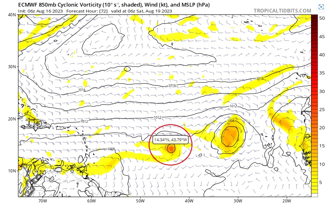
BobHarlem wrote:6z GFS at 240 hours is signficantly SW of the 0z run on this system (shows a cat 2 here) 0z it was east of Bermuda around the same time.

Image below is from 264 hours out though, at 240 it was around 21.3M 62.0W

https://i.imgur.com/ZRVVfsJ.png


Gfs fantasy tc breaks the ridge but still west of previous runs surely
1 likes   

User avatar
gatorcane
S2K Supporter
S2K Supporter
Posts: 23499
Age: 46
Joined: Sun Mar 13, 2005 3:54 pm
Location: Boca Raton, FL

Re: Low Pressure Forecast to Develop over the Central Atlantic

#72 Postby gatorcane » Wed Aug 16, 2023 6:23 am

Best to stick to the ensembles here given the complex setup (two systems close together) and wide range of solutions. The EPS and GEFS show weak development and nearly all recurve well east of the islands into the Central Atlantic. Thr GFS 200+ hour is low skill, would not even look at it for this system or anything else as it is WAY too inconsistent.
1 likes   

User avatar
SFLcane
S2K Supporter
S2K Supporter
Posts: 9627
Age: 46
Joined: Sat Jun 05, 2010 1:44 pm
Location: Lake Worth Florida

Re: Low Pressure Forecast to Develop over the Central Atlantic

#73 Postby SFLcane » Wed Aug 16, 2023 6:29 am

Image
0 likes   

User avatar
cycloneye
Admin
Admin
Posts: 139593
Age: 67
Joined: Thu Oct 10, 2002 10:54 am
Location: San Juan, Puerto Rico

Re: Low Pressure Forecast to Develop over the Central Atlantic

#74 Postby cycloneye » Wed Aug 16, 2023 6:35 am

TWD:

The axis of a tropical wave is in the central Atlantic near
37W/38W, from 19N southward, moving W at 15 kt. Scattered
moderate and isolated strong convection is noted from 07N to 13N
between 32W and 41W. A perturbation has developed in association
to the tropical wave within the monsoon trough. The tropical wave
will continue moving westward while this perturbation remains in
its wake. Environmental conditions appear conducive for gradual
development of this perturbation, and a tropical depression could
form during the next several days while moving toward the west or
west- northwest across the central tropical Atlantic.
1 likes   
Visit the Caribbean-Central America Weather Thread where you can find at first post web cams,radars
and observations from Caribbean basin members Click Here

User avatar
abajan
S2K Supporter
S2K Supporter
Posts: 4175
Joined: Sun Sep 07, 2003 5:10 am
Location: Barbados

Re: Low Pressure Forecast to Develop over the Central Atlantic

#75 Postby abajan » Wed Aug 16, 2023 6:46 am

Excerpt from 8 AM Tropical Weather Update:
Disorganized showers and thunderstorms located over the central
tropical Atlantic are associated with an elongated trough of low
pressure centered about 750 miles west-southwest of the Cabo Verde
Islands. Environmental conditions appear conducive for gradual
development of this system, and a tropical depression could form
during the next several days while moving toward the west or
west-northwest at about 10 mph across the central tropical Atlantic.
* Formation chance through 48 hours...low...30 percent.
* Formation chance through 7 days...medium...50 percent.
0 likes   

User avatar
Blown Away
S2K Supporter
S2K Supporter
Posts: 9874
Joined: Wed May 26, 2004 6:17 am

Re: Low Pressure Forecast to Develop over the Central Atlantic

#76 Postby Blown Away » Wed Aug 16, 2023 6:59 am

abajan wrote:Excerpt from 8 AM Tropical Weather Update:
Disorganized showers and thunderstorms located over the central
tropical Atlantic are associated with an elongated trough of low
pressure centered about 750 miles west-southwest of the Cabo Verde
Islands. Environmental conditions appear conducive for gradual
development of this system, and a tropical depression could form
during the next several days while moving toward the west or
west-northwest at about 10 mph across the central tropical Atlantic.
* Formation chance through 48 hours...low...30 percent.
* Formation chance through 7 days...medium...50 percent.


Interesting the movement is W but the cone is NW. Models struggling with competing lows.
1 likes   
Hurricane Eye Experience: David 79, Irene 99, Frances 04, Jeanne 04, Wilma 05... EYE COMING MY WAY IN 2024…
Hurricane Brush Experience: Andrew 92, Erin 95, Floyd 99, Matthew 16, Irma 17, Ian 22, Nicole 22…

User avatar
Blown Away
S2K Supporter
S2K Supporter
Posts: 9874
Joined: Wed May 26, 2004 6:17 am

Re: Low Pressure Forecast to Develop over the Central Atlantic

#77 Postby Blown Away » Wed Aug 16, 2023 7:41 am

Image
06z Euro
Image
00z Euro

Euro struggling with dominate low, 06z has the Central Atlantic low separating on it's own again.
2 likes   
Hurricane Eye Experience: David 79, Irene 99, Frances 04, Jeanne 04, Wilma 05... EYE COMING MY WAY IN 2024…
Hurricane Brush Experience: Andrew 92, Erin 95, Floyd 99, Matthew 16, Irma 17, Ian 22, Nicole 22…

jconsor
Professional-Met
Professional-Met
Posts: 532
Joined: Mon Jun 30, 2008 9:31 pm
Location: Jerusalem, Israel
Contact:

Re: Low Pressure Forecast to Develop over the Central Atlantic

#78 Postby jconsor » Wed Aug 16, 2023 8:03 am

I'd be wary of putting much weight on the 6z/18z ECMWF and EPS. They have tended to be much more active than the 0z/12z runs with this system.

Blown Away wrote:[url]https://i.postimg.cc/fyYXwK3v/06Z-EURO.jpg [/url]
06z Euro
[url]https://i.postimg.cc/3J70X24P/00Z-EURO.jpg [/url]
00z Euro

Euro struggling with dominate low, 06z has the Central Atlantic low separating on it's own again.
0 likes   

AutoPenalti
Category 5
Category 5
Posts: 3950
Age: 27
Joined: Mon Aug 17, 2015 4:16 pm
Location: Ft. Lauderdale, Florida

Re: Low Pressure Forecast to Develop over the Central Atlantic

#79 Postby AutoPenalti » Wed Aug 16, 2023 8:06 am

jconsor wrote:I'd be wary of putting much weight on the 6z/18z ECMWF and EPS. They have tended to be much more active than the 0z/12z runs with this system.

Blown Away wrote:[url]https://i.postimg.cc/fyYXwK3v/06Z-EURO.jpg [/url]
06z Euro
[url]https://i.postimg.cc/3J70X24P/00Z-EURO.jpg [/url]
00z Euro

Euro struggling with dominate low, 06z has the Central Atlantic low separating on it's own again.

Exhibit A:

 https://twitter.com/CraigSetzer/status/1691797916107645401


3 likes   
The posts in this forum are NOT official forecasts and should not be used as such. They are just the opinion of the poster and may or may not be backed by sound meteorological data. They are NOT endorsed by any professional institution or STORM2K. For official information, please refer to products from the NHC and NWS.


Model Runs Cheat Sheet:
GFS (5:30 AM/PM, 11:30 AM/PM)
HWRF, GFDL, UKMET, NAVGEM (6:30-8:00 AM/PM, 12:30-2:00 AM/PM)
ECMWF (1:45 AM/PM)

TCVN
is a weighted averaged

jlauderdal
S2K Supporter
S2K Supporter
Posts: 6810
Joined: Wed May 19, 2004 5:46 am
Location: NE Fort Lauderdale
Contact:

Re: Low Pressure Forecast to Develop over the Central Atlantic

#80 Postby jlauderdal » Wed Aug 16, 2023 8:15 am

AutoPenalti wrote:
jconsor wrote:I'd be wary of putting much weight on the 6z/18z ECMWF and EPS. They have tended to be much more active than the 0z/12z runs with this system.

Blown Away wrote:[url]https://i.postimg.cc/fyYXwK3v/06Z-EURO.jpg [/url]
06z Euro
[url]https://i.postimg.cc/3J70X24P/00Z-EURO.jpg [/url]
00z Euro

Euro struggling with dominate low, 06z has the Central Atlantic low separating on it's own again.

Exhibit A:

https://twitter.com/CraigSetzer/status/1691797916107645401

Craig is a sofla former tv met on cbs miami, he knows his stuff. The consistency of the modeling has been weak at best.
1 likes   


Return to “Talkin' Tropics”

Who is online

Users browsing this forum: Cpv17, Google Adsense [Bot], KirbyDude25, LarryWx, Tx_Summer and 63 guests