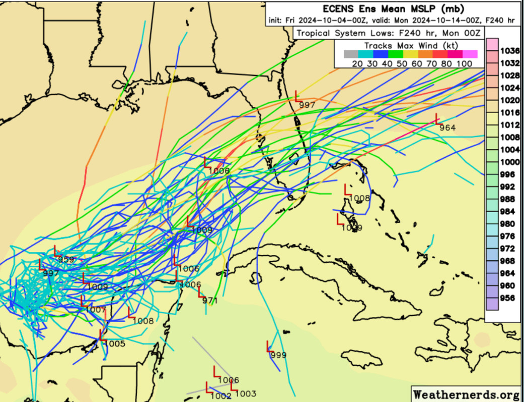
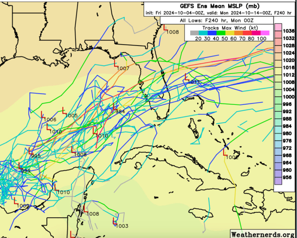
00z ECENS/GEFS…
Moderator: S2k Moderators


Steve wrote:Michele B wrote:
YIKES!!
This looks like coming close to Charley or Ian track.
Landfall or track?
Blown Away wrote:[url]https://i.postimg.cc/6qsYdLC3/IMG-0467.jpg [/url]
[url]https://i.postimg.cc/7Zc7GP3P/IMG-0468.jpg [/url]
00z ECENS/GEFS…

glad you got a laugh!Steve wrote:otowntiger wrote:skillz305 wrote:Now that the GFS shows development, I definitely have my eyes open.
I can just about guarantee that the very next run will be 100% different. I bet it will show no discernible vorticity.
I’m going to disagree. Models have called for a hook east system for a week. 00z’s will show some action. But I did laugh before posting so all good.


Weathertracker96 wrote:
Can you repost the link? All I see is a question mark


SFLcane wrote:Weathertracker96 wrote:
Can you repost the link? All I see is a question mark
https://i.imgur.com/yVElZsX.jpeg


toad strangler wrote:6z Euro sure looks like a TC in the making

SFLcane wrote:toad strangler wrote:6z Euro sure looks like a TC in the making
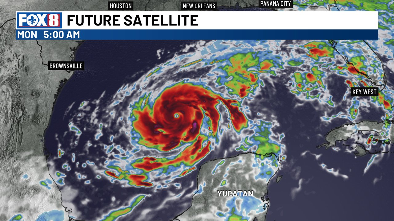
Well on its way 998mb..
https://i.imgur.com/qiy0Ebz.jpeg

boca wrote:SFLcane wrote:toad strangler wrote:6z Euro sure looks like a TC in the making
Well on its way 998mb..
https://i.imgur.com/qiy0Ebz.jpeg
Do you have a link to the site your on because it’s not yet on tropical titbits

Users browsing this forum: No registered users and 285 guests


