It seems like JB is always calling for a dead MDR with "in close" development. His forecast was also based off El Niño which is no longer likely to be in place for the peak of the season. The mid-levels in the MDR have been anomalously dry, but it remains to be seen how much this suppresses activity during the peak of the season.
2019 Indicators: SST'S / Sal / MSLP / Steering / Shear / Instability (See updated graphics at first post)
Moderator: S2k Moderators
Forum rules

The posts in this forum are NOT official forecasts and should not be used as such. They are just the opinion of the poster and may or may not be backed by sound meteorological data. They are NOT endorsed by any professional institution or STORM2K. For official information, please refer to products from the National Hurricane Center and National Weather Service.
-
CyclonicFury

- Category 5

- Posts: 2038
- Age: 27
- Joined: Sun Jul 02, 2017 12:32 pm
- Location: NC
- Contact:
Re: 2019 Indicators: SBleak picture fST'S / Sal / MSLP / Steering / Shear / Instability (See updated graphics at first p
It seems like JB is always calling for a dead MDR with "in close" development. His forecast was also based off El Niño which is no longer likely to be in place for the peak of the season. The mid-levels in the MDR have been anomalously dry, but it remains to be seen how much this suppresses activity during the peak of the season.
4 likes
NCSU B.S. in Meteorology Class of 2021. Tropical weather blogger at http://www.cyclonicfury.com. My forecasts and thoughts are NOT official, for official forecasts please consult the National Hurricane Center.
-
cycloneye

- Admin

- Posts: 149741
- Age: 69
- Joined: Thu Oct 10, 2002 10:54 am
- Location: San Juan, Puerto Rico
Re: 2019 Indicators: SST'S / Sal / MSLP / Steering / Shear / Instability (See updated graphics at first post)
Increasing a little his August numbers? The July ones were 14/6/2.
https://twitter.com/philklotzbach/status/1152276164473282560
https://twitter.com/philklotzbach/status/1152276164473282560
1 likes
Visit the Caribbean-Central America Weather Thread where you can find at first post web cams,radars
and observations from Caribbean basin members Click Here
and observations from Caribbean basin members Click Here

Re: 2019 Indicators: SST'S / Sal / MSLP / Steering / Shear / Instability (See updated graphics at first post)
Can't see anything getting going for a while out of the MDR. Ridiculous amount of dry mid level air.

0 likes
The following post is NOT an official forecast and should not be used as such. It is just the opinion of the poster and may or may not be backed by sound meteorological data. It is NOT endorsed by any professional institution including storm2k.org For Official Information please refer to the NHC and NWS products.
-
Kingarabian

- S2K Supporter

- Posts: 16381
- Joined: Sat Aug 08, 2009 3:06 am
- Location: Honolulu, Hawaii
Re: 2019 Indicators: SBleak picture fST'S / Sal / MSLP / Steering / Shear / Instability (See updated graphics at first p
CyclonicFury wrote:
It seems like JB is always calling for a dead MDR with "in close" development. His forecast was also based off El Niño which is no longer likely to be in place for the peak of the season. The mid-levels in the MDR have been anomalously dry, but it remains to be seen how much this suppresses activity during the peak of the season.
He goes by with whatever the ECMWF has.
0 likes
RIP Kobe Bryant
-
TheStormExpert
Re: 2019 Indicators: SST'S / Sal / MSLP / Steering / Shear / Instability (See updated graphics at first post)
blp wrote:Can't see anything getting going for a while out of the MDR. Ridiculous amount of dry mid level air.
https://i.imgur.com/VcotV31.gif
What’s the cause for such dryness in the mid-levels, SAL? Weren’t we just talking how moist and active the AEW were?
1 likes
-
TheStormExpert
Re: 2019 Indicators: SBleak picture fST'S / Sal / MSLP / Steering / Shear / Instability (See updated graphics at first p
Kingarabian wrote:CyclonicFury wrote:
It seems like JB is always calling for a dead MDR with "in close" development. His forecast was also based off El Niño which is no longer likely to be in place for the peak of the season. The mid-levels in the MDR have been anomalously dry, but it remains to be seen how much this suppresses activity during the peak of the season.
He goes by with whatever the ECMWF has.
The Euro may be onto something with it’s bleak Atlantic look for once if this mid-level dryness doesn’t disappear fast.
0 likes
-
NotSparta

- Professional-Met

- Posts: 1677
- Age: 24
- Joined: Fri Aug 18, 2017 8:24 am
- Location: Naples, FL
- Contact:
Re: 2019 Indicators: SBleak picture fST'S / Sal / MSLP / Steering / Shear / Instability (See updated graphics at first p
TheStormExpert wrote:Kingarabian wrote:CyclonicFury wrote:It seems like JB is always calling for a dead MDR with "in close" development. His forecast was also based off El Niño which is no longer likely to be in place for the peak of the season. The mid-levels in the MDR have been anomalously dry, but it remains to be seen how much this suppresses activity during the peak of the season.
He goes by with whatever the ECMWF has.
The Euro may be onto something with it’s bleak Atlantic look for once if this mid-level dryness doesn’t disappear fast.
If it is it's another case of being right for the wrong reasons, as it's probably underestimating Africa again
2 likes
This post was probably an opinion of mine, and in no way is official. Please refer to http://www.hurricanes.gov for official tropical analysis and advisories.
My website, with lots of tropical wx graphics, including satellite and recon: http://cyclonicwx.com
My website, with lots of tropical wx graphics, including satellite and recon: http://cyclonicwx.com
-
gatorcane

- S2K Supporter
- Posts: 23708
- Age: 48
- Joined: Sun Mar 13, 2005 3:54 pm
- Location: Boca Raton, FL
Re: 2019 Indicators: SST'S / Sal / MSLP / Steering / Shear / Instability (See updated graphics at first post)
One thing is for sure - use caution judging peak Atlantic hurricane season months around this time. Usually the Atlantic around this time is about as bad as it gets for genesis (and I have seen years far worse at this time than what I see now). But it is easy to try and extrapolate based on current conditions because the 384 hour GFS shows zip or the long-range Euro shows high pressures and sinking air across the basin for the next several months. Just go back and look at the discussions in this thread for the previous few years around this time, years which ended up turning quite active and high impact later in the season, As usually is the case things change quickly around mid August. I noticed the CFS starts to reduce the shear around that time across the entire basin including the Caribbean.
6 likes

Re: 2019 Indicators: SST'S / Sal / MSLP / Steering / Shear / Instability (See updated graphics at first post)
Good points gatorcane. I have been on this board 16 years and it’s the same every year. Around mid to late July some people start talking about a slow season because not much has happened yet, and current conditions are highly unfavorable and don’t look to be changing anytime soon. Then around mid August it’s literally like someone flipped a switch and the models start popping, and actual conditions follow suit. I predict in 3, maybe as long as 4 weeks, everyone will be singing a different tune around here.
6 likes
-
USTropics
- Professional-Met
- Posts: 2741
- Joined: Sun Aug 12, 2007 3:45 am
- Location: Florida State University
Re: 2019 Indicators: SST'S / Sal / MSLP / Steering / Shear / Instability (See updated graphics at first post)
I believe we'll see the mid-level atmosphere reset in a few weeks (or at least improve); the latest MJO forecast shows quite an impressive pulse passing through the Caribbean/Atlantic in 2-weeks that will act to promote rising air and convective pulses. We've just had an extensive SAL outbreak and the suppressed phase of the MJO (which promotes sinking, dry SAL air from the upper-levels to the mid-levels).

2 likes
-
cycloneye
- Admin
- Posts: 149741
- Age: 69
- Joined: Thu Oct 10, 2002 10:54 am
- Location: San Juan, Puerto Rico
Re: 2019 Indicators: SST'S / Sal / MSLP / Steering / Shear / Instability (See updated graphics at first post)
1 likes
Visit the Caribbean-Central America Weather Thread where you can find at first post web cams,radars
and observations from Caribbean basin members Click Here
and observations from Caribbean basin members Click Here

Re: 2019 Indicators: SST'S / Sal / MSLP / Steering / Shear / Instability (See updated graphics at first post)
0 likes
Andy D
(For official information, please refer to the NHC and NWS products.)
(For official information, please refer to the NHC and NWS products.)
-
Hurricaneman

- Category 5
- Posts: 7404
- Age: 45
- Joined: Tue Aug 31, 2004 3:24 pm
- Location: central florida
Re: 2019 Indicators: SST'S / Sal / MSLP / Steering / Shear / Instability (See updated graphics at first post)
With this record breaking CCKW the first week of August could pop like a cork and could be extremely active depending on Atlantic shear and if the SAL relents some
0 likes
-
CyclonicFury
- Category 5
- Posts: 2038
- Age: 27
- Joined: Sun Jul 02, 2017 12:32 pm
- Location: NC
- Contact:
Re: 2019 Indicators: SST'S / Sal / MSLP / Steering / Shear / Instability (See updated graphics at first post)
The biggest wild card of this season, in my opinion, is how much large scale subsidence/dry mid-level air/low instability affects activity. SSTs should definitely be warm enough to support TCG in the MDR by mid-late August. It appears increasingly likely ENSO will be neutral during the peak of the season, and the atmosphere has already responded somewhat, with shear in the Caribbean and MDR having been slightly below normal this month. If the Atlantic gets a big MJO pulse during the peak of the season like last year, this season could end up well above average. If not, it could even be slightly below average.
Large scale-subsidence can slow down activity, but it usually doesn't stop activity during the peak of the season. I'm not expecting a super active August due to the subsidence, but that doesn't mean we won't see a few TCs form. This may end up being a backloaded season once again if the velocity potential anomaly forecasts are correct.
Large scale-subsidence can slow down activity, but it usually doesn't stop activity during the peak of the season. I'm not expecting a super active August due to the subsidence, but that doesn't mean we won't see a few TCs form. This may end up being a backloaded season once again if the velocity potential anomaly forecasts are correct.
6 likes
NCSU B.S. in Meteorology Class of 2021. Tropical weather blogger at http://www.cyclonicfury.com. My forecasts and thoughts are NOT official, for official forecasts please consult the National Hurricane Center.
-
Shell Mound
- Category 5
- Posts: 2432
- Age: 33
- Joined: Thu Sep 07, 2017 3:39 pm
- Location: St. Petersburg, FL → Scandinavia
Re: 2019 Indicators: SST'S / Sal / MSLP / Steering / Shear / Instability (See updated graphics at first post)

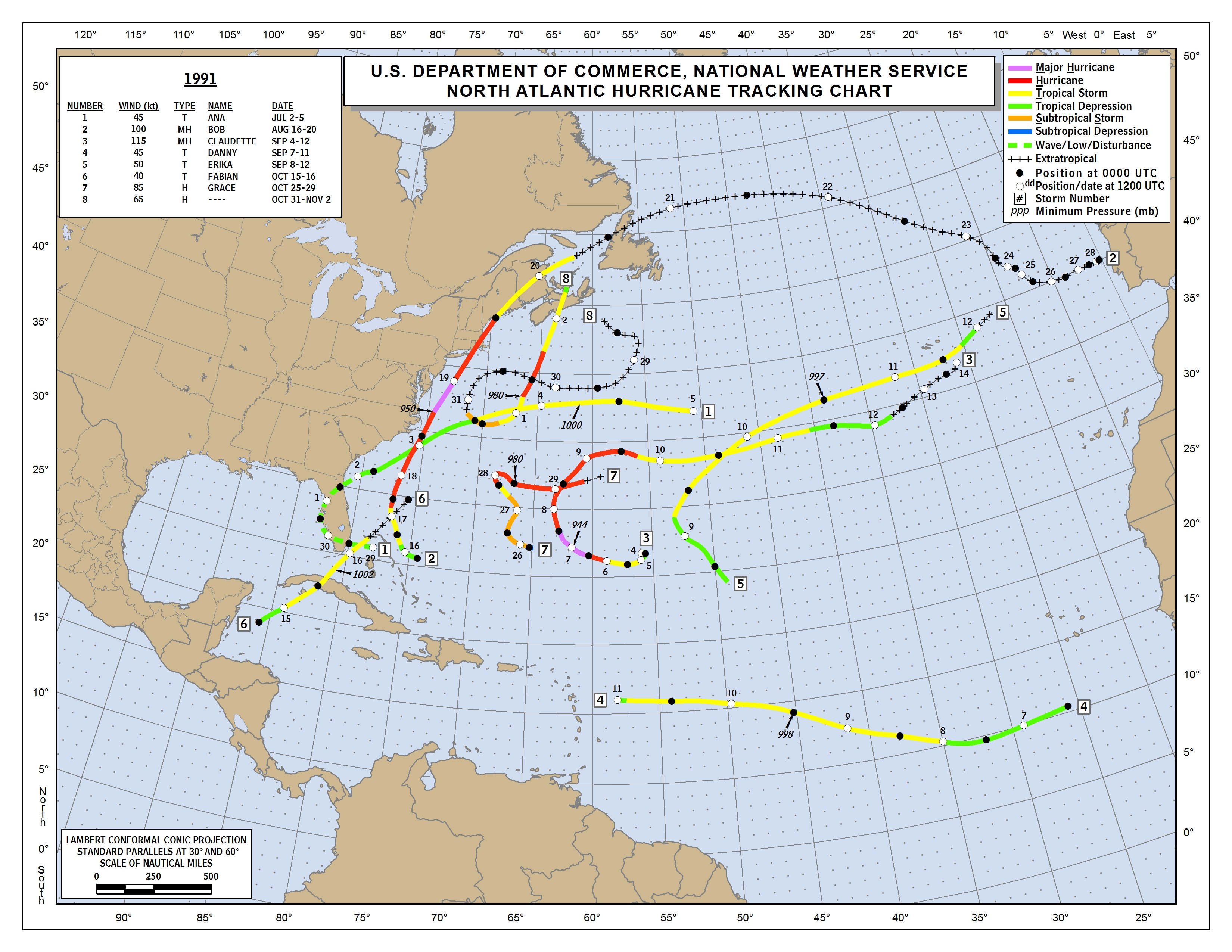
Perhaps 1991 is a potentially viable analog for 2019. The mid-level pattern in the Pacific from 20°S to 10°N and the Atlantic from 10°N to 35°N was strikingly similar in AMJ 1991 and AMJ 2019. Additionally, the tracks of ANDREA and BARRY seemingly correlate best with the general steering pattern in 1991. Given the much warmer MDR and colder tropical Pacific thus far in 2019, vs. 1991, perhaps this season will feature similar clusters of activity, but with much higher levels of activity, especially hurricanes and major hurricanes, since conditions are going to be much more conducive this season vs. 1991. Therefore, the Bay of Campeche, north-central Gulf Coast, and Mid-Atlantic/New England would face the highest risk in 2019.
5 likes
CVW / MiamiensisWx / Shell Mound
The posts in this forum are NOT official forecasts and should not be used as such. They are just the opinion of the poster and may or may not be backed by sound meteorological data. They are NOT endorsed by any professional institution or STORM2K. For official information, please refer to products from the NHC and NWS.
-
CyclonicFury
- Category 5
- Posts: 2038
- Age: 27
- Joined: Sun Jul 02, 2017 12:32 pm
- Location: NC
- Contact:
Re: 2019 Indicators: SST'S / Sal / MSLP / Steering / Shear / Instability (See updated graphics at first post)
https://twitter.com/philklotzbach/status/1153368493737144320
But...
https://twitter.com/TylerJStanfield/status/1153373606975590400
https://twitter.com/philklotzbach/status/1153375550330658818
https://twitter.com/yconsor/status/1153375193995390977
But...
https://twitter.com/TylerJStanfield/status/1153373606975590400
https://twitter.com/philklotzbach/status/1153375550330658818
https://twitter.com/yconsor/status/1153375193995390977
2 likes
NCSU B.S. in Meteorology Class of 2021. Tropical weather blogger at http://www.cyclonicfury.com. My forecasts and thoughts are NOT official, for official forecasts please consult the National Hurricane Center.
-
cycloneye
- Admin
- Posts: 149741
- Age: 69
- Joined: Thu Oct 10, 2002 10:54 am
- Location: San Juan, Puerto Rico
Re: 2019 Indicators: SST'S / Sal / MSLP / Steering / Shear / Instability (See updated graphics at first post)
This thread has been with bearish posts lately and here is one more.
https://twitter.com/BenNollWeather/status/1153465932330631168
https://twitter.com/BenNollWeather/status/1153465932330631168
0 likes
Visit the Caribbean-Central America Weather Thread where you can find at first post web cams,radars
and observations from Caribbean basin members Click Here
and observations from Caribbean basin members Click Here
-
NotSparta
- Professional-Met
- Posts: 1677
- Age: 24
- Joined: Fri Aug 18, 2017 8:24 am
- Location: Naples, FL
- Contact:
Re: 2019 Indicators: SST'S / Sal / MSLP / Steering / Shear / Instability (See updated graphics at first post)
cycloneye wrote:This thread has been with bearish posts lately and here is one more.
https://twitter.com/BenNollWeather/status/1153465932330631168
There are 3 guarantees in life: death, taxes, and the Euro showing a dry tropical ATL and Africa
14 likes
This post was probably an opinion of mine, and in no way is official. Please refer to http://www.hurricanes.gov for official tropical analysis and advisories.
My website, with lots of tropical wx graphics, including satellite and recon: http://cyclonicwx.com
My website, with lots of tropical wx graphics, including satellite and recon: http://cyclonicwx.com
-
storminabox
- Category 1

- Posts: 263
- Joined: Sun Jul 09, 2017 10:50 pm
Re: 2019 Indicators: SST'S / Sal / MSLP / Steering / Shear / Instability (See updated graphics at first post)
cycloneye wrote:This thread has been with bearish posts lately and here is one more.
https://twitter.com/BenNollWeather/status/1153465932330631168
The Euro calls for this every year. I wouldn’t put any value in this at this range
1 likes

Re: 2019 Indicators: SST'S / Sal / MSLP / Steering / Shear / Instability (See updated graphics at first post)
It never fails, the Euro always seems to forecast worst conditions for the Atlantic than what actually comes out to be.
1 likes
Who is online
Users browsing this forum: cstrunk and 129 guests