Ding, ding, ding….
https://twitter.com/andyhazelton/status/1563564557813321728
Low Pressure in the Central Atlantic (Is Invest 91L)
Moderator: S2k Moderators
Forum rules

The posts in this forum are NOT official forecasts and should not be used as such. They are just the opinion of the poster and may or may not be backed by sound meteorological data. They are NOT endorsed by any professional institution or STORM2K. For official information, please refer to products from the National Hurricane Center and National Weather Service.
-
Kingarabian

- S2K Supporter

- Posts: 16379
- Joined: Sat Aug 08, 2009 3:06 am
- Location: Honolulu, Hawaii
Re: Low Pressure in the Central Atlantic
NHC probably giving NCEP models a lot of weight here. But like Derek Ortt said and what some have alluded to over the past few days, the BOC phantom on the GFS is probably playing a role in it keeping this system weak. Unless the Euro comes in and drops it. Which i highly doubt it at this point.
Need the GFS on board so we don't have to keep waiting 12 hours for the CMC/Euro/UKMET to see the track evolution.
Need the GFS on board so we don't have to keep waiting 12 hours for the CMC/Euro/UKMET to see the track evolution.
0 likes
RIP Kobe Bryant

Re: Low Pressure in the Central Atlantic
tolakram wrote:12Z GFS running.
Here's the break in the ridge that cause most models to slow this way down to almost a stall in the shorter term. I think. Grey lines are the 500mb heights.
https://i.imgur.com/B8KWSiN.png
There is a TUTT due north of the system now, hasn't dug south at all since this morning but it has been producing some light shear. Looks like the convection on the north side of the system is trying to wrap west and by tonight it may be able to wrap itself up a little better ~15N. There is also an ULL north of Hispaniola and I would assume a weak anticyclonic circulation would form between the two ULL's by tomorrow that will allow this system to become an invest?
0 likes

-
skyline385

- Category 5

- Posts: 2728
- Age: 35
- Joined: Wed Aug 26, 2020 11:15 pm
- Location: Houston TX
Re: Low Pressure in the Central Atlantic
I really hope they figure out a way to fix the GFS’ Caribbean bias because at this point it’s affecting the tracks and official forecasts of actual systems which may be forming.
Sent from my iPhone using Tapatalk
Sent from my iPhone using Tapatalk
0 likes
-
cycloneye

- Admin

- Posts: 149727
- Age: 69
- Joined: Thu Oct 10, 2002 10:54 am
- Location: San Juan, Puerto Rico
Re: Low Pressure in the Central Atlantic
12z UKMET develops.

1 likes
Visit the Caribbean-Central America Weather Thread where you can find at first post web cams,radars
and observations from Caribbean basin members Click Here
and observations from Caribbean basin members Click Here
-
Craters
- Category 1

- Posts: 428
- Joined: Sat Aug 24, 2013 2:34 pm
- Location: Alvin, TX (south of Houston)
Re: Low Pressure in the Central Atlantic
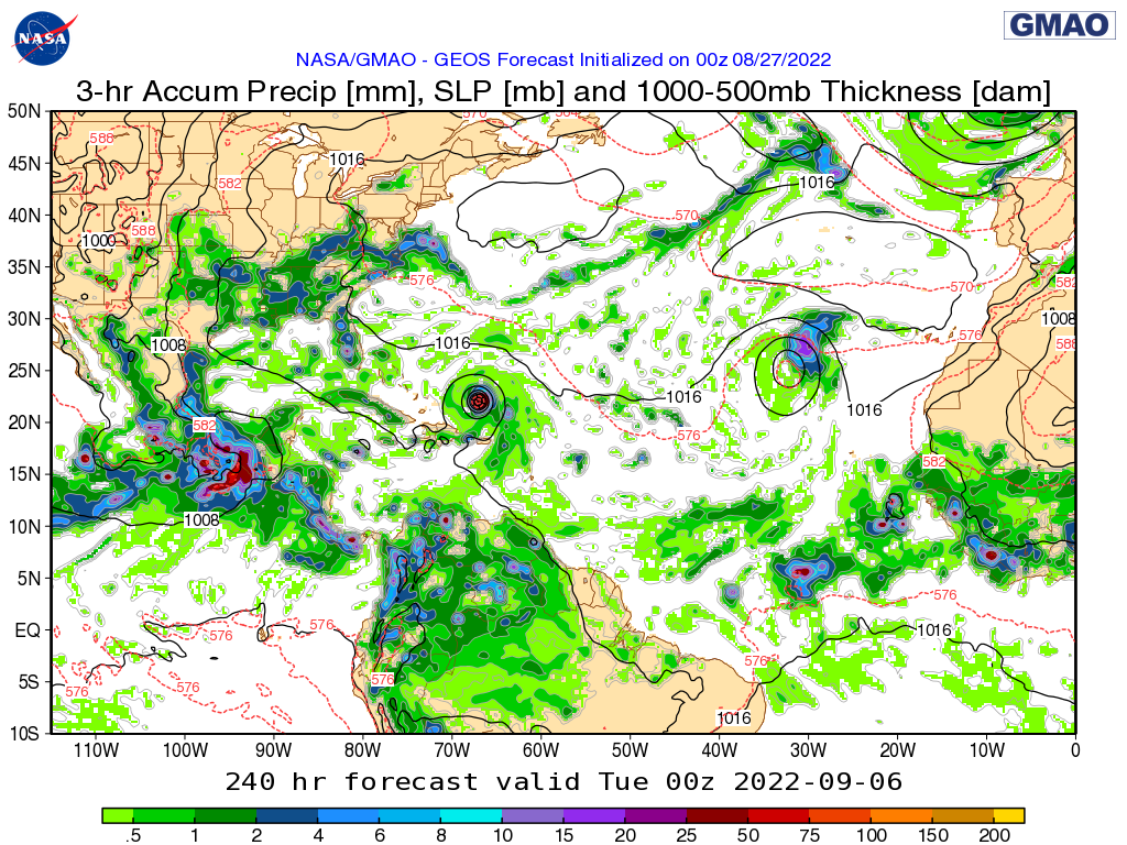
gatorcane wrote:00Z NASA model heading W to WNW at 240 hours:
https://i.postimg.cc/631HgQNK/6b20f7c7-889c-313f-807c-9e3bb7293b00.png
Probably worthwhile to note that it doesn't have any indication of the GFS ghostcane in the Gulf, either. Just some batches of decent rainfall spread along the western Gulf coast.
1 likes
Nothing that I post here should ever be treated as a forecast or anything resembling one. Please check with your local NWS office or the NHC for forecasts, watches, and warnings.
-
cycloneye
- Admin
- Posts: 149727
- Age: 69
- Joined: Thu Oct 10, 2002 10:54 am
- Location: San Juan, Puerto Rico
Re: Low Pressure in the Central Atlantic
10/40.

Central Tropical Atlantic:
An elongated area of low pressure associated with a tropical wave
over the central tropical Atlantic Ocean is producing some
disorganized showers and thunderstorms. Environmental conditions are
forecast to be generally favorable for some gradual development of
this system over the next several days, and a tropical depression
could form by the middle of next week as it moves west-northwestward
at 10 to 15 mph toward the waters east of the Leeward Islands.
* Formation chance through 48 hours...low...10 percent.
* Formation chance through 5 days...medium...40 percent.
2 likes
Visit the Caribbean-Central America Weather Thread where you can find at first post web cams,radars
and observations from Caribbean basin members Click Here
and observations from Caribbean basin members Click Here
-
SFLcane

- S2K Supporter
- Posts: 10281
- Age: 48
- Joined: Sat Jun 05, 2010 1:44 pm
- Location: Lake Worth Florida
Re: Low Pressure in the Central Atlantic
cycloneye wrote:10/40.Central Tropical Atlantic:
An elongated area of low pressure associated with a tropical wave
over the central tropical Atlantic Ocean is producing some
disorganized showers and thunderstorms. Environmental conditions are
forecast to be generally favorable for some gradual development of
this system over the next several days, and a tropical depression
could form by the middle of next week as it moves west-northwestward
at 10 to 15 mph toward the waters east of the Leeward Islands.
* Formation chance through 48 hours...low...10 percent.
* Formation chance through 5 days...medium...40 percent.
Here we go… Strong wording from the nhc. Invest soon
1 likes
-
Category5Kaiju

- Category 5
- Posts: 4347
- Joined: Thu Dec 24, 2020 12:45 pm
- Location: Seattle during the summer, Phoenix during the winter
Re: Low Pressure in the Central Atlantic
Is this system forecast to enter Hebert Box #1 as an intensifying system? From my understanding, Hebert Boxes are surprisingly good (though not 100% foolproof of course) indicators of whether or not a storm has a chance of hitting peninsular Florida as a potent hurricane
3 likes
Unless explicitly stated, all information in my posts is based on my own opinions and observations. Tropical storms and hurricanes can be extremely dangerous. Refer to an accredited weather research agency or meteorologist if you need to make serious decisions regarding an approaching storm.
-
skyline385
- Category 5
- Posts: 2728
- Age: 35
- Joined: Wed Aug 26, 2020 11:15 pm
- Location: Houston TX

-
SFLcane
- S2K Supporter
- Posts: 10281
- Age: 48
- Joined: Sat Jun 05, 2010 1:44 pm
- Location: Lake Worth Florida
Re: Low Pressure in the Central Atlantic
Category5Kaiju wrote:Is this system forecast to enter Hebert Box #1 as an intensifying system? From my understanding, Hebert Boxes are surprisingly good (though not 100% foolproof of course) indicators of whether or not a storm has a chance of hitting peninsular Florida as a potent hurricane
Technically this applies going through Herbert box as a major hurricane.
2 likes
-
skyline385
- Category 5
- Posts: 2728
- Age: 35
- Joined: Wed Aug 26, 2020 11:15 pm
- Location: Houston TX
Re: Low Pressure in the Central Atlantic
SFLcane wrote:Category5Kaiju wrote:Is this system forecast to enter Hebert Box #1 as an intensifying system? From my understanding, Hebert Boxes are surprisingly good (though not 100% foolproof of course) indicators of whether or not a storm has a chance of hitting peninsular Florida as a potent hurricane
Technically this applies going through Herbert box as a major hurricane.
Also examples like Maria and Gilbert which go through the box but miss SFL exist as well.
0 likes
-
Spacecoast

- Category 2

- Posts: 773
- Joined: Thu Aug 31, 2017 2:03 pm
Re: Low Pressure in the Central Atlantic
!2z GEFS: fwiw, it looks like some members get pulled N early (70-120 hrs) towards the brief ridge break.
Is consensus is that these GFS / GEFS runs are highly suspect due to the ghost on the left?


Is consensus is that these GFS / GEFS runs are highly suspect due to the ghost on the left?
0 likes
Re: Low Pressure in the Central Atlantic
Forms 42 hours earlier than 0Z run.
0 likes
Personal Forecast Disclaimer:
The posts in this forum are NOT official forecasts and should not be used as such. They are just the opinion of the poster and may or may not be backed by sound meteorological data. They are NOT endorsed by any professional institution or storm2k.org. For official information, please refer to the NHC and NWS products.
The posts in this forum are NOT official forecasts and should not be used as such. They are just the opinion of the poster and may or may not be backed by sound meteorological data. They are NOT endorsed by any professional institution or storm2k.org. For official information, please refer to the NHC and NWS products.
Re: Low Pressure in the Central Atlantic
These long "wait and see" trackers are intense stress tests.
This is a fairly common scenario that comes along: wave struggles with organizational and environmental conditions, then finds ideal conditions north of the islands under a ridge. Doesn't need that much time for it to really strengthen. We've seen this happen regularly over the years - usually doesn't end well for the Bahamas, but after that .. lots of unknowns
This is a fairly common scenario that comes along: wave struggles with organizational and environmental conditions, then finds ideal conditions north of the islands under a ridge. Doesn't need that much time for it to really strengthen. We've seen this happen regularly over the years - usually doesn't end well for the Bahamas, but after that .. lots of unknowns
0 likes
-
toad strangler

- S2K Supporter
- Posts: 4546
- Joined: Sun Jul 28, 2013 3:09 pm
- Location: Earth
- Contact:
Re: Low Pressure in the Central Atlantic
Category5Kaiju wrote:Is this system forecast to enter Hebert Box #1 as an intensifying system? From my understanding, Hebert Boxes are surprisingly good (though not 100% foolproof of course) indicators of whether or not a storm has a chance of hitting peninsular Florida as a potent hurricane
I consider the Hebert boxes old world meteorology.
1 likes
My Weather Station
https://www.wunderground.com/dashboard/pws/KFLPORTS603
https://www.wunderground.com/dashboard/pws/KFLPORTS603
-
InfernoFlameCat

- Category 5
- Posts: 2127
- Age: 23
- Joined: Mon Dec 14, 2020 10:52 am
- Location: Buford, GA
Re: Low Pressure in the Central Atlantic
Yeah, we really do not need another Andrew at all. I mean it really cannot get much worse than that. Two major hurricane landfalls from one storm. Katrina also followed a similar path.
0 likes
I am by no means a professional. DO NOT look at my forecasts for official information or make decisions based on what I post.
Goal: to become a registered expert over tropical and subtropical cyclones.
Goal: to become a registered expert over tropical and subtropical cyclones.
-
jlauderdal
- S2K Supporter
- Posts: 7240
- Joined: Wed May 19, 2004 5:46 am
- Location: NE Fort Lauderdale
- Contact:
Re: Low Pressure in the Central Atlantic
Why is that? Its just a benchmark...there is a 40/70 benchmark that is used for northeasterstoad strangler wrote:Category5Kaiju wrote:Is this system forecast to enter Hebert Box #1 as an intensifying system? From my understanding, Hebert Boxes are surprisingly good (though not 100% foolproof of course) indicators of whether or not a storm has a chance of hitting peninsular Florida as a potent hurricane
I consider the Hebert boxes old world meteorology.
0 likes

Re: Low Pressure in the Central Atlantic
Ridge looks more stout. 
12z

12zrun yesterday

12z
12zrun yesterday
Last edited by blp on Sat Aug 27, 2022 1:41 pm, edited 4 times in total.
0 likes
The following post is NOT an official forecast and should not be used as such. It is just the opinion of the poster and may or may not be backed by sound meteorological data. It is NOT endorsed by any professional institution including storm2k.org For Official Information please refer to the NHC and NWS products.
Who is online
Users browsing this forum: JoshwaDone and 96 guests