2019 Tropics: Global Model Runs Discussion (Out to day 16)

This is the general tropical discussion area. Anyone can take their shot at predicting a storms path.

Moderator: S2k Moderators

Forum rules

The posts in this forum are NOT official forecasts and should not be used as such. They are just the opinion of the poster and may or may not be backed by sound meteorological data. They are NOT endorsed by any professional institution or STORM2K. For official information, please refer to products from the National Hurricane Center and National Weather Service.

Help Support Storm2K
Message
Author
User avatar
wxman57
Moderator-Pro Met
Moderator-Pro Met
Posts: 22979
Age: 67
Joined: Sat Jun 21, 2003 8:06 pm
Location: Houston, TX (southwest)

Re: 2019 Tropics: Global Model Runs Discussion (Out to day 16)

#421 Postby wxman57 » Mon Aug 12, 2019 9:22 am

No need to get defensive as far as potential seasonal numbers. What I'm suggesting is that the current state of the tropics vs. many past seasons is quite different. The ITCZ is flat - no waves coming off Africa. The MDR is still quite hostile, even as mid-August approaches, and the only change I'm seeing is an increasingly hostile MDR.

Something is "off" in the tropics this season. All the season analogs we've come up with suggest 10 or fewer storms. Of course, there's debate about whether Andrea should have ever been named, and further debate on whether Barry really was a hurricane. Current naming criteria seem a bit looser than in the past, which may account for 1-2 additional storms per season. This is my 40th year forecasting worldwide TCs, and what I'm seeing isn't suggestive of an above-normal number of storms in the Atlantic Basin. 30-yr average is 14/7/3, by the way.

I went back to take a look at TPW imagery form past seasons to compare with today. First, 2008 vs. 2019. Quite a difference. No waves in 2019. Much drier air over western Africa this August, too.

Image

Now, last season. Same thing. Three active waves (BoC, Lesser Antilles, and by Africa) in 2018. Some evidence of a wave that was blown apart in the far east Atlantic.

Image
8 likes   

User avatar
CyclonicFury
Category 5
Category 5
Posts: 2025
Age: 26
Joined: Sun Jul 02, 2017 12:32 pm
Location: NC
Contact:

Re: 2019 Tropics: Global Model Runs Discussion (Out to day 16)

#422 Postby CyclonicFury » Mon Aug 12, 2019 9:29 am

wxman57 wrote:No need to get defensive as far as potential seasonal numbers. What I'm suggesting is that the current state of the tropics vs. many past seasons is quite different. The ITCZ is flat - no waves coming off Africa. The MDR is still quite hostile, even as mid-August approaches, and the only change I'm seeing is an increasingly hostile MDR.

Something is "off" in the tropics this season. All the season analogs we've come up with suggest 10 or fewer storms. Of course, there's debate about whether Andrea should have ever been named, and further debate on whether Barry really was a hurricane. Current naming criteria seem a bit looser than in the past, which may account for 1-2 additional storms per season. This is my 40th year forecasting worldwide TCs, and what I'm seeing isn't suggestive of an above-normal number of storms in the Atlantic Basin. 30-yr average is 14/7/3, by the way.

I went back to take a look at TPW imagery form past seasons to compare with today. First, 2008 vs. 2019. Quite a difference. No waves in 2019. Much drier air over western Africa this August, too.

http://wxman57.com/images/2008.JPG

Now, last season. Same thing. Three active waves (BoC, Lesser Antilles, and by Africa) in 2018. Some evidence of a wave that was blown apart in the far east Atlantic.

http://wxman57.com/images/2018.JPG

Respectfully disagree. There have been plenty of strong tropical waves exiting Africa. Africa looks "dead" right now because the Atlantic/Africa is in the suppressed phase of the MJO. Rainfall in Africa has been near-above normal over the past several months.

As for the dry air, the MDR has been anomalously dry at 500mb over the past month, but precipitable water has been above normal. The Atlantic is hostile *right now* but as the sinking branch breaks down, SSTs warm further and shear remains near-below normal, we should see several storms in September.
Last edited by CyclonicFury on Mon Aug 12, 2019 9:43 am, edited 1 time in total.
7 likes   
NCSU B.S. in Meteorology Class of 2021. Tropical weather blogger at http://www.cyclonicfury.com. My forecasts and thoughts are NOT official, for official forecasts please consult the National Hurricane Center.

User avatar
DioBrando
Category 4
Category 4
Posts: 904
Age: 28
Joined: Sun Aug 12, 2018 12:45 pm

Re: 2019 Tropics: Global Model Runs Discussion (Out to day 16)

#423 Postby DioBrando » Mon Aug 12, 2019 9:34 am

NotSparta wrote:Again, the subseasonal look is about as unfavorable as you can get, and IMO it's a bit of a knee jerk reaction to think that those conditions would lead to a dead season. The subseasonal look appears to get significantly more favorable, as we head into peak season

agreed with the ramp-up
0 likes   
blonde stacey (xe/xem/xir)

User avatar
DioBrando
Category 4
Category 4
Posts: 904
Age: 28
Joined: Sun Aug 12, 2018 12:45 pm

Re: 2019 Tropics: Global Model Runs Discussion (Out to day 16)

#424 Postby DioBrando » Mon Aug 12, 2019 9:36 am

CyclonicFury wrote:
wxman57 wrote:No need to get defensive as far as potential seasonal numbers. What I'm suggesting is that the current state of the tropics vs. many past seasons is quite different. The ITCZ is flat - no waves coming off Africa. The MDR is still quite hostile, even as mid-August approaches, and the only change I'm seeing is an increasingly hostile MDR.

Something is "off" in the tropics this season. All the season analogs we've come up with suggest 10 or fewer storms. Of course, there's debate about whether Andrea should have ever been named, and further debate on whether Barry really was a hurricane. Current naming criteria seem a bit looser than in the past, which may account for 1-2 additional storms per season. This is my 40th year forecasting worldwide TCs, and what I'm seeing isn't suggestive of an above-normal number of storms in the Atlantic Basin. 30-yr average is 14/7/3, by the way.

I went back to take a look at TPW imagery form past seasons to compare with today. First, 2008 vs. 2019. Quite a difference. No waves in 2019. Much drier air over western Africa this August, too.

http://wxman57.com/images/2008.JPG

Now, last season. Same thing. Three active waves (BoC, Lesser Antilles, and by Africa) in 2018. Some evidence of a wave that was blown apart in the far east Atlantic.

http://wxman57.com/images/2018.JPG

Respectfully disagree. There have been plenty of strong tropical waves exiting Africa. Africa looks "dead" right now because the Atlantic is in the suppressed phase of the MJO. Rainfall in Africa has been near-above normal over the past several months.

As for the dry air, the MDR has been anomalously dry at 500mb over the past month, but precipitable water has been above normal. The Atlantic is hostile *right now* but as the sinking branch breaks down, SSTs warm further and shear remains near-below normal, we should see several storms in September.

I must also respectfully disagree with OP, we're literally in a suppressed phase of an MJO and the wave that came towards the Atlantic (CCKW) was a suppressed-type too, plus sinking motion.

Twitter, models, etc all expect the current conditions will peter out and I'm sticking with that prediction.

2008 was literally a la nina, you can't even compare 2008 with 2019.

The MJO phase is currently in an unfavorable state right now but should move to phase 1 within the coming weeks according to Twitter.

The MDR is actually improving based on models scoured off sites like tropical tidbits. yes, mid-august will get a hostile mdr at worst peak but models state improvement after that.

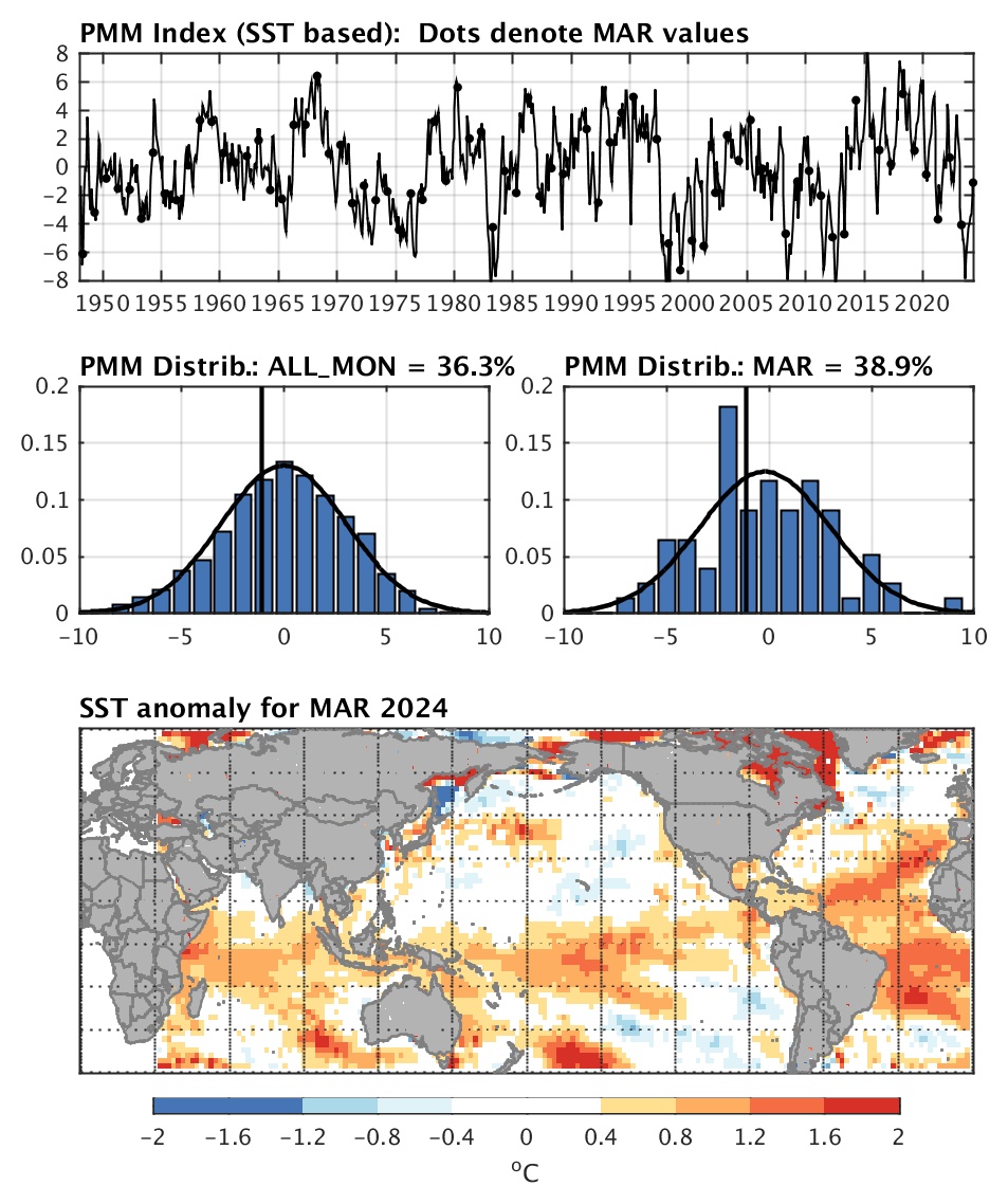
PMM is above average currently and has been like that since 2013. Every year is a different year in terms of expectations.
Image

For now, I'm still muting season cancel posts. it's way too early to do that.
2 likes   
blonde stacey (xe/xem/xir)

User avatar
wxman57
Moderator-Pro Met
Moderator-Pro Met
Posts: 22979
Age: 67
Joined: Sat Jun 21, 2003 8:06 pm
Location: Houston, TX (southwest)

Re: 2019 Tropics: Global Model Runs Discussion (Out to day 16)

#425 Postby wxman57 » Mon Aug 12, 2019 10:00 am

My main point for using 2008 was that it WAS an active season. That's what an active season looked like in the second week of August. Conditions are quite different from 2008 right now. I think that the southeast and east U.S. coast may be at a slightly enhanced risk of a hurricane impact this season due to the MDR being less favorable for development and because hurricanes may develop farther north and west this season.
5 likes   

User avatar
northjaxpro
S2K Supporter
S2K Supporter
Posts: 8900
Joined: Mon Sep 27, 2010 11:21 am
Location: Jacksonville, FL

Re: 2019 Tropics: Global Model Runs Discussion (Out to day 16)

#426 Postby northjaxpro » Mon Aug 12, 2019 10:10 am

wxman57 wrote:My main point for using 2008 was that it WAS an active season. That's what an active season looked like in the second week of August. Conditions are quite different from 2008 right now. I think that the southeast and east U.S. coast may be at a slightly enhanced risk of a hurricane impact this season due to the MDR being less favorable for development and because hurricanes may develop farther north and west this season.


Really, that has bern the case thus far. Wind shear and SAL just have been too oersistent in the MDR.

One thing I do point out is that this is beginning to resemble the 1997 North Atlantc Season.

That season featured no tropical cyclone development in the month of August. Here we are about midway through the month now.. That would really be something to have that happen again, uh..
1997 also featured only a total of 8 named storms in the North Atlantic basin and just 3 hurricanes, one of which was a major ,(Erika)
0 likes   
NEVER, EVER SAY NEVER in the tropics and weather in general, and most importantly, with life itself!!

________________________________________________________________________________________

Fay 2008 Beryl 2012 Debby 2012 Colin 2016 Hermine 2016 Julia 2016 Matthew 2016 Irma 2017 Dorian 2019

User avatar
northjaxpro
S2K Supporter
S2K Supporter
Posts: 8900
Joined: Mon Sep 27, 2010 11:21 am
Location: Jacksonville, FL

Re: 2019 Tropics: Global Model Runs Discussion (Out to day 16)

#427 Postby northjaxpro » Mon Aug 12, 2019 10:12 am

wxman57 wrote:My main point for using 2008 was that it WAS an active season. That's what an active season looked like in the second week of August. Conditions are quite different from 2008 right now. I think that the southeast and east U.S. coast may be at a slightly enhanced risk of a hurricane impact this season due to the MDR being less favorable for development and because hurricanes may develop farther north and west this season.


Really, that has been the case thus far. Wind shear and SAL just have been too persistent in the MDR.

One thing I do point out is that this is beginning to resemble the 1997 North Atlantc Season.

That season featured no tropical cyclone development in the month of August. Here we are about midway through the month now.. That would really be something to have that happen again, huh..
1997 also featured only a total of 8 named storms in the North Atlantic basin and just 3 hurricanes, one of which was a major ,(Erika)
Last edited by northjaxpro on Mon Aug 12, 2019 10:14 am, edited 3 times in total.
0 likes   
NEVER, EVER SAY NEVER in the tropics and weather in general, and most importantly, with life itself!!

________________________________________________________________________________________

Fay 2008 Beryl 2012 Debby 2012 Colin 2016 Hermine 2016 Julia 2016 Matthew 2016 Irma 2017 Dorian 2019

User avatar
DioBrando
Category 4
Category 4
Posts: 904
Age: 28
Joined: Sun Aug 12, 2018 12:45 pm

Re: 2019 Tropics: Global Model Runs Discussion (Out to day 16)

#428 Postby DioBrando » Mon Aug 12, 2019 10:12 am

This will peter out any moment those waves start clearing up the dry air:
Image
0 likes   
blonde stacey (xe/xem/xir)

User avatar
SoupBone
Category 5
Category 5
Posts: 3111
Joined: Tue Sep 20, 2005 5:24 pm

Re: 2019 Tropics: Global Model Runs Discussion (Out to day 16)

#429 Postby SoupBone » Mon Aug 12, 2019 10:14 am

wxman57 wrote:
Emmett_Brown wrote:
wxman57 wrote:It's nearly mid-August, and all we have to discuss is the possibility of a weak frontal low off the SE U.S. Coast (or NE Gulf) that could be classified as a TD or a weak TS as it tracks out to sea. MDR through Caribbean is absolutely dead. TPW loop shows nothing - no waves. My coworker pointed out that the moisture over west Africa on the TPW loop is moving from west to east (backwards). Not sure why NOAA bumped its numbers up last week.

NHC 5-Day Map
https://www.nhc.noaa.gov/xgtwo/two_atl_5d0.png


Is this a season cancel post from one of our veteran pros prior to August 15th? Intriguing...


Of course not, but I see nothing to suggest an above-normal season numbers-wise. We may well see 10 or fewer named storms this season (depending on the NHC's current naming criteria). There have been many seasons in the past with fewer than normal storms but with major impacts (1957, 1965, 1992, etc.). I think the MDR will remain dead, but that shifts development potential toward the west Caribbean, Gulf, and off the SE U.S. Coast, where there won't be as much warning before landfall.


This is my concern. Barry didn't really afford us a whole lot of time, and these systems are very frustrating for emergency managers and other decision makers.
1 likes   
Personal Forecast Disclaimer:
The posts in this forum are NOT official forecast and should not be used as such. They are just the opinion of the poster and may or may not be backed by sound meteorological data. They are NOT endorsed by any professional institution or storm2k.org. For official information, please refer to the NHC and NWS products.

User avatar
CyclonicFury
Category 5
Category 5
Posts: 2025
Age: 26
Joined: Sun Jul 02, 2017 12:32 pm
Location: NC
Contact:

Re: 2019 Tropics: Global Model Runs Discussion (Out to day 16)

#430 Postby CyclonicFury » Mon Aug 12, 2019 10:18 am

northjaxpro wrote:
wxman57 wrote:My main point for using 2008 was that it WAS an active season. That's what an active season looked like in the second week of August. Conditions are quite different from 2008 right now. I think that the southeast and east U.S. coast may be at a slightly enhanced risk of a hurricane impact this season due to the MDR being less favorable for development and because hurricanes may develop farther north and west this season.


Really, that has bern the case thus far. Wind shear and SAL just have been too oersistent in the MDR.

One thing I do point out is that this is beginning to resemble the 1997 North Atlantc Season.

That season featured no tropical cyclone development in the month of August. Here we are about midway through the month now.. That would really be something to have that happen again, uh..
1997 also featured only a total of 8 named storms in the North Atlantic basin and just 3 hurricanes, one of which was a major ,(Erika)

1997 was during a Super El Niño, 2019 is a dissipating Modoki Niño/warm neutral. Shear has been much lower than 1997 in the MDR and Caribbean.

I still believe the Atlantic won't be able to end August without a named storm.
4 likes   
NCSU B.S. in Meteorology Class of 2021. Tropical weather blogger at http://www.cyclonicfury.com. My forecasts and thoughts are NOT official, for official forecasts please consult the National Hurricane Center.

User avatar
DioBrando
Category 4
Category 4
Posts: 904
Age: 28
Joined: Sun Aug 12, 2018 12:45 pm

Re: 2019 Tropics: Global Model Runs Discussion (Out to day 16)

#431 Postby DioBrando » Mon Aug 12, 2019 10:19 am

CyclonicFury wrote:
northjaxpro wrote:
wxman57 wrote:My main point for using 2008 was that it WAS an active season. That's what an active season looked like in the second week of August. Conditions are quite different from 2008 right now. I think that the southeast and east U.S. coast may be at a slightly enhanced risk of a hurricane impact this season due to the MDR being less favorable for development and because hurricanes may develop farther north and west this season.


Really, that has bern the case thus far. Wind shear and SAL just have been too oersistent in the MDR.

One thing I do point out is that this is beginning to resemble the 1997 North Atlantc Season.

That season featured no tropical cyclone development in the month of August. Here we are about midway through the month now.. That would really be something to have that happen again, uh..
1997 also featured only a total of 8 named storms in the North Atlantic basin and just 3 hurricanes, one of which was a major ,(Erika)

1997 was during a Super El Niño, 2019 is a dissipating Modoki Niño/warm neutral. Shear has been much lower than 1997 in the MDR and Caribbean.

I still believe the Atlantic won't be able to end August without a named storm.


^ THIS.
Remember 2004?
Last edited by DioBrando on Mon Aug 12, 2019 10:20 am, edited 1 time in total.
0 likes   
blonde stacey (xe/xem/xir)

User avatar
SoupBone
Category 5
Category 5
Posts: 3111
Joined: Tue Sep 20, 2005 5:24 pm

Re: 2019 Tropics: Global Model Runs Discussion (Out to day 16)

#432 Postby SoupBone » Mon Aug 12, 2019 10:20 am

northjaxpro wrote:
wxman57 wrote:My main point for using 2008 was that it WAS an active season. That's what an active season looked like in the second week of August. Conditions are quite different from 2008 right now. I think that the southeast and east U.S. coast may be at a slightly enhanced risk of a hurricane impact this season due to the MDR being less favorable for development and because hurricanes may develop farther north and west this season.


Really, that has bern the case thus far. Wind shear and SAL just have been too oersistent in the MDR.

One thing I do point out is that this is beginning to resemble the 1997 North Atlantc Season.

That season featured no tropical cyclone development in the month of August. Here we are about midway through the month now.. That would really be something to have that happen again, uh..
1997 also featured only a total of 8 named storms in the North Atlantic basin and just 3 hurricanes, one of which was a major ,(Erika)


SAL typically peaks in mid-July, and so far, he's still a very steady force out there right now. No signs yet of him going away anytime soon.
0 likes   
Personal Forecast Disclaimer:
The posts in this forum are NOT official forecast and should not be used as such. They are just the opinion of the poster and may or may not be backed by sound meteorological data. They are NOT endorsed by any professional institution or storm2k.org. For official information, please refer to the NHC and NWS products.

User avatar
DioBrando
Category 4
Category 4
Posts: 904
Age: 28
Joined: Sun Aug 12, 2018 12:45 pm

Re: 2019 Tropics: Global Model Runs Discussion (Out to day 16)

#433 Postby DioBrando » Mon Aug 12, 2019 10:21 am

SoupBone wrote:
northjaxpro wrote:
wxman57 wrote:My main point for using 2008 was that it WAS an active season. That's what an active season looked like in the second week of August. Conditions are quite different from 2008 right now. I think that the southeast and east U.S. coast may be at a slightly enhanced risk of a hurricane impact this season due to the MDR being less favorable for development and because hurricanes may develop farther north and west this season.


Really, that has bern the case thus far. Wind shear and SAL just have been too oersistent in the MDR.

One thing I do point out is that this is beginning to resemble the 1997 North Atlantc Season.

That season featured no tropical cyclone development in the month of August. Here we are about midway through the month now.. That would really be something to have that happen again, uh..
1997 also featured only a total of 8 named storms in the North Atlantic basin and just 3 hurricanes, one of which was a major ,(Erika)


SAL typically peaks in mid-July, and so far, he's still a very steady force out there right now. No signs yet of him going away anytime soon.

or probably just taking longer than expected to peter out tbh
1 likes   
blonde stacey (xe/xem/xir)

User avatar
northjaxpro
S2K Supporter
S2K Supporter
Posts: 8900
Joined: Mon Sep 27, 2010 11:21 am
Location: Jacksonville, FL

Re: 2019 Tropics: Global Model Runs Discussion (Out to day 16)

#434 Postby northjaxpro » Mon Aug 12, 2019 10:23 am

Shear much lower in the Caribbean so far this season? Shear has been crippling.across the Caribbean to this juncture to me hasn't it? Or it is just me?
0 likes   
NEVER, EVER SAY NEVER in the tropics and weather in general, and most importantly, with life itself!!

________________________________________________________________________________________

Fay 2008 Beryl 2012 Debby 2012 Colin 2016 Hermine 2016 Julia 2016 Matthew 2016 Irma 2017 Dorian 2019

User avatar
CyclonicFury
Category 5
Category 5
Posts: 2025
Age: 26
Joined: Sun Jul 02, 2017 12:32 pm
Location: NC
Contact:

Re: 2019 Tropics: Global Model Runs Discussion (Out to day 16)

#435 Postby CyclonicFury » Mon Aug 12, 2019 10:25 am

northjaxpro wrote:Shear much lower in the Caribbean so far this season? Shear has been crippling.across the Caribbean to this juncture to me hasn't it? Or it is just me?

Climo shear in the Caribbean from June-early August is quite high. Below average shear in the Caribbean during that time is still usually too strong to allow TC genesis.
2 likes   
NCSU B.S. in Meteorology Class of 2021. Tropical weather blogger at http://www.cyclonicfury.com. My forecasts and thoughts are NOT official, for official forecasts please consult the National Hurricane Center.

User avatar
DioBrando
Category 4
Category 4
Posts: 904
Age: 28
Joined: Sun Aug 12, 2018 12:45 pm

Re: 2019 Tropics: Global Model Runs Discussion (Out to day 16)

#436 Postby DioBrando » Mon Aug 12, 2019 10:30 am

northjaxpro wrote:Shear much lower in the Caribbean so far this season? Shear has been crippling.across the Caribbean to this juncture to me hasn't it? Or it is just me?

Go and have a look at the shear maps in tropical tidbits, or look at my previous posts for your answer.
0 likes   
blonde stacey (xe/xem/xir)

User avatar
northjaxpro
S2K Supporter
S2K Supporter
Posts: 8900
Joined: Mon Sep 27, 2010 11:21 am
Location: Jacksonville, FL

Re: 2019 Tropics: Global Model Runs Discussion (Out to day 16)

#437 Postby northjaxpro » Mon Aug 12, 2019 10:36 am

DioBrando wrote:
northjaxpro wrote:Shear much lower in the Caribbean so far this season? Shear has been crippling.across the Caribbean to this juncture to me hasn't it? Or it is just me?

Go and have a look at the shear maps in tropical tidbits, or look at my previous posts for your answer.


Whether if the shear is to the level of where it was 1997 or not down there, we will not know that truly in full extent until we end this current season. My point is that shear still has been very hostile to this point in the Caribbean and I don't see that slackening in the immediate short term down there.
0 likes   
NEVER, EVER SAY NEVER in the tropics and weather in general, and most importantly, with life itself!!

________________________________________________________________________________________

Fay 2008 Beryl 2012 Debby 2012 Colin 2016 Hermine 2016 Julia 2016 Matthew 2016 Irma 2017 Dorian 2019

User avatar
DioBrando
Category 4
Category 4
Posts: 904
Age: 28
Joined: Sun Aug 12, 2018 12:45 pm

Re: 2019 Tropics: Global Model Runs Discussion (Out to day 16)

#438 Postby DioBrando » Mon Aug 12, 2019 10:38 am

northjaxpro wrote:
DioBrando wrote:
northjaxpro wrote:Shear much lower in the Caribbean so far this season? Shear has been crippling.across the Caribbean to this juncture to me hasn't it? Or it is just me?

Go and have a look at the shear maps in tropical tidbits, or look at my previous posts for your answer.


Whether if the shear is to the level of where it was 1997 or not down there, we will not know that truly in full extent until we end this current season. My point is that shear still has been very hostile to this point in the Caribbean and I don't see that slackening in the immediate short term down there.


Image
and
Image
0 likes   
blonde stacey (xe/xem/xir)

User avatar
CyclonicFury
Category 5
Category 5
Posts: 2025
Age: 26
Joined: Sun Jul 02, 2017 12:32 pm
Location: NC
Contact:

Re: 2019 Tropics: Global Model Runs Discussion (Out to day 16)

#439 Postby CyclonicFury » Mon Aug 12, 2019 10:42 am

northjaxpro wrote:
DioBrando wrote:
northjaxpro wrote:Shear much lower in the Caribbean so far this season? Shear has been crippling.across the Caribbean to this juncture to me hasn't it? Or it is just me?

Go and have a look at the shear maps in tropical tidbits, or look at my previous posts for your answer.


Whether if the shear is to the level of where it was 1997 or not down there, we will not know that truly in full extent until we end this current season. My point is that shear still has been very hostile to this point in the Caribbean and I don't see that slackening in the immediate short term down there.

 https://twitter.com/CyclonicFury/status/1160651099768070144


2 likes   
NCSU B.S. in Meteorology Class of 2021. Tropical weather blogger at http://www.cyclonicfury.com. My forecasts and thoughts are NOT official, for official forecasts please consult the National Hurricane Center.

User avatar
DioBrando
Category 4
Category 4
Posts: 904
Age: 28
Joined: Sun Aug 12, 2018 12:45 pm

Re: 2019 Tropics: Global Model Runs Discussion (Out to day 16)

#440 Postby DioBrando » Mon Aug 12, 2019 10:44 am

it's not the shear that's the problem, in fact, it's been far lower than last year. it's the suppressed CCKWs and MJO phases that are a problem, promoting dry air and sinking air and currently enhancing activity in asia. once the MJO moves near phase 1, which isn't that far away from now, conditions WILL, and I MEAN WILL, improve.

want to know why models currently (in the short term) are favoring activity near asia? because they have real current conditions to pick up on rather than projected activity/trends! there's something concrete! it'll configure once you'll see it!

around this time last year there were also many season cancel posts but florence and the gang turned up.

before hector and lane last year, models were showing nothing in the long term but hector and lane showed up, and so did norman, olivia, etc.
3 likes   
blonde stacey (xe/xem/xir)


Return to “Talkin' Tropics”

Who is online

Users browsing this forum: Google Adsense [Bot], Kingarabian, Wampadawg and 34 guests