2023 EPAC Season

This is the general tropical discussion area. Anyone can take their shot at predicting a storms path.

Moderator: S2k Moderators

Forum rules

The posts in this forum are NOT official forecasts and should not be used as such. They are just the opinion of the poster and may or may not be backed by sound meteorological data. They are NOT endorsed by any professional institution or STORM2K. For official information, please refer to products from the National Hurricane Center and National Weather Service.

Help Support Storm2K
Message
Author
User avatar
cycloneye
Admin
Admin
Posts: 139602
Age: 67
Joined: Thu Oct 10, 2002 10:54 am
Location: San Juan, Puerto Rico

Re: 2023 EPAC Season

#341 Postby cycloneye » Tue Aug 08, 2023 6:56 pm

Tropical Weather Outlook
NWS National Hurricane Center Miami FL
500 PM PDT Tue Aug 8 2023

For the eastern North Pacific...east of 140 degrees west longitude:

1. Central East Pacific:
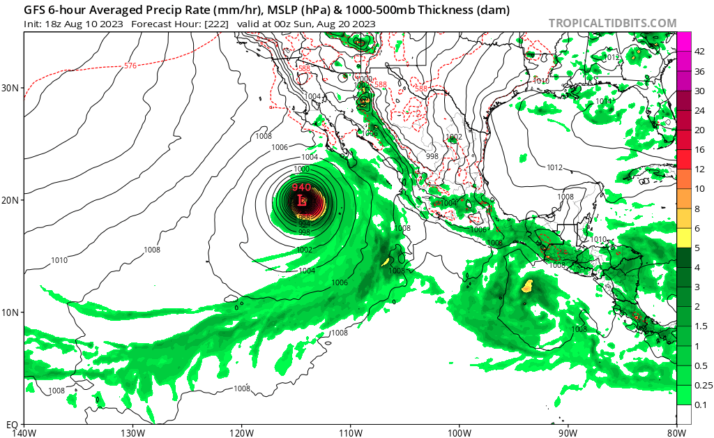
A tropical wave is producing widespread disorganized showers and
thunderstorms a couple of hundred miles south of the southern coast
of Mexico. Environmental conditions are expected to support gradual
development of the wave, and a tropical depression could form over
the weekend while the system moves generally westward across the
central portion of the basin.
* Formation chance through 48 hours...low...near 0 percent.
* Formation chance through 7 days...medium...60 percent.

Forecaster D. Zelinsky


Image
0 likes   
Visit the Caribbean-Central America Weather Thread where you can find at first post web cams,radars
and observations from Caribbean basin members Click Here

Ntxw
Storm2k Moderator
Storm2k Moderator
Posts: 21565
Joined: Wed Oct 21, 2009 6:34 pm
Location: DFW, Texas

Re: 2023 EPAC Season

#342 Postby Ntxw » Tue Aug 08, 2023 11:51 pm

Looks like another long-tracker signal is on the horizon. EPAC could be near 100 ACE by month's end or sooner.
1 likes   
The above post and any post by Ntxw is NOT an official forecast and should not be used as such. It is just the opinion of the poster and may or may not be backed by sound meteorological data. It is NOT endorsed by any professional institution including Storm2k. For official information, please refer to NWS products.

  Help support Storm2K!
Help Support Storm2K

User avatar
Kingarabian
S2K Supporter
S2K Supporter
Posts: 15462
Joined: Sat Aug 08, 2009 3:06 am
Location: Honolulu, Hawaii

Re: 2023 EPAC Season

#343 Postby Kingarabian » Wed Aug 09, 2023 11:48 am

Ntxw wrote:Looks like another long-tracker signal is on the horizon. EPAC could be near 100 ACE by month's end or sooner.

CMC agrees but the Euro and GFS are a bit pessimistic. That being said, global models are pretty horrible right now so it's possible we see another long tracker.
0 likes   
RIP Kobe Bryant

User avatar
cycloneye
Admin
Admin
Posts: 139602
Age: 67
Joined: Thu Oct 10, 2002 10:54 am
Location: San Juan, Puerto Rico

Re: 2023 EPAC Season

#344 Postby cycloneye » Wed Aug 09, 2023 12:41 pm

Kingarabian Yellow Evan Looks like the basin will be busy in the next 2 weeks.

Tropical Weather Outlook
NWS National Hurricane Center Miami FL
1100 AM PDT Wed Aug 9 2023

For the eastern North Pacific...east of 140 degrees west longitude:

Central East Pacific:
A tropical wave is producing a large area of disorganized showers
and thunderstorms several hundred miles south of the coast of
southwestern Mexico. Environmental conditions are expected to be
conducive for gradual development of this system, and a tropical
depression could form by the weekend or early next week while it
moves generally westward at about 15 mph across the central portion
of the basin.
* Formation chance through 48 hours...low...10 percent.
* Formation chance through 7 days...medium...60 percent.

Western East Pacific:
Another tropical wave located well to the southwest of the southern
tip of the Baja California peninsula is producing some disorganized
showers and thunderstorms. Environmental conditions could support
some gradual development of this system during the next several days
as it moves generally westward at 10 to 15 mph across the far
western portion of the basin and into the Central Pacific basin.
* Formation chance through 48 hours...low...near 0 percent.
* Formation chance through 7 days...low...20 percent.

Off the Coast of Southern Mexico:
An area of low pressure is forecast to develop early next week
offshore of Central America. Some gradual development of this system
is possible during the early and middle parts of next week as it
moves generally west-northwestward, roughly parallel to the coast
of southern Mexico.
* Formation chance through 48 hours...low...near 0 percent.
* Formation chance through 7 days...low...20 percent.

$$
Forecaster Reinhart


Image
1 likes   
Visit the Caribbean-Central America Weather Thread where you can find at first post web cams,radars
and observations from Caribbean basin members Click Here

Ntxw
Storm2k Moderator
Storm2k Moderator
Posts: 21565
Joined: Wed Oct 21, 2009 6:34 pm
Location: DFW, Texas

Re: 2023 EPAC Season

#345 Postby Ntxw » Wed Aug 09, 2023 3:12 pm

The orange is potential for long tracker, making Hawaiian direction on the Euro. Fernanda is the next name.

Image
0 likes   
The above post and any post by Ntxw is NOT an official forecast and should not be used as such. It is just the opinion of the poster and may or may not be backed by sound meteorological data. It is NOT endorsed by any professional institution including Storm2k. For official information, please refer to NWS products.


  Help support Storm2K!

Help Support Storm2K


User avatar
Yellow Evan
Professional-Met
Professional-Met
Posts: 15960
Age: 25
Joined: Fri Jul 15, 2011 12:48 pm
Location: Henderson, Nevada/Honolulu, HI
Contact:

Re: 2023 EPAC Season

#346 Postby Yellow Evan » Wed Aug 09, 2023 3:16 pm

There have been 3 signals on ensembles for a bit now. UL flow for all three appears divergent at first glance. Global models still need to play catch up a bit before I become confident in intensity of any of the systems.
1 likes   

Ntxw
Storm2k Moderator
Storm2k Moderator
Posts: 21565
Joined: Wed Oct 21, 2009 6:34 pm
Location: DFW, Texas

Re: 2023 EPAC Season

#347 Postby Ntxw » Wed Aug 09, 2023 6:07 pm

Tragic event in Lahaina, Hawaii. Whether indirectly or not, the pattern that yielded the passing of Hurricane Dora has proven both costly and deadly to the US anyway.
1 likes   
The above post and any post by Ntxw is NOT an official forecast and should not be used as such. It is just the opinion of the poster and may or may not be backed by sound meteorological data. It is NOT endorsed by any professional institution including Storm2k. For official information, please refer to NWS products.


  Help support Storm2K!

Help Support Storm2K


User avatar
cycloneye
Admin
Admin
Posts: 139602
Age: 67
Joined: Thu Oct 10, 2002 10:54 am
Location: San Juan, Puerto Rico

Re: 2023 EPAC Season

#348 Postby cycloneye » Wed Aug 09, 2023 6:46 pm

Tropical Weather Outlook
NWS National Hurricane Center Miami FL
500 PM PDT Wed Aug 9 2023

For the eastern North Pacific...east of 140 degrees west longitude:

Central East Pacific:
A tropical wave is producing a large area of disorganized showers
and thunderstorms several hundred miles south of the coast of
southwestern Mexico. Environmental conditions are expected to be
conducive for gradual development of this system, and a tropical
depression is likely to form by the weekend or early next week
while it moves generally westward at about 15 mph across the central
portion of the basin.
* Formation chance through 48 hours...low...20 percent.
* Formation chance through 7 days...high...70 percent.

Western East Pacific:
Another tropical wave located well to the southwest of the southern
tip of the Baja California peninsula is producing some disorganized
showers and thunderstorms. Environmental conditions could support
some gradual development of this system during the next several days
while it moves generally westward at 10 to 15 mph across the far
western portion of the basin and into the Central Pacific basin.
* Formation chance through 48 hours...low...near 0 percent.
* Formation chance through 7 days...low...20 percent.

Off the Coast of Southern Mexico:
An area of low pressure is forecast to form early next week
offshore of Central America. Some gradual development of this
system is possible during the early and middle parts of next week
while it moves generally west-northwestward, roughly parallel to the
coast of southern Mexico.
* Formation chance through 48 hours...low...near 0 percent.
* Formation chance through 7 days...low...20 percent.

$$
Forecaster Pasch


Image
0 likes   
Visit the Caribbean-Central America Weather Thread where you can find at first post web cams,radars
and observations from Caribbean basin members Click Here

User avatar
Extratropical94
Professional-Met
Professional-Met
Posts: 3535
Age: 29
Joined: Wed Oct 20, 2010 6:36 am
Location: Hamburg, Germany
Contact:

Re: 2023 EPAC Season

#349 Postby Extratropical94 » Thu Aug 10, 2023 7:56 am


Tropical Weather Outlook
NWS National Hurricane Center Miami FL
500 AM PDT Thu Aug 10 2023

For the eastern North Pacific...east of 140 degrees west longitude:

Central East Pacific:
A tropical wave continues to produce a large area of disorganized
showers and thunderstorms several hundred miles south of the coast
of southwestern Mexico. Environmental conditions appear conducive
for gradual development of this system, and a tropical depression is
likely to form over the weekend or early next week while it moves
westward at about 15 mph across the central portion of the basin.
* Formation chance through 48 hours...low...20 percent.
* Formation chance through 7 days...high...80 percent.

Western East Pacific:
Another tropical wave located well to the southwest of the southern
tip of the Baja California peninsula is producing some disorganized
showers and thunderstorms. Some gradual development of this system
is possible during the next several days while it moves generally
westward at 10 to 15 mph across the far western portion of the basin
and into the Central Pacific basin.
* Formation chance through 48 hours...low...near 0 percent.
* Formation chance through 7 days...low...20 percent.

Off the Coast of Southern Mexico:
An area of low pressure is forecast to form offshore of Central
America in a few days. Environmental conditions are expected to be
conducive for gradual development of this system, and a tropical
depression could form during the early or middle part of next week
while it moves generally west-northwestward, roughly parallel to the
coast of southern Mexico.
* Formation chance through 48 hours...low...near 0 percent.
* Formation chance through 7 days...medium...40 percent.

$$
Forecaster Reinhart
0 likes   
54° 11' 59'' N, 9° 9' 20'' E
Boomer Sooner!
Go Broncos! Go Cards! Go Niners!
- Daniel

User avatar
cycloneye
Admin
Admin
Posts: 139602
Age: 67
Joined: Thu Oct 10, 2002 10:54 am
Location: San Juan, Puerto Rico

Re: 2023 EPAC Season

#350 Postby cycloneye » Thu Aug 10, 2023 8:06 am

Extratropical94 wrote:

Tropical Weather Outlook
NWS National Hurricane Center Miami FL
500 AM PDT Thu Aug 10 2023

For the eastern North Pacific...east of 140 degrees west longitude:

Central East Pacific:
A tropical wave continues to produce a large area of disorganized
showers and thunderstorms several hundred miles south of the coast
of southwestern Mexico. Environmental conditions appear conducive
for gradual development of this system, and a tropical depression is
likely to form over the weekend or early next week while it moves
westward at about 15 mph across the central portion of the basin.
* Formation chance through 48 hours...low...20 percent.
* Formation chance through 7 days...high...80 percent.

Western East Pacific:
Another tropical wave located well to the southwest of the southern
tip of the Baja California peninsula is producing some disorganized
showers and thunderstorms. Some gradual development of this system
is possible during the next several days while it moves generally
westward at 10 to 15 mph across the far western portion of the basin
and into the Central Pacific basin.
* Formation chance through 48 hours...low...near 0 percent.
* Formation chance through 7 days...low...20 percent.

Off the Coast of Southern Mexico:
An area of low pressure is forecast to form offshore of Central
America in a few days. Environmental conditions are expected to be
conducive for gradual development of this system, and a tropical
depression could form during the early or middle part of next week
while it moves generally west-northwestward, roughly parallel to the
coast of southern Mexico.
* Formation chance through 48 hours...low...near 0 percent.
* Formation chance through 7 days...medium...40 percent.

$$
Forecaster Reinhart


The NHC site is not working. Where did you got the TWO from?
0 likes   
Visit the Caribbean-Central America Weather Thread where you can find at first post web cams,radars
and observations from Caribbean basin members Click Here

User avatar
Extratropical94
Professional-Met
Professional-Met
Posts: 3535
Age: 29
Joined: Wed Oct 20, 2010 6:36 am
Location: Hamburg, Germany
Contact:

Re: 2023 EPAC Season

#351 Postby Extratropical94 » Thu Aug 10, 2023 8:17 am

cycloneye wrote:
The NHC site is not working. Where did you got the TWO from?


https://tgftp.nws.noaa.gov/data/raw/ab/ ... two.ep.txt
0 likes   
54° 11' 59'' N, 9° 9' 20'' E
Boomer Sooner!
Go Broncos! Go Cards! Go Niners!
- Daniel

User avatar
cycloneye
Admin
Admin
Posts: 139602
Age: 67
Joined: Thu Oct 10, 2002 10:54 am
Location: San Juan, Puerto Rico

Re: 2023 EPAC Season

#352 Postby cycloneye » Thu Aug 10, 2023 12:25 pm

Tropical Weather Outlook
NWS National Hurricane Center Miami FL
1100 AM PDT Thu Aug 10 2023

For the eastern North Pacific...east of 140 degrees west longitude:

Central East Pacific:
A tropical wave continues to produce a large area of disorganized
showers and thunderstorms several hundred miles south-southwest of
the coast of southwestern Mexico. Environmental conditions appear
conducive for gradual development of this system, and a tropical
depression is likely to form late this weekend or early next week
while it moves westward at about 15 mph across the central portion
of the basin.
* Formation chance through 48 hours...low...20 percent.
* Formation chance through 7 days...high...80 percent.

Western East Pacific:
Another tropical wave located well to the southwest of the southern
tip of the Baja California peninsula is producing some disorganized
showers and thunderstorms. Some slow development of this system is
possible during the next several days while it moves generally
westward at 10 to 15 mph across the far western portion of the basin
and into the Central Pacific basin.
* Formation chance through 48 hours...low...near 0 percent.
* Formation chance through 7 days...low...20 percent.

Off the Coast of Southern Mexico:
An area of low pressure is forecast to form offshore of Central
America in a few days. Environmental conditions are expected to be
conducive for gradual development of this system, and a tropical
depression could form during the early or middle part of next week
while it moves generally west-northwestward, roughly parallel to the
coast of southern Mexico.
* Formation chance through 48 hours...low...near 0 percent.
* Formation chance through 7 days...medium...50 percent.

$$
Forecaster Reinhart


https://tgftp.nws.noaa.gov/data/raw/ab/ ... two.ep.txt
0 likes   
Visit the Caribbean-Central America Weather Thread where you can find at first post web cams,radars
and observations from Caribbean basin members Click Here

User avatar
gatorcane
S2K Supporter
S2K Supporter
Posts: 23499
Age: 46
Joined: Sun Mar 13, 2005 3:54 pm
Location: Boca Raton, FL

Re: 2023 EPAC Season

#353 Postby gatorcane » Thu Aug 10, 2023 6:28 pm

Wow GFS going nuts with this one :eek:

Image
0 likes   

User avatar
cycloneye
Admin
Admin
Posts: 139602
Age: 67
Joined: Thu Oct 10, 2002 10:54 am
Location: San Juan, Puerto Rico

Re: 2023 EPAC Season

#354 Postby cycloneye » Thu Aug 10, 2023 6:47 pm

Western East Pacific:
Another tropical wave located well to the southwest of the southern
tip of the Baja California peninsula is producing some disorganized
showers and thunderstorms. Some slow development of this system is
possible during the next several days while it moves westward at 10
to 15 mph across the far western portion of the basin and into the
Central Pacific basin.
* Formation chance through 48 hours...low...near 0 percent.
* Formation chance through 7 days...low...20 percent.

Off the Coast of Southern Mexico:
An area of low pressure is forecast to form offshore of Central
America in a few days. Environmental conditions are expected to be
conducive for gradual development of this system, and a tropical
depression could form during the early or middle part of next week
while it moves generally west-northwestward, roughly parallel to the
coast of southern Mexico.
* Formation chance through 48 hours...low...near 0 percent.
* Formation chance through 7 days...medium...50 percent.


Invest 98E is up
0 likes   
Visit the Caribbean-Central America Weather Thread where you can find at first post web cams,radars
and observations from Caribbean basin members Click Here

Ntxw
Storm2k Moderator
Storm2k Moderator
Posts: 21565
Joined: Wed Oct 21, 2009 6:34 pm
Location: DFW, Texas

Re: 2023 EPAC Season

#355 Postby Ntxw » Thu Aug 10, 2023 11:31 pm

So outside of 98E the models generally agree that a CA->Mexican coast hugger type large, sprawling system should form. Much like Eugene, will take some RI. But it is a fairly robust signal from the globals. Being El Nino, been waiting for one of these parallel to coast tracks to blow up something really strong i.e. a Linda, Rick, or Patricia ilk.
2 likes   
The above post and any post by Ntxw is NOT an official forecast and should not be used as such. It is just the opinion of the poster and may or may not be backed by sound meteorological data. It is NOT endorsed by any professional institution including Storm2k. For official information, please refer to NWS products.


  Help support Storm2K!

Help Support Storm2K


User avatar
cycloneye
Admin
Admin
Posts: 139602
Age: 67
Joined: Thu Oct 10, 2002 10:54 am
Location: San Juan, Puerto Rico

Re: 2023 EPAC Season

#356 Postby cycloneye » Fri Aug 11, 2023 4:56 am

Ntxw wrote:So outside of 98E the models generally agree that a CA->Mexican coast hugger type large, sprawling system should form. Much like Eugene, will take some RI. But it is a fairly robust signal from the globals. Being El Nino, been waiting for one of these parallel to coast tracks to blow up something really strong i.e. a Linda, Rick, or Patricia ilk.


However, looks like this time it will not curve into Mexico like Patricia.
0 likes   
Visit the Caribbean-Central America Weather Thread where you can find at first post web cams,radars
and observations from Caribbean basin members Click Here

User avatar
gatorcane
S2K Supporter
S2K Supporter
Posts: 23499
Age: 46
Joined: Sun Mar 13, 2005 3:54 pm
Location: Boca Raton, FL

Re: 2023 EPAC Season

#357 Postby gatorcane » Fri Aug 11, 2023 6:36 am

The GFS continues to really like this Mexico coast hugger and brings it down into the 940s mbs
0 likes   

User avatar
cycloneye
Admin
Admin
Posts: 139602
Age: 67
Joined: Thu Oct 10, 2002 10:54 am
Location: San Juan, Puerto Rico

Re: 2023 EPAC Season

#358 Postby cycloneye » Fri Aug 11, 2023 7:38 am

2. Western East Pacific:
Another tropical wave located well to the southwest of the southern
tip of the Baja California peninsula is producing a large area
of disorganized showers and thunderstorms. Some slow development
of this system is possible during the next several days while it
moves westward to west-northwestward at about 10 mph across the far
western portion of the basin, crossing into the Central Pacific
basin on Sunday.
* Formation chance through 48 hours...low...10 percent.
* Formation chance through 7 days...low...30 percent.

3. Off the Coast of Southern Mexico:
An area of low pressure is forecast to form offshore of Central
America in a few days. Environmental conditions are expected to be
conducive for gradual development of this system, and a tropical
depression could form during the early or middle part of next week
while it moves generally west-northwestward, roughly parallel to the
coast of southern Mexico.
* Formation chance through 48 hours...low...near 0 percent.
* Formation chance through 7 days...medium...60 percent.
0 likes   
Visit the Caribbean-Central America Weather Thread where you can find at first post web cams,radars
and observations from Caribbean basin members Click Here

Ntxw
Storm2k Moderator
Storm2k Moderator
Posts: 21565
Joined: Wed Oct 21, 2009 6:34 pm
Location: DFW, Texas

Re: 2023 EPAC Season

#359 Postby Ntxw » Fri Aug 11, 2023 9:01 am

73+ units of ACE so far. Could see anywhere from 2-4 hurricanes at least in the next couple of weeks. El Nino.

Image
3 likes   
The above post and any post by Ntxw is NOT an official forecast and should not be used as such. It is just the opinion of the poster and may or may not be backed by sound meteorological data. It is NOT endorsed by any professional institution including Storm2k. For official information, please refer to NWS products.


  Help support Storm2K!

Help Support Storm2K


User avatar
Kingarabian
S2K Supporter
S2K Supporter
Posts: 15462
Joined: Sat Aug 08, 2009 3:06 am
Location: Honolulu, Hawaii

Re: 2023 EPAC Season

#360 Postby Kingarabian » Fri Aug 11, 2023 9:40 am

A large sprawling strong system off of the coast of Mexico... Have to see it to believe it.
0 likes   
RIP Kobe Bryant


Return to “Talkin' Tropics”

Who is online

Users browsing this forum: alan1961, Datsaintsfan09, FLCrackerGirl, Google Adsense [Bot], Gums, Ivanhater, kenayers, LarryWx, Sambucol2024, StormWeather, Stratton23 and 93 guests