


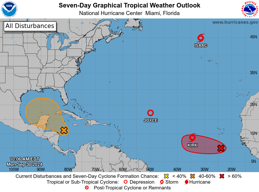
cycloneye wrote:Important change of the timing at 8 AM TWO:Western Caribbean Sea and Gulf of Mexico:
A large and disorganized area of low pressure located over the
western and southwestern Caribbean Sea is producing some shower and
thunderstorm activity. Environmental conditions could become
conducive for gradual development, and a tropical depression could
form in a few days while the system is over the southern Gulf of
Mexico or northwestern Caribbean Sea. While interests in the
northwestern Caribbean Sea and along the U.S. Gulf Coast should
continue to monitor the progress of this system, the timetable for
potential development has shifted later toward late week or this
weekend.
* Formation chance through 48 hours...low...near 0 percent.
* Formation chance through 7 days...medium...40 percent.
https://i.imgur.com/Bzb6Yq4.png
And they lopped off 10%, but that may due to longer time frame.


