
SouthFLTropics wrote:Took the long way around the GOM to end up at Panama City and Appilachicola. That size storm would stack a ton of water into the Big Bend.
This track would cause massive damage along the entire northern Gulf coast from Mississippi coast to the big bend. That's a crazy run and very scary!
Sent from my iPhone using Tapatalk
Low pressure developing over the western Caribbean Sea (Is Invest 97L)
Moderator: S2k Moderators
Forum rules

The posts in this forum are NOT official forecasts and should not be used as such. They are just the opinion of the poster and may or may not be backed by sound meteorological data. They are NOT endorsed by any professional institution or STORM2K. For official information, please refer to products from the National Hurricane Center and National Weather Service.
Re: Area of low pressure to develop over the western Caribbean Sea
1 likes
-
SouthFLTropics

- Category 5

- Posts: 4258
- Age: 50
- Joined: Thu Aug 14, 2003 8:04 am
- Location: Port St. Lucie, Florida
Re: Area of low pressure to develop over the western Caribbean Sea
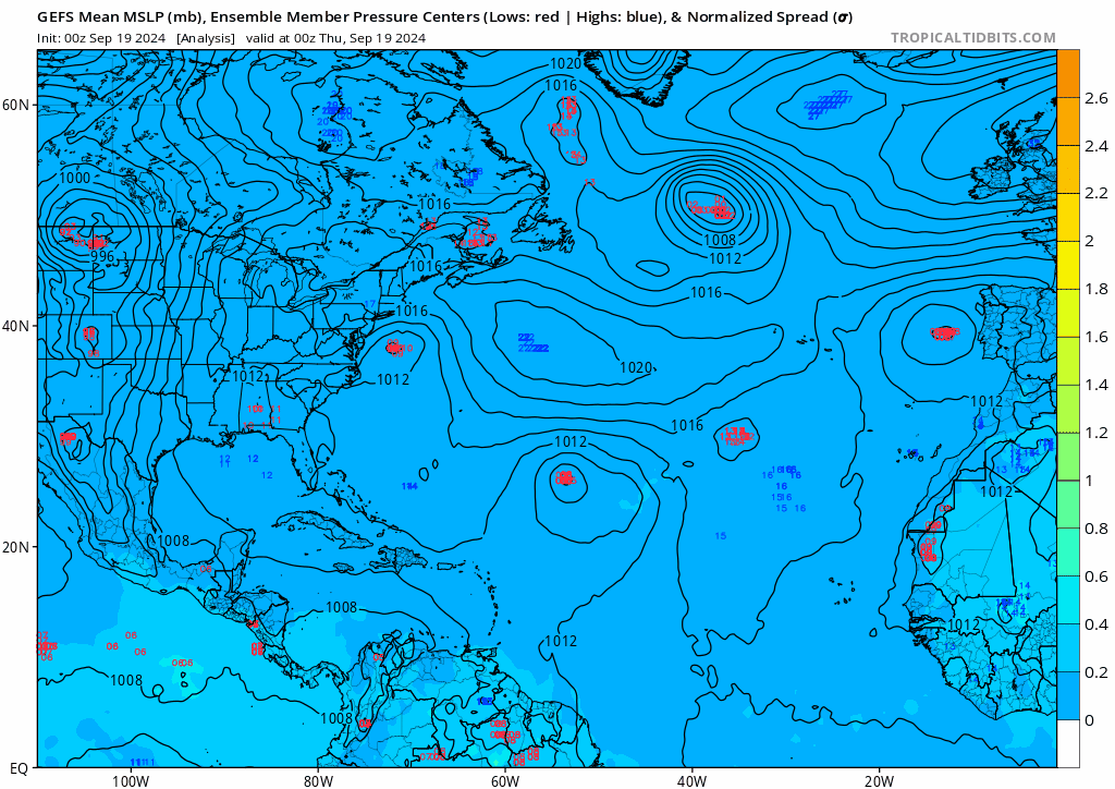
GEFS Ensembles through 192 still seem to be hugging the eastern side of the GOM.
Sent from my iPhone using Tapatalk
Sent from my iPhone using Tapatalk
1 likes
Fourth Generation Florida Native
Personal Storm History: David 79, Andrew 92, Erin 95, Floyd 99, Irene 99, Frances 04, Jeanne 04, Wilma 05, Matthew 16, Irma 17, Ian 22, Nicole 22, Milton 24
Personal Storm History: David 79, Andrew 92, Erin 95, Floyd 99, Irene 99, Frances 04, Jeanne 04, Wilma 05, Matthew 16, Irma 17, Ian 22, Nicole 22, Milton 24


Re: Area of low pressure to develop over the western Caribbean Sea
eastcoastFL wrote:I’m also noticing that on this GFS run that it develops in the western Carib and it avoids all land interaction as it splits the gap between the Yucatán and western Cuba. It’s already a significant storm before it reaches the gulf.
This run certainly wastes no time stacking the system- rapid intensification in the northern WCar followed by a (likely) 960 major by the time it even enters the GOM as it shoots the Yucatán channel and avoids any disruption. If that track were to come to fruition, a massive storm as depicted could be a believable result.
1 likes
Re: Area of low pressure to develop over the western Caribbean Sea
And if anyone wants to have a laugh at one of the more absurd model solutions in recent memory, just watch what that MDR storm does at the end of the run 
Last edited by Beef Stew on Thu Sep 19, 2024 12:24 am, edited 1 time in total.
3 likes
-
ThunderForce

- Tropical Storm

- Posts: 208
- Age: 26
- Joined: Tue Sep 27, 2022 6:20 pm
- Location: Calhoun County, Florida
Re: Area of low pressure to develop over the western Caribbean Sea
I won't lie, to be honest this current GFS run makes me feel sick. The amount of destruction this would cause is immense.
I know it's still at least a week or so out, but...
I know it's still at least a week or so out, but...
1 likes
Please refer to the NWS, NHC, SPC or a professional meteorologist for information and decision making during storms.

Re: Area of low pressure to develop over the western Caribbean Sea
Beef Stew wrote:And if anyone wants to have a laugh at one of the more absurd model solutions in recent memory, just watch what that MDR storm does at the end of the run
Yeah I just came here to say I didn’t what was more wild on that GFS 00Z run, the Category 5 Hurricane approaching the Central Gulf Coast or the southwest moving hurricane approaching the Dominican Republic/Greater Antilles from the northeast?
2 likes

Re: Area of low pressure to develop over the western Caribbean Sea
Tropical Tidbits is less ideal than Weathernerds for viewing ensembles (as it seems to show pressure a bit lower and also doesn't show winds), but this is stronger than any run that I remember. Also stronger with the MDR storm.
(This run also suggests it will be a race for getting to the H name.)
(This run also suggests it will be a race for getting to the H name.)
1 likes
TC naming lists: retirements and intensity
Most aggressive Advisory #1's in North Atlantic (cr. kevin for starting the list)
Most aggressive Advisory #1's in North Atlantic (cr. kevin for starting the list)
-
AxaltaRacing24
- Category 5
- Posts: 1774
- Age: 25
- Joined: Wed Jul 27, 2016 11:14 am
- Location: Jupiter, FL
Re: Area of low pressure to develop over the western Caribbean Sea
SouthFLTropics wrote:Man this is a crazy scary run… let’s hope and pray this doesn’t come to pass. 216 hours and sub 930mb… looks to maybe be starting a turn to the NNE. Someone is getting wrecked on this run, big time.
Sent from my iPhone using Tapatalk
If this thing splits the channel, (like this run), it will most likely become at cat 2 at the very least. It's looking like Louisiana is the furthest west this thing will get, with Texas still having an outside chance.
That being said, the GFS ensembles show a STRONG signal for Florida that is anywhere from 6-10 days out.
We do not even have a storm yet, anything listed is essentially all that is known so far. Saturday into Sunday seems to be when the models will be in a realistic time range where it can be somewhat narrowed down.
2 likes
-
ConvergenceZone
.gif)
- Category 5
- Posts: 5241
- Joined: Fri Jul 29, 2005 1:40 am
- Location: Northern California
Re: Area of low pressure to develop over the western Caribbean Sea
what's weird is seeing the models support, yet when you look at the western carib satellite it seems pretty much void of any convection whatsoever.
1 likes

Re: Area of low pressure to develop over the western Caribbean Sea
ConvergenceZone wrote:what's weird is seeing the models support, yet when you look at the western carib satellite it seems pretty much void of any convection whatsoever.
GFS does not initiate deep convection until Sunday, probably a good bar to watch.
0 likes
Kendall -> SLO -> PBC
Memorable Storms: Katrina (for its Florida landfall...) Wilma Matthew Irma
Memorable Storms: Katrina (for its Florida landfall...) Wilma Matthew Irma
Re: Area of low pressure to develop over the western Caribbean Sea
0z Euro ends with a 1000mb TS slowly drifting E out of the Bay of Campeche.
0 likes
Kendall -> SLO -> PBC
Memorable Storms: Katrina (for its Florida landfall...) Wilma Matthew Irma
Memorable Storms: Katrina (for its Florida landfall...) Wilma Matthew Irma

Re: Area of low pressure to develop over the western Caribbean Sea
Another look at the doomsday 0z GFS:

Sent from my iPhone using Tapatalk
Sent from my iPhone using Tapatalk
3 likes
Area of low pressure to develop over the western Caribbean Sea

Sent from my iPhone using Tapatalk
Last edited by N2FSU on Thu Sep 19, 2024 2:48 am, edited 1 time in total.
0 likes
Re: Area of low pressure to develop over the western Caribbean Sea
Landfall 0z GFS

Sent from my iPhone using Tapatalk
Sent from my iPhone using Tapatalk
0 likes

Re: Area of low pressure to develop over the western Caribbean Sea
Up to 0/40.
3. Northwestern Caribbean Sea and Southeastern Gulf of Mexico:
A broad area of low pressure could form late this weekend or early
next week over the western and northwestern Caribbean Sea.
Thereafter, gradual development of this system is possible, and a
tropical depression could form as the system moves slowly to the
north or northwest over the northwestern Caribbean Sea and into the
southeastern Gulf of Mexico through the middle part of next week.
* Formation chance through 48 hours...low...near 0 percent.
* Formation chance through 7 days...medium...40 percent.
2 likes
-
Stratton23
- Category 5
- Posts: 3575
- Joined: Fri Jul 21, 2023 10:59 pm
- Location: Katy, Tx
Re: Area of low pressure to develop over the western Caribbean Sea
The 00z Euro AIFS is something you would see in willy wonka, thats is by far the most wonkavator track ive ever seen, storm crosses the yucatan as a TS, moves west toward mexico, then stops, makes a loop south, and the. goes back east with another landfall over the yucatan peninsula, weirdest model track ive ever seen
2 likes
Re: Area of low pressure to develop over the western Caribbean Sea
Stratton23 wrote:The 00z Euro AIFS is something you would see in willy wonka, thats is by far the most wonkavator track ive ever seen, storm crosses the yucatan as a TS, moves west toward mexico, then stops, makes a loop south, and the. goes back east with another landfall over the yucatan peninsula, weirdest model track ive ever seen
Haha that's definitely a unique track
1 likes
-
eastcoastFL

- Category 5
- Posts: 3996
- Age: 44
- Joined: Thu Apr 12, 2007 12:29 pm
- Location: Palm City, FL
Re: Area of low pressure to develop over the western Caribbean Sea
The 06z GFS so far is a bit weaker and further SW at 156hrs.
0 likes
Personal Forecast Disclaimer:
The posts in this forum are NOT official forecast and should not be used as such. They are just the opinion of the poster and may or may not be backed by sound meteorological data. They are NOT endorsed by any professional institution or storm2k.org. For official information, please refer to the NHC and NWS products.
The posts in this forum are NOT official forecast and should not be used as such. They are just the opinion of the poster and may or may not be backed by sound meteorological data. They are NOT endorsed by any professional institution or storm2k.org. For official information, please refer to the NHC and NWS products.
-
eastcoastFL
- Category 5
- Posts: 3996
- Age: 44
- Joined: Thu Apr 12, 2007 12:29 pm
- Location: Palm City, FL
Re: Area of low pressure to develop over the western Caribbean Sea
Runs into the Yucatán at 168hrs 996mb.192h it reaches the gulf as a 990mb storm. Quite a difference a run can make. We're in for a long week ahead.
0 likes
Personal Forecast Disclaimer:
The posts in this forum are NOT official forecast and should not be used as such. They are just the opinion of the poster and may or may not be backed by sound meteorological data. They are NOT endorsed by any professional institution or storm2k.org. For official information, please refer to the NHC and NWS products.
The posts in this forum are NOT official forecast and should not be used as such. They are just the opinion of the poster and may or may not be backed by sound meteorological data. They are NOT endorsed by any professional institution or storm2k.org. For official information, please refer to the NHC and NWS products.
Re: Area of low pressure to develop over the western Caribbean Sea
6z GFS

Sent from my iPad using Tapatalk
Sent from my iPad using Tapatalk
0 likes
Who is online
Users browsing this forum: No registered users and 164 guests