Moderator: S2k Moderators


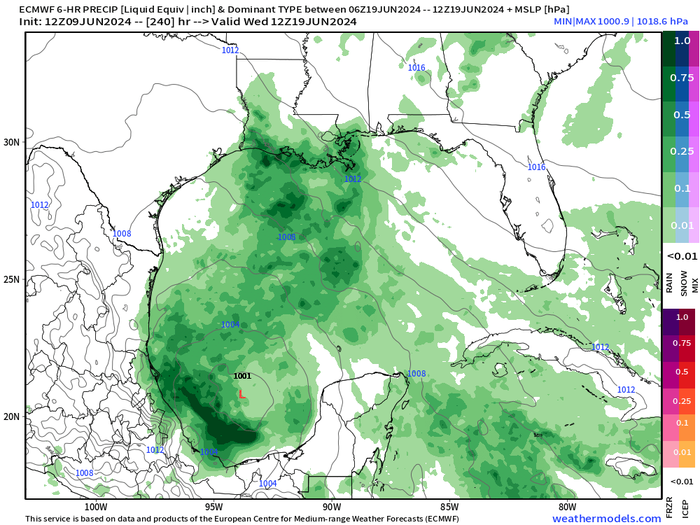
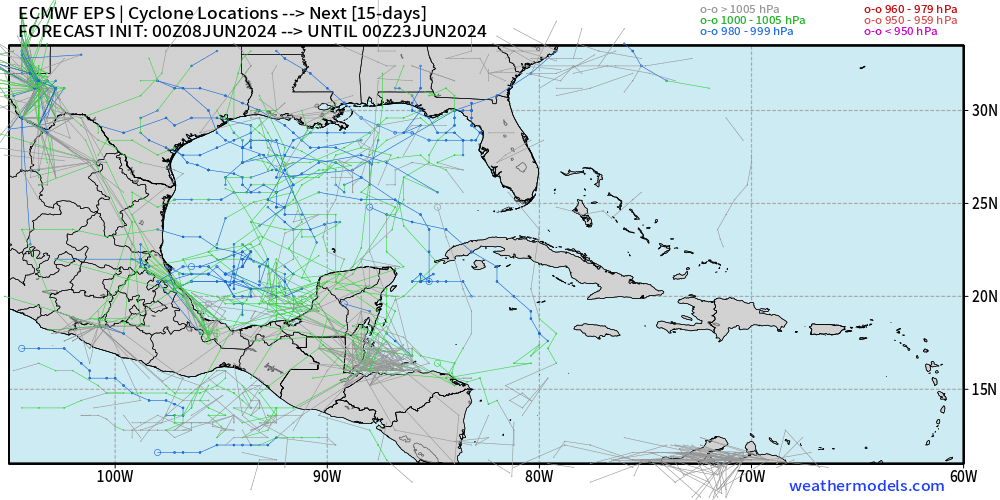
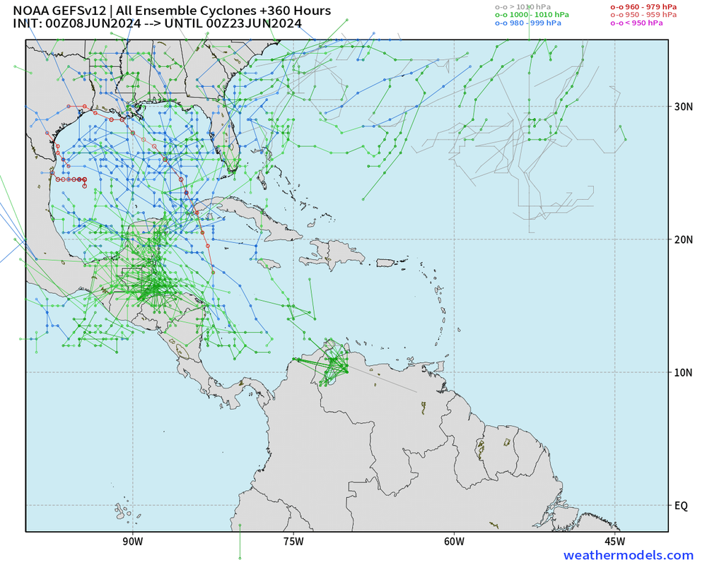
skyline385 wrote:Active 0z runs from both EPS and GEFS, most of the members are within the 240hr range, I think we are very likely getting a lemon soon if 12z keeps this level of activity.
[url]https://i.postimg.cc/8k0HnNj8/image.png [/url]
[url]https://i.postimg.cc/3JztWYTj/image.png [/url]
Stratton23 wrote:jlauderdal i wouldnt write it off, ive seen systems develop in worse environments , it obviously wont be an extremely conducive environment due to shear, but I think its enough for a low to be able to close off into a weak depression maybe a tropical storm , upper level pattern favors a ridge over the central to eastern US, so whatever tries to get going is likely going to get steered more towards louisiana or texas


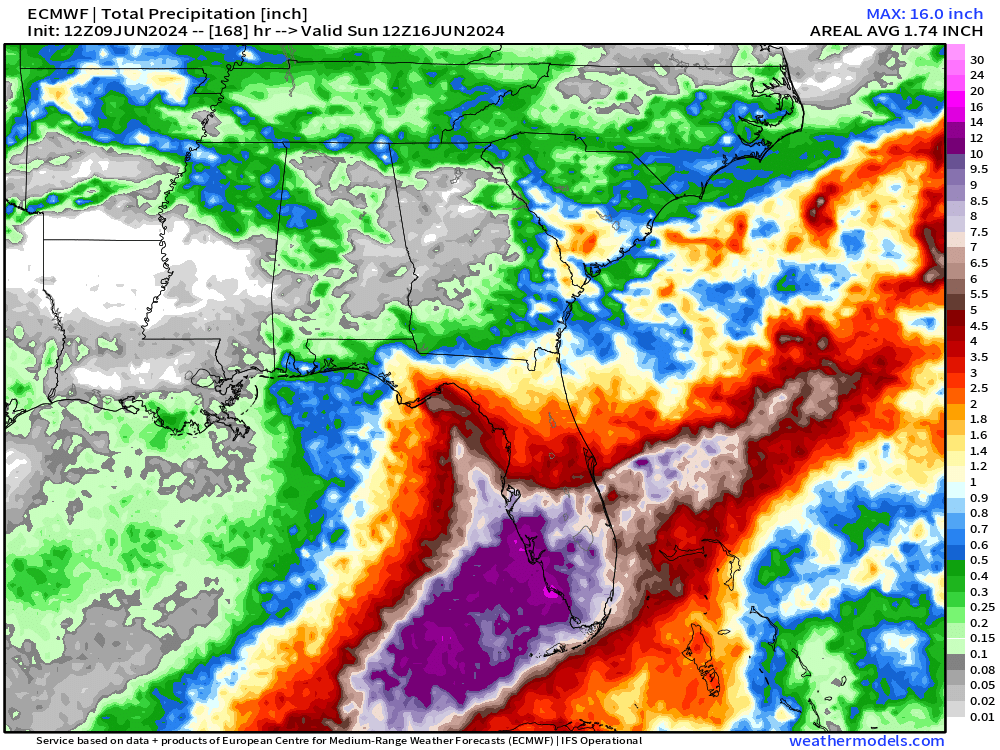
Stratton23 wrote:jlauderdal right now im thinking widespread 4-6 inches for most of florida with isolated 8+ totals in some spots seems like a fair bet, also will depend on where the system goes, steering pattern is a bit tricky

GFS is rather aggressive with totals.AtlanticWind wrote:From NWS Miami
The long range models are showing that high pressure will remain
over the Western Atlantic waters with the mid to upper level low
over the Western Gulf of Mexico. At the same time, the models are
showing a tropical disturbance to move northward from the
Caribbean Sea into the Central of eastern Gulf of Mexico. This
will allow for the continuation of the south southwest wind flow
over South Florida and allow for very deep tropical moisture to
work into South Florida from the Caribbean sea. Therefore, likely
to widespread rains along with some thunderstorms are forecast for
South Florida for the middle to end of next week. Some of the
rains and thunderstorms could also produce heavy rains over South
Florida during this time frame. More on this in the hydro section
below.
Highs for this time will also be cooler over South Florida mainly
in the 80s due to the cloud cover and rains. However, the lows
will be warm across South Florida with mid to upper 70s interior
areas to around 80 metro areas.
Looks like a stormy week due to Tropical disturbance

jlauderdal wrote:]GFS is rather aggressive with totals.


Users browsing this forum: gib and 153 guests