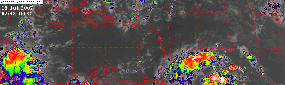
Infared Image of low
Let's see if the convection persists for 24 hours or goes poof.
Invest 99L,Central Caribbean,Analysis,Sat Pics,Models Thread
Moderator: S2k Moderators
Forum rules

The posts in this forum are NOT official forecasts and should not be used as such. They are just the opinion of the poster and may or may not be backed by sound meteorological data. They are NOT endorsed by any professional institution or STORM2K. For official information, please refer to products from the National Hurricane Center and National Weather Service.
-
cycloneye

- Admin

- Posts: 148763
- Age: 69
- Joined: Thu Oct 10, 2002 10:54 am
- Location: San Juan, Puerto Rico
0 likes
Visit the Caribbean-Central America Weather Thread where you can find at first post web cams,radars
and observations from Caribbean basin members Click Here
and observations from Caribbean basin members Click Here
-
HurricaneMaster_PR

- Category 2

- Posts: 795
- Joined: Tue Jul 22, 2003 6:23 pm
- Location: San Juan, Puerto Rico
TROPICAL WEATHER DISCUSSION
NWS TPC/NATIONAL HURRICANE CENTER MIAMI FL
805 PM EDT WED AUG 30 2006
A HIGH AMPLITUDE TROPICAL WAVE IS ALONG 46W/47W S OF 23N MOVING
W NEAR 10 KT. THIS FORWARD SPEED HAS SLOWED AND WILL CONTINUE TO
MOVE SLOWLY OVER THE NEXT FEW DAYS AS STEERING CURRENTS ARE
FAIRLY WEAK IN THE CENTRAL ATLC. A 1011 MB LOW IS ALONG THE WAVE
NEAR 17N. THE SFC LOW REMAINS EASY TO LOCATE AS IT IS A
LOW-LEVEL SWIRL DEVOID OF ANY SIGNIFICANT CONVECTION. BECAUSE OF
THE LACK OF ORGANIZATION....DEVELOPMENT IS NOT EXPECTED AT THIS
TIME.
0 likes
-
HurricaneMaster_PR
- Category 2
- Posts: 795
- Joined: Tue Jul 22, 2003 6:23 pm
- Location: San Juan, Puerto Rico
TROPICAL WEATHER OUTLOOK
NWS TPC/NATIONAL HURRICANE CENTER MIAMI FL
1030 PM EDT WED AUG 30 2006
FOR THE NORTH ATLANTIC...CARIBBEAN SEA AND THE GULF OF MEXICO...
AN AREA OF LOW PRESSURE LOCATED ABOUT 950 MILES EAST OF THE
LEEWARD ISLANDS IS MOVING SLOWLY WESTWARD. THE ASSOCIATED SHOWER
ACTIVITY IS MINIMAL AND DEVELOPMENT IS NOT ANTICIPATED AT THIS
TIME.
ELSEWHERE...TROPICAL STORM FORMATION IS NOT EXPECTED THROUGH
FRIDAY.
$$
FORECASTER BEVEN
0 likes
-
Meso

- Category 5

- Posts: 1609
- Age: 39
- Joined: Mon Aug 09, 2004 12:14 pm
- Location: South Africa
- Contact:
000
ABNT20 KNHC 310929
TWOAT
TROPICAL WEATHER OUTLOOK
NWS TPC/NATIONAL HURRICANE CENTER MIAMI FL
530 AM EDT THU AUG 31 2006
FOR THE NORTH ATLANTIC...CARIBBEAN SEA AND THE GULF OF MEXICO...
AN AREA OF LOW PRESSURE LOCATED ABOUT 850 MILES EAST OF THE
LEEWARD ISLANDS IS MOVING WESTWARD. THE ASSOCIATED SHOWER
ACTIVITY REMAINS MINIMAL AND DEVELOPMENT IS NOT EXPECTED AT
THIS TIME.
0 likes
-
cycloneye
- Admin
- Posts: 148763
- Age: 69
- Joined: Thu Oct 10, 2002 10:54 am
- Location: San Juan, Puerto Rico
ABNT20 KNHC 311507
TWOAT
TROPICAL WEATHER OUTLOOK
NWS TPC/NATIONAL HURRICANE CENTER MIAMI FL
1130 AM EDT THU AUG 31 2006
FOR THE NORTH ATLANTIC...CARIBBEAN SEA AND THE GULF OF MEXICO...
THE NATIONAL HURRICANE CENTER IS ISSUING ADVISORIES ON TROPICAL
STORM ERNESTO...LOCATED ABOUT 105 MILES SOUTH-SOUTHEAST OF
CHARLESTON SOUTH CAROLINA.
AN AREA OF LOW PRESSURE LOCATED ABOUT 750 MILES EAST OF THE
LEEWARD ISLANDS IS MOVING WESTWARD. THE ASSOCIATED SHOWER
ACTIVITY REMAINS MINIMAL AND SIGNIFICANT DEVELOPMENT IS NOT
EXPECTED.
ELSEWHERE...TROPICAL STORM FORMATION IS NOT EXPECTED THROUGH
FRIDAY.
$$
FORECASTER AVILA
0 likes
Visit the Caribbean-Central America Weather Thread where you can find at first post web cams,radars
and observations from Caribbean basin members Click Here
and observations from Caribbean basin members Click Here

This little low sure isn't getting much discussion on this board and everything except moisture looks like is in it's favor.
What's San Juan saying.
http://www.ghcc.msfc.nasa.gov/GOES/GOES ... gMez1d.jpg
What's San Juan saying.
http://www.ghcc.msfc.nasa.gov/GOES/GOES ... gMez1d.jpg
0 likes
-
cycloneye
- Admin
- Posts: 148763
- Age: 69
- Joined: Thu Oct 10, 2002 10:54 am
- Location: San Juan, Puerto Rico
AN ATLANTIC OCEAN TROPICAL WAVE IS ALONG 49W/50W MOVING WEST
10 KT. A 1013 MB LOW PRESSURE CENTER IS ALONG THE WAVE NEAR
16.5N. THIS LOW CENTER IS CLEARLY EVIDENT ON VISIBLE SATELLITE
IMAGERY. SCATTERED MODERATE SHOWERS ARE FOUND FROM 16N TO 18N
BETWEEN 48W AND 50W. ISOLATED MODERATE SHOWERS WERE OCCURRING
FROM 13N TO 15N BETWEEN 47W AND 49W JUST SOUTH OF THE LOW
CENTER.
From the 2 PM discussion.
0 likes
Visit the Caribbean-Central America Weather Thread where you can find at first post web cams,radars
and observations from Caribbean basin members Click Here
and observations from Caribbean basin members Click Here
-
dixiebreeze
- S2K Supporter

- Posts: 5140
- Joined: Wed Sep 03, 2003 5:07 pm
- Location: crystal river, fla.
Starting to get its act together I think:
http://www.ssd.noaa.gov/goes/east/catl/avn-l.jpg
Maybe Labor Day won't be so quiet after all.
http://www.ssd.noaa.gov/goes/east/catl/avn-l.jpg
Maybe Labor Day won't be so quiet after all.
0 likes
-
HurricaneMaster_PR
- Category 2
- Posts: 795
- Joined: Tue Jul 22, 2003 6:23 pm
- Location: San Juan, Puerto Rico
dixiebreeze wrote:Starting to get its act together I think:
http://www.ssd.noaa.gov/goes/east/catl/avn-l.jpg
Maybe Labor Day won't be so quiet after all.
Remember Dixie, the one we are talking here is the one reaching longitude 50W not the one near 35W...
0 likes
-
dixiebreeze
- S2K Supporter
- Posts: 5140
- Joined: Wed Sep 03, 2003 5:07 pm
- Location: crystal river, fla.
-
DESTRUCTION5

- Category 5
- Posts: 4430
- Age: 44
- Joined: Wed Sep 03, 2003 11:25 am
- Location: Stuart, FL
Sanibel wrote:I see something with a loose band of curvature bending in to the center near 11N-32W.
It looks like it could convect and form like Ernesto when it gets past the dry area in the central Atlantic.
Expecting this to form if I'm reading 2006 correctly.
i agree..Come 60-70w we may be looking at a player
0 likes
-
GeneratorPower

- S2K Supporter
- Posts: 1648
- Age: 46
- Joined: Sun Dec 18, 2005 11:48 pm
- Location: Huntsville, AL
I think we are referring to the system at approximately 13N 35W. This is the one that seems to be getting its act together. There is another one to the northeast of it that looks about the same as it did yesterday.
I've been watching the 13/35 wave for several hours and there is stron convection right near the LLC, which is evident on visible satellite imagery. The infrared imagery is showing some deeper convection to the northwest of the center. It looks much better now in terms of convection than it did for the last couple of days. This convection is more consolidated and very near the LLC, if not right on top of it.
It still appears to be limited in extent, but there is a large envelope of moisture around the system, especially to the south.
Watch the IR loop and be sure to let it auto-update. The next couple hours are important because the current burst of convection will either hold fast or dissipate. In my mind, if it holds fast that will be a good sign we're looking at Florence within the next couple of days. If it dissipates, it's probably going to delay things 24 hours.
0 likes
-
HurricaneMaster_PR
- Category 2
- Posts: 795
- Joined: Tue Jul 22, 2003 6:23 pm
- Location: San Juan, Puerto Rico
People the one near 13N 35W is being discussed here:
http://www.storm2k.org/phpbb2/viewtopic ... &start=200
http://www.storm2k.org/phpbb2/viewtopic ... &start=200
0 likes


-
Wx_Warrior
- Category 5
- Posts: 2718
- Joined: Thu Aug 03, 2006 3:58 pm
- Location: Beaumont, TX


-
dixiebreeze
- S2K Supporter
- Posts: 5140
- Joined: Wed Sep 03, 2003 5:07 pm
- Location: crystal river, fla.
-
Hyperstorm

- Category 5
- Posts: 1500
- Joined: Sun Sep 07, 2003 3:48 am
- Location: Ocala, FL
Just changed the title to avoid major confusion...
The tropical low has moved slowly WSW over the past couple of days with no significant changes in organization. The SAL influence is still there, although each passing day it is less so.
Currently, upper-level winds are behaving very similar to what was predicted by the GFS a couple of days ago with the trough to the west and northwest splitting into a huge upper-low, which is now covering the entire western Atlantic and Caribbean. There is also an upper-level low NE of this system which is digging southward. If the system doesn't move fast enough, it might get sheared heavily soon.
The system is still under marginally favorable conditions aloft and SSTs are warming the further west it goes. I think this is going to be one of these systems that starts firing up greatly as it approaches the islands. With the more southern latitude (compared to 48 hours ago), this one might just enter the Caribbean Sea.
Watch for any increase in thunderstorm activity...
0 likes
-
cycloneye
- Admin
- Posts: 148763
- Age: 69
- Joined: Thu Oct 10, 2002 10:54 am
- Location: San Juan, Puerto Rico
Good about the title change as the confusion about the systems was big.Because of where I am,I am watching it very closely.
0 likes
Visit the Caribbean-Central America Weather Thread where you can find at first post web cams,radars
and observations from Caribbean basin members Click Here
and observations from Caribbean basin members Click Here
Who is online
Users browsing this forum: No registered users and 59 guests