

Here's a radar loop. You can see the system offshore.
http://weather.noaa.gov/radar/loop/DS.p ... kltx.shtml
Special Tropical Disturbance Statement!
Moderator: S2k Moderators
Forum rules

The posts in this forum are NOT official forecasts and should not be used as such. They are just the opinion of the poster and may or may not be backed by sound meteorological data. They are NOT endorsed by any professional institution or STORM2K. For official information, please refer to products from the National Hurricane Center and National Weather Service.


-
AJC3

- Admin

- Posts: 4152
- Age: 62
- Joined: Tue Aug 31, 2004 7:04 pm
- Location: Ballston Spa, New York
- Contact:
This would be the time to start looking at surface observations (METARS, ship reports, buoys, C-mans)
(One of the mods can thumbnail these if desired)
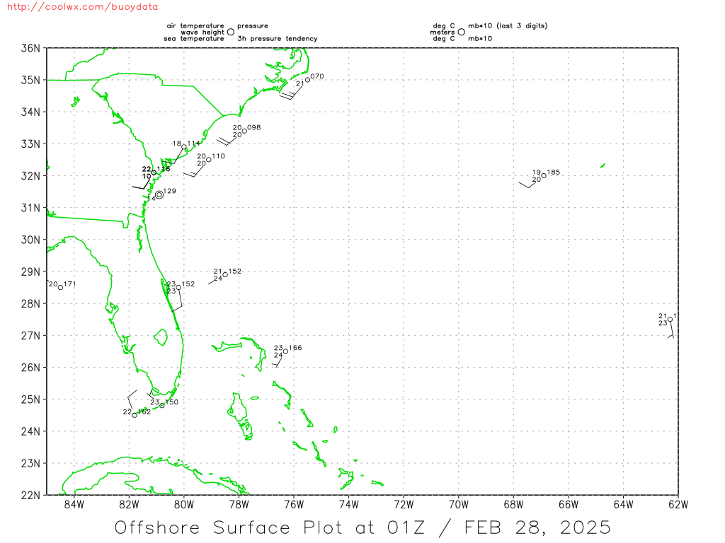
http://coolwx.com/buoydata/data/curr/atl-seus.png
http://www.rap.ucar.edu/weather/surface ... rs_clt.gif
Here are some points I would consider: If a LLC were to form it would be brief and TINY based on the current observations. Given the quick forward speed (enviromental H85 to H50 flow is about 25-30KT), 15-20KT S-SE surface flow ahead of this system, this feature only has about 6 more hours to generate enough surface pressure falls to reverse the flow ahead of it to a northerly component before it moves inland over NC.
Consider that the environmental flow is also gettting squeezed between the stout deep layer western ATLC ridge and an approaching short wave trough.
It's a race against time, and I think the system will make it to the NC coast before having the chance to close off.
(One of the mods can thumbnail these if desired)
http://coolwx.com/buoydata/data/curr/atl-seus.png
http://www.rap.ucar.edu/weather/surface ... rs_clt.gif
Here are some points I would consider: If a LLC were to form it would be brief and TINY based on the current observations. Given the quick forward speed (enviromental H85 to H50 flow is about 25-30KT), 15-20KT S-SE surface flow ahead of this system, this feature only has about 6 more hours to generate enough surface pressure falls to reverse the flow ahead of it to a northerly component before it moves inland over NC.
Consider that the environmental flow is also gettting squeezed between the stout deep layer western ATLC ridge and an approaching short wave trough.
It's a race against time, and I think the system will make it to the NC coast before having the chance to close off.
0 likes
-
terstorm1012

- S2K Supporter

- Posts: 1314
- Age: 44
- Joined: Fri Sep 10, 2004 5:36 pm
- Location: Millersburg, PA
-
mvtrucking

- S2K Supporter
- Posts: 698
- Age: 67
- Joined: Sat Jul 09, 2005 10:01 am
- Location: Monroe,La
000
WONT41 KNHC 271829
DSAAT
SPECIAL TROPICAL DISTURBANCE STATEMENT
NWS TPC/NATIONAL HURRICANE CENTER MIAMI FL
228 PM EDT TUE JUN 27 2006
RECENT INFORMATION FROM AN AIR FORCE RESERVE RECONNAISSANCE AIRCRAFT
INDICATES THE AREA OF DISTURBED WEATHER IS CENTERED ABOUT 35 MILES
SOUTHWEST OF CAPE LOOKOUT NORTH CAROLINA. WHILE THERE IS A SMALL
AREA OF GALE FORCE WINDS ON ITS EAST SIDE... THE SYSTEM DOES NOT
HAVE A CLOSED SURFACE CIRCULATION... AND IS THEREFORE NOT A
TROPICAL CYCLONE AT THIS TIME. THE AIRCRAFT WILL CONTINUE TO
INVESTIGATE THE SYSTEM THIS AFTERNOON.
THERE IS STILL THE POTENTIAL FOR THIS SYSTEM TO DEVELOP INTO A
TROPICAL STORM AS IT MOVES NORTH TO NORTH-NORTHEASTWARD AT 20 TO 25
MPH. RESIDENTS IN COASTAL REGIONS OF NORTH CAROLINA... VIRGINIA...
AND THE DELMARVA PENINSULA SHOULD CLOSELY MONITOR THE PROGRESS OF
THIS SYSTEM TODAY AS TROPICAL STORM WARNINGS COULD BE REQUIRED WITH
LITTLE NOTICE. EVEN IF THIS SYSTEM DOES NOT FORM INTO A TROPICAL
CYCLONE... IT WILL PRODUCE SHOWERS AND THUNDERSTORMS WITH LOCALLY
HEAVY RAINFALL AND STRONG GUSTY WINDS ACROSS THE MID-ATLANTIC AREA
TODAY AND TONIGHT.
FORECASTER STEWART
$$
0 likes
Who is online
Users browsing this forum: No registered users and 123 guests