Surface Trough Offshore the SE U.S Coast (Is Invest 90L)

This is the general tropical discussion area. Anyone can take their shot at predicting a storms path.

Moderator: S2k Moderators

Forum rules

The posts in this forum are NOT official forecasts and should not be used as such. They are just the opinion of the poster and may or may not be backed by sound meteorological data. They are NOT endorsed by any professional institution or STORM2K. For official information, please refer to products from the National Hurricane Center and National Weather Service.

Help Support Storm2K
Message
Author
User avatar
ouragans
Category 1
Category 1
Posts: 490
Age: 53
Joined: Sun Jun 12, 2011 12:09 pm
Location: Abymes, Guadeloupe F.W.I
Contact:

Re: Potential Development Off the SE U.S Coast

#21 Postby ouragans » Thu Jul 22, 2021 7:00 am

1. A broad trough of low pressure located over southern Georgia is expected to move off of the southeastern United States coastline by Friday. Environmental conditions are expected to be marginally
conducive for some gradual development over the weekend and into early next week while the system drifts slowly offshore of coastal North and South Carolina.
* Formation chance through 48 hours...low...10 percent.
* Formation chance through 5 days...low...30 percent.
1 likes   
Personal forecast disclaimer
This post is a personal point of view, not an information. Please refer to official statements for life-threatening decisions.

David '79, Frederic '79, Hugo '89, Iris, Luis & Marilyn '95, Georges '98, Lenny '99, Dean '07, Irma '17, Maria '17, Fiona '22, Philippe '23, Tammy '23
16°13'33.3,"6N -61°36'39.5"W

User avatar
GCANE
S2K Supporter
S2K Supporter
Posts: 11496
Joined: Mon Oct 22, 2007 8:03 am

Re: Potential Development Off the SE U.S Coast

#22 Postby GCANE » Thu Jul 22, 2021 9:13 am

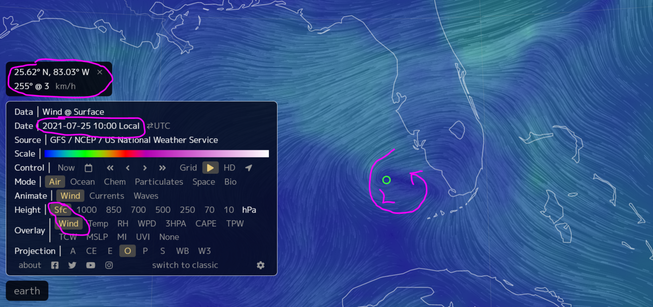
Looks like the tail end of the trof may drop enough south and could end up spinning up a surface low in the east GOM, north of the Keys, in a few days.
Keeping an eye on it.

Image
3 likes   

User avatar
GCANE
S2K Supporter
S2K Supporter
Posts: 11496
Joined: Mon Oct 22, 2007 8:03 am

Re: Potential Development Off the SE U.S Coast

#23 Postby GCANE » Thu Jul 22, 2021 12:17 pm

ICON showing development in the GOM heading to Houston
0 likes   

User avatar
GCANE
S2K Supporter
S2K Supporter
Posts: 11496
Joined: Mon Oct 22, 2007 8:03 am

Re: Potential Development Off the SE U.S Coast

#24 Postby GCANE » Thu Jul 22, 2021 12:21 pm

Image

Image
0 likes   

User avatar
aspen
Category 5
Category 5
Posts: 8818
Joined: Sat Oct 12, 2019 7:10 pm
Location: Connecticut, USA

Re: Potential Development Off the SE U.S Coast

#25 Postby aspen » Thu Jul 22, 2021 12:33 pm

GCANE wrote:ICON showing development in the GOM heading to Houston

Looks like this area snaps, with one half getting dragged out to sea by a front and the other half making it into the Gulf. We’ll need to watch closely to see if that happens, because then there would be the chance for two systems to develop, one of which will be a land impact.
2 likes   
Irene '11 Sandy '12 Hermine '16 5/15/2018 Derecho Fay '20 Isaias '20 Elsa '21 Henri '21 Ida '21

I am only a meteorology enthusiast who knows a decent amount about tropical cyclones. Look to the professional mets, the NHC, or your local weather office for the best information.

AlphaToOmega
Category 5
Category 5
Posts: 1448
Joined: Sat Jun 26, 2021 10:51 am
Location: Somewhere in Massachusetts

Re: Potential Development Off the SE U.S Coast

#26 Postby AlphaToOmega » Thu Jul 22, 2021 1:06 pm

ZCZC MIATWOAT ALL
TTAA00 KNHC DDHHMM

Tropical Weather Outlook
NWS National Hurricane Center Miami FL
200 PM EDT Thu Jul 22 2021

For the North Atlantic...Caribbean Sea and the Gulf of Mexico:

1. A broad trough of low pressure located over southeast Georgia is
expected to move off of the southeastern United States coastline
later this evening. Environmental conditions are forecast to
be marginally conducive for some gradual development over the
weekend and into early next week while the system drifts slowly
offshore of the southeastern United States.
* Formation chance through 48 hours...low...10 percent.
* Formation chance through 5 days...low...30 percent.

Forecaster Papin/Beven
0 likes   

User avatar
captainbarbossa19
Professional-Met
Professional-Met
Posts: 1092
Age: 27
Joined: Wed Aug 21, 2019 11:09 pm
Location: Beaumont, TX

Re: Potential Development Off the SE U.S Coast

#27 Postby captainbarbossa19 » Thu Jul 22, 2021 2:17 pm

aspen wrote:
GCANE wrote:ICON showing development in the GOM heading to Houston

Looks like this area snaps, with one half getting dragged out to sea by a front and the other half making it into the Gulf. We’ll need to watch closely to see if that happens, because then there would be the chance for two systems to develop, one of which will be a land impact.


This setup is a lot like Edouard in 2008. Need to watch and see if something develops.
1 likes   

User avatar
Nimbus
Category 5
Category 5
Posts: 5300
Joined: Mon Jul 19, 2004 10:54 am

Re: Potential Development Off the SE U.S Coast

#28 Postby Nimbus » Thu Jul 22, 2021 4:11 pm

A. POSSIBLE LOW-LEVEL INVEST MISSION EAST OF FLORIDA
NEAR 29.5N 78.5W FOR 24/1800Z.


So the front may be digging a little further south before the shear lets up.
30% probably covers development chances for a broader location other than just at the red X.
2 likes   

AlphaToOmega
Category 5
Category 5
Posts: 1448
Joined: Sat Jun 26, 2021 10:51 am
Location: Somewhere in Massachusetts

Re: Potential Development Off the SE U.S Coast

#29 Postby AlphaToOmega » Thu Jul 22, 2021 5:53 pm

The global models (GFS, ECMWF, CMC, and ICON) show a storm coming off the East Coast and heading out to sea. They also show a tropical storm forming in the Gulf of Mexico. Therefore, it is safe to say that the low will split into two systems within the next few days. They will likely develop into Tropical Storms Fred and Grace.
0 likes   

User avatar
Jr0d
S2K Supporter
S2K Supporter
Posts: 1409
Joined: Tue Aug 27, 2019 10:52 am
Location: Cayo Hueso

Re: Potential Development Off the SE U.S Coast

#30 Postby Jr0d » Thu Jul 22, 2021 6:09 pm

I don't think it is safe to say the front will split into two systems.

The Atlantic side is showing an elongated low, so that may not be a tropical system or even sub-tropical.

The energy that makes it to the gulf is far from certain either. So far the NHC is it mentioning the area of the SE coast for development, and nothing for the gulf...and only 30%....though I have a feeling Stewart will up the odds Tonite.
0 likes   

AlphaToOmega
Category 5
Category 5
Posts: 1448
Joined: Sat Jun 26, 2021 10:51 am
Location: Somewhere in Massachusetts

Re: Potential Development Off the SE U.S Coast

#31 Postby AlphaToOmega » Thu Jul 22, 2021 6:27 pm

ZCZC MIATWOAT ALL
TTAA00 KNHC DDHHMM

Tropical Weather Outlook
NWS National Hurricane Center Miami FL
800 PM EDT Thu Jul 22 2021

For the North Atlantic...Caribbean Sea and the Gulf of Mexico:

1. A trough of low pressure located near the coasts of southeast
Georgia and southern South Carolina is expected to move offshore
tonight. Environmental conditions are forecast to be marginally
conducive for some gradual development over the weekend and into
early next week while the system drifts slowly offshore of the
southeastern United States.
* Formation chance through 48 hours...low...20 percent.
* Formation chance through 5 days...low...30 percent.

Forecaster Blake
0 likes   

User avatar
Category5Kaiju
Category 5
Category 5
Posts: 4095
Joined: Thu Dec 24, 2020 12:45 pm
Location: Seattle

Re: Potential Development Off the SE U.S Coast

#32 Postby Category5Kaiju » Thu Jul 22, 2021 7:24 pm

If something happens and we actually manage to get a Fred and a Grace by this month's end, I am going to eat my old sweater.
5 likes   
Unless explicitly stated, all info in my posts is based on my own opinions and observations. Tropical storms and hurricanes can be extremely dangerous. Do not think you can beat Mother Nature. Refer to an accredited weather research agency or meteorologist if you need to make serious decisions regarding an approaching storm.

User avatar
AnnularCane
S2K Supporter
S2K Supporter
Posts: 2862
Joined: Thu Jun 08, 2006 9:18 am
Location: Wytheville, VA

Re: Potential Development Off the SE U.S Coast

#33 Postby AnnularCane » Thu Jul 22, 2021 7:35 pm

Category5Kaiju wrote:If something happens and we actually manage to get a Fred and a Grace by this month's end, I am going to eat my old sweater.


Well, if you season it just right, it might not be so bad. Although I imagine it would be pretty chewy. :lol:
1 likes   
"But it never rained rain. It never snowed snow. And it never blew just wind. It rained things like soup and juice. It snowed mashed potatoes and green peas. And sometimes the wind blew in storms of hamburgers." -- Judi Barrett, Cloudy with a Chance of Meatballs

OuterBanker
S2K Supporter
S2K Supporter
Posts: 1731
Joined: Wed Feb 26, 2003 10:53 am
Location: Nags Head, NC
Contact:

Re: Potential Development Off the SE U.S Coast

#34 Postby OuterBanker » Thu Jul 22, 2021 7:48 pm

No model is making much of this. Until we have a low that closes off no model will do well. Euro and Canadian are showing a small spin up that becomes an elongated low along the se coast. Gfs splits energy after a small spin up with one split into gulf. Again no model shows any real tropical development. I would think that the recon would be canceled if no low develops. But, a word of caution. A few years ago a low developed off the coast and went from tropical depression to cat two in 36 hrs.
0 likes   

User avatar
Category5Kaiju
Category 5
Category 5
Posts: 4095
Joined: Thu Dec 24, 2020 12:45 pm
Location: Seattle

Re: Potential Development Off the SE U.S Coast

#35 Postby Category5Kaiju » Thu Jul 22, 2021 7:59 pm

In recent years at least, I do think that the Gulf Stream has really boosted the ability of many of these systems to form, albeit short lived or weak. We’ll see what happens though, but given the recent year occurrences, nothing would really surprise me.
0 likes   
Unless explicitly stated, all info in my posts is based on my own opinions and observations. Tropical storms and hurricanes can be extremely dangerous. Do not think you can beat Mother Nature. Refer to an accredited weather research agency or meteorologist if you need to make serious decisions regarding an approaching storm.

User avatar
AtlanticWind
S2K Supporter
S2K Supporter
Posts: 1888
Age: 66
Joined: Sun Aug 08, 2004 9:57 pm
Location: Plantation,Fla

Re: Potential Development Off the SE U.S Coast

#36 Postby AtlanticWind » Thu Jul 22, 2021 10:44 pm

Systems have seemed to over perform the models so far this year, we will see if this continues with this one.
0 likes   

User avatar
fci
S2K Supporter
S2K Supporter
Posts: 3324
Joined: Tue Sep 14, 2004 10:29 am
Location: Lake Worth, FL

Re: Potential Development Off the SE U.S Coast

#37 Postby fci » Thu Jul 22, 2021 11:13 pm

AlphaToOmega wrote:The global models (GFS, ECMWF, CMC, and ICON) show a storm coming off the East Coast and heading out to sea. They also show a tropical storm forming in the Gulf of Mexico. Therefore, it is safe to say that the low will split into two systems within the next few days. They will likely develop into Tropical Storms Fred and Grace.


Such a shame that the G storm isn’t named Ginger. :lol:
1 likes   
Personal Forecast Disclaimer:
My posts are just my opinion and are most likely not backed by sound meteorological data. They are NOT endorsed by any professional institution or storm2k.org. For official information, please refer to the NHC and NWS products.
Bottom line is that I am just expressing my opinion!!!

User avatar
Category5Kaiju
Category 5
Category 5
Posts: 4095
Joined: Thu Dec 24, 2020 12:45 pm
Location: Seattle

Re: Potential Development Off the SE U.S Coast

#38 Postby Category5Kaiju » Thu Jul 22, 2021 11:40 pm

fci wrote:
AlphaToOmega wrote:The global models (GFS, ECMWF, CMC, and ICON) show a storm coming off the East Coast and heading out to sea. They also show a tropical storm forming in the Gulf of Mexico. Therefore, it is safe to say that the low will split into two systems within the next few days. They will likely develop into Tropical Storms Fred and Grace.


Such a shame that the G storm isn’t named Ginger. :lol:


Ginger? You mean the 1971 hurricane, the plant root, or Ginger Zee the meteorologist? :D
0 likes   
Unless explicitly stated, all info in my posts is based on my own opinions and observations. Tropical storms and hurricanes can be extremely dangerous. Do not think you can beat Mother Nature. Refer to an accredited weather research agency or meteorologist if you need to make serious decisions regarding an approaching storm.

User avatar
itglobalsecure
S2K Supporter
S2K Supporter
Posts: 20
Joined: Mon May 31, 2010 7:55 pm
Location: Madison, WI

Re: Potential Development Off the SE U.S Coast

#39 Postby itglobalsecure » Thu Jul 22, 2021 11:45 pm

fci wrote:
Such a shame that the G storm isn’t named Ginger. :lol:


So true. What an opportunity missed!
0 likes   

User avatar
AtlanticWind
S2K Supporter
S2K Supporter
Posts: 1888
Age: 66
Joined: Sun Aug 08, 2004 9:57 pm
Location: Plantation,Fla

Re: Surface Trough Offshore the SE U.S Coast

#40 Postby AtlanticWind » Fri Jul 23, 2021 12:14 am

Tropical Weather Outlook
NWS National Hurricane Center Miami FL
200 AM EDT Fri Jul 23 2021

For the North Atlantic...Caribbean Sea and the Gulf of Mexico:

A trough of low pressure located just offshore of the coasts of
southeastern Georgia and southern South Carolina is producing
limited shower and thunderstorm activity. Environmental conditions
are forecast to be marginally conducive for some gradual
development over the weekend and into early next week while the
system drifts offshore of the southeastern United States.
* Formation chance through 48 hours...low...20 percent.
* Formation chance through 5 days...low...30 percent.
0 likes   


Return to “Talkin' Tropics”

Who is online

Users browsing this forum: Google Adsense [Bot], Hurrilurker, LarryWx, MGC, WaveBreaking and 34 guests