Area of disturbed weather in the Caribbean
Moderator: S2k Moderators
Forum rules

The posts in this forum are NOT official forecasts and should not be used as such. They are just the opinion of the poster and may or may not be backed by sound meteorological data. They are NOT endorsed by any professional institution or STORM2K. For official information, please refer to products from the National Hurricane Center and National Weather Service.
-
dixiebreeze

- S2K Supporter

- Posts: 5140
- Joined: Wed Sep 03, 2003 5:07 pm
- Location: crystal river, fla.
Re: Caribbean development next week?
Another view: http://wwwghcc.msfc.nasa.gov/GOES/goeseasthurrir.html
0 likes
-
Cainer

- Tropical Storm

- Posts: 188
- Age: 34
- Joined: Mon May 05, 2008 3:26 pm
- Location: Yarmouth, Nova Scotia
This is a pretty impressive blob for early June. Cloud tops were up around -80 at one point. Still though, a blob doesn't make a TD; though I wouldn't be surprised to see something try to work down to the surface in the convection. Shear is still high, but lightening up a little bit. You never know, stranger things have happened!
0 likes
-
brunota2003

- S2K Supporter
- Posts: 9476
- Age: 35
- Joined: Sat Jul 30, 2005 9:56 pm
- Location: Stanton, KY...formerly Havelock, NC
- Contact:
http://www.ndbc.noaa.gov/station_page.php?station=42057
There is the nearest buoy, which is NE of Honduras (just north of the convection) and pressures are rising, not a good sign if you want something to develop.
There is the nearest buoy, which is NE of Honduras (just north of the convection) and pressures are rising, not a good sign if you want something to develop.
0 likes
-
floridasun78
- Category 5

- Posts: 3755
- Joined: Sun May 17, 2009 10:16 pm
- Location: miami fl
-
floridasun78
- Category 5
- Posts: 3755
- Joined: Sun May 17, 2009 10:16 pm
- Location: miami fl
ZCZC MIATWOAT ALL
TTAA00 KNHC DDHHMM
TROPICAL WEATHER OUTLOOK
NWS TPC/NATIONAL HURRICANE CENTER MIAMI FL
200 AM EDT MON JUN 8 2009
FOR THE NORTH ATLANTIC...CARIBBEAN SEA AND THE GULF OF MEXICO...
1. CLOUDINESS...SHOWERS...AND THUNDERSTORMS OVER THE SOUTHWESTERN
CARIBBEAN SEA ARE ASSOCIATED WITH A BROAD AREA OF LOW PRESSURE.
UPPER-LEVEL WINDS ARE FORECAST TO REMAIN UNFAVORABLE FOR
DEVELOPMENT OF THIS SYSTEM. HOWEVER...LOCALLY HEAVY RAINS ARE
POSSIBLE OVER PORTIONS OF CENTRAL AMERICA DURING THE NEXT COUPLE OF
DAYS. THERE IS A LOW CHANCE... LESS THAN 30 PERCENT...OF THIS
SYSTEM BECOMING A TROPICAL CYCLONE DURING THE NEXT 48 HOURS.
2. TROPICAL CYCLONE FORMATION IS NOT EXPECTED DURING THE NEXT 48 HOURS.
$$
FORECASTER PASCH/COBB
NNNN
http://www.nhc.noaa.gov/gtwo_atl.shtml
0 likes


-
wxman57

- Moderator-Pro Met

- Posts: 23127
- Age: 68
- Joined: Sat Jun 21, 2003 8:06 pm
- Location: Houston, TX (southwest)
Re: Area of disturbed weather in the western Caribbean
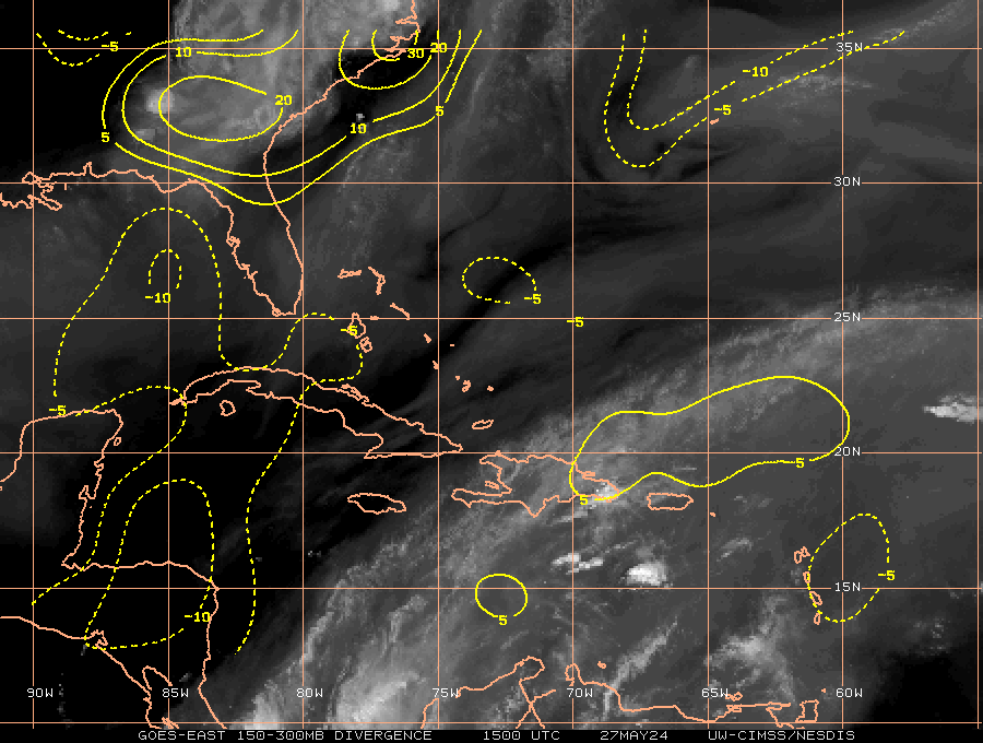
Just a tropical wave interacting with a sharp upper-level trof axis in a high shear environment for now. As the wave axis continues moving westward today, the convection should diminish. Just in the past hour I think I can detect the convection starting to wane. No invest today.
0 likes

Re:
KWT wrote:Still got huge convective burst, though I do wonder whether it is the shear itself which is helping to blow up this convective blob, it does happen sometimes.
Shear driven mostly look at the Upper Divergence, but there is some low level convergence now.
0 likes
-
cycloneye
- Admin

- Posts: 148741
- Age: 69
- Joined: Thu Oct 10, 2002 10:54 am
- Location: San Juan, Puerto Rico
Re: Area of disturbed weather in the western Caribbean
395
ABNT20 KNHC 081153
TWOAT
TROPICAL WEATHER OUTLOOK
NWS TPC/NATIONAL HURRICANE CENTER MIAMI FL
800 AM EDT MON JUN 8 2009
FOR THE NORTH ATLANTIC...CARIBBEAN SEA AND THE GULF OF MEXICO...
CLOUDINESS...SHOWERS...AND THUNDERSTORMS OVER THE SOUTHWESTERN
CARIBBEAN SEA ARE ASSOCIATED WITH A SURFACE TROUGH. UPPER-LEVEL
WINDS ARE FORECAST TO REMAIN UNFAVORABLE FOR DEVELOPMENT OF THIS
SYSTEM. HOWEVER...LOCALLY HEAVY RAINS ARE POSSIBLE OVER PORTIONS
OF CENTRAL AMERICA AND JAMAICA DURING THE NEXT COUPLE OF DAYS.
THERE IS A LOW CHANCE... LESS THAN 30 PERCENT...OF THIS
SYSTEM BECOMING A TROPICAL CYCLONE DURING THE NEXT 48 HOURS.
TROPICAL CYCLONE FORMATION IS NOT EXPECTED DURING THE NEXT 48 HOURS.
$$
FORECASTER BRENNAN/BLAKE
0 likes


Re: Area of disturbed weather in the western Caribbean
This would be a nice place for a TUTT to set up camp, Well for us here in the CONUS.

0 likes
Re: Area of disturbed weather in the western Caribbean
Sheared east and weakening. Weak to begin with. We'll see if it bursts again tonight from diurnal enhancement.
0 likes


Re: Area of disturbed weather in the western Caribbean
Pretty interesting Qiuck scat This morning.

0 likes
Re: Area of disturbed weather in the western Caribbean
tailgater wrote:Pretty interesting Qiuck scat This morning.
Surface through is pretty apparent there isn't it?
Last edited by RL3AO on Mon Jun 08, 2009 11:52 am, edited 1 time in total.
0 likes
-
Ed Mahmoud
Re: Area of disturbed weather in the western Caribbean
RL3AO wrote:tailgater wrote:Pretty interesting Qiuck scat This morning.
Surface though is pretty apparent there isn't it?
If there is a low, it is inland in Nicaragua.
0 likes


Who is online
Users browsing this forum: No registered users and 176 guests