2015 Global model runs discussion
Moderator: S2k Moderators
Forum rules

The posts in this forum are NOT official forecasts and should not be used as such. They are just the opinion of the poster and may or may not be backed by sound meteorological data. They are NOT endorsed by any professional institution or STORM2K. For official information, please refer to products from the National Hurricane Center and National Weather Service.
-
floridasun78
- Category 5

- Posts: 3755
- Joined: Sun May 17, 2009 10:16 pm
- Location: miami fl
The 0Z GFS at hour 180 (10/20) in the Bay of Campeche has a 1007 mb closed sfc low. That's quite different from prior GFS runs. It is quite a bit earlier than earlier runs put a low there. Hmmmm. Let's see where it goes.
0 likes
Personal Forecast Disclaimer:
The posts in this forum are NOT official forecasts and should not be used as such. They are just the opinion of the poster and may or may not be backed by sound meteorological data. They are NOT endorsed by any professional institution or storm2k.org. For official information, please refer to the NHC and NWS products.
The posts in this forum are NOT official forecasts and should not be used as such. They are just the opinion of the poster and may or may not be backed by sound meteorological data. They are NOT endorsed by any professional institution or storm2k.org. For official information, please refer to the NHC and NWS products.
0Z GFS: W GOM strengthens to 1002 mb at 216 hours/10-22 at 0z moving NNE toward N Gulf coast. Much different and more threatening solution.
Low then moves NE and then ENE toward NE Gulf coast.
Edit: It appears that the 0Z CMC will be much further NE in the GOM and stronger after WC low forms vs the low burying itself into SW GOM on 12Z CMC. Still more maps to be released.
Update on 0Z CMC: hour 186 has 998 mb low just an of n tip of Yucatan drifting very slowly northward 18Z on 10/20. At hour 222, hurricane at 988 mb in middle of Gulf drifting NNE or NE. Hour 240: 992 mb H moving ENE toward S or C FL for potential hit late 10/23.
Ahead of this, very heavy rains fall through much of the SE US aided by secondary low forming off the SE coast.
New ballgame, folks. Wait til Gator, HM, and others see what has happened with the 0Z GFS/CMC!
0 likes
Personal Forecast Disclaimer:
The posts in this forum are NOT official forecasts and should not be used as such. They are just the opinion of the poster and may or may not be backed by sound meteorological data. They are NOT endorsed by any professional institution or storm2k.org. For official information, please refer to the NHC and NWS products.
The posts in this forum are NOT official forecasts and should not be used as such. They are just the opinion of the poster and may or may not be backed by sound meteorological data. They are NOT endorsed by any professional institution or storm2k.org. For official information, please refer to the NHC and NWS products.
Re: 2015 Global model runs discussion
The 0Z NAVGEM sticks with a threatening situation with a 969 mb H at hour 180 (10/20 12Z) in the SE gulf moving very slowly NW but getting ready to recurve as a high gets ready to move offshore the NE US.
The 0Z GEFS members are now all over the place and is more threatening to the US Gulf coast in general vs. the 18Z run with varying landfall days/locations.
The 0Z Euro still has pretty much nothing (similar to the 12Z Euro) and is very different from the 0Z GFS. Stay tuned for the later models of Tue! We have a new ballgame for at least the time being.
0 likes
Personal Forecast Disclaimer:
The posts in this forum are NOT official forecasts and should not be used as such. They are just the opinion of the poster and may or may not be backed by sound meteorological data. They are NOT endorsed by any professional institution or storm2k.org. For official information, please refer to the NHC and NWS products.
The posts in this forum are NOT official forecasts and should not be used as such. They are just the opinion of the poster and may or may not be backed by sound meteorological data. They are NOT endorsed by any professional institution or storm2k.org. For official information, please refer to the NHC and NWS products.

Re: 2015 Global model runs discussion
0 likes
Andy D
(For official information, please refer to the NHC and NWS products.)
(For official information, please refer to the NHC and NWS products.)
-
CourierPR

- Category 5
- Posts: 1336
- Age: 71
- Joined: Tue Aug 31, 2004 7:53 pm
- Location: Pompano Beach, Florida
Re: 2015 Global model runs discussion
The western Caribbean is moistening. We may be in for an interesting end game.
0 likes
-
Kingarabian

- S2K Supporter

- Posts: 16294
- Joined: Sat Aug 08, 2009 3:06 am
- Location: Honolulu, Hawaii
-
Weatherwatcher98
- Category 1

- Posts: 346
- Joined: Sat Sep 12, 2015 10:53 am
Re: 2015 Global model runs discussion
That does not seem a likely October Storm Track 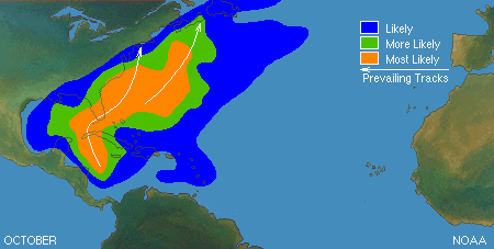
0 likes
Personal Forecast Disclaimer:
The posts in this forum are NOT official forecast and should not be used as such. They are just the opinion of the poster and may or may not be backed by sound meteorological data. They are NOT endorsed by any professional institution or storm2k.org. For official information, please refer to the NHC and NWS products.
The posts in this forum are NOT official forecast and should not be used as such. They are just the opinion of the poster and may or may not be backed by sound meteorological data. They are NOT endorsed by any professional institution or storm2k.org. For official information, please refer to the NHC and NWS products.
-
stormlover2013
-
Weatherwatcher98
- Category 1
- Posts: 346
- Joined: Sat Sep 12, 2015 10:53 am
Re: 2015 Global model runs discussion
I agree.stormlover2013 wrote:until the EURO bites then I wouldn't be to worried
0 likes
Personal Forecast Disclaimer:
The posts in this forum are NOT official forecast and should not be used as such. They are just the opinion of the poster and may or may not be backed by sound meteorological data. They are NOT endorsed by any professional institution or storm2k.org. For official information, please refer to the NHC and NWS products.
The posts in this forum are NOT official forecast and should not be used as such. They are just the opinion of the poster and may or may not be backed by sound meteorological data. They are NOT endorsed by any professional institution or storm2k.org. For official information, please refer to the NHC and NWS products.
-
stormlover2013
Re: 2015 Global model runs discussion
and I am not just saying this being a euro homer but the euro has been money over the last month
0 likes

Re:
gatorcane wrote:The NAVGEM has backed off from the intense hurricane it is showing. It still shows a T.S. in the SE Gulf but nothing as strong as before. As expected it is folding...
Gator,
It may very well be folding, which you predicted and would surprise very few of us since we know it is about as unreliable as any model. However, with it still having a solid TS in a similar threatening position, I wouldn't be surprised if it were to go back to a H on some later runs being that intensity forecasts are often jumpy. At least it still has a WC genesis, which it has yet to give up on.
Also, note that the 0Z CMC (yes, I realize it is not too much less unreliable than the NAVGEM) has gone back closer to the NAVGEM. Furthermore, the 0Z GFS sort of went a little in the direction of the NAVGEM late with it having a TC in the NE GOM.
0 likes
Personal Forecast Disclaimer:
The posts in this forum are NOT official forecasts and should not be used as such. They are just the opinion of the poster and may or may not be backed by sound meteorological data. They are NOT endorsed by any professional institution or storm2k.org. For official information, please refer to the NHC and NWS products.
The posts in this forum are NOT official forecasts and should not be used as such. They are just the opinion of the poster and may or may not be backed by sound meteorological data. They are NOT endorsed by any professional institution or storm2k.org. For official information, please refer to the NHC and NWS products.
-
stormlover2013
Re: 2015 Global model runs discussion
I wouldn't even bring up the cmc and navy they are the 2 worse models with the Nam
0 likes
Re: 2015 Global model runs discussion
stormlover, I'm pretty sure everyone knows those models performance records. What you are looking for is clusters of models agreeing.
0 likes
-
stormlover2013
Re: 2015 Global model runs discussion
I know what I am looking for and what I am seeing is only one consistent model in the past month and that's the euro, GFS has been up and down, CMC horrible, Navy is horrible, so until euro gets on board then I wouldn't be worried....
0 likes
Re: 2015 Global model runs discussion
stormlover2013 wrote:I wouldn't even bring up the cmc and navy they are the 2 worse models with the Nam
The NAM may be the very worst as it goes out only a mere 84 hours and still tends to be awful.
0 likes
Personal Forecast Disclaimer:
The posts in this forum are NOT official forecasts and should not be used as such. They are just the opinion of the poster and may or may not be backed by sound meteorological data. They are NOT endorsed by any professional institution or storm2k.org. For official information, please refer to the NHC and NWS products.
The posts in this forum are NOT official forecasts and should not be used as such. They are just the opinion of the poster and may or may not be backed by sound meteorological data. They are NOT endorsed by any professional institution or storm2k.org. For official information, please refer to the NHC and NWS products.

Re: 2015 Global model runs discussion
If you're waiting on the euro only you may be waiting awhile as far as genesis they aren't the best as sometimes they missed development or where late to the party. Granted, if they come, it will help solidify any model consensus.
Last edited by caneman on Tue Oct 13, 2015 10:33 am, edited 1 time in total.
0 likes
Who is online
Users browsing this forum: No registered users and 64 guests