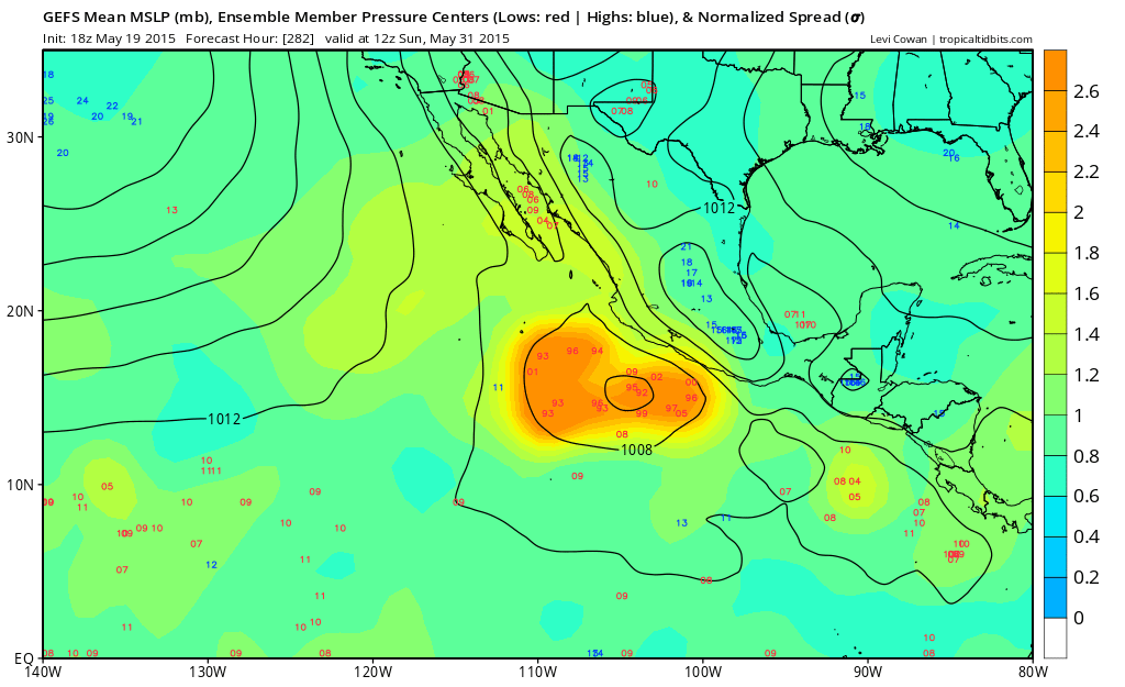
2015 EPAC Season

This is the general tropical discussion area. Anyone can take their shot at predicting a storms path.

Moderator: S2k Moderators

Forum rules

The posts in this forum are NOT official forecasts and should not be used as such. They are just the opinion of the poster and may or may not be backed by sound meteorological data. They are NOT endorsed by any professional institution or STORM2K. For official information, please refer to products from the National Hurricane Center and National Weather Service.

Help Support Storm2K
Message
Author
CaliforniaResident
Tropical Storm
Tropical Storm
Posts: 212
Joined: Fri Feb 21, 2014 1:47 pm

Re: Re:

#161 Postby CaliforniaResident » Tue May 19, 2015 10:45 pm

xtyphooncyclonex wrote:
CaliforniaResident wrote:If we don't see a named storm in the EPAC by the end of this month, I'm going to recant my 33/22/11 season forecast and also my forecast for a Southern California landfall in early to mid October.

So you're saying the presence of a named storm this month will affect a California landfall by October?


If we are going to have a superhyperactive season (which would be required for any sort of landfall in California), we have to start early and considering that the average first EPAC named storm is in May, if we don't get one by the end of the month, we'll have a late start.
0 likes   

User avatar
xtyphooncyclonex
Category 5
Category 5
Posts: 3861
Age: 23
Joined: Sat Dec 08, 2012 9:07 am
Location: Cebu City
Contact:

Re: Re:

#162 Postby xtyphooncyclonex » Tue May 19, 2015 10:52 pm

CaliforniaResident wrote:
xtyphooncyclonex wrote:
CaliforniaResident wrote:If we don't see a named storm in the EPAC by the end of this month, I'm going to recant my 33/22/11 season forecast and also my forecast for a Southern California landfall in early to mid October.

So you're saying the presence of a named storm this month will affect a California landfall by October?


If we are going to have a superhyperactive season (which would be required for any sort of landfall in California), we have to start early and considering that the average first EPAC named storm is in May, if we don't get one by the end of the month, we'll have a late start.

Not all of the most active seasons had an early start, like 1997. Some also of the inactive seasons start early.

I was also talking about your Cali landfall, not the overall seasonal forecasts.
0 likes   
REMINDER: My opinions that I, or any other NON Pro-Met in this forum, are unofficial. Please do not take my opinions as an official forecast and warning. I am NOT a meteorologist. Following my forecasts blindly may lead to false alarm, danger and risk if official forecasts from agencies are ignored.

User avatar
Yellow Evan
Professional-Met
Professional-Met
Posts: 16143
Age: 27
Joined: Fri Jul 15, 2011 12:48 pm
Location: Henderson, Nevada/Honolulu, HI
Contact:

Re: Re:

#163 Postby Yellow Evan » Tue May 19, 2015 11:11 pm

xtyphooncyclonex wrote:
CaliforniaResident wrote:
If we are going to have a superhyperactive season (which would be required for any sort of landfall in California), we have to start early and considering that the average first EPAC named storm is in May, if we don't get one by the end of the month, we'll have a late start.

Not all of the most active seasons had an early start, like 1997. Some also of the inactive seasons start early.

I was also talking about your Cali landfall, not the overall seasonal forecasts.


1997 isn't a record hurricane season that people make it out to be.

In my set, I have the average 1st storm listed as May 29. A start of +-5 days isn't that significant.

Now, I sitll have my doubts on a 33/22/11 season.
0 likes   

User avatar
Yellow Evan
Professional-Met
Professional-Met
Posts: 16143
Age: 27
Joined: Fri Jul 15, 2011 12:48 pm
Location: Henderson, Nevada/Honolulu, HI
Contact:

Re: 2015 EPAC Season

#164 Postby Yellow Evan » Tue May 19, 2015 11:13 pm

Image

Ensemble support for this is through the roof.
0 likes   

User avatar
xtyphooncyclonex
Category 5
Category 5
Posts: 3861
Age: 23
Joined: Sat Dec 08, 2012 9:07 am
Location: Cebu City
Contact:

Re: Re:

#165 Postby xtyphooncyclonex » Tue May 19, 2015 11:21 pm

Yellow Evan wrote:
xtyphooncyclonex wrote:
CaliforniaResident wrote:
If we are going to have a superhyperactive season (which would be required for any sort of landfall in California), we have to start early and considering that the average first EPAC named storm is in May, if we don't get one by the end of the month, we'll have a late start.

Not all of the most active seasons had an early start, like 1997. Some also of the inactive seasons start early.

I was also talking about your Cali landfall, not the overall seasonal forecasts.


1997 isn't a record hurricane season that people make it out to be.

In my set, I have the average 1st storm listed as May 29. A start of +-5 days isn't that significant.

Now, I sitll have my doubts on a 33/22/11 season.


I never said 1997 was the record highest, all I said was that it was among the most active on record. Well, the point there is that a season does not have to start early nor late to become an active season, or even if the first storm forms a slight deviation from the average. Speaking of a 33/22/11 season, I think that's not very likely. El Niño years tend to be quality-over-quantity years in the Pacific, like 1991 and 1997. Crazy active years are usually during weak events or warm neutral, like 1982 (although it later exploded to a super Niño near the end of the season), 1985, 1990, 1992, 1994 and 2014.
0 likes   
REMINDER: My opinions that I, or any other NON Pro-Met in this forum, are unofficial. Please do not take my opinions as an official forecast and warning. I am NOT a meteorologist. Following my forecasts blindly may lead to false alarm, danger and risk if official forecasts from agencies are ignored.

User avatar
Yellow Evan
Professional-Met
Professional-Met
Posts: 16143
Age: 27
Joined: Fri Jul 15, 2011 12:48 pm
Location: Henderson, Nevada/Honolulu, HI
Contact:

Re: Re:

#166 Postby Yellow Evan » Tue May 19, 2015 11:30 pm

xtyphooncyclonex wrote:I never said 1997 was the record highest, all I said was that it was among the most active on record. Well, the point there is that a season does not have to start early nor late to become an active season, or even if the first storm forms a slight deviation from the average. Speaking of a 33/22/11 season, I think that's not very likely. El Niño years tend to be quality-over-quantity years in the Pacific, like 1991 and 1997. Crazy active years are usually during weak events or warm neutral, like 1982 (although it later exploded to a super Niño near the end of the season), 1992, 1994 and 2014.


This I agree with and I've pointed the same thing out a couple times on here.

I will say though the most active a seaosn has been that has had a start after the 1st week of June is 20 storms.

So, if we get nothing by June 5 or so, I'd only get concerned then. And all signs are pointing to something next week.
0 likes   

User avatar
Yellow Evan
Professional-Met
Professional-Met
Posts: 16143
Age: 27
Joined: Fri Jul 15, 2011 12:48 pm
Location: Henderson, Nevada/Honolulu, HI
Contact:

Re: 2015 EPAC Season

#167 Postby Yellow Evan » Tue May 19, 2015 11:53 pm

Image

0z CMC also has Andres.
0 likes   

User avatar
cycloneye
Admin
Admin
Posts: 145350
Age: 68
Joined: Thu Oct 10, 2002 10:54 am
Location: San Juan, Puerto Rico

Re: 2015 EPAC Season

#168 Postby cycloneye » Wed May 20, 2015 5:18 am

00z ECMWF shows it for a second run in a row.

Image
0 likes   
Visit the Caribbean-Central America Weather Thread where you can find at first post web cams,radars
and observations from Caribbean basin members Click Here

User avatar
Yellow Evan
Professional-Met
Professional-Met
Posts: 16143
Age: 27
Joined: Fri Jul 15, 2011 12:48 pm
Location: Henderson, Nevada/Honolulu, HI
Contact:

Re: 2015 EPAC Season

#169 Postby Yellow Evan » Wed May 20, 2015 7:38 am

Image

0z GFS

Image

6z GFS
0 likes   

User avatar
cycloneye
Admin
Admin
Posts: 145350
Age: 68
Joined: Thu Oct 10, 2002 10:54 am
Location: San Juan, Puerto Rico

Re: 2015 EPAC Season

#170 Postby cycloneye » Wed May 20, 2015 12:41 pm

12z GFS is once again with it starting on May 28.

Image


Image
0 likes   
Visit the Caribbean-Central America Weather Thread where you can find at first post web cams,radars
and observations from Caribbean basin members Click Here

User avatar
cycloneye
Admin
Admin
Posts: 145350
Age: 68
Joined: Thu Oct 10, 2002 10:54 am
Location: San Juan, Puerto Rico

Re: 2015 EPAC Season

#171 Postby cycloneye » Wed May 20, 2015 12:59 pm

Not for area that models develop.


TROPICAL WEATHER OUTLOOK
NWS NATIONAL HURRICANE CENTER MIAMI FL
1100 AM PDT WED MAY 20 2015

For the eastern North Pacific...east of 140 degrees west longitude:

1. An area of low pressure could form over the weekend well to the
west-southwest of the southern tip of Baja California.
Environmental conditions are expected to be conducive for some
subsequent development while the system moves slowly northwestward.
* Formation chance through 48 hours...low...near 0 percent
* Formation chance through 5 days...low...20 percent

Forecaster Beven


Image
0 likes   
Visit the Caribbean-Central America Weather Thread where you can find at first post web cams,radars
and observations from Caribbean basin members Click Here

User avatar
Kingarabian
S2K Supporter
S2K Supporter
Posts: 15981
Joined: Sat Aug 08, 2009 3:06 am
Location: Honolulu, Hawaii

#172 Postby Kingarabian » Wed May 20, 2015 2:47 pm

^ That area they were talking about on Twitter. Really early for a CPAC storm though.
0 likes   
RIP Kobe Bryant

User avatar
Yellow Evan
Professional-Met
Professional-Met
Posts: 16143
Age: 27
Joined: Fri Jul 15, 2011 12:48 pm
Location: Henderson, Nevada/Honolulu, HI
Contact:

#173 Postby Yellow Evan » Wed May 20, 2015 2:50 pm

I have some doubts about the 0/20 system given that shear is high at this time of year.
0 likes   

User avatar
gatorcane
S2K Supporter
S2K Supporter
Posts: 23691
Age: 47
Joined: Sun Mar 13, 2005 3:54 pm
Location: Boca Raton, FL

#174 Postby gatorcane » Wed May 20, 2015 3:50 pm

ECMWF has it now for a third-run in a row:

Image
0 likes   

User avatar
cycloneye
Admin
Admin
Posts: 145350
Age: 68
Joined: Thu Oct 10, 2002 10:54 am
Location: San Juan, Puerto Rico

Re: 2015 EPAC Season

#175 Postby cycloneye » Wed May 20, 2015 5:55 pm

18z GFS has a landfall as a hurricane near Acapulco.I don't pay attention to those early model scenarios in terms of tracks because it will change a lot.Imagine the large swing between Cabo San Lucas and Acapulco in only 3 runs.
0 likes   
Visit the Caribbean-Central America Weather Thread where you can find at first post web cams,radars
and observations from Caribbean basin members Click Here

User avatar
Yellow Evan
Professional-Met
Professional-Met
Posts: 16143
Age: 27
Joined: Fri Jul 15, 2011 12:48 pm
Location: Henderson, Nevada/Honolulu, HI
Contact:

#176 Postby Yellow Evan » Wed May 20, 2015 6:31 pm

An area of low pressure could form during the next few days well to
the west-southwest of the southern tip of Baja California.
Environmental conditions are expected to conducive for some gradual
development of the system while it moves slowly northwestward.
* Formation chance through 48 hours...low...near 0 percent
* Formation chance through 5 days...low...20 percent

$$
Forecaster Brown
0 likes   

User avatar
Yellow Evan
Professional-Met
Professional-Met
Posts: 16143
Age: 27
Joined: Fri Jul 15, 2011 12:48 pm
Location: Henderson, Nevada/Honolulu, HI
Contact:

#177 Postby Yellow Evan » Wed May 20, 2015 7:12 pm

Image

FTR, here is the 18z GFS for entertainment purposes only.
0 likes   

User avatar
Yellow Evan
Professional-Met
Professional-Met
Posts: 16143
Age: 27
Joined: Fri Jul 15, 2011 12:48 pm
Location: Henderson, Nevada/Honolulu, HI
Contact:

Re: 2015 EPAC Season

#178 Postby Yellow Evan » Wed May 20, 2015 7:18 pm

cycloneye wrote:18z GFS has a landfall as a hurricane near Acapulco.I don't pay attention to those early model scenarios in terms of tracks because it will change a lot.Imagine the large swing between Cabo San Lucas and Acapulco in only 3 runs.


I'd put more weight into this since the GFS is in good agreement with its ensembles.

Image

Image

Still, it's 10 days out, so nothing is set in stone. Something to keep an eye on though.
0 likes   

User avatar
cycloneye
Admin
Admin
Posts: 145350
Age: 68
Joined: Thu Oct 10, 2002 10:54 am
Location: San Juan, Puerto Rico

Re: 2015 EPAC Season

#179 Postby cycloneye » Thu May 21, 2015 6:58 am

TROPICAL WEATHER OUTLOOK
NWS NATIONAL HURRICANE CENTER MIAMI FL
500 AM PDT THU MAY 21 2015

For the eastern North Pacific...east of 140 degrees west longitude:

1. A tropical wave located several hundred miles south-southwest of
the southern tip of Baja California is producing a large area of
disorganized cloudiness and showers. Environmental conditions are
currently not conducive for development of this system. However,
they are expected to become conducive for some slow development
over the weekend.
* Formation chance through 48 hours...low...near 0 percent
* Formation chance through 5 days...low...30 percent

2. An area of low pressure is expected to form during the next
couple of days well to the west-southwest of the southern tip of
Baja California. Environmental conditions are expected to be
conducive for gradual development of the system over the weekend
while the low moves slowly northwestward.
* Formation chance through 48 hours...low...near 0 percent
* Formation chance through 5 days...low...30 percent

Forecaster Beven

Image
0 likes   
Visit the Caribbean-Central America Weather Thread where you can find at first post web cams,radars
and observations from Caribbean basin members Click Here

User avatar
Yellow Evan
Professional-Met
Professional-Met
Posts: 16143
Age: 27
Joined: Fri Jul 15, 2011 12:48 pm
Location: Henderson, Nevada/Honolulu, HI
Contact:

#180 Postby Yellow Evan » Thu May 21, 2015 8:07 am

Image

0z GFs like the 18z run.

Image

6z GFS a little weaker and more W
0 likes   


Return to “Talkin' Tropics”

Who is online

Users browsing this forum: TomballEd and 36 guests