EPAC / Caribbean development later this week?
Moderator: S2k Moderators
Forum rules

The posts in this forum are NOT official forecasts and should not be used as such. They are just the opinion of the poster and may or may not be backed by sound meteorological data. They are NOT endorsed by any professional institution or STORM2K. For official information, please refer to products from the National Hurricane Center and National Weather Service.


Re: EPAC/SW Caribbean development next week?
OK that really catches my attention as Central America could be affected, let's see if the models are consistent on the next runs although we cannot deny that they're smelling something.
0 likes
-
Hurricane Andrew

- S2K Supporter

- Posts: 1891
- Age: 27
- Joined: Sun May 23, 2010 2:53 pm
- Location: KS
http://tc.met.psu.edu/
1)go to that link
2)click GFDL
3)advance it to past 60 hours.
The system shows up.
1)go to that link
2)click GFDL
3)advance it to past 60 hours.
The system shows up.
0 likes
The Enthusiast
NREMT-AEMT, WX nerd
Irene '11, Sandy '12, Irma '17 (SAR)
"Hard to think we were born to live this way..." -Wage War

Yeah that is pretty much as the models were expecting Hurakan from the looks of things.
0 likes
Personal Forecast Disclaimer:
The posts in this forum are NOT official forecast and should not be used as such. They are just the opinion of the poster and may or may not be backed by sound meteorological data. They are NOT endorsed by any professional institution or storm2k.org. For official information, please refer to the NHC and NWS products
The posts in this forum are NOT official forecast and should not be used as such. They are just the opinion of the poster and may or may not be backed by sound meteorological data. They are NOT endorsed by any professional institution or storm2k.org. For official information, please refer to the NHC and NWS products

-
HURAKAN

- Professional-Met

- Posts: 46086
- Age: 38
- Joined: Thu May 20, 2004 4:34 pm
- Location: Key West, FL
- Contact:
Re: EPAC / Caribbean development later this week?
850 MB vorticity over the Gulf of Fonseca:

Upper Divergence:

Lower Convergence:

Upper Divergence:
Lower Convergence:
0 likes
-
somethingfunny

- ChatStaff

- Posts: 3926
- Age: 37
- Joined: Thu May 31, 2007 10:30 pm
- Location: McKinney, Texas
Re: EPAC / Caribbean development later this week?
Looking good. Did anybody take up tolakram on his bet? 
0 likes
Its certainly interesting, though Joe B expects the whole lot to lift NE into the SW Cairrbean over the week, so both sides of the basins need watching still...
Bet this is an invest soon enough...
Bet this is an invest soon enough...
0 likes
Personal Forecast Disclaimer:
The posts in this forum are NOT official forecast and should not be used as such. They are just the opinion of the poster and may or may not be backed by sound meteorological data. They are NOT endorsed by any professional institution or storm2k.org. For official information, please refer to the NHC and NWS products
The posts in this forum are NOT official forecast and should not be used as such. They are just the opinion of the poster and may or may not be backed by sound meteorological data. They are NOT endorsed by any professional institution or storm2k.org. For official information, please refer to the NHC and NWS products
-
Hurricane Andrew
- S2K Supporter
- Posts: 1891
- Age: 27
- Joined: Sun May 23, 2010 2:53 pm
- Location: KS
Re: EPAC / Caribbean development later this week?
somethingfunny wrote:Looking good. Did anybody take up tolakram on his bet?
Can you show me? i cant find it.
I say...Invest by Wednesday
TD by Saturday.
0 likes
The Enthusiast
NREMT-AEMT, WX nerd
Irene '11, Sandy '12, Irma '17 (SAR)
"Hard to think we were born to live this way..." -Wage War

Re: EPAC / Caribbean development later this week?
It seems to be slowly becoming a consensus that there is a good chance that a tropical cyclone could develop in the extreme east Pacific during the next four days. From there, if said system forms, it seems that Mexico or Central America could be affected.
Some of the models seem to be indicating that the system, or at least a chunk of energy from it, could be pulled northeastward into the Caribbean.
In terms of the Pacific system forming, most of the models seem to be on board to some extent (ECMWF, CMC, NAM, GFS, WRF, perhaps some others).
Some of the models seem to be indicating that the system, or at least a chunk of energy from it, could be pulled northeastward into the Caribbean.
In terms of the Pacific system forming, most of the models seem to be on board to some extent (ECMWF, CMC, NAM, GFS, WRF, perhaps some others).
0 likes
-
somethingfunny
- ChatStaff
- Posts: 3926
- Age: 37
- Joined: Thu May 31, 2007 10:30 pm
- Location: McKinney, Texas
Re: SW Caribbean development next week?
tolakram (posted on the 18th) wrote:This is the first EPAC storm. I don't care where it's showing it develop, for the 3rd (that I've been paying attention too) year in a row the models are showing something developing in the SW Caribbean and I'd bet money this will be an EPAC system.
0 likes
Re: EPAC / Caribbean development later this week?
BigA wrote:
Some of the models seem to be indicating that the system, or at least a chunk of energy from it, could be pulled northeastward into the Caribbean.
In terms of the Pacific system forming, most of the models seem to be on board to some extent (ECMWF, CMC, NAM, GFS, WRF, perhaps some others).
Yep, there is a decent enough disturbance already present to suggest this is a real system that could develop...
As for the first point, well something like that happened with the start of the 2008 season so its quite possible...
0 likes
Personal Forecast Disclaimer:
The posts in this forum are NOT official forecast and should not be used as such. They are just the opinion of the poster and may or may not be backed by sound meteorological data. They are NOT endorsed by any professional institution or storm2k.org. For official information, please refer to the NHC and NWS products
The posts in this forum are NOT official forecast and should not be used as such. They are just the opinion of the poster and may or may not be backed by sound meteorological data. They are NOT endorsed by any professional institution or storm2k.org. For official information, please refer to the NHC and NWS products
-
Hurricane Andrew
- S2K Supporter
- Posts: 1891
- Age: 27
- Joined: Sun May 23, 2010 2:53 pm
- Location: KS
Re: SW Caribbean development next week?
somethingfunny wrote:tolakram (posted on the 18th) wrote:This is the first EPAC storm. I don't care where it's showing it develop, for the 3rd (that I've been paying attention too) year in a row the models are showing something developing in the SW Caribbean and I'd bet money this will be an EPAC system.
Tell them that i ain't bettin' mulah' but i will bet nothing.
0 likes
The Enthusiast
NREMT-AEMT, WX nerd
Irene '11, Sandy '12, Irma '17 (SAR)
"Hard to think we were born to live this way..." -Wage War
-
Hurricane Andrew
- S2K Supporter
- Posts: 1891
- Age: 27
- Joined: Sun May 23, 2010 2:53 pm
- Location: KS
Re: EPAC / Caribbean development later this week?
KWT wrote:BigA wrote:
Some of the models seem to be indicating that the system, or at least a chunk of energy from it, could be pulled northeastward into the Caribbean.
In terms of the Pacific system forming, most of the models seem to be on board to some extent (ECMWF, CMC, NAM, GFS, WRF, perhaps some others).
Yep, there is a decent enough disturbance already present to suggest this is a real system that could develop...
As for the first point, well something like that happened with the start of the 2008 season so its quite possible...
GFDL is on board, HWRF a tiny bit....
0 likes
The Enthusiast
NREMT-AEMT, WX nerd
Irene '11, Sandy '12, Irma '17 (SAR)
"Hard to think we were born to live this way..." -Wage War
-
Ivanhater

- Storm2k Moderator

- Posts: 11167
- Age: 39
- Joined: Fri Jul 01, 2005 8:25 am
- Location: Pensacola
Re: EPAC / Caribbean development later this week?
Model rundown
18z Nam

GFS

Canadian

Euro

18z Nam
GFS
Canadian
Euro
0 likes
Michael
18Z GFS is more aggressive in moving the energy across central America and into the Caribbean...shows a 1005 mb tropical storm north of Nicaragua in 120 hours.
http://www.nco.ncep.noaa.gov/pmb/nwprod ... n_120l.gif
http://www.nco.ncep.noaa.gov/pmb/nwprod ... n_120l.gif
0 likes


-
cycloneye

- Admin

- Posts: 148740
- Age: 69
- Joined: Thu Oct 10, 2002 10:54 am
- Location: San Juan, Puerto Rico
Re: EPAC / Caribbean development later this week?
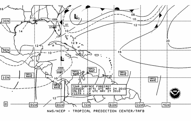
From evening discussion of EPAC by TPC:
http://www.nhc.noaa.gov/text/refresh/MI ... 2208.shtml?
THE MOST SIGNIFICANT
TROUGH EXTENDS FROM 06N85W THROUGH COSTA RICA INTO THE EXTREME
SW CARIBBEAN AND IS ASSOCIATED WITH AN AREA OF INCREASINGLY
DISTURBED WEATHER. LAST VISIBLE SATELLITE IMAGERY INDICATED WELL
DEFINED LOW AND MID LEVEL CYCLONIC TURNING OVER PORTIONS OF
SOUTHERN CENTRAL AMERICA. SURFACE OBSERVATIONS AND LOW CLOUD
MOTIONS SUGGEST A BROAD LOW PRESSURE AREA MAY BE DEVELOPING OVER
NORTHERN COSTA RICA OR SOUTHERN NICARAGUA. THE AREA OF
CONVECTION NEAR THE TROUGH IS LIKELY DUE TO INCREASING S TO SW
WINDS S OF THE ITCZ AND UPPER LEVEL DIFFLUENT FLOW TO THE SE OF
AN ANTICYCLONE NEAR 14N102W.
0 likes
Visit the Caribbean-Central America Weather Thread where you can find at first post web cams,radars
and observations from Caribbean basin members Click Here
and observations from Caribbean basin members Click Here
-
Hurricane Andrew
- S2K Supporter
- Posts: 1891
- Age: 27
- Joined: Sun May 23, 2010 2:53 pm
- Location: KS
-
meteorologyman
- Category 2

- Posts: 541
- Joined: Wed Mar 15, 2006 6:48 pm
- Location: Florida, Kissimmee/St.CLoud
Re: EPAC / Caribbean development later this week?
Wierd this is reminding me of 2004 hurricane Season. Alex and Bonnie formed a few a days apart. Alex formed east of FL and moved N then east out to sea. Bonnie formed in the Atlantic and enter the Caribbean into FL. Only difference is That they formed in end of July and early August.
This year what might be Alex is forming again east of FL, and what may be Bonnie Is forming in Eastern Pacific but head up into the Caribbean if forecast models hold.
This year what might be Alex is forming again east of FL, and what may be Bonnie Is forming in Eastern Pacific but head up into the Caribbean if forecast models hold.
0 likes
Who is online
Users browsing this forum: Ulf and 60 guests