2025 Global Model Runs Discussion (Out thru day 16)

This is the general tropical discussion area. Anyone can take their shot at predicting a storms path.

Moderator: S2k Moderators

Forum rules

The posts in this forum are NOT official forecasts and should not be used as such. They are just the opinion of the poster and may or may not be backed by sound meteorological data. They are NOT endorsed by any professional institution or STORM2K. For official information, please refer to products from the National Hurricane Center and National Weather Service.

Help Support Storm2K
Message
Author
LarryWx
S2K Supporter
S2K Supporter
Posts: 6755
Joined: Sun Sep 07, 2003 2:04 pm
Location: GA

Re: 2025 Global Model Runs Discussion (Out thru day 16)

#1261 Postby LarryWx » Sat Oct 11, 2025 12:58 am

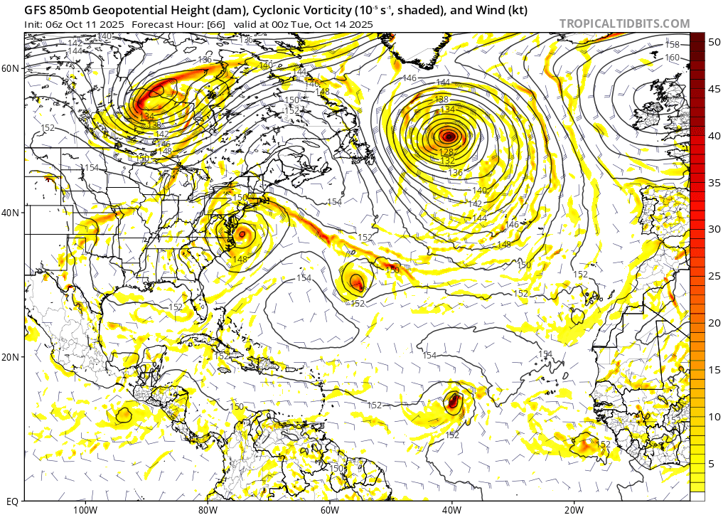
Category5Kaiju wrote:Ngl, with storm after storm this year turning out to sea, it does feel somewhat odd to see some of these long-range models, especially the deepmind AI ones, showing a possible signal in the ECAR later this month. The absolute hotspot for activity this year has been the Sargasso Sea....but will this season manage to produce something noteworthy in the Caribbean or Gulf before the end? We shall see.


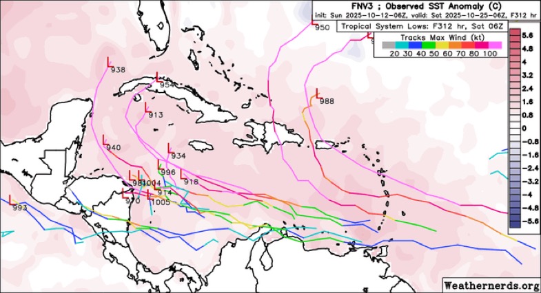
The last season with no TC in the Caribbean was 1997.
0 likes   
Personal Forecast Disclaimer:
The posts in this forum are NOT official forecasts and should not be used as such. They are just the opinion of the poster and may or may not be backed by sound meteorological data. They are NOT endorsed by any professional institution or storm2k.org. For official information, please refer to the NHC and NWS products.

Fancy1002
Tropical Storm
Tropical Storm
Posts: 217
Joined: Sun Dec 25, 2022 3:47 pm

Re: 2025 Global Model Runs Discussion (Out thru day 16)

#1262 Postby Fancy1002 » Sat Oct 11, 2025 2:23 am

TheDreamTraveler wrote:
Fancy1002 wrote:
TampaWxLurker wrote:12z GFS has a future MH Karen forming off the northeastern tip of the Yucatan at +168 hrs, then meandering around the western Gulf for a week+
Still hasn't actually gotten anywhere at +342 hrs in the model that's still running.

I’m pretty sure Karen will be taken by the East Coast storm in a few days so that will likely be L


Funnily enough neither of those 2 storms took the Karen name and instead that one way north east in the Atlantic did

Don’t rub it in lol
0 likes   

Cachondo23
Tropical Storm
Tropical Storm
Posts: 120
Joined: Wed May 25, 2022 5:56 am

Re: 2025 Global Model Runs Discussion (Out thru day 16)

#1263 Postby Cachondo23 » Sat Oct 11, 2025 6:01 am

Looks like CV season won’t end any time soon?
2 likes   

User avatar
Teban54
Category 5
Category 5
Posts: 3526
Joined: Sat May 19, 2018 1:19 pm

Re: 2025 Global Model Runs Discussion (Out thru day 16)

#1264 Postby Teban54 » Sat Oct 11, 2025 7:04 am

Even though 6z GFS no longer has the 907 mb en route to Florida, it's still developing the wave, just that it recurves and hits Hispaniola instead as a 949 mb MH.

Notably, this means GFS has shown this exact development scenario (a wave tracking across MDR and developing near Eastern Caribbean) 3 runs in a row.

Tomas 2010 may be a good analog for the 18z and 6z runs.

Image
0 likes   

WeatherBoy2000
Category 1
Category 1
Posts: 439
Joined: Mon Apr 10, 2023 9:29 am

Re: 2025 Global Model Runs Discussion (Out thru day 16)

#1265 Postby WeatherBoy2000 » Sat Oct 11, 2025 7:24 am

Teban54 wrote:Even though 6z GFS no longer has the 907 mb en route to Florida, it's still developing the wave, just that it recurves and hits Hispaniola instead as a 949 mb MH.

Notably, this means GFS has shown this exact development scenario (a wave tracking across MDR and developing near Eastern Caribbean) 3 runs in a row.

Tomas 2010 may be a good analog for the 18z and 6z runs.

https://i.postimg.cc/k52MDHvQ/gfs-z850-vort-atl-fh66-384.gif


This is the wave that follows the current mdr AOI. This maybe a legit long term signal given there's pretty strong eps support as well, gotta see if it lasts.
1 likes   

User avatar
AnnularCane
S2K Supporter
S2K Supporter
Posts: 2935
Joined: Thu Jun 08, 2006 9:18 am
Location: Wytheville, VA

Re: 2025 Global Model Runs Discussion (Out thru day 16)

#1266 Postby AnnularCane » Sat Oct 11, 2025 9:29 am

Teban54 wrote:Even though 6z GFS no longer has the 907 mb en route to Florida, it's still developing the wave, just that it recurves and hits Hispaniola instead as a 949 mb MH.

Notably, this means GFS has shown this exact development scenario (a wave tracking across MDR and developing near Eastern Caribbean) 3 runs in a row.

Tomas 2010 may be a good analog for the 18z and 6z runs.

https://i.postimg.cc/k52MDHvQ/gfs-z850-vort-atl-fh66-384.gif


Dance party in the Atlantic. :lol:
0 likes   
"But it never rained rain. It never snowed snow. And it never blew just wind. It rained things like soup and juice. It snowed mashed potatoes and green peas. And sometimes the wind blew in storms of hamburgers." -- Judi Barrett, Cloudy with a Chance of Meatballs

User avatar
SFLcane
S2K Supporter
S2K Supporter
Posts: 10225
Age: 47
Joined: Sat Jun 05, 2010 1:44 pm
Location: Lake Worth Florida

Re: 2025 Global Model Runs Discussion (Out thru day 16)

#1267 Postby SFLcane » Sat Oct 11, 2025 9:59 am

Teban54 wrote:Even though 6z GFS no longer has the 907 mb en route to Florida, it's still developing the wave, just that it recurves and hits Hispaniola instead as a 949 mb MH.

Notably, this means GFS has shown this exact development scenario (a wave tracking across MDR and developing near Eastern Caribbean) 3 runs in a row.

Tomas 2010 may be a good analog for the 18z and 6z runs.

https://i.postimg.cc/k52MDHvQ/gfs-z850-vort-atl-fh66-384.gif


Any TC in the nw carib could certainly pose a threat to cuba/fl if there is indeed one.Huge trof on most of the models ready to scoop anything northward. Just Speculation at this point

Image

Image
1 likes   

User avatar
cycloneye
Admin
Admin
Posts: 147764
Age: 69
Joined: Thu Oct 10, 2002 10:54 am
Location: San Juan, Puerto Rico

Re: 2025 Global Model Runs Discussion (Out thru day 16)

#1268 Postby cycloneye » Sat Oct 11, 2025 10:43 am

12z ICON on board with development.

Image
3 likes   
Visit the Caribbean-Central America Weather Thread where you can find at first post web cams,radars
and observations from Caribbean basin members Click Here

Cachondo23
Tropical Storm
Tropical Storm
Posts: 120
Joined: Wed May 25, 2022 5:56 am

Re: 2025 Global Model Runs Discussion (Out thru day 16)

#1269 Postby Cachondo23 » Sat Oct 11, 2025 11:55 am

Very low rider for this time of the year.
Last edited by Cachondo23 on Sat Oct 11, 2025 12:08 pm, edited 1 time in total.
0 likes   

TomballEd
Category 5
Category 5
Posts: 1031
Age: 61
Joined: Wed Aug 16, 2023 4:52 pm
Location: Spring/Klein area, not Tomball

Re: 2025 Global Model Runs Discussion (Out thru day 16)

#1270 Postby TomballEd » Sat Oct 11, 2025 11:55 am

Day 16 hurricanes are cool to look at but they are no more likely to occur than an ensemble member storm at that range.

Speaking of ensembles, GFS and Euro ensembles suggest a possible late October Caribbean storm.

Image
3 likes   

TomballEd
Category 5
Category 5
Posts: 1031
Age: 61
Joined: Wed Aug 16, 2023 4:52 pm
Location: Spring/Klein area, not Tomball

Re: 2025 Global Model Runs Discussion (Out thru day 16)

#1271 Postby TomballEd » Sat Oct 11, 2025 12:24 pm

Puerto Rico (with Hispaniola involved) and Bermuda threat on the GFS.
0 likes   

User avatar
cycloneye
Admin
Admin
Posts: 147764
Age: 69
Joined: Thu Oct 10, 2002 10:54 am
Location: San Juan, Puerto Rico

Re: 2025 Global Model Runs Discussion (Out thru day 16)

#1272 Postby cycloneye » Sun Oct 12, 2025 4:30 am

00z Euro develops wave that is still inside West Africa.

Image
3 likes   
Visit the Caribbean-Central America Weather Thread where you can find at first post web cams,radars
and observations from Caribbean basin members Click Here

LarryWx
S2K Supporter
S2K Supporter
Posts: 6755
Joined: Sun Sep 07, 2003 2:04 pm
Location: GA

Re: 2025 Global Model Runs Discussion (Out thru day 16)

#1273 Postby LarryWx » Sun Oct 12, 2025 8:51 am

cycloneye wrote:00z Euro develops wave that is still inside West Africa.

https://i.imgur.com/heAsKY5.gif


And suddenly after 6 runs in a row developing it, the 6Z GFS drops it. :lol: You can’t make this stuff up, folks! But it still has some upper level vorticity as well as some GEFS support fwiw.
1 likes   
Personal Forecast Disclaimer:
The posts in this forum are NOT official forecasts and should not be used as such. They are just the opinion of the poster and may or may not be backed by sound meteorological data. They are NOT endorsed by any professional institution or storm2k.org. For official information, please refer to the NHC and NWS products.

User avatar
SFLcane
S2K Supporter
S2K Supporter
Posts: 10225
Age: 47
Joined: Sat Jun 05, 2010 1:44 pm
Location: Lake Worth Florida

Re: 2025 Global Model Runs Discussion (Out thru day 16)

#1274 Postby SFLcane » Sun Oct 12, 2025 9:04 am

LarryWx wrote:
cycloneye wrote:00z Euro develops wave that is still inside West Africa.

https://i.imgur.com/heAsKY5.gif


And suddenly after 6 runs in a row developing it, the 6Z GFS drops it. :lol: You can’t make this stuff up, folks! But it still has some upper level vorticity as well as some GEFS support fwiw.


Meh gfs has been complete trash this season to be frank most models have been at times this yr. There is still a pretty respectable ensemble signal on the gefs,eps so who knows.

Image
5 likes   

User avatar
Kazmit
Category 5
Category 5
Posts: 2199
Age: 22
Joined: Mon Jul 25, 2016 8:49 am
Location: Bermuda

Re: 2025 Global Model Runs Discussion (Out thru day 16)

#1275 Postby Kazmit » Sun Oct 12, 2025 11:04 am

LarryWx wrote:
cycloneye wrote:00z Euro develops wave that is still inside West Africa.

https://i.imgur.com/heAsKY5.gif


And suddenly after 6 runs in a row developing it, the 6Z GFS drops it. :lol: You can’t make this stuff up, folks! But it still has some upper level vorticity as well as some GEFS support fwiw.

And the ICON is now on board too! :spam:
2 likes   
Igor 2010, Sandy 2012, Fay 2014, Gonzalo 2014, Joaquin 2015, Nicole 2016, Humberto 2019, Imelda 2025

I am only a tropical weather enthusiast. My predictions are not official and may or may not be backed by sound meteorological data. For official information, please refer to the NHC and NWS products.

LarryWx
S2K Supporter
S2K Supporter
Posts: 6755
Joined: Sun Sep 07, 2003 2:04 pm
Location: GA

Re: 2025 Global Model Runs Discussion (Out thru day 16)

#1276 Postby LarryWx » Sun Oct 12, 2025 11:39 am

Kazmit wrote:
LarryWx wrote:
cycloneye wrote:00z Euro develops wave that is still inside West Africa.

https://i.imgur.com/heAsKY5.gif


And suddenly after 6 runs in a row developing it, the 6Z GFS drops it. :lol: You can’t make this stuff up, folks! But it still has some upper level vorticity as well as some GEFS support fwiw.

And the ICON is now on board too! :spam:


The 12Z GFS kind of reluctantly brought it back from 6Z’s nothing though with it not as strong as the prior runs. But in GFS fashion, it gets to MH strength as it goes between PR and Hisp way out on 10/24 **fwiw**.

The 12Z CMC has it for the 2nd run in a row and it’s stronger than the prior run. It has a cat 1 hurricane hitting E PR late 10/21 to early 10/22 as it recurves into a trough to its N.

The UKMET (12Z) still doesn’t have it.
0 likes   
Personal Forecast Disclaimer:
The posts in this forum are NOT official forecasts and should not be used as such. They are just the opinion of the poster and may or may not be backed by sound meteorological data. They are NOT endorsed by any professional institution or storm2k.org. For official information, please refer to the NHC and NWS products.

IsabelaWeather
Category 1
Category 1
Posts: 299
Age: 36
Joined: Tue Jul 07, 2020 7:29 am
Location: Isabela, Puerto Rico

Re: 2025 Global Model Runs Discussion (Out thru day 16)

#1277 Postby IsabelaWeather » Sun Oct 12, 2025 11:57 am

LarryWx wrote:
Kazmit wrote:
LarryWx wrote:
And suddenly after 6 runs in a row developing it, the 6Z GFS drops it. :lol: You can’t make this stuff up, folks! But it still has some upper level vorticity as well as some GEFS support fwiw.

And the ICON is now on board too! :spam:


The 12Z GFS kind of reluctantly brought it back from 6Z’s nothing though with it not as strong as the prior runs. But in GFS fashion, it gets to MH strength as it goes between PR and Hisp way out on 10/24 **fwiw**.

The 12Z CMC has it for the 2nd run in a row and it’s stronger than the prior run. It has a cat 1 hurricane hitting E PR late 10/21 to early 10/22 as it recurves into a trough to its N.

The UKMET (12Z) still doesn’t have it.


That would be an amazing track for me to watch happen lol.
0 likes   

Fancy1002
Tropical Storm
Tropical Storm
Posts: 217
Joined: Sun Dec 25, 2022 3:47 pm

Re: 2025 Global Model Runs Discussion (Out thru day 16)

#1278 Postby Fancy1002 » Sun Oct 12, 2025 12:30 pm

So based on what I’ve seen, if it develops enough near the Leeward Islands, the system will head north and out to sea, but if development is delayed enough into the Caribbean, then Florida and Cuba have something to worry about.
0 likes   

TomballEd
Category 5
Category 5
Posts: 1031
Age: 61
Joined: Wed Aug 16, 2023 4:52 pm
Location: Spring/Klein area, not Tomball

Re: 2025 Global Model Runs Discussion (Out thru day 16)

#1279 Postby TomballEd » Sun Oct 12, 2025 2:09 pm

Fancy1002 wrote:So based on what I’ve seen, if it develops enough near the Leeward Islands, the system will head north and out to sea, but if development is delayed enough into the Caribbean, then Florida and Cuba have something to worry about.


I count 4 ensemble members along with the op GFS that hits or passes very close to Puerto Rico. Or the United States still has a chance of seeing a hurricane landfall.
1 likes   

User avatar
Jr0d
S2K Supporter
S2K Supporter
Posts: 1442
Joined: Tue Aug 27, 2019 10:52 am
Location: Cayo Hueso

Re: 2025 Global Model Runs Discussion (Out thru day 16)

#1280 Postby Jr0d » Sun Oct 12, 2025 5:07 pm

Still a good ensemble signal in the west Carib from the GFS and Canadian at the end of their runs. However the GFS and to a lesser extent the Canadian has consistently shown a signal there often all season long so I dont think its anything to worry about for now.

The wave the models show possibly developing and heading towards PR is something we may need to keep an eye on...interesting enough the ICON has been the southern outlier...it will be interesting to see what it does when its forecast range takes it it PR's longitude.
2 likes   


Return to “Talkin' Tropics”

Who is online

Users browsing this forum: Fancy1002, gib, islandgirl45, LarryWx, WaveBreaking and 72 guests