
I just see no evidence of an LLC, MLC, or center near that blob, that blob is just temporary NE of the center....should warm with time...
the center SW that is moving W or just a bit WSW is the one that should sustain in my opinion.
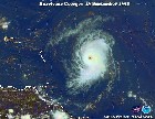
TS Florence,Analysis,Sat Pics,Models Thread #4
Moderator: S2k Moderators
Forum rules

The posts in this forum are NOT official forecasts and should not be used as such. They are just the opinion of the poster and may or may not be backed by sound meteorological data. They are NOT endorsed by any professional institution or STORM2K. For official information, please refer to products from the National Hurricane Center and National Weather Service.

-
cinlfla

- Category 2

- Posts: 687
- Joined: Mon Aug 16, 2004 7:16 pm
- Location: Titusville, Florida on the Spacecoast
Looking at the Infrared Floater You can see the center moving Due west I beleive the convection thats trying to build over the center is causing an illusion of a southward motion, but I do see a due west motion of course this is my opinion.
http://www.ssd.noaa.gov/goes/flt/t1/loop-ir2.html
http://www.ssd.noaa.gov/goes/flt/t1/loop-ir2.html
Last edited by cinlfla on Tue Sep 05, 2006 6:39 pm, edited 1 time in total.
0 likes
-
JonathanBelles
- Professional-Met

- Posts: 11430
- Age: 35
- Joined: Sat Dec 24, 2005 9:00 pm
- Location: School: Florida State University (Tallahassee, FL) Home: St. Petersburg, Florida
- Contact:
-
Weatherfreak14

- Category 5

- Posts: 1383
- Joined: Sat Sep 24, 2005 3:40 pm
- Location: Beaufort, SC
- Contact:
cinlfla wrote:Looking at the Infrared Floater You can see the center moving Due west I beleive the convection thats trying to build over the center is causing an illusion of a southward motion, but I do see a due west motion of course this is my opinion.
http://www.ssd.noaa.gov/goes/flt/t1/loop-ir2.html
Put the LAT/LON on u can see it falling in LAT.
0 likes

-
Weatherfreak14
- Category 5
- Posts: 1383
- Joined: Sat Sep 24, 2005 3:40 pm
- Location: Beaufort, SC
- Contact:
I still think the mm5fsu Model has a good take on this system and think this is what this storm will do. http://moe.met.fsu.edu/tcgengifs/
0 likes

cycloneye wrote:Cyclenall,I added the storm2k disclaimer to your post.
Thanks.
cpdaman wrote:how can your total percentages equal more than 100% , your example equal 175%
now there could be some overlappng but how can there be 55% chance of no land effected and 50 % some land effected that is 105%?
i am not trying to flame, i am just wondering (i could be in the wrong)
I don't do it that way. I have seen this type of % before where it doesn't have to equal 100%. This question has been asked before once.
0 likes

-
cycloneye

- Admin

- Posts: 148763
- Age: 69
- Joined: Thu Oct 10, 2002 10:54 am
- Location: San Juan, Puerto Rico
ROCK wrote:http://euler.atmos.colostate.edu/~vigh/guidance/atlantic/early1.png
getting little closer to PR, uh Luis....
No worries here.
0 likes
Visit the Caribbean-Central America Weather Thread where you can find at first post web cams,radars
and observations from Caribbean basin members Click Here
and observations from Caribbean basin members Click Here
-
MiamiensisWx
ROCK wrote:http://euler.atmos.colostate.edu/~vigh/guidance/atlantic/early1.png
getting little closer to PR, uh Luis....
Link doesn't work. No access to the plots.
0 likes
-
SouthFloridawx

- S2K Supporter

- Posts: 8346
- Age: 47
- Joined: Tue Jul 26, 2005 1:16 am
- Location: Sarasota, FL
- Contact:
-
Weathermaster
- Tropical Depression

- Posts: 79
- Joined: Thu Sep 04, 2003 10:33 am
- Location: Carolina, PR
Track remembers me Hurricane Luis 1995...
Florence remember me Hurricane Luis in 1995. After it gets 17.0 latitude it went right to the west and almost hit us in PR.
http://www.wunderground.com/hurricane/at199512.asp
http://www.wunderground.com/hurricane/at199512.asp
0 likes
-
Zardoz
- Category 1

- Posts: 309
- Joined: Fri Aug 25, 2006 9:48 am
- Location: Severe weather-challenged Southern California
cinlfla wrote:...I believe the convection that's trying to build over the center is causing an illusion of a southward motion.
I don't know. Is it really just an illusion, or has Flo turned WSW? :
http://www.ssd.noaa.gov/goes/east/catl/loop-avn.html
http://www.ssd.noaa.gov/goes/flt/t1/loop-ir2.html
0 likes
Man I always screw this one up...  ..early guidance...18utc
http://euler.atmos.colostate.edu/~vigh/ ... /index.htm
http://euler.atmos.colostate.edu/~vigh/ ... /index.htm
Last edited by ROCK on Tue Sep 05, 2006 6:55 pm, edited 1 time in total.
0 likes
-
Derek Ortt
the new GFDL is out to lunch
It has the system mvoing at a heading of 334 in 30 hours, not very likely. It's track, while the idea seems valid, is likely just a little to the right
http://twister.sbs.ohio-state.edu/text/ ... s/06090523
It has the system mvoing at a heading of 334 in 30 hours, not very likely. It's track, while the idea seems valid, is likely just a little to the right
http://twister.sbs.ohio-state.edu/text/ ... s/06090523
0 likes
Derek Ortt wrote:the new GFDL is out to lunch
It has the system mvoing at a heading of 334 in 30 hours, not very likely. It's track, while the idea seems valid, is likely just a little to the right
http://twister.sbs.ohio-state.edu/text/ ... s/06090523
Hopefully so... I think the GFDL has it going nearly right over Bermuda.
0 likes
-
JonathanBelles
- Professional-Met
- Posts: 11430
- Age: 35
- Joined: Sat Dec 24, 2005 9:00 pm
- Location: School: Florida State University (Tallahassee, FL) Home: St. Petersburg, Florida
- Contact:
Zardoz wrote:cinlfla wrote:...I believe the convection that's trying to build over the center is causing an illusion of a southward motion.
I don't know. Is it really just an illusion, or has Flo turned WSW? :
http://www.ssd.noaa.gov/goes/east/catl/loop-avn.html
http://www.ssd.noaa.gov/goes/flt/t1/loop-ir2.html
i was just wondering to myself that.
0 likes
Who is online
Users browsing this forum: bird and 98 guests