Tropical Wave in the East-Central Caribbean (Is Invest 92L)
Moderator: S2k Moderators
Forum rules

The posts in this forum are NOT official forecasts and should not be used as such. They are just the opinion of the poster and may or may not be backed by sound meteorological data. They are NOT endorsed by any professional institution or STORM2K. For official information, please refer to products from the National Hurricane Center and National Weather Service.
-
ElectricStorm

- Category 5

- Posts: 5157
- Age: 25
- Joined: Tue Aug 13, 2019 11:23 pm
- Location: Norman, OK
Re: Tropical Wave in the Eastern Caribbean
I think this could be the one to cause some trouble down the road. Much more so than TD25 IMO
0 likes
B.S Meteorology, University of Oklahoma '25
Please refer to the NHC, NWS, or SPC for official information.
Please refer to the NHC, NWS, or SPC for official information.
-
Blown Away

- S2K Supporter

- Posts: 10253
- Joined: Wed May 26, 2004 6:17 am
Re: Tropical Wave in the Eastern Caribbean


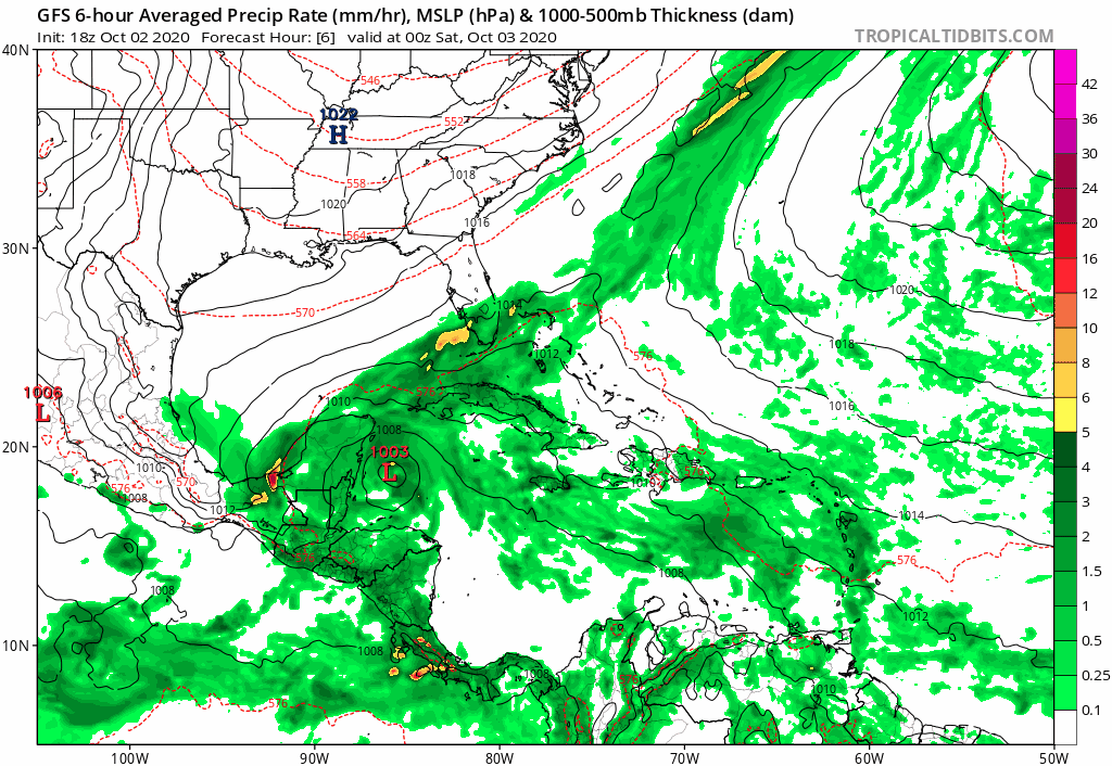
12z GFS has this TW moving from Central Caribbean over Cuba and into SFL as maybe a TD/TS between hours 52-126.
0 likes
Hurricane Eye Experience: David 79, Irene 99, Frances 04, Jeanne 04, Wilma 05… Hurricane Brush Experience: Andrew 92, Erin 95, Floyd 99, Matthew 16, Irma 17, Ian 22, Nicole 22…
-
Blown Away
- S2K Supporter
- Posts: 10253
- Joined: Wed May 26, 2004 6:17 am
Re: Tropical Wave in the Eastern Caribbean

Area getting for active...
5 likes
Hurricane Eye Experience: David 79, Irene 99, Frances 04, Jeanne 04, Wilma 05… Hurricane Brush Experience: Andrew 92, Erin 95, Floyd 99, Matthew 16, Irma 17, Ian 22, Nicole 22…
Re: Tropical Wave in the Eastern Caribbean
northjaxpro wrote:12Z CMC moves potential Delta in 192 hours northeast from the Central Gulf, and shows it approaching Panama City as a 992 mb Cat 1.
.
This is in agreement with the consensus since yesterday that is suggesting highest risk within a couple hundred miles on either side of the FL Panhandle to FL Big Bend stretch. Climowise, That is one of the highest risk areas for a genesis in early Oct.
The good news vs 2018's Michael is that northern Gulf SSTs are much cooler than they were with the approach of Michael. With Michael, N Gulf SSTs averaged near a record high for early Oct of 85 F due to record SE US heat. Now, thanks largely to a much cooler late Sep to early Oct. vs 2018, N Gulf SSTs are averaging only ~81 F (actually close to normal) or ~4 F cooler. Right on the coast, temps are ~79 F vs ~84 F on Michael's approach. So, the fuel would not be nearly as high for any TC that were to approach the N Gulf coast.
Now if this were to go to far SW FL/S FL, that would be totally different as the Gulf down there is about the same as it was in 2018 or ~85 F averaged out.
0 likes
Personal Forecast Disclaimer:
The posts in this forum are NOT official forecasts and should not be used as such. They are just the opinion of the poster and may or may not be backed by sound meteorological data. They are NOT endorsed by any professional institution or storm2k.org. For official information, please refer to the NHC and NWS products.
The posts in this forum are NOT official forecasts and should not be used as such. They are just the opinion of the poster and may or may not be backed by sound meteorological data. They are NOT endorsed by any professional institution or storm2k.org. For official information, please refer to the NHC and NWS products.
-
Blown Away
- S2K Supporter
- Posts: 10253
- Joined: Wed May 26, 2004 6:17 am
Re: Tropical Wave in the Eastern Caribbean
LarryWx wrote:northjaxpro wrote:12Z CMC moves potential Delta in 192 hours northeast from the Central Gulf, and shows it approaching Panama City as a 992 mb Cat 1.
.
This is in agreement with the consensus since yesterday that is suggesting highest risk within a couple hundred miles on either side of the FL Panhandle to FL Big Bend stretch. Climowise, That is one of the highest risk areas for a genesis in early Oct.
The good news vs 2018's Michael is that northern Gulf SSTs are much cooler than they were with the approach of Michael. With Michael, N Gulf SSTs averaged near a record high for early Oct of 85 F due to record SE US heat. Now, thanks largely to a much cooler late Sep to early Oct. vs 2018, N Gulf SSTs are averaging only ~81 F (actually close to normal) or ~4 F cooler. Right on the coast, temps are ~79 F vs ~84 F on Michael's approach. So, the fuel would not be nearly as high for any TC that were to approach the N Gulf coast.
Now if this were to go to far SW FL/S FL, that would be totally different as the Gulf down there is about the same as it was in 2018 or ~85 F averaged out.

12z CMC... Hours 54-198
2 likes
Hurricane Eye Experience: David 79, Irene 99, Frances 04, Jeanne 04, Wilma 05… Hurricane Brush Experience: Andrew 92, Erin 95, Floyd 99, Matthew 16, Irma 17, Ian 22, Nicole 22…

Re: Tropical Wave in the Eastern Caribbean
LarryWx wrote: Now if this were to go to far SW FL/S FL, that would be totally different as the Gulf down there is about the same as it was in 2018 or ~85 F averaged out.
Atmosphere in the southern FL peninsula area would be much more supportive as well. Although the northern Gulf still has marginal SSTs for tropical activity (right around the 26.5C threshold), there is a whole lot of continental dry air up there thanks to those early cold fronts.
2 likes
Re: Tropical Wave in the Eastern Caribbean
LarryWx wrote:northjaxpro wrote:12Z CMC moves potential Delta in 192 hours northeast from the Central Gulf, and shows it approaching Panama City as a 992 mb Cat 1.
.
This is in agreement with the consensus since yesterday that is suggesting highest risk within a couple hundred miles on either side of the FL Panhandle to FL Big Bend stretch. Climowise, That is one of the highest risk areas for a genesis in early Oct.
The good news vs 2018's Michael is that northern Gulf SSTs are much cooler than they were with the approach of Michael. With Michael, N Gulf SSTs averaged near a record high for early Oct of 85 F due to record SE US heat. Now, thanks largely to a much cooler late Sep to early Oct. vs 2018, N Gulf SSTs are averaging only ~81 F (actually close to normal) or ~4 F cooler. Right on the coast, temps are ~79 F vs ~84 F on Michael's approach. So, the fuel would not be nearly as high for any TC that were to approach the N Gulf coast.
Now if this were to go to far SW FL/S FL, that would be totally different as the Gulf down there is about the same as it was in 2018 or ~85 F averaged out.
Regarding the above, I'll now post two Gulf SST maps to show how much warmer it was with Michael's approach in 2018 vs now:
October 5, 2018: N Gulf all the way to the coast was 29-30 C (near 29C at the coast) or near an early Oct. record of ~85 F thanks to record SE US heat the prior two weeks. Note that SSTs off of SW FL were also near 29-30 C (~85 F):

In sharp contrast for the N Gulf, the October 1, 2020 map shows SSTs mainly in the 26-28 C range (near 26 C at the coast) or an average near 81 F meaning ~4 F cooler than it was on Michael's approach. And if anything, they'll likely cool down over the next week due to a cool next few days. So, if there were a H approaching the N Gulf coast in about a week, it would be traveling over much cooler water vs what Michael encountered as it approached the coast.
However, if a H were to approach SW FL south of Ft. Myers, where SSTs are 29-30 C, the fuel would be about the same as that of 2018 and the W Caribbean is actually ~ 2 F warmer at 30-31 C instead of 29-30 C:

1 likes
Personal Forecast Disclaimer:
The posts in this forum are NOT official forecasts and should not be used as such. They are just the opinion of the poster and may or may not be backed by sound meteorological data. They are NOT endorsed by any professional institution or storm2k.org. For official information, please refer to the NHC and NWS products.
The posts in this forum are NOT official forecasts and should not be used as such. They are just the opinion of the poster and may or may not be backed by sound meteorological data. They are NOT endorsed by any professional institution or storm2k.org. For official information, please refer to the NHC and NWS products.
Re: Tropical Wave in the Eastern Caribbean
The 12Z EPS is pretty active and has these 8 sub 1,000 mb CONUS hits out of 51 members with a * indicating H strength:
1. Tampa, FL 10/10
*2. SE LA 10/10
3. SE LA 10/10
4. FL Panhandle 10/12
*5. LA 10/12
*6. LA 10/13
*7. FL Big Bend 10/14
8. Galveston, TX 10/17

1. Tampa, FL 10/10
*2. SE LA 10/10
3. SE LA 10/10
4. FL Panhandle 10/12
*5. LA 10/12
*6. LA 10/13
*7. FL Big Bend 10/14
8. Galveston, TX 10/17
Last edited by LarryWx on Fri Oct 02, 2020 3:45 pm, edited 1 time in total.
0 likes
Personal Forecast Disclaimer:
The posts in this forum are NOT official forecasts and should not be used as such. They are just the opinion of the poster and may or may not be backed by sound meteorological data. They are NOT endorsed by any professional institution or storm2k.org. For official information, please refer to the NHC and NWS products.
The posts in this forum are NOT official forecasts and should not be used as such. They are just the opinion of the poster and may or may not be backed by sound meteorological data. They are NOT endorsed by any professional institution or storm2k.org. For official information, please refer to the NHC and NWS products.
-
northjaxpro

- S2K Supporter
- Posts: 8900
- Joined: Mon Sep 27, 2010 11:21 am
- Location: Jacksonville, FL
Re: Tropical Wave in the Eastern Caribbean

Impressive 850 mb vorticity signature across the Eastern Caribbean with the strong wave. We should be seeing Invest 92L designation very soon!!
2 likes
NEVER, EVER SAY NEVER in the tropics and weather in general, and most importantly, with life itself!!
________________________________________________________________________________________
Fay 2008 Beryl 2012 Debby 2012 Colin 2016 Hermine 2016 Julia 2016 Matthew 2016 Irma 2017 Dorian 2019
________________________________________________________________________________________
Fay 2008 Beryl 2012 Debby 2012 Colin 2016 Hermine 2016 Julia 2016 Matthew 2016 Irma 2017 Dorian 2019
Re: Tropical Wave in the Eastern Caribbean
12Z UKMET: still nothing for this through 144
1 likes
Personal Forecast Disclaimer:
The posts in this forum are NOT official forecasts and should not be used as such. They are just the opinion of the poster and may or may not be backed by sound meteorological data. They are NOT endorsed by any professional institution or storm2k.org. For official information, please refer to the NHC and NWS products.
The posts in this forum are NOT official forecasts and should not be used as such. They are just the opinion of the poster and may or may not be backed by sound meteorological data. They are NOT endorsed by any professional institution or storm2k.org. For official information, please refer to the NHC and NWS products.
-
northjaxpro
- S2K Supporter
- Posts: 8900
- Joined: Mon Sep 27, 2010 11:21 am
- Location: Jacksonville, FL
Re: Tropical Wave in the Eastern Caribbean

The wave is currently battling 20-30kt shear in its current position, and it looks as if it will continue to do so for the next 36 hours or so. However, if the wave traverses west-northwest toward the Western Caribbean by the end of this weekend, there is a anticyclone present there in that region.
Chances of development really look quite decent beginning Sunday and into early next week, if the wave reaches the W. Caribbean. Now, should the wave take the 12Z GFS route of moving northwestward, conditions for development would be marginal at best, with a much weaker system emerging as it would likely be still battling shear and also land interaction with the Greater Antillles.
2 likes
NEVER, EVER SAY NEVER in the tropics and weather in general, and most importantly, with life itself!!
________________________________________________________________________________________
Fay 2008 Beryl 2012 Debby 2012 Colin 2016 Hermine 2016 Julia 2016 Matthew 2016 Irma 2017 Dorian 2019
________________________________________________________________________________________
Fay 2008 Beryl 2012 Debby 2012 Colin 2016 Hermine 2016 Julia 2016 Matthew 2016 Irma 2017 Dorian 2019
Re: Tropical Wave in the Eastern Caribbean
Any opinion on the likelihood that the para GFS' much further N movement of TD 25 into the Gulf is going to verify? If so, the para GFS is suggesting that the followup wave would likely also track much further north and come into the east coast of FL from the east as a relatively weak TC followed by not much Gulf development. It isn't just the last para GFS run that did this, but rather the last FOUR runs that have done this! Is it on crack or is it seeing reality? If correct, that would likely keep this from getting too strong.
0 likes
Personal Forecast Disclaimer:
The posts in this forum are NOT official forecasts and should not be used as such. They are just the opinion of the poster and may or may not be backed by sound meteorological data. They are NOT endorsed by any professional institution or storm2k.org. For official information, please refer to the NHC and NWS products.
The posts in this forum are NOT official forecasts and should not be used as such. They are just the opinion of the poster and may or may not be backed by sound meteorological data. They are NOT endorsed by any professional institution or storm2k.org. For official information, please refer to the NHC and NWS products.
Re: Tropical Wave in the Eastern Caribbean
18z GFS shows development near Jamaica and keep it as a TD/Weak TS moving NW in the gulf
0 likes
Re: Tropical Wave in the Eastern Caribbean
A tropical wave is producing widespread cloudiness, showers, and
thunderstorms over the eastern Caribbean Sea, with locally
heavy rainfall and gusty winds affecting portions of the ABC
Islands, the Lesser Antilles, the Virgin Islands, and Puerto Rico.
Environmental conditions are expected to become a little more
conducive for development, and a tropical depression could form next
week while the system moves westward or west-northwestward at about
15 mph across the central and western Caribbean Sea.
* Formation chance through 48 hours...low...10 percent.
* Formation chance through 5 days...medium...40 percent.
0 likes
Re: Tropical Wave in the Eastern Caribbean
About the most ominous run yet of GEFS for CONUS is 18Z with 14 TS+ hits of 31 members with 2 of these appearing to be from a followup:
* = H
*FL Big Bend 10/9
*SE LA 10/9
SE LA 10/10
SE LA 10/10
*AL 10/10
*LA 10/10
*AL 10/11
*FL {Pan} 10/11
FL (TPA) 10/11
MS 10/12
*TX 10/13
TX 10/14
From followup:
*SE FL 10/14
*SE LA 10/15
* = H
*FL Big Bend 10/9
*SE LA 10/9
SE LA 10/10
SE LA 10/10
*AL 10/10
*LA 10/10
*AL 10/11
*FL {Pan} 10/11
FL (TPA) 10/11
MS 10/12
*TX 10/13
TX 10/14
From followup:
*SE FL 10/14
*SE LA 10/15
3 likes
Personal Forecast Disclaimer:
The posts in this forum are NOT official forecasts and should not be used as such. They are just the opinion of the poster and may or may not be backed by sound meteorological data. They are NOT endorsed by any professional institution or storm2k.org. For official information, please refer to the NHC and NWS products.
The posts in this forum are NOT official forecasts and should not be used as such. They are just the opinion of the poster and may or may not be backed by sound meteorological data. They are NOT endorsed by any professional institution or storm2k.org. For official information, please refer to the NHC and NWS products.

Re: Tropical Wave in the Eastern Caribbean
I’m starting to get a little uneasy about “future Delta”. More models are showing development, it’s been getting further south on each run, and a big upper-level ridge is expected to develop and create a low-shear environment over the western Caribbean starting by the end of the weekend. Assuming there isn’t a ton of dry air, future Delta could have a much higher ceiling than Gamma, with a combination of low shear, 30-31C SSTs, much less land interaction, and more time over water.
2 likes
Irene '11 Sandy '12 Hermine '16 5/15/2018 Derecho Fay '20 Isaias '20 Elsa '21 Henri '21 Ida '21
I am only a meteorology enthusiast who knows a decent amount about tropical cyclones. Look to the professional mets, the NHC, or your local weather office for the best information.
I am only a meteorology enthusiast who knows a decent amount about tropical cyclones. Look to the professional mets, the NHC, or your local weather office for the best information.
-
Blown Away
- S2K Supporter
- Posts: 10253
- Joined: Wed May 26, 2004 6:17 am
Re: Tropical Wave in the Eastern Caribbean
aspen wrote:I’m starting to get a little uneasy about “future Delta”. More models are showing development, it’s been getting further south on each run, and a big upper-level ridge is expected to develop and create a low-shear environment over the western Caribbean starting by the end of the weekend. Assuming there isn’t a ton of dry air, future Delta could have a much higher ceiling than Gamma, with a combination of low shear, 30-31C SSTs, much less land interaction, and more time over water.
Getting the look just S of PR...
2 likes
Hurricane Eye Experience: David 79, Irene 99, Frances 04, Jeanne 04, Wilma 05… Hurricane Brush Experience: Andrew 92, Erin 95, Floyd 99, Matthew 16, Irma 17, Ian 22, Nicole 22…
-
ElectricStorm
- Category 5
- Posts: 5157
- Age: 25
- Joined: Tue Aug 13, 2019 11:23 pm
- Location: Norman, OK
Re: Tropical Wave in the Eastern Caribbean
aspen wrote:I’m starting to get a little uneasy about “future Delta”. More models are showing development, it’s been getting further south on each run, and a big upper-level ridge is expected to develop and create a low-shear environment over the western Caribbean starting by the end of the weekend. Assuming there isn’t a ton of dry air, future Delta could have a much higher ceiling than Gamma, with a combination of low shear, 30-31C SSTs, much less land interaction, and more time over water.
Yeah I definitely agree with this. I've been thinking this *could* be the one that develops early enough to take full advantage of the insane OHC and SSTs in the Western Caribbean, assuming shear relaxes and dry air stays out of the way
0 likes
B.S Meteorology, University of Oklahoma '25
Please refer to the NHC, NWS, or SPC for official information.
Please refer to the NHC, NWS, or SPC for official information.
-
TheStormExpert
Re: Tropical Wave in the Eastern Caribbean
Weather Dude wrote:aspen wrote:I’m starting to get a little uneasy about “future Delta”. More models are showing development, it’s been getting further south on each run, and a big upper-level ridge is expected to develop and create a low-shear environment over the western Caribbean starting by the end of the weekend. Assuming there isn’t a ton of dry air, future Delta could have a much higher ceiling than Gamma, with a combination of low shear, 30-31C SSTs, much less land interaction, and more time over water.
Yeah I definitely agree with this. I've been thinking this *could* be the one that develops early enough to take full advantage of the insane OHC and SSTs in the Western Caribbean, assuming shear relaxes and dry air stays out of the way
If Gamma fails to become much which may be more likely looking at shear maps then this COULD become stronger than currently anticipated.
0 likes
-
ElectricStorm
- Category 5
- Posts: 5157
- Age: 25
- Joined: Tue Aug 13, 2019 11:23 pm
- Location: Norman, OK
Re: Tropical Wave in the Eastern Caribbean
TheStormExpert wrote:Weather Dude wrote:aspen wrote:I’m starting to get a little uneasy about “future Delta”. More models are showing development, it’s been getting further south on each run, and a big upper-level ridge is expected to develop and create a low-shear environment over the western Caribbean starting by the end of the weekend. Assuming there isn’t a ton of dry air, future Delta could have a much higher ceiling than Gamma, with a combination of low shear, 30-31C SSTs, much less land interaction, and more time over water.
Yeah I definitely agree with this. I've been thinking this *could* be the one that develops early enough to take full advantage of the insane OHC and SSTs in the Western Caribbean, assuming shear relaxes and dry air stays out of the way
If Gamma fails to become much which may be more likely looking at shear maps then this COULD become stronger than currently anticipated.
Yeah that's another reason why I'm really watching this one. As aspen pointed out earlier, Gamma is a rather broad system so it may take a bit to really get going, and it already doesn't have a lot of time before interaction with land, shear and, dry air. We'll see how it all plays out but for now I'm on the side that this becomes stronger than Gamma
0 likes
B.S Meteorology, University of Oklahoma '25
Please refer to the NHC, NWS, or SPC for official information.
Please refer to the NHC, NWS, or SPC for official information.
Who is online
Users browsing this forum: No registered users and 133 guests