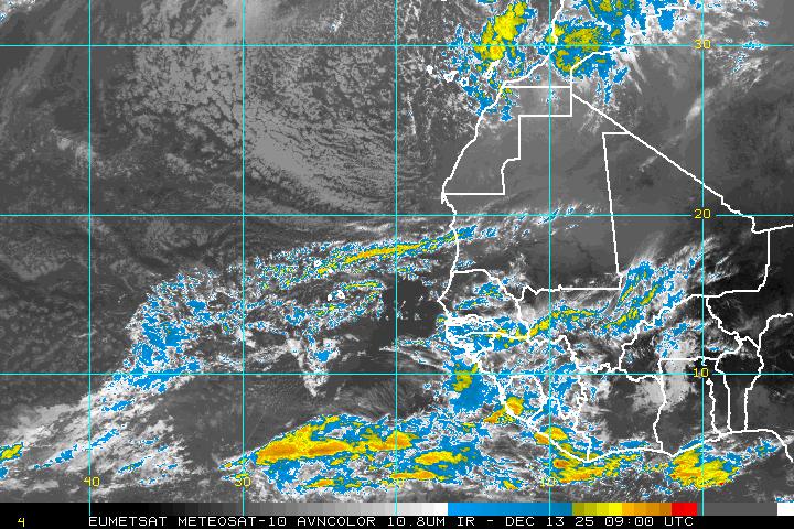
Development with Tropical Wave in MDR?
Moderator: S2k Moderators
Forum rules
The posts in this forum are NOT official forecasts and should not be used as such. They are just the opinion of the poster and may or may not be backed by sound meteorological data. They are NOT endorsed by any professional institution or STORM2K. For official information, please refer to products from the National Hurricane Center and National Weather Service.
-
Brent
- S2K Supporter

- Posts: 38496
- Age: 37
- Joined: Sun May 16, 2004 10:30 pm
- Location: Tulsa Oklahoma
- Contact:
Re: Development with Strong Tropical Wave in MDR?
Looks interesting to me but have to see if it holds together. I think this might be the first real shot at a named storm down the road, but it is pretty early for a system that far east, so if any development occurs I would expect it to be very slow.
0 likes
- cycloneye
- Admin

- Posts: 148741
- Age: 69
- Joined: Thu Oct 10, 2002 10:54 am
- Location: San Juan, Puerto Rico
Re: Development with Strong Tropical Wave in MDR?
It has a good circulation,but a future quickScat may reveal if its in the mid-levels or at the surface.The flash that you see in the loop is the timeframe from sun to night.


0 likes
-
OpieStorm
Re: Development with Strong Tropical Wave in MDR?
Looks REALLY impressive for this time of the season, but like others have said it has a unfavorable road in front of it. Maybe something from this will develop in the caribbean in a few days.
0 likes
- cycloneye
- Admin

- Posts: 148741
- Age: 69
- Joined: Thu Oct 10, 2002 10:54 am
- Location: San Juan, Puerto Rico
Re: Development with Strong Tropical Wave in MDR?
No surprise that this disturbance has been introduced as a tropical wave in the 18z surface analysis.


0 likes
Re: Development with Strong Tropical Wave in MDR?
It's bursting. The only reason they probably aren't investing this is because of conditions ahead. Should be interesting to see how it handles SAL.
0 likes
- gatorcane
- S2K Supporter

- Posts: 23703
- Age: 47
- Joined: Sun Mar 13, 2005 3:54 pm
- Location: Boca Raton, FL
Re: Development with Strong Tropical Wave in MDR?
I'd have to say the NHC is being very conservative on this one. You never know what they are thinking really. I've seen many areas roll off of Africa that don't look nearly this good that they would already have mentioned in the TWO...(even some that haven't even rolled off Africa yet).
If it were Aug or Sept. it would already be under some code at this point.
Why not give it a code yellow at least? I now its only Jul 14th but still....
I agree 24 hours of maintaining this appearance and it will be mentioned in the TWO (if not I have no idea why really) even if they say conditions are going to become unfavorable....
Here is another view -- impressive indeed:

0 likes
-
Ed Mahmoud
Re: Development with Strong Tropical Wave in MDR?
1996 Bertha came off Africa with what looked like rotation as well, as far as early July CV systems.
SSTs are warm enough. Decent low level convergence, fairly good upper divergence. Shear a touch higher than preferred for development, per CIMSS chart.
I am firmly in the possible, not quite probable camp.
If it stays close to 10ºN, it avoids the worst of the shear the next few days.
Looking at CIMSS mean layer steering, if it is a weak to moderate (below hurricane) system, it should track generally West most of the way to the Caribbean, if the steering doesn't change too much.
0 likes
Re: Development with Strong Tropical Wave in MDR?
gatorcane wrote:I'd have to say the NHC is being very conservative on this one. You never know what they are thinking really. I've seen many areas roll off of Africa that don't look nearly this good that they would already have mentioned in the TWO...(even some that haven't even rolled off Africa yet).
If it were Aug or Sept. it would already be under some code at this point.
Why not give it a code yellow at least? I now its only Jul 14th but still....
I agree 24 hours of maintaining this appearance and it will be mentioned in the TWO (if not I have no idea why really) even if they say conditions are going to become unfavorable....
Here is another view -- impressive indeed:
Shouldn't this wave suffer the same fate as the one further west and die off? Why would it be any different?
0 likes
-
Ed Mahmoud
Re: Development with Strong Tropical Wave in MDR?
I forget whether the lead wave clears the SAL for the tail runner, or vice versa.
Quitting time.
Quitting time.
0 likes
-
JonathanBelles
- Professional-Met

- Posts: 11430
- Age: 35
- Joined: Sat Dec 24, 2005 9:00 pm
- Location: School: Florida State University (Tallahassee, FL) Home: St. Petersburg, Florida
- Contact:
I dont want to talk about the consistancy of the NHC and numbering invests, but with the TWO's they have code yellow as "Low <30%". This could be interpreted as anything 0%< chance of cyclogenesis <30%, correct? I'm not saying that I would mark this code yellow, but I am saying I would redefine that guideline. Right now, if the NHC stuck to this wording, this blob, as well as one to the west of it, would be code yellow.
0 likes
Got to admit this does look pretty impressive for a July Cape Verde system. Time of year is probably against this system but the system may be showing the way for later in the season with regards to wave that could form .
Still it is bursting and I wouldn't be all that surprised that if it does hold this shape another 12hrs then we may get an invest out of this, we shall see!
Still it is bursting and I wouldn't be all that surprised that if it does hold this shape another 12hrs then we may get an invest out of this, we shall see!
0 likes
- gatorcane
- S2K Supporter

- Posts: 23703
- Age: 47
- Joined: Sun Mar 13, 2005 3:54 pm
- Location: Boca Raton, FL
Re:
fact789 wrote:I dont want to talk about the consistancy of the NHC and numbering invests, but with the TWO's they have code yellow as "Low <30%". This could be interpreted as anything 0%< chance of cyclogenesis <30%, correct? I'm not saying that I would mark this code yellow, but I am saying I would redefine that guideline. Right now, if the NHC stuck to this wording, this blob, as well as one to the west of it, would be code yellow.
Basically the NHC gives these areas a 0% chance of development as of the last TWO.
I'm going to say they will give it code yellow by the next TWO
0 likes
- wxman57
- Moderator-Pro Met

- Posts: 23127
- Age: 68
- Joined: Sat Jun 21, 2003 8:06 pm
- Location: Houston, TX (southwest)
Re: Development with Strong Tropical Wave in MDR?
I snapped a screen shot of the disturbance before sunset there, along with several observations that appear to indicate a broad low-level circulation. Earlier obs during the day were indicative of a circulation as well. The NHC typically ignores such systems as they move off the west coast of Africa, preferring to wait a day or two to see if they hold together before initiating an invest. It's quite common for such systems to look great 12-24 hours after moving offshore but fall apart shortly after. One thing in its favor, at least initially, is that the environment immediately in its path is more moist than with the previous disturbance. However, if you check the latest MIMIC TPW imagery you'll see a sudden push of dry air southward across the Cape Verde Islands toward the disturbance in the past 3-6 hours. So it may have to tangle with drier air in the next day or two. And beyond that, wind shear will slowly increase. Development chances remain low.
MIMIC TPW Imagery:
http://cimss.ssec.wisc.edu/tropic/real- ... /main.html

MIMIC TPW Imagery:
http://cimss.ssec.wisc.edu/tropic/real- ... /main.html

0 likes
- wxman57
- Moderator-Pro Met

- Posts: 23127
- Age: 68
- Joined: Sat Jun 21, 2003 8:06 pm
- Location: Houston, TX (southwest)
Re: Re:
gatorcane wrote:fact789 wrote:I dont want to talk about the consistancy of the NHC and numbering invests, but with the TWO's they have code yellow as "Low <30%". This could be interpreted as anything 0%< chance of cyclogenesis <30%, correct? I'm not saying that I would mark this code yellow, but I am saying I would redefine that guideline. Right now, if the NHC stuck to this wording, this blob, as well as one to the west of it, would be code yellow.
Basically the NHC gives these areas a 0% chance of development as of the last TWO.
I'm going to say they will give it code yellow by the next TWO
Remember, the TWO only deals with potential development over the next 48 hours. It's not a long-range development potential outlook. And the chance of development within 48 hours is very low. Maybe not zero, but probably less than 5%. I don't know what their criteria are for TWO inclusion, or invest classification.
0 likes
- cycloneye
- Admin

- Posts: 148741
- Age: 69
- Joined: Thu Oct 10, 2002 10:54 am
- Location: San Juan, Puerto Rico
Re: Development with Strong Tropical Wave in MDR?
QuickScat pass at 3:54 PM EDT.It looks like the circulation is at mid-levels as no circulation shows up.Some west winds appear though.


0 likes
- cycloneye
- Admin

- Posts: 148741
- Age: 69
- Joined: Thu Oct 10, 2002 10:54 am
- Location: San Juan, Puerto Rico
Re: Development with Strong Tropical Wave in MDR?
Still hanging well despite the diurnal minimal period.


0 likes
- DESTRUCTION5
- Category 5

- Posts: 4430
- Age: 44
- Joined: Wed Sep 03, 2003 11:25 am
- Location: Stuart, FL
-
lonelymike
- S2K Supporter

- Posts: 634
- Joined: Sat Jul 26, 2008 10:12 am
- Location: walton county fla
Re: Development with Strong Tropical Wave in MDR?
The ratings...er Weather channel is already pushing this as the first major depression of 2009. If it even hints of bleeding it leads 

0 likes
Who is online
Users browsing this forum: No registered users and 154 guests


