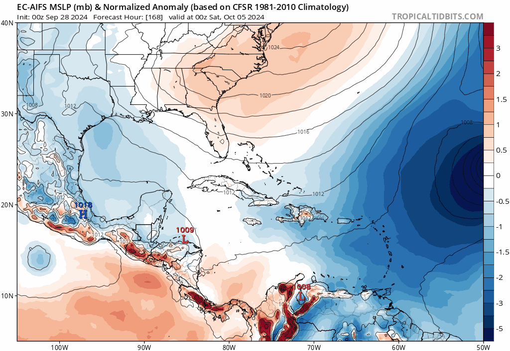
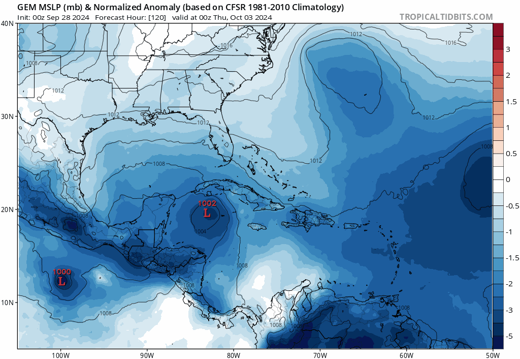
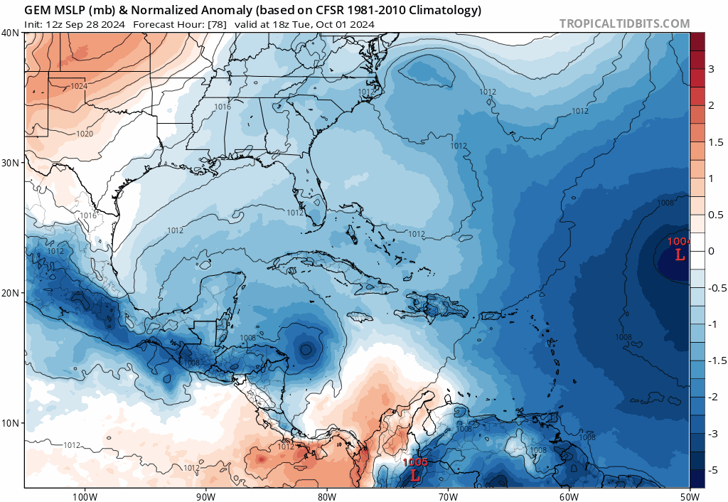
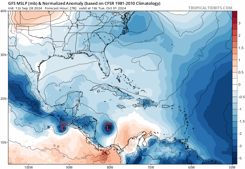
wxman57 wrote:Ah, another storm late next week? The setup looks quite different from Helene, and the models are seeing it, with the exception of the GFS. The upper-level pattern has shifted to fall across the Gulf. Models, except for the GFS, indicate a significant cold front moving south through the Gulf on Tuesday. Kind of similar to the setup before Francine, but with stronger west wind aloft across the northern Gulf - a less favorable environment. Whenever a cold front makes it south across the western Gulf, the air accelerates down the coast of Mexico, forming a natural wave on the front, usually east of Brownsville. The Euro, ICON, and Canadian see the front, though the Canadian adds some extra flair in the extended range. GFS doesn't see the front.
What's going to happen? I wouldn't go with the GFS solution, as it's almost always too aggressive with strengthening in this setup. Plus, it may be too weak with the front. Euro is generally too weak this far out. I'd go with the 00Z ICON solution. More of a frontal low in the central Gulf by next Saturday. With all the model support, I think a low will, indeed develop. I don't know if it'll be tropical enough for the NHC to name. Given the upper level flow, I'd say Florida will be in its sights. Hopefully, it's a weak low.
Meanwhile, I now have 5 more comp days to take, so I think I'll take Monday and Tuesday off. Kind of chilly outside this morning. It's 68 degrees! Better check the status of the heater. Have to let it warm up a bit before heading out for a long ride.
Thar works for me Xman!....and yes!....its chilly outside this morning....feels great!....enjoy your time off bro...
.