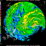
model trends and landfall

This is the general tropical discussion area. Anyone can take their shot at predicting a storms path.

Moderator: S2k Moderators

Forum rules

The posts in this forum are NOT official forecasts and should not be used as such. They are just the opinion of the poster and may or may not be backed by sound meteorological data. They are NOT endorsed by any professional institution or STORM2K. For official information, please refer to products from the National Hurricane Center and National Weather Service.

Help Support Storm2K
Message
Author
User avatar
docjoe
S2K Supporter
S2K Supporter
Posts: 262
Joined: Thu Sep 09, 2004 10:42 pm
Location: SE Alabama..formerly the land of ivan and dennis

model trends and landfall

#1 Postby docjoe » Sat Jul 09, 2005 5:43 pm

The local mets here in Pensacola seem to indicate the models are shifting west towards MS/AL line. However the 5PM NHC discussion seems to say just the opposite to me.....HELP!!! I am now confused!!!! :D :D


I EXPECT DENNIS TO RESUME A NORTHWEST MOTION OF 320 TO 325 DEGREES. THE NEW 18Z NHC MODEL GUIDANCE IS MORE CONVERGENT AND IS NOW IN BETTER AGREEMENT ON A TRACK TOWARD THE WESTERN FLORIDA PANHANDLE TO SOUTHERN ALABAMA AREA. THE NOGAPS AND GFDN MODELS HAVE SHIFTED SHARPLY TO THE RIGHT
...OR EAST OF LOUISIANA...AND THE NHC MODEL CONSENSUS HAS ALSO SHIFTED TO THE RIGHT AND CLOSER TO THE PREVIOUS 3 NHC FORECAST TRACKS. AS A RESULT...NO SIGNIFICANT CHANGE WAS MADE TO THE PREVIOUS FORECAST TRACK.
0 likes   

Return to “Talkin' Tropics”

Who is online

Users browsing this forum: No registered users and 60 guests