puerto rico and u. s. virgin islands forecast discussion
national weather service san juan pr
515 pm ast mon dec 13 2004
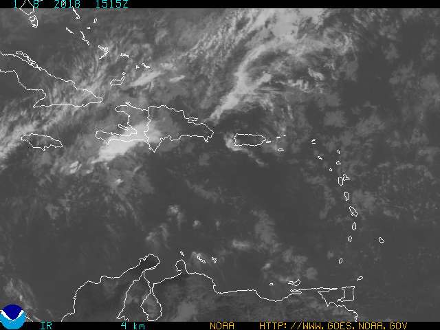
. discussion ... a broad low to mid level trough located over the u. s.
virgin islands late this afternoon ... will continue moving west
across the remainder of the local area tonight through tuesday. this
feature will then become nearly stationary over hispaniola tuesday
night and wednesday ... before drifting back to the east southeast
wednesday night through thursday and probably friday too. this
feature has already brought an increase in cloudiness and showers to
the u. s. virgin islands ... the northeast half of puerto rico and the
adjacent coastal waters this afternoon and expect a rather unsettled
pattern to remain over the local islands for the next few days...
possibly into the upcoming weekend. still appears that once the
trough axis moves just past puerto rico ... its movement will slow...
the trough will stall and then its remnants will get pushed back to
the east southeast across the local islands again wednesday night
through friday ... as mid latitude troughiness and a cold front swing
east southeast across the southwest north atlantic. latest guidance
indicates that cold front probably will not make it this far
southeast ... but broad low level troughiness will become located over
the eastern caribbean through at least saturday and probably well
beyond. thus ... still appears that a rather unsettled next several
days are in store for the local area.
All this week the surface trough will move slow thru the NE caribbean causing scattered showers over Puerto Rico,Virgin Islands and the Leewards so not good days for sure for all who live in this area.