EPAC Convection Impacting Coast
Moderator: S2k Moderators
Forum rules

The posts in this forum are NOT official forecasts and should not be used as such. They are just the opinion of the poster and may or may not be backed by sound meteorological data. They are NOT endorsed by any professional institution or STORM2K. For official information, please refer to products from the National Hurricane Center and National Weather Service.
-
wx247

- S2K Supporter

- Posts: 14279
- Age: 42
- Joined: Wed Feb 05, 2003 10:35 pm
- Location: Monett, Missouri
- Contact:
EPAC Convection Impacting Coast
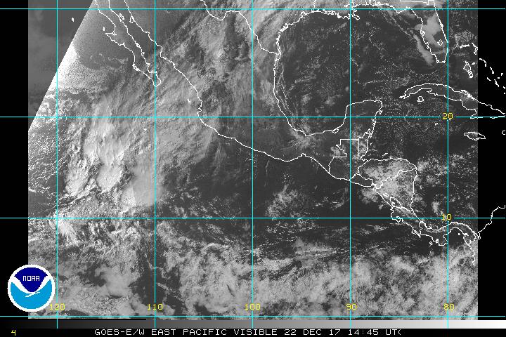
Looks like this blob has some intense convection. The Mexican coastline will get in on some of this later today as well. Possible development here...
0 likes
Personal Forecast Disclaimer:
The posts in this forum are NOT official forecast and should not be used as such. They are just the opinion of the poster and may or may not be backed by sound meteorological data. They are NOT endorsed by any professional institution or storm2k.org. For official information, please refer to the NHC and NWS products.
The posts in this forum are NOT official forecast and should not be used as such. They are just the opinion of the poster and may or may not be backed by sound meteorological data. They are NOT endorsed by any professional institution or storm2k.org. For official information, please refer to the NHC and NWS products.

-
wx247
- S2K Supporter
- Posts: 14279
- Age: 42
- Joined: Wed Feb 05, 2003 10:35 pm
- Location: Monett, Missouri
- Contact:
It is the little wave the couldn't, but soon may. 
0 likes
Personal Forecast Disclaimer:
The posts in this forum are NOT official forecast and should not be used as such. They are just the opinion of the poster and may or may not be backed by sound meteorological data. They are NOT endorsed by any professional institution or storm2k.org. For official information, please refer to the NHC and NWS products.
The posts in this forum are NOT official forecast and should not be used as such. They are just the opinion of the poster and may or may not be backed by sound meteorological data. They are NOT endorsed by any professional institution or storm2k.org. For official information, please refer to the NHC and NWS products.
-
Aquawind

- Category 5

- Posts: 6714
- Age: 62
- Joined: Mon Jun 16, 2003 10:41 pm
- Location: Salisbury, NC
- Contact:
Same Ole Story.. 
000
ABPZ20 KNHC 060947
TWOEP
TROPICAL WEATHER OUTLOOK
NWS TPC/NATIONAL HURRICANE CENTER MIAMI FL
4 AM PDT SUN JUNE 6 2004
FOR THE EASTERN NORTH PACIFIC...EAST OF 140 DEGREES WEST LONGITUDE..
A BROAD AREA OF LOW PRESSURE LOCATED A COUPLE HUNDRED MILES
WEST-SOUTHWEST OF ACAPULCO MEXICO IS ACCOMPANIED BY CLOUDINESS...
SHOWERS AND THUNDERSTORMS. SOME DEVELOPMENT OF THIS SYSTEM IS
POSSIBLE AS IT MOVES SLOWLY WEST-NORTHWESTWARD OVER THE NEXT DAY OR
TWO. THERE IS ALSO A POTENTIAL FOR LOCALLY HEAVY RAINFALL OVER
PORTIONS OF THE SOUTHWEST COAST OF MEXICO.
ELSEWHERE...TROPICAL STORM FORMATION IS NOT EXPECTED THROUGH MONDAY.
FORECASTER PASCH
0 likes
-
wx247
- S2K Supporter
- Posts: 14279
- Age: 42
- Joined: Wed Feb 05, 2003 10:35 pm
- Location: Monett, Missouri
- Contact:
Yeah, convection looks more disorganized this morning.
0 likes
Personal Forecast Disclaimer:
The posts in this forum are NOT official forecast and should not be used as such. They are just the opinion of the poster and may or may not be backed by sound meteorological data. They are NOT endorsed by any professional institution or storm2k.org. For official information, please refer to the NHC and NWS products.
The posts in this forum are NOT official forecast and should not be used as such. They are just the opinion of the poster and may or may not be backed by sound meteorological data. They are NOT endorsed by any professional institution or storm2k.org. For official information, please refer to the NHC and NWS products.
-
lilbump3000

- Category 4

- Posts: 966
- Age: 38
- Joined: Sat Sep 20, 2003 10:09 am
- Location: New Orleans, Louisiana
- Contact:
Some models are already picking up on this system.
http://files.hurricanealley.net/storms/EP94TRP.html
http://files.hurricanealley.net/storms/EP94TRP.html
0 likes
-
HURAKAN

- Professional-Met

- Posts: 46086
- Age: 38
- Joined: Thu May 20, 2004 4:34 pm
- Location: Key West, FL
- Contact:
TD-2E looks to be in the near future ......


BUT, I don't see any terribly organized, DO YOU SEE IT? .........
In my opinion, if something were to develop nothing great is going to come from it since it's near cold waters already, maybe a strong TD or weak TS.
Sandy Delgado
 R.I.P. FORMER PRESIDENT RONALD REAGAN
BUT, I don't see any terribly organized, DO YOU SEE IT? .........
In my opinion, if something were to develop nothing great is going to come from it since it's near cold waters already, maybe a strong TD or weak TS.
Sandy Delgado
R.I.P. FORMER PRESIDENT RONALD REAGAN
0 likes
Who is online
Users browsing this forum: No registered users and 52 guests