Hurricanehink wrote:Subtropicals are fine in my book. Oddly enough, we haven't had a strictly all Subtropical storm for a while, I believe since 1992 with the April storm. Most other times, they became tropical. Florence (1994), Florence, Leslie, and Michael (2000), Karen, Noel, and Olga (2001), Gustav and Kyle (2002), and Ana and Peter (2003). There were only two subtropicals, and they weren't even storms operationally. Just a little information I'd like to pass on.
By the way, when did they change from Subtropical Storm 1 to Subtropical Storm such and such? I noticed it first in 2002 with Subtropical Storm Gustav, but in 2000, Karen was Subtropical Storm 1, if memory serves m right.
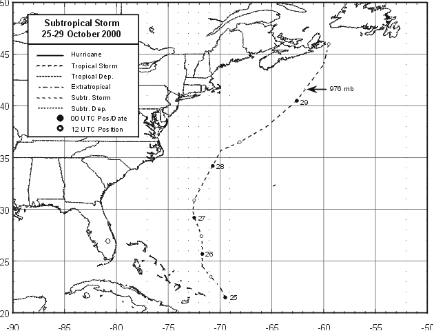
You are 100% right, in 2002 the NHC came to a decition to give name to subtropical systems, that's why when Gustav was a SS received a name. For the amounts of subtropical storms, you are almost right, but not complete. In October of 2000, after Nadine, a subtropical storm developed next to the Bahamas, right where this disturbance is now, and moved northward. At first the NHC didn't admit this subtropical storm but was added to the list of 2000's storms when the NHC did the Best Track. Look at the map below.

Sandy Delgado


