Weakening Frontal Low ESE of Bermuda

This is the general tropical discussion area. Anyone can take their shot at predicting a storms path.

Moderator: S2k Moderators

Forum rules

The posts in this forum are NOT official forecasts and should not be used as such. They are just the opinion of the poster and may or may not be backed by sound meteorological data. They are NOT endorsed by any professional institution or STORM2K. For official information, please refer to products from the National Hurricane Center and National Weather Service.

Help Support Storm2K
Message
Author
Team Ghost
Tropical Low
Tropical Low
Posts: 24
Joined: Wed Nov 05, 2025 1:38 am

Weakening Frontal Low ESE of Bermuda

#1 Postby Team Ghost » Wed Dec 17, 2025 12:21 pm

There is currently a stationary front in the Southwestern North Atlantic that is forecast to develop into a low pressure system.

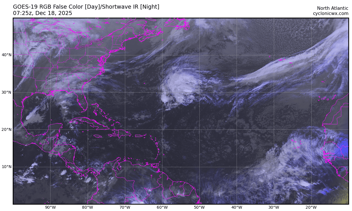
From the 2025-12-17T12:15Z Tropical Weather Discussion:
Southwest N Atlantic Gale Warning: Low pressure is forecast to
develop Wed night near 29N59W, along the stationary front that
currently extends from 29N55W southwestward through the SE
Bahamas, then across east central Cuba. Gale force winds are
expected to begin across the W semicircle of the low center
early Thu morning then increase to 40 kt Thu evening and night as
the low moves E-NE. The low is then expected to move NE on Fri,
and lift N of 31N and the forecast area. Peak seas are expected to
build to 15-18 ft Thu night, with a large area of seas 12 ft and
higher from 27.5N between 54W and 60W by Thu night. Please read
the latest High Seas Forecast issued by the National Hurricane
Center at website https://www.nhc.noaa.gov/text/MIAHSFAT2.shtml
for more information this event.


The NHC has not marked this on their Tropical Weather Outlook; but the GFS, ECMWF, and CMC all show a possibility of the low acquiring subtropical characteristics as early as 42 hours from now.
2 likes   

Team Ghost
Tropical Low
Tropical Low
Posts: 24
Joined: Wed Nov 05, 2025 1:38 am

Re: Developing Gale ESE of Bermuda

#2 Postby Team Ghost » Thu Dec 18, 2025 2:41 am

Image
0 likes   

Team Ghost
Tropical Low
Tropical Low
Posts: 24
Joined: Wed Nov 05, 2025 1:38 am

Re: Developing Gale ESE of Bermuda

#3 Postby Team Ghost » Thu Dec 18, 2025 6:05 pm

...SPECIAL FEATURES...

Western and Central Atlantic Gale Warning:
An intensifying 1014 mb frontal low pressure system is near
28N56W. N to NE near-gale to gale-force winds are occurring just
northwest and just south of the center. Seas of 12 to 15 ft (3.5
to 4.5 m) are found north of 28N between 56W and 59W. As the low
tracks slowly east-northeastward through this evening, NW to NE
gale to strong- gale winds will shift and expand to north of 28N
between 54W and 57W. Seas will also rise to between 12 and 19 ft
(3.5 to 5.5 m) and shift to north of 28N between 54W and 59W. The
low is expected to be near 29N55.5W and gradually weaken on Fri
morning. As a result, winds are forecast to decrease below gale-
force around mid Fri afternoon. Afterward, seas should also
subside below 12 ft late Fri night or early Sat morning.

Please read the latest High Seas and Offshore Waters Forecasts
issued by the National Hurricane Center at website:
https://www.nhc.noaa.gov/text/MIAHSFAT2.shtml and
https://www.nhc.noaa.gov/marine/offshores.php for more information
this event.
0 likes   

ChrisH-UK
Category 2
Category 2
Posts: 667
Joined: Sat May 29, 2021 8:22 am

Re: Gale Center ESE of Bermuda

#4 Postby ChrisH-UK » Fri Dec 19, 2025 5:59 am

Looks. a nice intresting feature looks to haev a good rotation. GFS has it winds at the 50 mph mark.


Image
2 likes   

User avatar
wwizard
Tropical Depression
Tropical Depression
Posts: 79
Joined: Tue Oct 27, 2020 11:28 pm
Location: TEXAS

Re: Gale Center ESE of Bermuda

#5 Postby wwizard » Fri Dec 19, 2025 1:34 pm

Getting that unnamed subtropical storm when it’s all said and done vibe.
0 likes   
Alicia, Allison, Ike, Harvey, Nicholas, Beryl


Return to “Talkin' Tropics”

Who is online

Users browsing this forum: No registered users and 294 guests