#1008 Postby Category5Kaiju » Mon May 20, 2024 9:34 am
Woofde wrote:skyline385 wrote:Pas_Bon wrote:
The obvious concern regarding cyclogenesis and RI fuel these hot waters present notwithstanding, I'm really concerned about the coral reefs in the Caribbean, GOM, and tropical Atlantic.
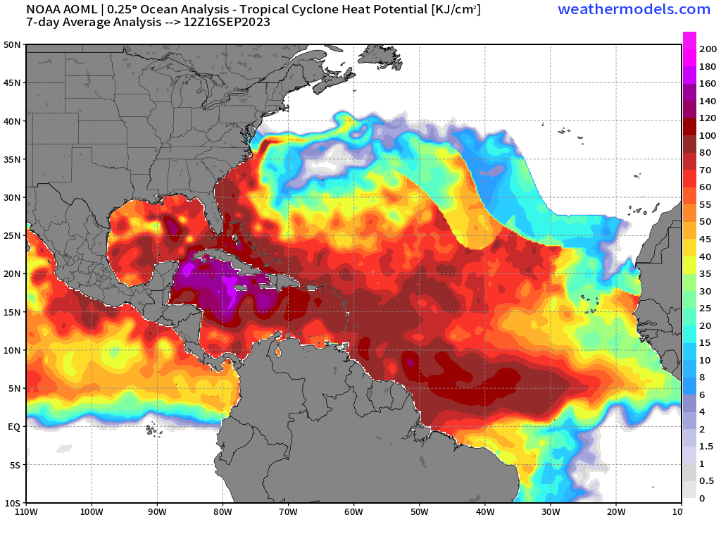
The plot here is for OHC though not SST. OHCs don't directly influence TCG or RI but can be a factor where too much OHC reduces the effect of upwelling and hence reducing the effect of upwelling for slow moving systems.
OHC is especially important for stronger systems right? If I remember correctly, they interact much deeper in the water column than weaker systems. I would imagine it increases the potential top end of the intensity spectrum.
Yes indeed. Part of the reason why Dorian, for example, was able to remain at Cat 5 strength while stalling for several days because the UOHC near the Bahamas was very high.
0 likes
Unless explicitly stated, all information covered in my posts is based on my opinions and observations. Please refer to a professional meteorologist or an accredited weather research agency otherwise, especially if serious decisions must be made in the event of a potentially life-threatening tropical storm or hurricane.


