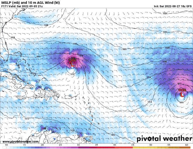
MH getting yanked from Bahamas latitude to the NE and then ENE under @30N in Aug/Sept. Obviously it can happen, just usually not during Aug early Sept. JMHO
Moderator: S2k Moderators


cycloneye wrote:20/50.Shower activity associated with an elongated area of low pressure
over the central tropical Atlantic Ocean has become a little better
organized since yesterday. Environmental conditions are forecast to
be generally favorable for additional gradual development over the
next several days, and a tropical depression could form by the
middle of next week as it moves west-northwestward at 10 to 15 mph
toward the waters east of the Leeward Islands.
* Formation chance through 48 hours...low...20 percent.
* Formation chance through 5 days...medium...50 percent


SFLcane wrote:Real curious to see what the ecmwf does tonight.
SFLcane wrote:Real curious to see what the ecmwf does tonight.

otowntiger wrote:SFLcane wrote:Real curious to see what the ecmwf does tonight.
Not sure why it wouldn’t still show a sharp recurve.


Iceresistance wrote:Joe B is thinking that this would be a Bahamas and SE USA threat. (#4)
https://twitter.com/BigJoeBastardi/status/1563543897800085504?ref_src=twsrc%5Egoogle%7Ctwcamp%5Eserp%7Ctwgr%5Etweet
AutoPenalti wrote:Coming back to reality and realizing all models showed a recurve including the Euro during the Irma period, at around this longitude as well.

Blown Away wrote:[url]https://i.postimg.cc/pdkwkRc9/54658299.gif [/url]
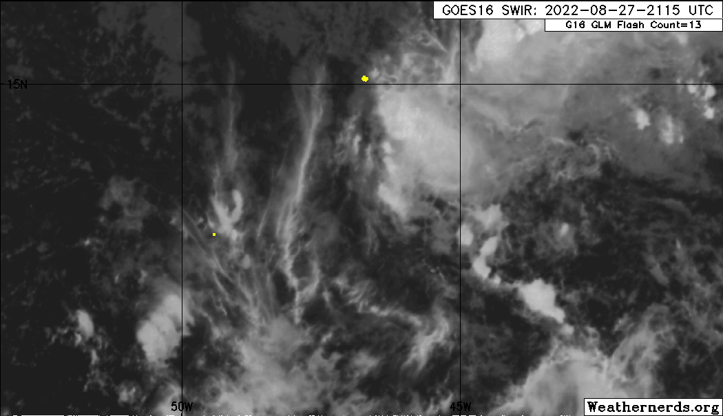
NHC 8pm @14N/42W, little eddy spinning @10.5N/44W.
Convection has waned.
SouthFLTropics wrote:AutoPenalti wrote:Coming back to reality and realizing all models showed a recurve including the Euro during the Irma period, at around this longitude as well.
Just an example of what you just said... Euro 00z from 9/1/2017 for Irma. We all know how that turned out.
https://i.imgur.com/gGeANpG.gif
SFLcane wrote:Blown Away wrote:[url]https://i.postimg.cc/pdkwkRc9/54658299.gif [/url]
NHC 8pm @14N/42W, little eddy spinning @10.5N/44W.
Convection has waned.
Yea, right now seems to be on life support battling dry air.
Users browsing this forum: Google Adsense [Bot] and 112 guests
